Purchase Risk Clarified for a High-Risk Residential Property
The Project:
A private purchaser was in the process of acquiring a residential property in the South East. As part of standard conveyancing, an environmental search flagged the site as being at high risk of surface water flooding, with additional references to historic flooding in the surrounding area.
While the property itself showed no obvious signs of recent flooding, the search results introduced uncertainty at a critical stage in the transaction. The purchaser required a clearer understanding of the actual risk before proceeding, particularly given potential implications for mortgage approval and insurance.
Unda was instructed to undertake a site-specific review to establish whether the reported risk was representative of real conditions, and whether any constraints would affect the viability of the purchase.
The Challenge:
The primary issue was not confirmed flooding, but uncertainty.
The environmental search data indicated a level of risk that would typically raise concern for lenders and insurers. However, these datasets are intentionally precautionary and can overstate risk at an individual property scale, particularly where mapping is based on broad topographic modelling rather than detailed site conditions.
This created several immediate risks:
- The purchaser could withdraw unnecessarily from a viable property
- Mortgage lending could be delayed or declined
- Insurance premiums could be inflated or cover restricted
- The transaction could stall while further clarification was sought
There was also a mismatch between the mapped risk and the purchaser’s observations during viewings, including the absence of visible flow routes or evidence of past flood impacts.
Without a proportionate, site-specific assessment, the transaction risked being driven by precautionary data rather than actual flood behaviour.
What We Did:
The approach focused on testing whether the mapped risk translated into a credible mechanism for flooding at the property itself.
We reviewed Environment Agency surface water mapping alongside local topography, site levels, and surrounding land features to understand how water would realistically move through the area during heavy rainfall events. This was supplemented by a desk-based review of historic flood records and publicly available incident data.
The analysis identified that the modelled surface water flow routes passed near the wider area but did not interact directly with the property footprint. Small changes in ground levels and boundary features were sufficient to divert flow away from the building, which was not captured in the coarse resolution mapping used for the initial search.
We also considered how exceedance flows would behave under more extreme rainfall conditions, testing whether water could pond or accumulate against the structure. This confirmed that while shallow surface water flooding could occur within the surrounding road network, the property itself was unlikely to experience internal flooding.
Given the purchaser’s concern around insurability, we set out the findings in a format suitable for insurers, clearly distinguishing between mapped risk and actual exposure. This aligns with the type of evidence typically required in a flood risk survey for property purchase, but with a more detailed focus on interpreting model outputs and local conditions.
No physical mitigation measures were required. Instead, the emphasis was on evidencing why intervention was not necessary, which is often the more critical point in transaction-led assessments.
The Outcome:
The assessment clarified that the property was not subject to the level of flood risk implied by the initial search data.
This allowed the purchaser to proceed with a clearer understanding of the actual risk profile, avoiding unnecessary withdrawal from the transaction. The findings also provided sufficient reassurance for lending and supported discussions around obtaining appropriate cover under flood risk insurance, without disproportionate premiums or exclusions.
The transaction progressed without delay, with risk understood rather than assumed.
This project demonstrates how site-specific interpretation of flood data can prevent precautionary mapping from driving unnecessary decisions during property transactions.
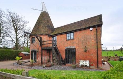 A red brick house with a conical roof and windmill-like structure, featuring large windows, an exterior staircase, outdoor seating, and a paved courtyard, set in a rural area with grass and trees.