Flood Modelling Services
Get a Quote
Flood modelling services give you a site-specific picture of how floodwater would behave on and around your land — how deep it would get, how fast it would move and how far it would spread — where the national flood maps cannot. Unda builds, reviews and challenges hydrological and hydraulic models for planning applications, development design, flood map challenges and due diligence across England and Wales, and has delivered more than 5,000 flood risk assessments since 2014.
Not every site needs a model, and one of the most useful things a flood risk consultant can tell you is that yours doesn't. Where modelling is needed, though, the difference between a model the Environment Agency accepts and one it sends back is usually decided before a single simulation is run — in the scoping, the data and the assumptions.
A flood model is only worth commissioning when it answers a question the existing flood data cannot.
Told your flood risk assessment needs modelling?
Send us your site details and one of our experienced flood risk consultants will come back with a tailored, no-obligation quote within 60 minutes.
Get a QuoteWhat is flood modelling?
Flood modelling is the use of hydrological and hydraulic analysis to simulate how water behaves during a flood. A model predicts flood levels, extents, depths, velocities and hazard across a site and its surroundings, producing site-specific evidence for planning applications, development design, flood map challenges and property or investment decisions.
The two halves of that definition do different jobs. Hydrological modelling estimates how much water arrives — the flows generated by a rainfall event or carried by a river. Hydraulic modelling then works out where that water goes once it exceeds the channel or drainage network: the route it takes, the depth it reaches and the speed it travels. Industry-standard packages such as HEC-RAS, TUFLOW, Flood Modeller and InfoWorks ICM handle the calculations; our guide to flood modelling software, tools and techniques explains how they differ and how the right one is chosen.
The software matters far less than the judgement around it. Government guidance on using modelling for flood risk assessments is clear that the approach, inputs and assumptions must suit the site and the question being asked — a principle that runs through everything on this page.
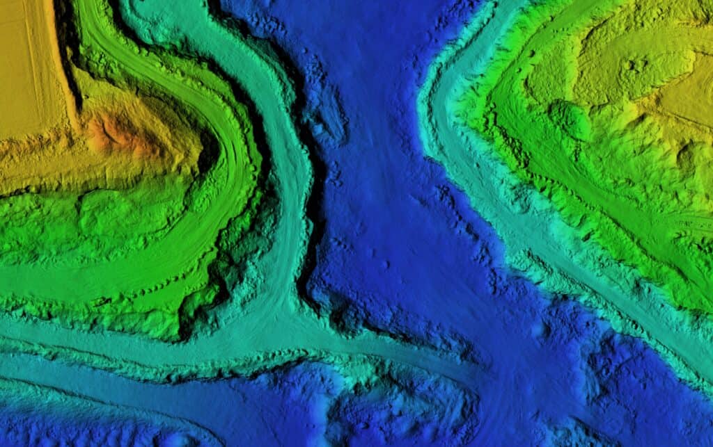
Flood modelling or a Flood Risk Assessment: what's the difference?
The two are often confused, and the distinction matters because it decides what you should commission. A Flood Risk Assessment identifies and assesses flood risk to a site; flood modelling is the detailed technical analysis that sits inside an assessment when standard data cannot answer the question on its own.
| Flood Risk Assessment | Flood modelling | |
|---|---|---|
| What it is | A report assessing all sources of flood risk to a site and its development | A computational simulation of how floodwater behaves on and around the site |
| When you need it | Most planning applications in Flood Zones 2 and 3, larger Flood Zone 1 sites, and property or insurance decisions | Only where existing flood data lacks the accuracy or detail to support the decision |
| What you get | A submission-ready assessment of risk, mitigation and policy compliance | Predicted flood levels, extents, depths, velocities and hazard, plus technical reporting |
| How they fit together | The FRA is the deliverable planners read | The model is the evidence engine behind it on complex sites |
Most of the models we build feed directly into a Flood Risk Assessment for planning applications, but modelling is also commissioned standalone — to challenge mapping, test a design or inform an acquisition.
Is flood modelling the right service for you?
Plenty of people land on this page needing something related but different. If any of these fit your situation, you'll get to the right answer faster on the matching page:
- Applying for planning permission in England? Start with a Flood Risk Assessment for planning — modelling is only added where the site demands it.
- Building in Wales? The Welsh equivalent is a Flood Consequence Assessment under TAN15.
- Asked for sequential testing? We prepare Sequential and Exception Test reports alongside FRAs.
- Buying a home flagged for flood risk? Our homebuyer flood risk survey is built for purchase decisions.
- Insurer raising concerns? A Flood Risk Assessment for insurance purposes gives underwriters property-level evidence.
- Chasing BREEAM credits? The BREEAM Flood Risk Assessment is structured for Pol 03.
- Groundwater or a basement in the picture? See our hydrogeologist-led groundwater flood risk assessments.
- Drainage rather than flooding? You may need a surface water drainage strategy and SuDS design instead.
Not sure which applies? Contact us and we'll point you at the right report — it costs nothing to ask.
When is flood modelling required?
Flood modelling is required where the existing flood risk information does not provide enough accuracy or confidence to support a planning or development decision. In practice, that tends to mean one of six situations:
- National mapping doesn't reflect local conditions. The Flood Map for Planning is a strategic dataset; culverts, defences and local topography can make site reality quite different.
- Development within or beside a watercourse or floodplain. Riverside and floodplain sites almost always need flood levels defined more precisely than mapping allows.
- The proposal could affect flood levels or flow routes. Anything that displaces floodwater must quantify the effect on neighbouring land.
- Floodplain compensation is needed. Level-for-level compensation schemes are designed and proven through modelling.
- Climate change scenarios must be tested. Some sites need bespoke runs of the uplifted flows and rainfall that policy requires.
- The Environment Agency or council has asked for it. Often via an EA objection to a planning application that existing evidence couldn't resolve.
The bar for "required" has shifted recently. Since the Environment Agency's May 2026 Flood Map for Planning update added banded surface water depth data, some routine sites can now be assessed from published depths without a bespoke model — which is exactly the kind of proportionality call we make before quoting. A quick look at our free flood risk map postcode checker, or at nearby gauges on the live river levels map, is a sensible first step before anyone commissions anything.
Flood modelling for planning applications
Where a planning application needs modelling, the model becomes the load-bearing evidence in the Flood Risk Assessment: it defines flood levels with more accuracy than national datasets, maps extents, depths and velocities across the site, classifies hazard to people and property, quantifies the impact of the proposals and demonstrates that mitigation actually works.
That evidence is judged against a published benchmark. The Environment Agency's river modelling technical standards — first published in 2021 and last updated on 8 May 2026 — set out what a credible model looks like: an approach justified against the site, calibration and verification against observed flood data where any exists, sensitivity testing on roughness, inflows and climate change allowances, and a Model User Report documenting the build, assumptions and limitations. Our plain-English guide to the EA river modelling technical standards covers what reviewers actually check, and why models get sent back.
Environment Agency reviewers don't just look at your results — they look at whether the model behind them can be trusted, reproduced and audited.
Inputs decide credibility too. A model is only as good as its terrain data, which is why we work from Environment Agency LiDAR — explained in our guide to LiDAR data for flood risk and drainage planning — refined where it matters with a topographical survey of the site itself. Flows and rainfall are uplifted using the current climate change allowances for flood risk assessments, which vary by river basin district and epoch and are one of the most common things reviewers find out of date.
What is the difference between 1D and 2D flood modelling?
A 1D model represents a river or drainage network as a single line and calculates levels and flows along it; a 2D model spreads water across a grid of ground levels so it can move in any direction; a linked 1D–2D model runs both at once, keeping the channel in 1D while the floodplain floods in 2D. The right choice follows from the flood source and the question — not from the software.
Represents: the river or pipe network as a single line of cross-sections.
Best for: in-channel flows, structures such as culverts and weirs, long river reaches.
Limitation: cannot show how water spreads once it leaves the channel.
Represents: the ground surface as a grid or mesh, so water moves in any direction.
Best for: floodplain spreading, surface water routes, urban sites, depth and hazard mapping.
Limitation: data-hungry — needs good terrain and inflow data to be worth running.
Represents: the channel in 1D and the floodplain in 2D, exchanging flow between them.
Best for: riverside development sites where both channel and floodplain behaviour matter.
Status: the default starting point for detailed UK flood risk assessments.
Beyond these sit the specialist runs: combined fluvial and surface water models, climate change scenario modelling, breach and residual risk modelling behind defences, and floodplain compensation modelling. The same rule applies to all of them — start from the source of the risk, then pick the dimensionality and package that answers the question at proportionate cost.
Can flood modelling change what the flood map says about your site?
Sometimes, yes. National flood mapping — published through the official Flood Map for Planning service — is deliberately strategic and, in places, conservative — our article on whether flood maps are accurate explains why a mapped extent and reality can part company. The NaFRA2 national reassessment put 4.6 million properties in England at surface water risk and 2.4 million at river and coastal risk, and those totals moved substantially on data improvements alone — which cuts both ways for individual sites.
Where the mapping is demonstrably wrong for a site, a formal challenge is possible. The burden of proof sits with the applicant, and the evidence has to be site-specific modelling the Environment Agency can reproduce and audit — the process, and when it's worth pursuing, is set out in our guide to the EA flood map challenge. We review existing hydraulic models and their assumptions, identify resolution and input limitations, refine extents with updated data and prepare the challenge submission itself.
Just as often, though, the pragmatic route isn't a challenge at all. A site-specific Flood Risk Assessment that demonstrates the real risk — and designs mitigation around it — can unlock a site faster than re-drawing the Flood Map for Planning. Part of our job is telling you which route your site justifies.
Modelling for site design: floor levels, access and floodplain compensation
The most valuable modelling often happens before an application is drawn up, because a model lets you test the design rather than defend it. By running development scenarios iteratively we help design flood risk out of a scheme: optimising the layout and land use, setting finished floor levels against modelled flood levels rather than guesswork, checking safe access and egress during a flood event, and evaluating whether proposed mitigation actually performs.
Floodplain compensation is the clearest example. Where development displaces floodplain storage, the Environment Agency expects level-for-level compensatory flood storage — replacement storage at the same flood levels, demonstrated through a cut-and-fill exercise in level bands, typically of 100mm or 200mm. Modelling proves the compensation works at every stage of a flood, not just in total volume. The same scenario testing supports designs that live with water, such as floodable voids beneath raised buildings, and quantifies the residual flood risk that remains behind defences if they fail or are overtopped.
It is far cheaper to move a building at the modelling stage than to redesign a scheme after an Environment Agency objection.
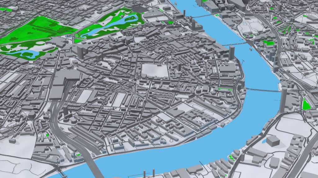
Flood modelling for due diligence and acquisition
Modelling also supports decisions that never go near a planning committee. On higher-value or more complex sites, lenders, insurers and investors increasingly want flood risk quantified rather than screened — refining the risk to a development site before purchase, identifying discrepancies between mapped and actual risk, supporting viability and valuation work, and providing evidence a funder can rely on.
This due-diligence modelling is typically commissioned where standard flood data leaves too much uncertainty to price. It sits alongside our property-focused reports — the homebuyer survey for residential purchases and the insurance FRA where an underwriter needs convincing — and draws on the same local knowledge behind our published guides to flood risk area by area, river by river and council by council.
What does flood modelling cost?
It depends on the site, and anyone quoting a fixed price before understanding yours is guessing. The cost of flood modelling is driven by the flood sources involved, the size and complexity of the model domain, the quality of data already available (an existing EA model to build from is very different from a bare catchment), the number of scenarios and climate change runs required, and whether floodplain compensation or a formal map challenge is in scope.
What we can promise is proportionality: we scope the smallest model that credibly answers the question, we tell you when published data makes modelling unnecessary, and every quote is free and tailored. For the wider picture on assessment fees, see our guide to how much a flood risk assessment costs.
Find out what modelling your site actually needs
Every quote is free, scoped to your site and with you within 60 minutes on a working day.
Get a QuoteWhat you receive: outputs and reporting
A model on its own convinces nobody — the deliverable is evidence a reviewer can interrogate. Depending on scope, flood modelling from Unda provides:
- Predicted flood levels for the full range of design events, present day and with climate change.
- Flood extents, depths and velocities mapped across the site and surrounding area.
- Flood hazard classification — the depth-velocity rating that drives safe access and egress decisions.
- Development impact assessment quantifying the scheme's effect on flood levels and flow routes elsewhere.
- Mitigation and compensation evaluation proving the proposed measures perform.
- A Model User Report and technical reporting in the format the Environment Agency's standards expect, ready to sit inside an FRA or stand alone.
Why choose Unda for flood modelling?
Modelling is where flood risk consultancy is easiest to get wrong — over-scoped into unnecessary cost, or under-scoped into an objection. Our approach is built to avoid both:
- Modelling integrated with planning strategy. We judge when modelling is required and when it isn't, and align every output with what the Environment Agency and council will accept — because an elegant model that fails policy is worthless.
- Chartered, accountable consultants. Unda is a CIWEM Business Partner with chartered (C.WEM MCIWEM) consultants, and every report is signed off by a Senior Flood Risk Consultant.
- A track record at scale. More than 5,000 flood risk assessments delivered across England and Wales since 2014, from single dwellings to strategic sites.
- In-house capability. Modelling, GIS analysis and drainage design sit in one team — our explainer on GIS in flood risk and modelling shows how the spatial work underpins the numbers.
- Local knowledge, wherever the site is. Published flood risk guides across 230+ towns and counties, dozens of named rivers and the councils we work with most.
How our flood modelling process works
- Scope the question. We establish what decision the model must support, review existing data and confirm whether modelling is required at all.
- Assemble the data. LiDAR terrain data, topographical survey where needed, and existing EA models and flood data — obtained through the Environment Agency's data products.
- Establish the hydrology. Design flows and rainfall for the full range of events, uplifted for climate change.
- Build and run the model. The appropriate 1D, 2D or linked model, checked against observed flood behaviour where records exist.
- Test the scheme. Development scenarios, mitigation options, compensation schemes and sensitivity runs.
- Report and support. Mapped outputs, a Model User Report and a technical report — then we deal with the Environment Agency's questions until the application is resolved.
Flood modelling FAQs
What is flood modelling?
Flood modelling is the use of hydrological and hydraulic analysis to simulate how water behaves during flood events. It predicts flood levels, extents, depths, velocities and hazard across a site and its surroundings, providing site-specific evidence where national flood mapping is not detailed or accurate enough.
When is flood modelling required?
Flood modelling is typically required where standard flood risk data cannot answer the question — sites near watercourses or within the floodplain, proposals that could affect flood levels or flow routes, floodplain compensation schemes, formal flood map challenges, or where the Environment Agency or council has asked for detailed evidence.
Is flood modelling always required for a Flood Risk Assessment?
No. Many Flood Risk Assessments can be completed using existing datasets and mapping — and since the Environment Agency published banded surface water depth data in May 2026, more routine sites can be assessed without a bespoke model. Modelling is only needed where additional detail is required to demonstrate that development is safe and appropriate.
What is the difference between flood modelling and a Flood Risk Assessment?
A Flood Risk Assessment identifies and assesses flood risk to a site and is the report a planning authority reads. Flood modelling is the more detailed technical analysis used within an assessment — or standalone — where standard data is not sufficient to define levels, extents or impacts.
What is the difference between 1D and 2D flood modelling?
A 1D model represents a river or drainage network as a single line and calculates flow along it — quick and effective for in-channel behaviour. A 2D model spreads water across a grid of ground levels, showing how it moves over floodplains and urban surfaces. Detailed UK assessments usually link the two, with the channel in 1D and the floodplain in 2D.
Can flood modelling reduce my flood risk classification?
In some cases, detailed modelling can demonstrate that site-specific flood risk differs from national mapping, particularly where existing data is conservative or does not reflect local conditions. That evidence can support a formal flood map challenge — though a well-evidenced FRA is sometimes the more pragmatic route.
Does a flood model of my watercourse already exist?
Quite possibly. The Environment Agency holds hydraulic models for many main rivers, available on request through its flood data products. Where a suitable model exists we build from it rather than starting again, which saves both time and cost — checking its age, resolution and assumptions first.
What is a Model User Report?
A Model User Report documents how a hydraulic model was built — its data, assumptions, calibration and limitations — so a reviewer can judge whether the results can be trusted. The Environment Agency's river modelling technical standards expect one with any model submitted as evidence, and a thin or missing report is a common reason models are rejected.
How accurate is flood modelling?
A well-built model is the most accurate flood risk evidence available for a site — but accuracy depends on inputs and validation, not software. Good terrain data, sound hydrology, calibration against observed floods where records exist, and honest sensitivity testing matter far more than the package used. That is why reviewers scrutinise the build, not just the results.
How long does flood modelling take?
The timescale depends on site complexity, data availability and the type of modelling required. Simple modelling can be completed relatively quickly, while complex 2D or iterative design modelling takes longer — and if Environment Agency data or models need to be requested, that lead time matters too. We confirm a programme with every quotation.
What information is needed for flood modelling?
Typical requirements include topographic survey data, hydrological inputs, details of the proposed development, and any existing flood data or modelling for the area. The exact list depends on the scope — we confirm what is needed, and obtain most of it ourselves, at the outset.
How much does flood modelling cost?
Costs vary with site size, complexity, data availability and the type of modelling required — a site with an existing EA model to build from is a very different job from an unmodelled catchment. Early advice defines the proportionate scope and avoids unnecessary work; every quote is free and tailored to the site.
Speak to our flood risk consultants about flood modelling
If your project needs flood modelling — or you suspect it might not, and want that confirmed before spending money — our consultants will advise on the most appropriate approach and prepare the analysis your site requires. We provide modelling within a wider Flood Risk Assessment or as a standalone service for design development, due diligence and reviews of existing flood data.
A modelling objection holding up your permission?
Tell us where your application is stuck and our experienced consultants will advise on the modelling needed to move it forward.
Get a QuotePrefer to talk it through first? Call our experienced consultants on +44 (0) 1293 214444, email enquiries@unda.co.uk or contact us online to discuss flood modelling services and flood risk strategy for your site.
