New Home Approved Where the Surface Water Data Stopped Short
The objection could not be answered from the published maps. A new home in Worthing had to show safe access and escape across a hundred-year lifetime, and the Environment Agency's surface water climate change mapping reached only 2040 to 2060. Unda agreed a stand-in design event with the council's drainage reviewer, and the reviewer moved from recommending refusal to recording low risk.
| Client | Small developer |
| Location | Worthing, West Sussex |
| Planning authority | Worthing Borough Council |
| Flood risk | Flood Zone 1 · surface water |
| Development | 1 dwelling |
| Service | Flood risk assessment for planning applications — with a surface water drainage strategy and a sequential and exception test |
| Outcome | Approved with conditions |
Mapped high risk, with the data stopping short
The plot is a small brownfield site in Worthing, already hard surfaced, where one new home was proposed. Little about it stood out on the Environment Agency's Flood Map for Planning: Flood Zone 1, no defences, no flooding on record nearby, nothing from rivers, the sea, groundwater, sewers or reservoirs.
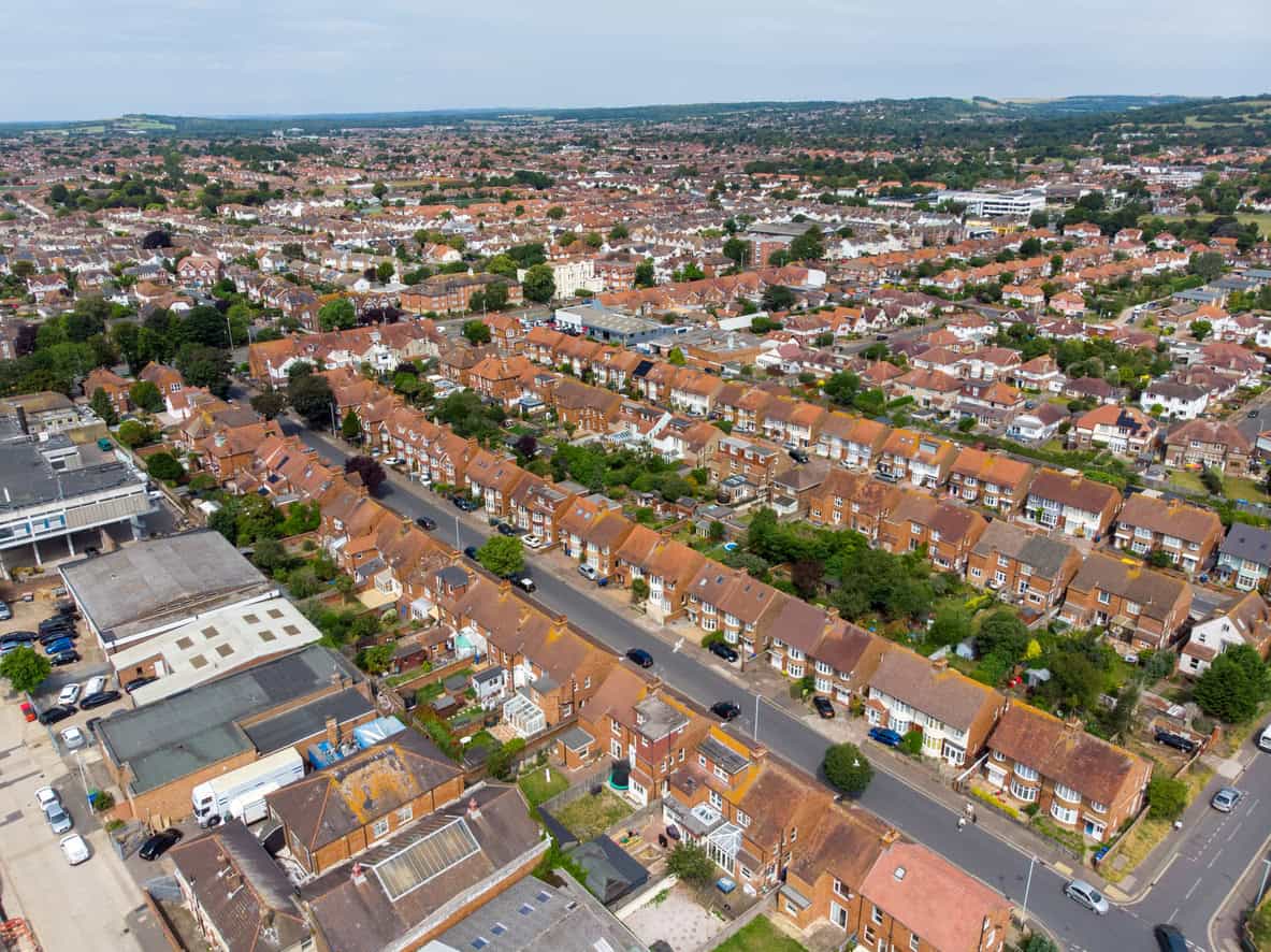
Surface water did. The Environment Agency's mapping bands the site High, at present and across the 2040 to 2060 period its climate change layers covered.
That banding was what the councils' drainage consultant fixed on, the firm they use to review flood risk. Their objection asked for safe access and escape over the lifetime of the development, a hundred years with an allowance for climate change. Mapping running only to 2040 to 2060 was insufficient, they said. No other mapping existed. The event the objection called for had never been published.
Why Flood Zone 1 settled nothing
A site this small in Flood Zone 1 would not normally need a flood risk assessment for planning applications. Two things changed that. It sat inside a mapped surface water risk area, and the proposal put a home on ground that had none, raising the site's flood risk vulnerability classification to more vulnerable.
From there the application needed a full assessment of every flood source, a surface water drainage strategy, and a sequential and exception test. Four consultation responses in a row recommended refusal: on the sequential test, on safe access and escape, on the drainage design, and on displaced floodwater. The flood zone was never the argument. Surface water was.
Agreeing a stand-in design event
Three routes were open. The first was to reply that the objection asked for evidence that did not exist, which was true and settled nothing; the second was to assess against the near-term layers and defend that choice, which the reviewer had rejected once already. The third was to ask which event to use.
Unda took the third. Working with the councils' drainage consultant, it was agreed that the rarest event the near-term mapping does cover, the 1 in 1,000 chance layer for 2040 to 2060, would stand in for the 1 in 100 year plus climate change planning event, and that agreement went into the assessment as a recorded appendix.
Against that stand-in event, the deepest water reaching the ground where the home would stand is 0.2 m, and the footprint falls outside the next depth band up. The route out on foot does reach the hazard band dangerous to children, the elderly and the infirm, though it stays below the band that endangers the general public.
The design followed. The floor was set roughly twice the design depth above the surrounding ground, over a floodable void running under the whole footprint, so the new building takes no floodwater storage from the site; resistance and resilience measures then run through it, from the slab up to the wiring and the meters.
Escape cannot be relied on once water is moving. Safety rests on leaving before it arrives, under a flood warning and evacuation plan tied into the area's emergency plans, with the building as refuge for anyone who stays. Soakaways were ruled out by the offset one needs from a building, so storage went beneath permeable paving, slowing what leaves the plot.
Approved, with one detail left to condition
Worthing Borough Council granted planning permission, subject to conditions.
By then the consultant had changed position in writing. The banding had not changed; the event the site was measured against had. The site had been shown to be at a low risk of surface water flooding, safe access and egress demonstrated, and no increase in flood risk elsewhere; the risk, the consultant added, was lower than initially anticipated.
Two things besides Unda's work moved the position. The council's planning policy officer, not the drainage consultant, determined that the sequential and exception tests were passed. And one objection was never settled on the papers: the consultant held the discharge rate so tight that the flow control risked blocking, so the council took it into a pre-commencement condition.
Two conditions rest on that evidence: one binds the development to the mitigation the flood risk assessment sets out and requires the evacuation plan before occupation, the other holds back construction until the drainage scheme is approved.
What this means for similar sites
Where a policy test reaches further than the published data, settle the design event with the reviewer first. The order matters. An assessment that answers a question the reviewer did not ask reads as an evasion, however sound its method. The gap that forced this substitution has since closed: the Environment Agency has added surface water climate change extents on a 2070s allowance, with banded depths.
A High band on the surface water map describes how often water arrives, not how deep it gets. Read the depth layers before writing a site off: the same mapping that banded this site High showed shallow water where the home would stand. Flood Zone 1 exempts nothing once the use changes: raising the vulnerability classification brings every flood source, the drainage hierarchy and the sequential test into play.
About the author. Jesy is a Flood Risk Consultant specialising in property purchase, insurance and due diligence. The assessment was reviewed and authorised by Emma Jeffery, Senior Flood Risk Consultant. Unda has been trading since 2014, is a CIWEM Business Partner with CIWEM member and chartered (C.WEM MCIWEM) consultants, and has delivered 5,000+ flood risk assessments and drainage strategies across England and Wales.
Jesy Ferry · MSc, BSc (Hons), GradCIWEM
A flood risk assessment for planning applications gives an applicant here an agreed basis to measure against, and a reviewer the evidence to recommend approval.
Asked to prove something the maps do not cover?
Tell our experienced consultants about your site and get a tailored quote within 60 minutes on a working day.
Start a quoteRelated projects
- Residential Conversion Approved in Flood Zone 2 Despite Surface Water Flood Risk: surface water, not the flood zone, drove the objection.
- Village Homes Approved in Flood Zone 3 After an Earlier Flood Refusal: the flood work split in two on resubmission.
 Ground like this is already hard surfaced, so surface water has nowhere to go and the mapping bands whole streets as high risk.
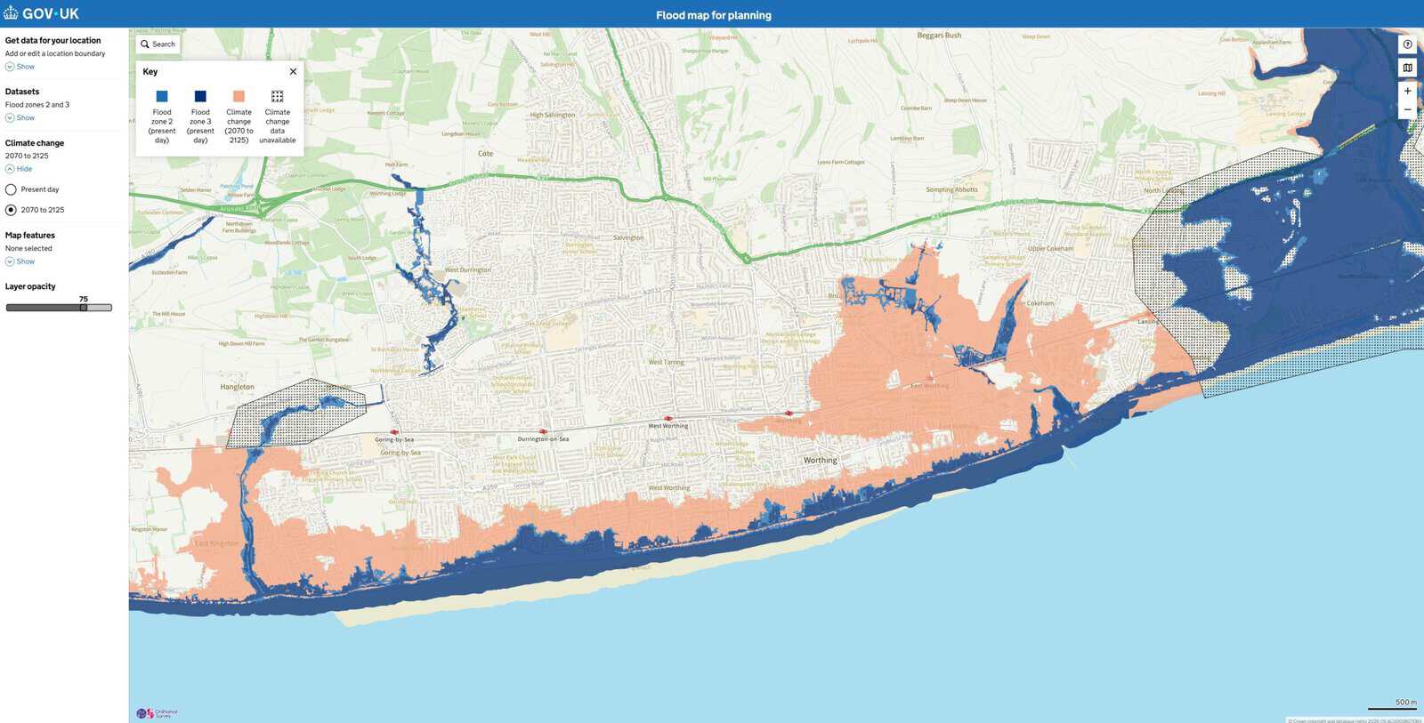
 The rivers and sea layers run to 2125. The surface water layers stopped at 2060, which is where the objection on this site came from.
