What Is a Weather Bomb? Explosive Cyclogenesis Explained
Estimated reading time 8 minutes
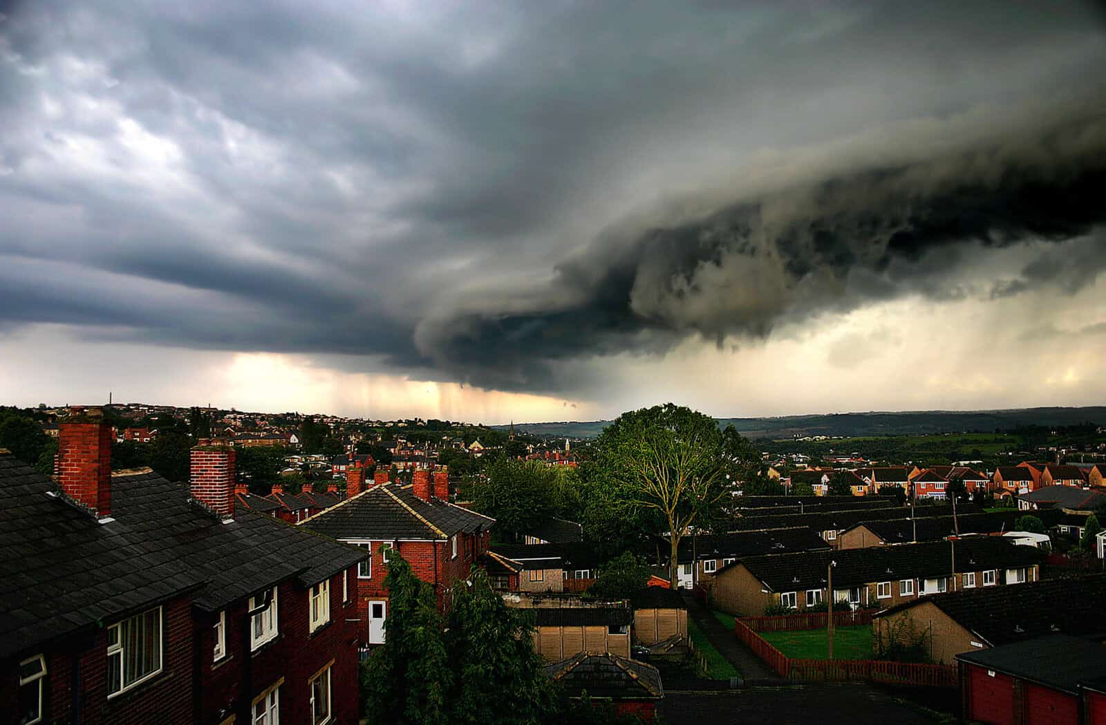
A weather bomb is the informal name for a storm whose central pressure drops by at least 24 millibars in 24 hours, a process meteorologists call explosive cyclogenesis. The result is a deep, fast-developing area of low pressure that brings damaging winds, heavy rain and, for low-lying and coastal parts of the UK, a serious flood risk.
For anyone developing, buying or insuring property near the coast or a floodplain, the wind is only half the story. What comes with it, the surge, the rainfall and the runoff, is where the flooding starts.
What does “weather bomb” actually mean?
“Weather bomb” is a media term rather than an official Met Office warning category, but the science behind it is real. The Met Office defines a weather bomb as a low pressure system whose central pressure falls 24 millibars in 24 hours through explosive cyclogenesis.
That 24-millibar figure is not arbitrary. It comes from a 1980 paper by meteorologists Fred Sanders and John Gyakum, who set the threshold for a cyclone “bomb” at a 24 mb drop in 24 hours at 60° latitude, scaled a little for how far north or south the storm sits. One such drop is called a “bergeron”. If you want the full technical picture, the Wikipedia entry on explosive cyclogenesis sets out the maths and the history. In plain terms: the pressure falls fast, the storm deepens fast, and the winds turn dangerous quickly.
How a weather bomb forms
Weather bombs are driven by the jet stream, the ribbon of fast-moving air high in the atmosphere. When the jet stream pulls air away from the top of a developing low faster than air can be replaced near the surface, the pressure at sea level drops.
Lower pressure draws in more air from the surrounding area. As that air rushes in and the system spins, it tightens and accelerates, the way an ice skater speeds up by pulling their arms in. It is a feedback loop: lower pressure, faster winds, lower pressure again. The strongest gusts usually arrive within a few hours and can be strong enough to bring down trees and damage buildings.
The UK sits in a prime spot for this. We are at the end of a North Atlantic storm track, where mild, moist air meets colder air and the jet stream runs strong through autumn and winter. That is the same Atlantic weather machinery that drives most of our serious flooding, which is why the Met Office’s role in flood management matters as much as its role in forecasting the wind.
Weather bomb, bomb cyclone or named storm?
These terms get used interchangeably, so they are worth untangling. A weather bomb (also called a “bomb cyclone” or “bombogenesis”) describes how fast a storm deepens. A named storm, such as Storm Éowyn or Storm Goretti, is simply a storm the Met Office or Met Éireann has named because it is expected to cause disruption. A storm can be both. Not every named storm is a weather bomb, and not every weather bomb gets a name. For planning purposes, the nickname matters far less than the impact on the ground.
Weather bombs and the UK: recent examples
The UK sees a handful of these most years, almost always between October and March. A few recent ones:
- Storm Goretti (January 2026) brought record-breaking winds and left thousands of homes without power. Storm Chandra followed weeks later, pushing rivers in the south-west to record levels.
- Storm Éowyn (January 2025) paired hurricane-force gusts with heavy rain and triggered flood warnings across the UK.
- Storm Doris (2017) reached gusts of 94 mph, and in 2014 a weather bomb off the Outer Hebrides produced waves measured at more than 15 metres.
The pattern is familiar. Violent wind grabs the headlines, and flooding does the lasting damage.
Why a weather bomb is a flood risk, not just a wind story
This is where a weather bomb stops being a meteorology lesson and starts mattering for a specific site. A deep, fast-moving low raises UK flood risk in three ways at once.
Coastal and tidal flooding. Very low pressure lifts the sea surface, and strong onshore winds push water towards the coast. When this storm surge arrives on a high spring tide, sea levels can climb well above normal. This is tidal (sea) flooding, and it is why defences such as the Thames Barrier close more often during storm season.
River (fluvial) flooding. Weather bombs drag in bands of heavy, persistent rain. On ground that is already saturated, that rain runs straight off into watercourses, which is fluvial flooding. Storm Chandra showed how quickly catchments in the south-west can reach record levels.
Surface water flooding. Intense rainfall overwhelms drains and gullies faster than they can cope, and water pools in streets and low spots. Surface water (pluvial) flooding is now the largest single source of flood risk in England, and it does not need a river nearby to do damage.
Most of the time a genuine weather bomb brings some combination of all three. Our guide to the different types of flooding breaks each source down. And as our analysis of how heavier rainfall is changing UK flood risk explains, the rain falling in these storms is roughly 20% more intense than it was a century ago, so the flooding that follows is worsening even when the wind is not.
What this means if you’re building or buying near water
A single storm does not change a site’s flood zone. But weather bombs are a useful reminder of why the planning system treats flood risk so seriously, and why a generic screening report often will not cut it.
If your site sits in Flood Zone 2 or 3, or in Flood Zone 1 with surface water risk shown on the Flood Map for Planning, you will usually need a site-specific flood risk assessment for planning to support your application. A good FRA looks past the broad national maps at how rivers, the sea, surface water and groundwater actually behave at your site, and sets finished floor levels and mitigation against the design flood level plus a climate change allowance. Where a site falls in Flood Zone 2 or 3, you may also need to pass the Sequential and Exception Tests. In Wales, the equivalent document is a Flood Consequence Assessment.
Drainage matters too. Managing the runoff a storm like this produces is exactly what a surface water drainage strategy is for, and it is frequently a condition of planning permission.
One of our experienced Flood Risk Consultants will get back to you within 60 minutes
Frequently asked questions
Often, yes. The low pressure and strong winds can drive a coastal storm surge, while the heavy rain that comes with the system causes river and surface water flooding. The exact risk depends on the tide, how saturated the ground already is, and the lie of the land.
A few times most years, concentrated in autumn and winter when the Atlantic jet stream is strongest. Not all of them are severe, and not all are given a storm name.
Yes. “Weather bomb”, “bomb cyclone” and “bombogenesis” all describe the same thing: a storm whose central pressure falls at least 24 millibars in 24 hours.
It can be. The winds alone can bring down trees and damage property, and the flooding that follows is often more damaging still, especially on the coast and in low-lying areas.
The Met Office issues the warnings, and the Flood Forecasting Centre translates that weather into flood risk for England and Wales.
Worried about flood risk at your site?
If a development, purchase or insurance decision turns on flood risk, it pays to understand the real risk rather than read it off a storm headline. Our flood risk consultants prepare clear, policy-compliant flood risk assessments for sites across England and Wales. Speak to Unda about a flood risk assessment for your site for a no-obligation quote.
Latest news






One of our experienced Flood Risk Consultants will get back to you within 60 minutes
