Cold Store Bought Below the Flood Level in a Pumped Fen
No flood is recorded at this cold store, and its ground floor sits about two and a half metres below the flood level its Flood Zone 3 designation implies. Both hold, because the fen around Chatteris is drained by pumps an internal drainage board maintains. For the food business buying it, Unda set out what that reliance rests on and where it could fail. The purchase completed.
| Client | Commercial purchaser, a food business |
| Location | Chatteris, Cambridgeshire |
| Watercourse | The Middle Level pumped drainage system |
| Flood risk | Flood Zone 3 · fluvial · surface water |
| Development | Commercial · cold store and pack house, no works proposed |
| Service | Flood risk assessment for due diligence — desk study of every flood source, a site walkover, and a report written for the buyer |
| Outcome | Risk clarified; purchase completed |
Flood Zone 3, and nothing on record
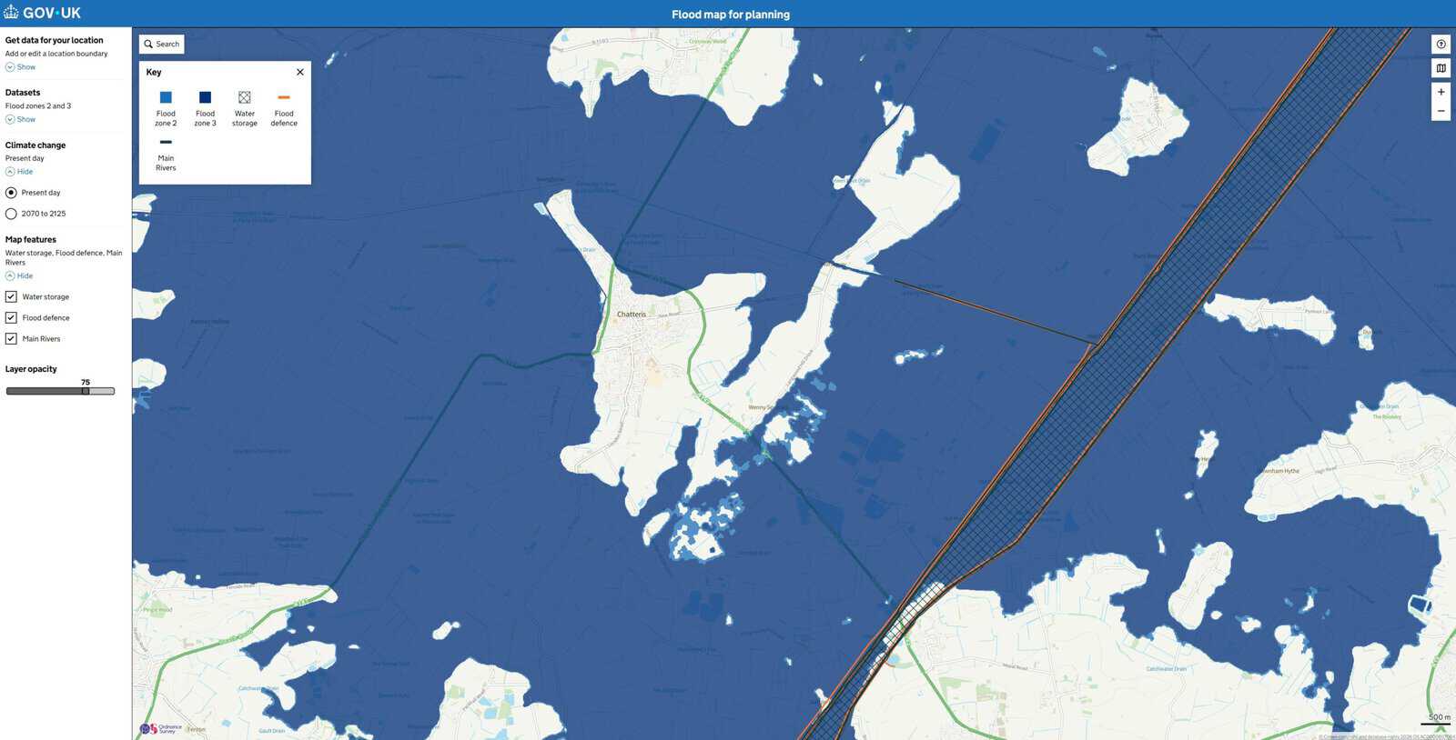
The site is a cold store and pack house on a business park at Chatteris, bought by a food business to run as it stood. National mapping places all of it in Flood Zone 3, the band for land with the highest chance of river flooding.
Yet the Environment Agency holds no record of it flooding, and the district's list of recorded floods, running back to 1912, does not include it. The business wanted the two reconciled before committing, in terms that would satisfy an insurer, and instructed a flood risk assessment for due diligence.
The level described a fen without pumps
Neither the Environment Agency nor the drainage authorities held modelled flood levels here. The flood zone outline comes from a national model built in the early 2000s, whose method produced extents, not levels. There was no number to measure the floor against.
Reporting the zone as it stood would have told the business only that the site was high risk. Instead Unda worked out what the outline represents here, read a level off its edge using airborne survey data, and set that against the surveyed floor. The floor sits about two and a half metres below.
That number sounds alarming and describes something that does not happen. Flood zones are drawn without defences. Here the fen lies below its own rivers, so the outline maps the water that would spread if the channels and pumping stations stopped, which is why almost the whole district carries the same band. The two and a half metres measures the depth of the buyer's reliance on that system, not a flood the building is waiting for.
The standard, and how it gives
Reliance can be described. The Middle Level, the network of embanked channels draining this part of the Fens to the tidal Great Ouse, is held to a flood with a 1 in 100 chance in any year. Inside it the ground is pumped by the Nightlayers Internal Drainage Board, one of the public bodies managing water levels in low-lying districts. The board publishes a lower figure for its own works: a general standard of 1 in 35 to 50 years alongside the Middle Level, which it says should be read not literally but as a 2 to 3 per cent chance of some overspilling each year.
Protection of that kind gives in a few known ways, which the assessment named: a blockage in the drains, a flood exceeding the banks, and loss of the pumping station serving the district. The third has a precedent. In the Easter floods of 1998 the Middle Level reached its highest recorded levels, and every board pumping station discharging into it was shut down for more than a day so the peak could pass without overtopping the banks. No property flooded. The system held by refusing to take any more water, and that is the protection a building here has.
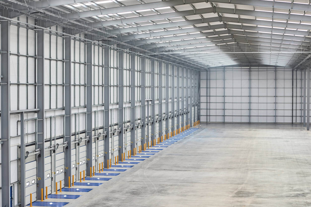
The walkover turned to the part of the system the business would own. On site the drainage was clear and working, and a pump suggested the yard is lifted into the boundary drain, not falling in. The loading docks are the lowest ground here, cut more than a metre below the floor slab so lorries can back up, and the surface water mapping puts the deepest water anywhere on the site in them. They are also where goods cross the threshold, so water there stops the building working without touching the floor.
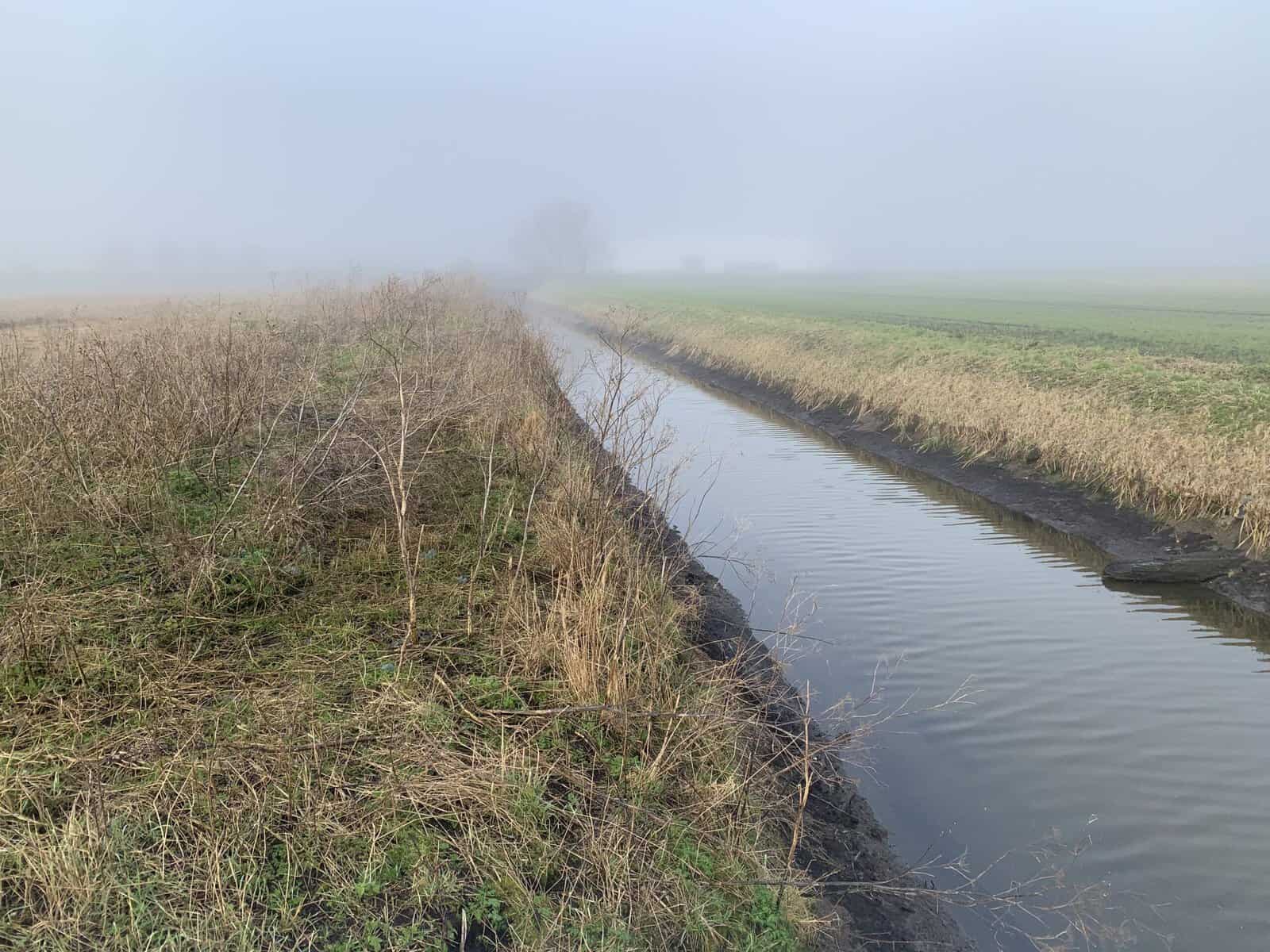
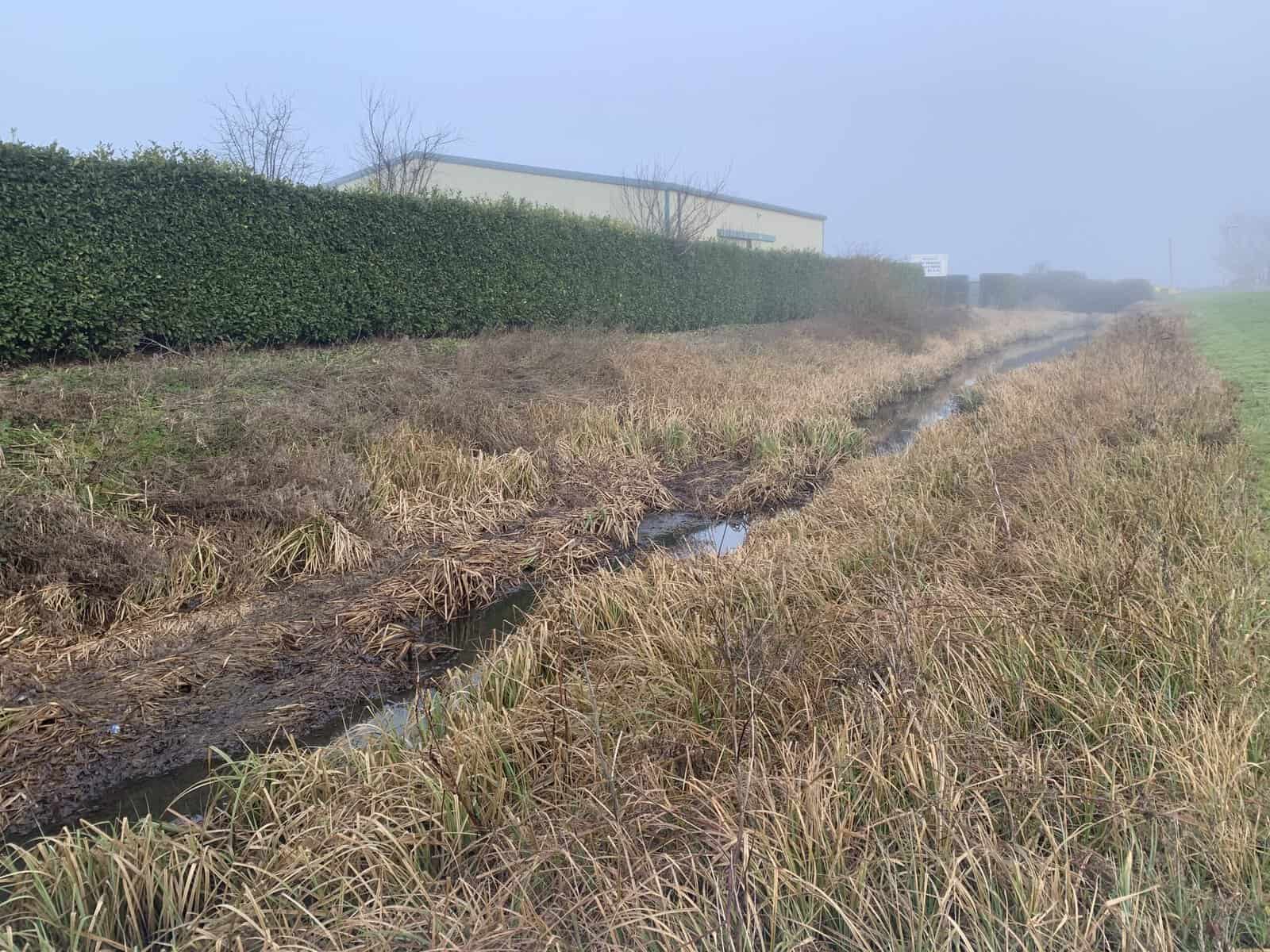
Over the boundary, the drains the site discharges into were overgrown, and not the buyer's to clear.
The purchase completed
The business completed. That was its own judgement, weighed with everything an acquisition weighs; the flood work was one input and recommended nothing either way. What was issued was a due diligence assessment covering all six sources of flooding, the site's place in the pumped system and the standard it is held to, the ways that protection could give, and measures from maintaining the site's drains and pumps to resistance at the docks and doors.
It was written for an insurer too. Flood Re does not cover commercial property, so cover is bought on the open market, where a building's own evidence is what separates it from its postcode.
What this means for similar sites
In a pumped landscape a flood zone tells you about the land and little about the building, and nearly every site carries the same label. What a buyer needs is what holds the water back, who owns it, what standard it meets, and its condition. Those four questions are where the residual risk sits. A drainage board publishes its standard, and the Environment Agency's own Fens evidence is blunt about the assets doing this work ageing together.
The rest of the answer is on the site itself. You inherit two drainage systems: one inside the boundary, which you can maintain, and one outside it, which you can only watch and report. Where a building has been dug into the ground for operational reasons, a loading dock or a plant room, that feature is usually the lowest point on the plot and the first place water gathers, whatever the river is doing.
About the author. Emma is a Senior Flood Risk Consultant, and a policy and flood modelling expert. Unda has been trading since 2014, is a CIWEM Business Partner with CIWEM member and chartered (C.WEM MCIWEM) consultants, and has delivered 5,000+ flood risk assessments and drainage strategies across England and Wales.
Emma Jeffery · MSci (Hons)
A flood risk assessment for due diligence turns a flood zone label into what a buyer can act on: what protects the building, whose it is, the standard it is held to, and which parts of it the buyer owns on completion.
Buying a building the flood maps call high risk?
Send the site address and what it is used for, and Unda's experienced consultants will return a tailored quote within 60 minutes on a working day.
Start a quoteRelated projects
- Riverside House Purchase Withdrawn After Flood Level Test: a floor measured against modelled river levels, and a buyer who walked away.
- New Build Purchase Completed Away From a Village's Flood Hotspots: a village's flood record traced to watercourses that never reached the plot.
 The drains a buyer does not own are the ones that look like this, and clearing them depends on somebody else's maintenance round.
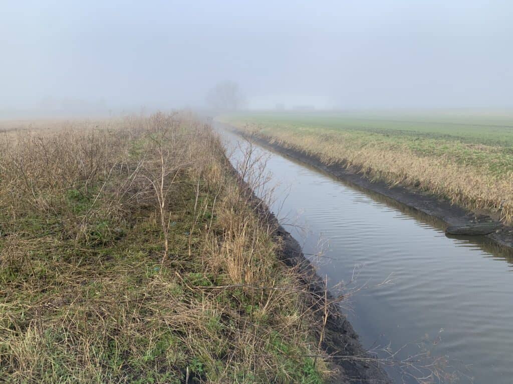 Channels like this one, kept clear and cut to profile, are what keep a fen building dry, and most of them sit outside the boundary a buyer controls.
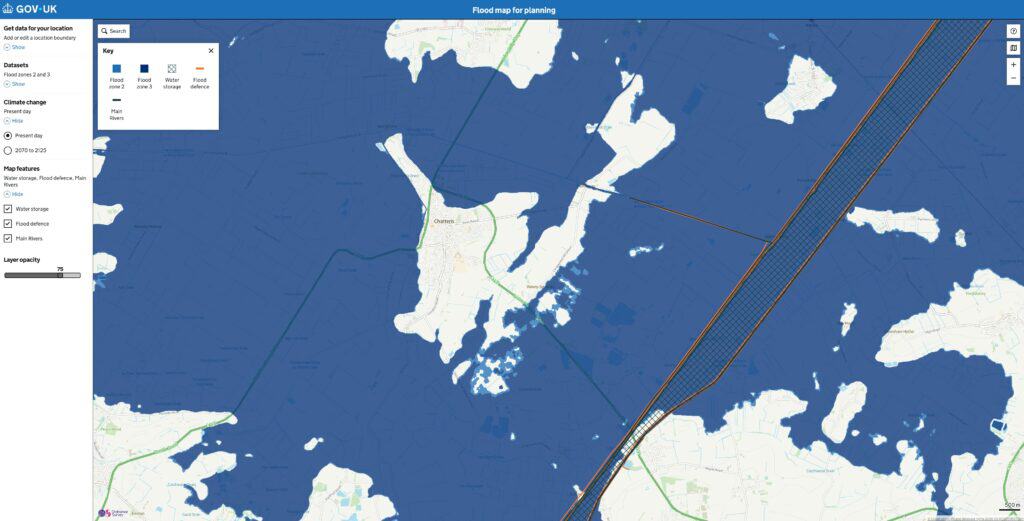 Flood Zone 3 covers almost everything outside the town, which is why the zone on its own tells a buyer very little here.
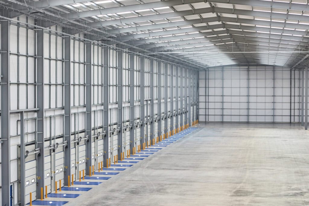 Loading docks sit below the slab so lorries can back up, which makes them the lowest ground on a site and the first place water gathers.
