Riverside House Purchase Withdrawn After Floor Tested Against Thames Flood Levels
The maps and the owner disagreed, and both were right. A riverside house at Goring-on-Thames sits in Flood Zone 3, yet its owner said the house itself had never flooded. Unda set the estimated ground floor against modelled Thames flood levels: water reaches it from the 1 in 75 year event. The buyer withdrew.
| Client | Purchaser |
| Location | Goring-on-Thames, Oxfordshire |
| Watercourse | River Thames and a side channel |
| Flood risk | Flood Zone 3 (partly 3b) · fluvial · groundwater |
| Development | 1 dwelling · existing (no works proposed) |
| Service | Flood risk survey for property purchase — desk study, walkover and report |
| Outcome | Risk clarified; purchase withdrawn |
Flood Zone 3, yet never flooded
On paper the position appeared unambiguous. The Environment Agency's Flood Map for Planning places the house in Flood Zone 3, the local authorities' strategic flood risk assessment puts part of the grounds in the functional floodplain, where floodwater has to flow or be stored during an event, and Environment Agency records show water reaching those grounds five times since the 1940s. One recorded outline crosses part of the house itself.
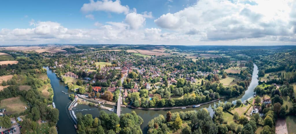
The Thames at Goring-on-Thames: lock, weir and road bridge, Chilterns behind. Setting, not evidence of the risk: these structures manage navigation, not floodwater.
The owner's account pointed the other way, and nothing in the defences explained it. The house had never flooded, and the embankments nearby hold back only the floods the river produces most often.
Both were true. A flood zone maps land and says nothing about the level of a floor, so a house inside the floodplain can still sit above the water that crosses it. That discrepancy was the buyer's entire difficulty.
Why the maps could not answer
What the buyer needed was narrower than anything the mapping carries. Flood Zone 3 accommodates a wet lawn in a bad winter and water through the reception rooms alike, and a conveyancing search reproduces the same national mapping in a different colour, so neither establishes how often floodwater reaches a particular floor, which was the only thing capable of deciding whether the purchase went ahead.
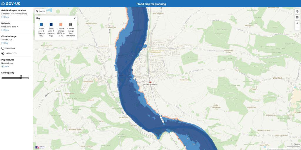
Flood Map for Planning around Goring and Streatley: Flood Zone 3 dark blue, Flood Zone 2 light blue, the 2070 to 2125 climate change extent orange. It identifies floodplain land, which is the limitation this job turned on, and carries nothing about the level of a floor. © Crown copyright and database rights 2026 OS.
Setting the floor against modelled levels
Unda's flood risk survey for property purchase began with the Environment Agency's modelled flood levels at the house, from frequent floods to the genuinely rare, with and without climate change. A laser survey flown over the ground confirmed that land surrounding the house floods in frequent events. Where the building itself sat remained unresolved.
No survey of the floor existed, so the walkover settled it, measuring the ground floor against the rear patio and the gravel forecourt: the estimated finished floor level sat just beneath a 1 in 75 year flood.
Set against each other, the levels answered the buyer's question. Floodwater remains below the floor in everything the river produces routinely, reaches it at the 1 in 75 year event, and stands roughly 230 mm above it in a 1 in 100 year flood. A flood of that frequency carries a little over a 1 per cent chance in any given year, and that chance returns every year, which is what a flood return period means over a mortgage. The largest floods on record at the nearest river gauges fell short of the estimated floor, consistent with the owner's account.
The walkover identified where water would get in first. A sunken side door with no drainage, and a patio door with no step to hold back shallow water.
Three routes followed, and the report set all three out rather than a verdict. Relying on the mapping and flood history alone was set aside: neither establishes how often water reaches the floor. Resistance measures, meaning flood doors, anti-flood air bricks and non-return valves on the drains, would keep out present-day depths of that order. Climate change scenarios put floodwater a metre or more above the floor, beyond the 600 mm point at which keeping water out becomes structural rather than a matter of fitting products, so any refurbishment would need resilience measures to limit the damage once water is inside.
The remaining flood sources registered lower. Surface water mapping keeps clear of the building, and groundwater susceptibility is high with no basement for it to reach. Because every margin rested on an estimated floor, the report recommended a topographic survey of floor and threshold levels.
The buyer withdrew
After reading the report, the buyer decided not to proceed. The decision was the buyer's own: the report made no recommendation either way, and nothing besides its findings moved the position.
Unda issued a flood risk survey report covering every source of flooding at the property, the modelled levels against the estimated floor, and the points at which water would enter first. It also set out what living there would involve: flood warnings, a flood plan, resistance measures at the entrances, resilience built into any refurbishment, and keeping the side channel clear, a duty falling to whoever owns land beside a watercourse.
What this means for similar sites
A house can have no flood history at all and still sit below the levels that matter. Here the largest floods on record stopped short of the floor while a far more ordinary flood does not, which is why a house can be in a flood zone yet never have flooded. An owner's memory is worth hearing, but it cannot substitute for the floor measured against modelled levels.
An estimate was enough to frame the decision, although firm figures need a topographical survey of floor and threshold levels. Depth determines the remedy as well. Flood doors suit shallow flooding, while greater depths move the answer towards property flood resilience.
About the author. Jesy is a Flood Risk Consultant specialising in property purchase, insurance and due diligence. Unda has been trading since 2014, is a CIWEM Business Partner with CIWEM member and chartered (C.WEM MCIWEM) consultants, and has delivered 5,000+ flood risk assessments and drainage strategies across England and Wales.
Jesy Ferry · MSc, BSc (Hons), GradCIWEM
Unda's flood risk survey for property purchase tells a buyer how often, and how deep, floodwater would reach the floor of the house they are committing to, which a flood zone cannot.
Weighing up a riverside home in Flood Zone 3?
Send us the address for a tailored quote from our experienced consultants within 60 minutes on a working day.
Start a quoteRelated projects
- Surface Water Risk Located to the Garden, Not the Home: surface water on a Berkshire purchase pooled in the garden, below the house.
- New Build Bought Clear of a Village's Flood Hotspots: a Surrey village's flood history sat away from the plot, and the buyers completed.
The Thames at Goring-on-Thames, where a buyer withdrew from buying a riverside house after its floor was tested against modelled flood levels.
Much of the riverside edge of Goring-on-Thames sits in Flood Zone 3, so the buyer needed the floor tested against flood levels, not the zone alone. 