Retrospective Dwelling in Flood Zone 2 Approved Using Modelled River Levels
The house was already finished, so the usual answer to a flood risk problem, changing the building, was not available. It stands in Hampshire on a plot mapped in Flood Zones 2 and 3, and a retrospective application had to justify it as built. Unda requested the Environment Agency's modelled river levels rather than argue from the map. The council granted permission.
| Client | Homeowner |
| Location | Hampshire |
| Watercourse | River Ems |
| Flood risk | Flood Zone 2, plot partly Flood Zone 3 · fluvial · surface water very low · sewer and reservoir low |
| Development | 1 dwelling, built before permission |
| Service | Flood risk assessment for planning applications — Environment Agency modelled level data, ground and threshold levels, and a report for the retrospective application |
| Outcome | Approved |
A finished house with nothing left to change
A retrospective application is judged against the same flood risk policy as any other, and a new home counts as more vulnerable development, so the applicant had to show the house would be safe for its lifetime without making flooding worse anywhere else. The council wanted that evidence with the application, and Unda was instructed to prepare a flood risk assessment for planning applications for a building that was already standing.
On a scheme that has not been built, a flood risk problem has obvious answers. Floor levels go up, the footprint moves, drainage is laid out to suit the ground. None of those were open here. A more vulnerable home mapped in Flood Zones 2 and 3 is exactly the case that attracts an objection asking for that kind of redesign, and nobody could have delivered one. The only thing left that could still move was the evidence.
Asking the model, not the map
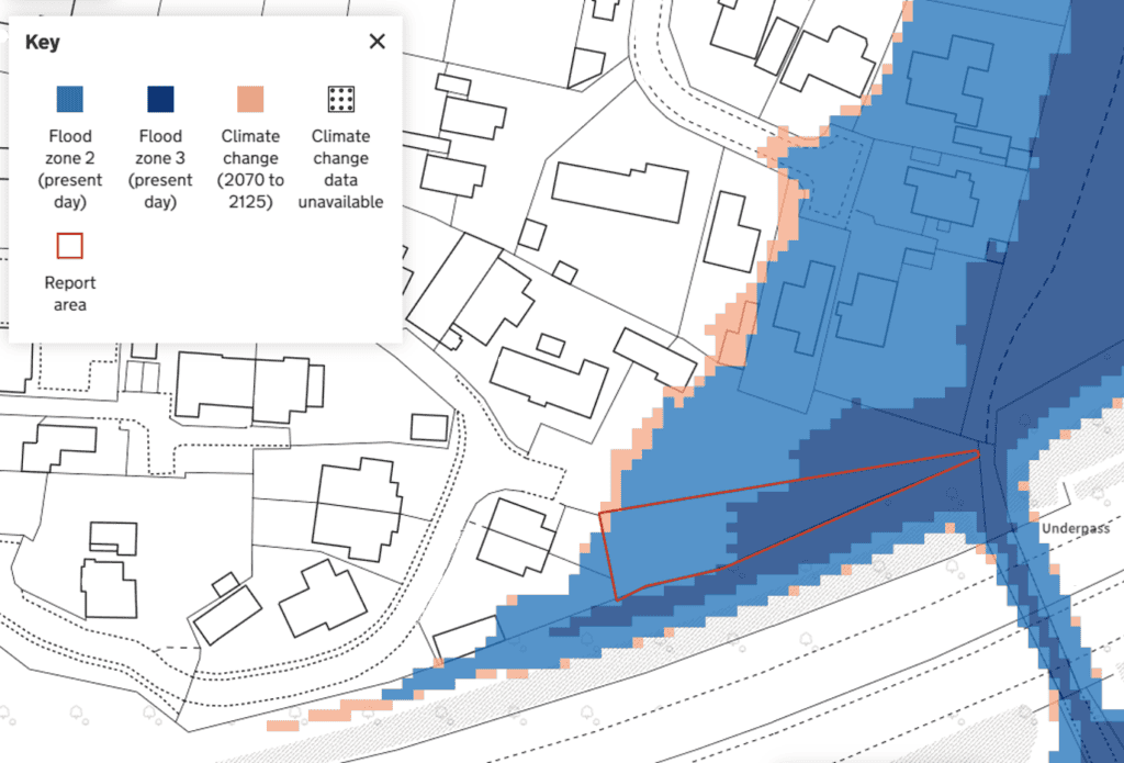
The Environment Agency's Flood Map for Planning puts the plot in Flood Zone 2 and partly in Flood Zone 3, with the risk coming from the River Ems. It also falls inside the Flood Zones plus climate change extent, which shows how far the zones spread as river flows rise, so the future picture had to be answered alongside the present one.
Arguing from the published zones alone would have left the central question open, because a zone describes a stretch of land and the application turned on one building inside it. Altering the house was the other way out. A finished dwelling closed it. The third route was to make the evidence finer, so Unda requested detailed modelled flood levels and extents from the Environment Agency's River Ems model, supplied as Product 4 flood data, which gives modelled levels at points across a site rather than one outline.
Where the extent and the level disagreed
The model put the house entirely in Flood Zone 2, outside the 1 in 100 year flood extent at the present day, and outside it under every climate change allowance supplied with the model. That is the flood a new home is assessed against, so the finished building already passed the test that mattered most.
Only the 1 in 1,000 year event is mapped as reaching the house, and that reading does not agree with the modelled level for the same event. The extent is drawn across the building. The level sits about half a metre below the lowest ground around it, and more than a metre below the door thresholds. The assessment reported both, and on either reading the water stays below the ground the house is built on. The other sources sit lower still. Surface water risk to the building is very low, sewer and reservoir risk are low, and there is no record of the site having flooded.
Approved, with undertakings attached
The council granted retrospective planning permission for the house. Unda issued a flood risk assessment for the application. It gave the modelled levels at the building, and the ground and threshold levels they were measured against. On those it concluded the house was suitable in flood risk terms, subject to the measures agreed.
The evidence was not the whole of it. Safe access and egress was already available on foot, to higher ground that stays dry in the 1 in 100 year flood with climate change. No ground had been raised inside that extent, so no floodplain storage was lost. New fencing was specified as hit-and-miss or palisade, open enough to let floodwater through. The applicant agreed to register for flood warnings, and to fit flood resistance and resilience measures where a finished house allows them, which keep water out or limit the damage if it gets in. The decision itself was the council's. It covered more than flood risk.
What this means for similar sites
A flood zone tells a council what kind of land a house sits on. It does not say where the water the policy actually tests for would reach. Flood Zone 2 runs out to the 1 in 1,000 year outline, so a home inside it can still stand clear of the 1 in 100 year flood with climate change, as this one does, and only modelled levels at the building will show whether it does.
Once a house is finished it cannot be redesigned to answer an objection, and a retrospective application reopens flood risk in full. Ground and threshold levels then carry as much weight as the model, because they are what the modelled levels are measured against. Both are worth measuring before the application goes in, because retrospective cases start on the back foot and an answer already in hand counts for more than one produced under a request for further information.
About the author. Jackie is a co-founder and Director of Unda with 30+ years in flood risk, and sits on CIWEM's South Eastern Branch committee. Unda has been trading since 2014, is a CIWEM Business Partner with CIWEM member and chartered (C.WEM MCIWEM) consultants, and has delivered 5,000+ flood risk assessments and drainage strategies across England and Wales.
Jackie Stone · MSci, BSc (Hons), DIC, CIWEM Environmental Partner
A flood risk assessment for planning applications produces the evidence a council needs before it can grant permission for a house that is already standing.
Built first and now need flood risk evidence?
Send us the address for a tailored quote from our experienced consultants within 60 minutes on a working day.
Start a quoteRelated projects
- Village Homes Approved in Flood Zone 3 After an Earlier Flood Refusal: a Fenland village-edge site approved at the second attempt, after two separate reports answered what the first application had not.
- Retrospective Stable Yard Drained Around Existing Soakaways Beside Ancient Woodland: drainage evidence for an Oxfordshire yard already built, keeping the soakaways where they were and taking effluent out of protected woodland.
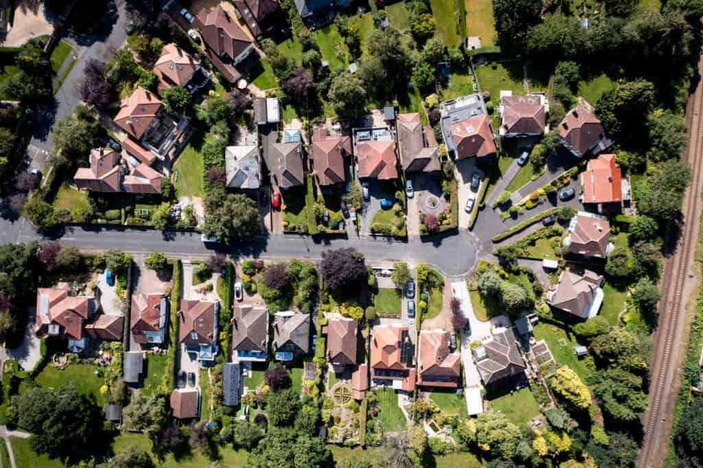
An overhead look at a settled cul-de-sac layout, the sort of already-built plot a retrospective assessment has to work around rather than redesign.
The red report area sits right on the edge of the Flood Zone 2 and 3 shading, matching the modelling that placed the dwelling clear of the main flood extent.