Groundwater Monitoring for Planning: Requirements, Timing and Delays
Estimated reading time 13 minutes
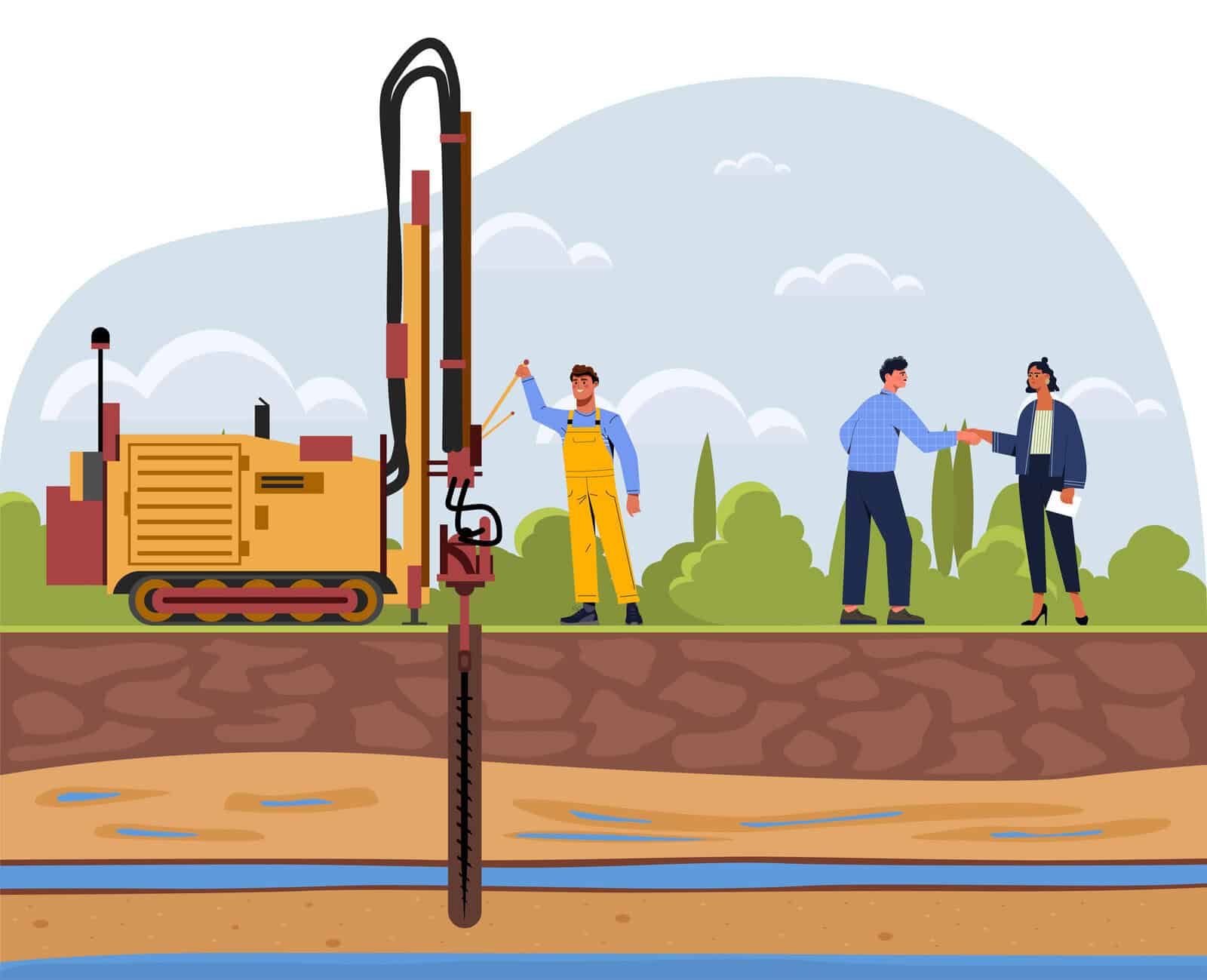
Groundwater monitoring for planning is the process of measuring how the water table beneath a site rises and falls over the seasons, usually to prove that an infiltration-based drainage scheme will actually work. It is most often needed where Sustainable Drainage Systems (SuDS) are designed to soak surface water into the ground, because the drainage feature has to sit a safe distance above the highest groundwater level. That evidence carries real weight in a planning decision, and it is rarely as simple as it looks on paper. If your scheme relies on infiltration, it sits at the heart of a defensible surface water drainage strategy, and getting the timing right is what keeps the application moving.
Timing is where it usually goes wrong. Useful groundwater data has to capture the winter peak, so monitoring that is not planned early is the single most common cause of delay on drainage-led applications.
Miss the winter monitoring window and the next opportunity is a year away, which is why poorly timed groundwater monitoring can set a scheme back six to twelve months.
What is groundwater monitoring in planning?
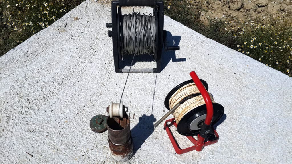
Groundwater monitoring records how groundwater levels change through the seasons, using either shallow trial pits or professionally installed boreholes. Levels are read manually with a dip meter, or logged automatically by a datalogger, so you end up with the seasonal high and low rather than a single snapshot.
That seasonal picture is the whole point, because groundwater is not static. Levels move with rainfall and geology, and a reading taken in a dry August can sit metres below the true winter peak. A one-off measurement tells you very little; a monitored record across the wet season tells you what the drainage design actually has to cope with. In planning, monitoring is most commonly required to support infiltration-based drainage under the 2025 National Standards for Sustainable Drainage Systems, and it is usually done alongside BRE365 infiltration testing. The two are closely linked, and one without the other is rarely enough to justify an infiltration-led strategy.
When is groundwater monitoring required?
Groundwater monitoring is required where infiltration is the primary way surface water will discharge from a site. If a soakaway, infiltration basin or permeable feature is proposed, the Lead Local Flood Authority (LLFA) will want monitored data before it accepts the strategy. An LLFA reviewing an infiltration scheme expects the monitoring to demonstrate three things.
- Infiltration is viable in principle. The water table is low enough for surface water to soak away.
- Storage is protected. Groundwater will not rise into the drainage feature and swallow its capacity.
- No harm elsewhere. Discharging to ground will not cause groundwater flooding or contamination off site.
Where infiltration is the only realistic option, that data usually has to be submitted with the planning application itself. Where an alternative route exists, such as a discharge to a watercourse or sewer, some authorities will accept the detail being resolved later under a drainage condition. Whether monitoring is needed up front, and how much, is exactly the kind of call a specialist makes at the outset — and where groundwater flooding is a concern in its own right, it belongs in a dedicated groundwater flood risk assessment rather than left to chance.
How does groundwater monitoring support infiltration SuDS design?
Groundwater monitoring supports infiltration design by proving there is enough separation between the base of the drainage feature and the highest expected groundwater level. Most guidance looks for at least one metre of clearance, measured against the seasonal peak rather than the level on the day of the survey.
The base of an infiltration feature is normally expected to sit at least one metre above the highest recorded groundwater level, which is why the monitoring has to run through the winter to catch the peak.
If the water table turns out to be too shallow, infiltration may not be feasible at all, and the strategy has to move down the SuDS hierarchy towards other discharge methods, as explored in nature-based and green SuDS approaches. So monitoring can decide whether an infiltration-led scheme is viable, and with it whether the development can proceed as designed.
How long does groundwater monitoring take, and why does timing matter?
Groundwater monitoring usually runs through the winter, when levels are at their highest, and typically takes several months. Depending on the authority and the site, that can mean monitoring across the November to May wet season, and in some cases a full twelve months of data. Groundwater peaks around January to March, so the programme has to be built around the calendar, not the other way round.
The programme risk speaks for itself: miss a winter, and the next chance is a year away. Starting too late, or only finding out about the requirement when the LLFA raises it, is one of the most common reasons a drainage-led application stalls. Dorset Council, for instance, typically expects up to twelve months of groundwater monitoring, with a reduced November to May window accepted only where the peak has clearly been captured.
Can you reduce the risk before full monitoring starts?
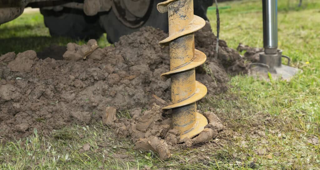
Yes. Early trial pits, dug at the feasibility stage, give a first indication of groundwater level and ground conditions long before a formal monitoring programme finishes. They do not replace monitored data, but they flag an obvious problem early, before a drainage strategy is built on the wrong assumptions. A sensible early-stage approach runs roughly like this.
- Dig trial pits at feasibility to get a first read on groundwater level and soil type.
- Combine that with the topographical survey and available desk data to judge whether infiltration is even plausible.
- If it looks marginal, install monitoring boreholes early so the winter window is not missed.
- Line the monitoring up with BRE365 infiltration testing so both datasets are gathered together.
Getting this groundwork in early sits alongside the wider drainage information needed for planning conditions, and it is often the difference between a strategy that holds up and one that comes apart at consultation. If you are unsure whether your site even needs it, our guide on whether you need infiltration testing is a good place to start.
Why aren't groundwater monitoring results always straightforward?
Monitoring wells do not always reflect the true groundwater conditions across a site. A borehole can intercept a localised permeable layer, or capture perched water sitting on a clay lens, and report a level that is not representative of the surrounding ground.
A single well rarely characterises a whole site, so a good consultant reads the numbers sensibly rather than taking one borehole at face value.
That can produce a genuine disconnect between what a trial pit shows during infiltration testing and what a monitoring well records over the season. It is a real technical limitation, not a reason to skip the work. Authorities still need formal monitoring data to make a decision, so the process is robust in principle even when it is awkward in practice.
Why does groundwater monitoring delay planning applications?
Groundwater monitoring delays applications because the data cannot be rushed. It has to span the wet season, and that season comes round once a year, so a requirement spotted late leaves the whole programme waiting on the weather. The delays tend to come from four places.
- Seasonal constraints. Credible data must capture the winter groundwater peak.
- Late identification. The requirement often surfaces only when the LLFA comments during consultation.
- Inconsistent policy. The bar varies between councils, so it is not always clear at the start.
- Data gaps. An incomplete record invites an objection rather than an approval.
Where the monitoring falls short, an LLFA will often hold its objection until proper data arrives, delaying determination and sometimes forcing a resubmission. Understanding why an LLFA objects to a drainage strategy is the first step to avoiding one.
Why do requirements vary between councils?
Requirements vary because there is no single national standard for how much groundwater monitoring a planning application needs. Each authority sets its own expectations, shaped by local geology, flood history and how much risk it is willing to carry, and applies them differently from site to site.
| Authority | Typical monitoring expectation | Accepted window |
|---|---|---|
| Dorset Council | Up to 12 months of groundwater monitoring | Reduced Nov–May window only where the peak is clearly captured |
| Arun District Council | Monitoring set out in updated drainage validation requirements | Guided by the council's published groundwater monitoring guidance |
| Typical LLFA | Wet-season monitoring where infiltration is proposed | Winter period, extended where the data is inconclusive |
Some authorities, such as Dorset, publish detailed guidance on groundwater, flood risk and sustainable drainage. Others, such as Arun, have quietly raised the bar through updated groundwater monitoring requirements, and we set out what that means for applicants on our Arun District Council flood risk and drainage requirements page. Either way, the practical lesson is the same: check the specific authority's position before you design the drainage strategy, not after.
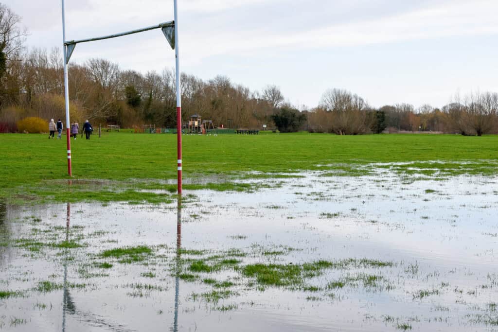
Groundwater constraints bite hardest across the chalk of southern England, where water tables can swing several metres between summer and winter — which is why monitoring features so heavily in our area guidance for Dorset, Wiltshire, Hampshire and West Sussex.
Common mistakes in groundwater monitoring and infiltration testing
Most of the common mistakes come from treating monitoring as a box to tick rather than a genuine input to the drainage design. The ones that keep recurring:
- Wrong season. Monitoring outside the correct window, so the winter peak is never captured.
- Too little separation. Failing to show the required clearance between the drainage feature and the water table.
- Misplaced testing. Poor alignment between where the testing is done and where the drainage features will sit.
- Thin data. Incomplete datasets, or results extrapolated from too few readings.
- Unproven assumptions. Assuming infiltration will work without the evidence to back it.
How should you approach groundwater monitoring strategically?
Treat groundwater monitoring as an early design input, not a late compliance task. The schemes that avoid delay are the ones where groundwater is considered from the first feasibility review, with enough programme time built in to capture a full winter if that is what the authority wants. Government planning practice guidance on flood risk expects all sources of flooding, groundwater included, to be assessed — and the National Standards for Sustainable Drainage Systems expect infiltration features to sit clear of the water table. In practice that means:
- Assess feasibility early, including trial pits where they help.
- Confirm the specific LLFA's monitoring expectations before committing to a strategy.
- Integrate monitoring with infiltration testing and the drainage design, rather than running them in isolation.
- Allow enough time in the programme for the winter window, with a fallback discharge route in mind.
Handled well, groundwater monitoring gives you the evidence to support a viable drainage strategy; handled poorly, it delays planning, invites objections and can force a fundamental redesign.
If you are working on a drainage-led planning application, it pays to build groundwater into the picture early. Unda's team can help with surface water drainage strategy and design, preliminary drainage design for planning, and the flood risk assessment work that sits alongside it. Get in touch for a no-obligation quote and one of our flood risk consultants will come back to you.
Frequently asked questions
Can I submit a planning application before groundwater monitoring is complete?
Sometimes. Where infiltration is the only viable discharge route, most authorities want the monitoring data with the application. Where an alternative discharge exists, some will accept outline evidence up front and let the full monitoring be resolved later under a drainage condition. It depends on the authority and the site, so confirm the position before you submit rather than assuming.
What is the difference between groundwater monitoring and BRE365 infiltration testing?
They answer different questions. Groundwater monitoring measures how high the water table rises over the season. BRE365 infiltration testing measures how quickly the soil lets water soak away. An infiltration scheme needs both a fast enough soil rate and enough clearance above the winter groundwater peak, which is why the two are almost always carried out together.
Can dataloggers replace manual dip readings?
Largely, yes. A datalogger records groundwater levels automatically at set intervals, giving a much denser record than periodic manual dips and cutting out repeated site visits. Manual readings are still handy to calibrate and sense-check the logger, but continuous logging is now the usual way to build a reliable seasonal profile.
How deep are groundwater monitoring boreholes, and how many do I need?
Depth and number depend on the ground and the size of the scheme. Boreholes are generally installed deep enough to sit below the expected winter water table, and larger or more variable sites need more than one to be representative. A single well rarely characterises a whole site, which is one reason the monitoring layout is worth thinking about.
Does every site need groundwater monitoring?
No. Monitoring is driven by infiltration drainage and by groundwater flood risk. A site discharging to a sewer or watercourse, on ground with no groundwater constraint, may not need it at all. It becomes important where infiltration is proposed, where the water table is high, or where the site sits on a susceptible aquifer such as chalk.
About the author. Ellen is a Flood Risk and Drainage Consultant working across flood risk assessment and sustainable drainage design. Unda has been trading since 2014, is a CIWEM Business Partner with CIWEM member and chartered (C.WEM MCIWEM) consultants, and has delivered 5,000+ flood risk assessments and drainage strategies across England and Wales.
Ellen Webb · BSc (Hons), GradCIWEM
Latest news



One of our experienced Flood Risk Consultants will get back to you within 60 minutes