What Is a Weir? How Weirs and Sluices Control River Levels
Estimated reading time 14 minutes
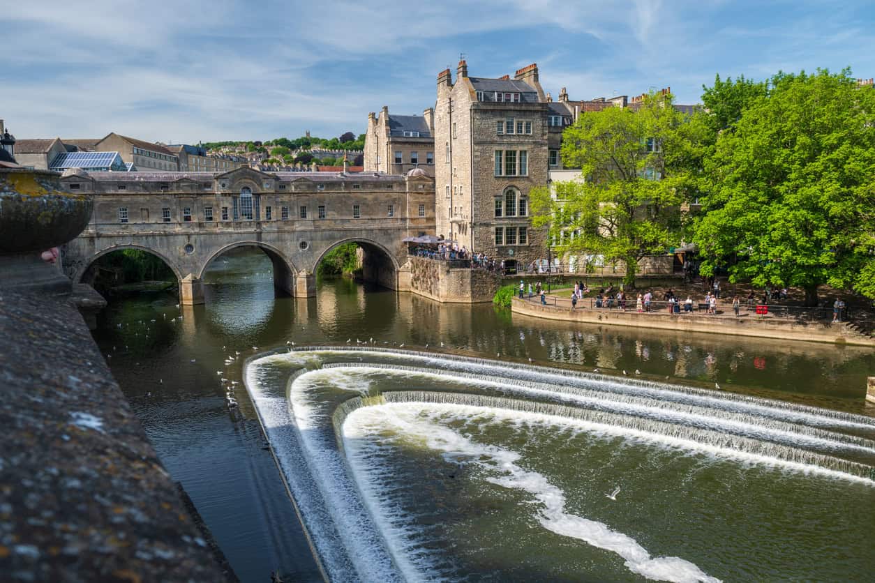
What is a weir? It is a low barrier built across the full width of a river, so that the water spills over its top instead of passing round it. The job of a weir is to hold the river upstream at a higher, steadier level than it would keep on its own, and that held level is what makes a weir useful, as well as what shapes the flood risk around it. The Environment Agency's asset data dictionary describes a weir in exactly those terms and treats it as fixed: once the crest is built, its height does not change. A gate that can be raised or lowered to adjust the level is recorded as a different kind of structure altogether.
Most weirs in England and Wales were built to manage water levels, many of them before 1900 to drive mills or keep rivers navigable. Plenty still work alongside sluice gates and locks, and from the bank the three are easy to confuse: the weir fixes the level, the gates adjust it, and the lock lets boats move between the level above and the level below.
A weir holds a river up in ordinary flows. In a large flood it is drowned out, and the river runs over it with little check.
What does a weir do?
A weir raises the water level upstream and holds it steady. The deeper, slower stretch of river behind the crest keeps a river deep enough for boats, keeps water intakes submerged in dry weather, and gives hydrologists a fixed control from which to calculate flow. Water tumbling over the crest also picks up oxygen on the way down.
- Navigation. On the non-tidal Thames, the Environment Agency is the navigation authority for 135 miles of river from Cricklade to Teddington and runs 45 lock sites. The weirs beside the locks hold each reach deep enough for boats, most of all in a dry summer.
- Water supply. A held level keeps abstraction intakes under water when the river would otherwise drop below them.
- Flow measurement. A weir of known shape gives a fixed relationship between the depth of water above the crest and the flow passing over it. Environment Agency guidance describes weirs as the backbone of the national network of flow-gauging stations.
- Mills and heritage. Many older weirs were built to power mills. The mills have mostly gone. The weirs, and the water levels they set, have not.
Because a weir sets the normal water level along its reach, it also sets the starting point for any flood on that reach. A flood risk assessment for planning on a weir-controlled stretch of river has to account for the structure, its crest level and, where there are gates, how they are worked.
Types of weir
Weirs are grouped by crest shape, for a practical reason. The crest decides how water passes over it and how accurately the flow can be measured. The five below cover the forms met on UK rivers and in drainage schemes.
| Type | Crest shape | Typical use | Point to note |
|---|---|---|---|
| Broad-crested | A flat, wide sill, often masonry or concrete | Level control on rivers; many old mill and navigation weirs | Covered for flow measurement by ISO 3846 |
| Sharp-crested (thin-plate) | A thin plate with a sharp top edge, cut straight across or as a V-notch | Measuring small flows in ditches, channels and drainage overflows | Rare on rivers; the weir overflow sizing calculator covers the sizing |
| Crump | A triangular profile, sloping 1:2 on the upstream face and 1:5 downstream | Flow-gauging stations | Accurate across a wide range of flows |
| Labyrinth | Folded in plan into a zigzag, to give a longer crest in a narrow channel | Holding a steady upstream level where space is tight | The benefit fades in high flows, when it behaves like a straight weir |
| Ogee | A curved crest shaped to follow the underside of the falling water | Reservoir spillways and larger river structures | Water stays in contact with the face as it falls |
The Crump weir is named after E. S. Crump, whose 1952 paper in the Proceedings of the Institution of Civil Engineers set out the triangular profile, and the National River Flow Archive still lists it as a standard gauging station type. Its accuracy comes at a cost. The Environment Agency's weir guidance records that the flat-V Crump is favoured by hydrometrists and disliked by fisheries officers as a barrier to fish.
What is a sluice gate?
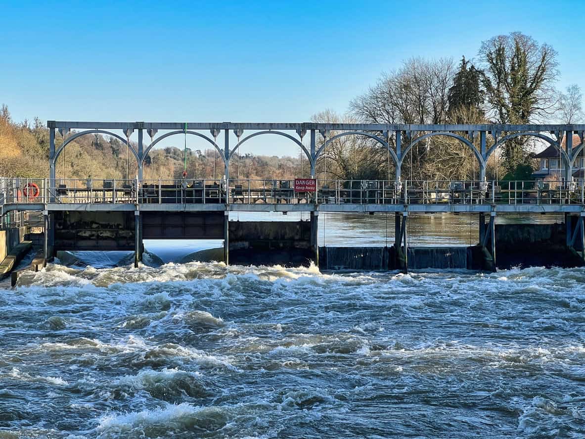
A sluice gate is a movable gate that controls how much water passes through an opening. Where a weir's crest is fixed, a sluice gate can be raised, lowered or swung open, so whoever operates it can hold a level in dry weather and let more water through as the river rises. Larger river weirs are often gated for that reason.

The gates themselves come in a few forms. A vertical-lift gate slides up and down in a frame. A radial gate is curved and pivots upwards out of the flow. A penstock is a smaller gate or valve that controls flow through a pipe, culvert or outfall, and turns up on mill leats, ponds and drainage systems. The Environment Agency groups all of them as control gates, meaning structures that adjust water levels and flows within a watercourse.
Many river control structures combine the two: a fixed weir to hold the ordinary level, and gates alongside it to pass higher flows.
What happens to weirs and sluices in a flood?
As a river rises, the gates on a controlled weir are opened in stages to let more water through. Once every gate is fully open, the operator has no further control, and the level is set by the flow and by the shape of the channel and floodplain. A weir can slow how quickly water backs up early in a flood. It cannot hold back a large one.
- Normal flows. Gates are partly closed, holding the level for navigation and abstraction.
- Rising flows. The Environment Agency opens the gates in a controlled sequence to pass the extra water and stop it backing up over the banks. On the Thames the boards at each lock turn yellow for "stream increasing", then red for "strong stream", at which point the Environment Agency advises all boats not to navigate.
- Gates fully open. On the Thames this is known locally as "fully drawn". The Environment Agency says that once it is reached, it can exert no more control if levels keep rising.
- Beyond that point. A fixed crest is drowned out and the river runs over it much as it would over the channel bed.
So a weir is not a flood defence in the planning sense. It has no design standard of protection, the Environment Agency records weirs as a separate asset type from flood defences, and a weir nearby does not move a site into a lower Flood Zone, for the same reason that sites stay in a Flood Zone after new defences are built. Where weirs do take a direct part in reducing flood risk, it is as one component of a purpose-built scheme, such as the Jubilee River flood relief channel, which uses five control weirs to divert Thames flood flows around Maidenhead, Windsor and Eton.
Blockage is the other flood risk at a weir. Fallen trees, debris and even loose boats can lodge against a crest or a part-open gate and push the water level up behind it, and a gate that jams or loses power may not open at all. The Environment Agency's blockage management guide deals with weirs and control gates alongside culverts and screens. Levels at the gauges above and below many weirs can be followed on the live river levels map.
Planning a site on a weir-controlled river?
A flood risk assessment has to show the site stays safe once the gates are fully open, and when the weir blocks. Send the site details and a quote comes back within 60 minutes.
Start an FRA quoteWhy are weirs dangerous?
The danger sits just below the crest. Water dropping over a weir meets slower water downstream and forms a hydraulic jump, a band of churning water in which the surface current runs back towards the weir. A swimmer or canoe caught in it is carried back to the foot of the weir and turned over, again and again. Paddlers call this a stopper, or towback.
"…trapping them in turbulent water with the inevitable risk of drowning."
Environment Agency, River Weirs Good Practice Guide (2003), on the return current below a weir

The same guide lists the weirs most likely to trap people. Straight weirs with a level crest can form a stopper across the whole width of the river, with no gap at either end to escape through; horseshoe-shaped weirs are flagged as a trapping hazard too. The Environment Agency describes flow near weirs and sluices as particularly hazardous, and warns that conditions can change without warning while the weirs are being operated.
Flat, calm water a few metres downstream says nothing about the stopper at the foot of the weir.
Who owns weirs, and what consent covers work on them?
A weir belongs to whoever owns the structure. That is usually the owner of the river bed beneath it. The Environment Agency owns and operates the weirs on the non-tidal Thames. The Canal & River Trust looks after 795 weirs on its waterways, and a great many more belong to riparian owners, mill owners and estates. Government guidance on owning a watercourse requires owners to keep any weir clear and to get permission before building or changing one.
Which permission applies depends on the river. Whether it is a main river or an ordinary watercourse decides the flood risk regulator, and a separate licence covers impounding the water.
| Consent | When it applies | Who issues it |
|---|---|---|
| Flood risk activity permit | Building, altering or repairing a structure in, over or under a main river, or working within 8 m of one (16 m if tidal) | Environment Agency |
| Ordinary watercourse consent | Building, raising or altering a weir on any other watercourse, under section 23 of the Land Drainage Act 1991 | Lead local flood authority, or the internal drainage board where one exists |
| Impounding licence | Building, altering or removing a weir, which the Water Resources Act 1991 counts as impounding works | Environment Agency |
In Wales, Natural Resources Wales issues the permit and the impounding licence, and ordinary watercourse consent comes from the local authority.
Fish passage brings a further duty. In rivers used by salmon or sea trout, the Salmon and Freshwater Fisheries Act 1975 lets the Environment Agency require a fish pass in any new or raised obstruction. The Eels (England and Wales) Regulations 2009 require notice before a weir is built or altered, and regulation 14 lets the agency require an eel pass as well, and any pass that is needed, whether for salmon or for eels, goes through fish pass approval before it is built.
What does a weir mean for nearby property and development?
A weir shapes the water level along its reach in ordinary conditions and, if it blocks or its gates fail, during a flood as well. A flood risk assessment that treats the river as a plain channel is likely to understate the risk. That can end in an objection from the Environment Agency, or in refusal. For a buyer, a weir nearby is a reason to check modelled flood levels against the floor, not a sign of protection.
- The model has to include the structure. Environment Agency guidance on using modelling for flood risk assessments expects in-channel structures that affect flood risk to be represented, blockage of significant structures to be tested, and the failure of water control assets such as sluices to be modelled. That is the work of hydraulic flood modelling for planning.
- The worst case can set the floor level. If the blocked-weir or failed-gate run gives a higher flood level than the design run, floor levels, freeboard and safe access are tested against it. A scheme that passes on the design run can fail on this one, and the fix is raised floors, a new access route, fewer units or, at worst, refusal.
- Some risk always remains. Even with the gates working as intended, the residual flood risk from a structure blocking or failing stays with the site, and has to be managed through the design and a flood plan.
- Buyers inherit all of this. A flood risk survey when buying a house compares the modelled river levels with the property's floor and threshold levels before exchange, while there is still time to renegotiate or walk away.
Buying a home near a weir or sluice?
A flood risk survey tests the property's floor levels against the modelled river levels before exchange. Quotes are returned within the hour.
Get a property flood surveyWhere Unda comes in
Unda prepares flood risk assessments and hydraulic models for sites on rivers controlled by weirs and sluices, including the blockage and gate-failure runs the Environment Agency expects to see. For a planning application on a controlled reach, the starting point is a flood risk assessment for planning that builds the structure in from the outset.
Frequently asked questions
Can you swim or kayak over a weir?
Not safely, unless the weir was designed for it. Some weirs have canoe passes or marked portage routes, where paddlers lift their boats out and carry them round; on the Thames, unpowered boats are advised not to navigate at all once the yellow "stream increasing" boards go up. Swimming near a weir is best avoided at any flow.
What is the difference between a sluice gate and a flood gate?
A sluice gate sits in the river and controls how much water flows through it. A flood gate closes a gap in a flood wall or embankment, such as a road or footpath opening, and keeps floodwater out when it is shut. The Environment Agency records the two as different types of asset.
Can a weir make flooding worse upstream?
It can. Raising the normal level upstream is the whole purpose of a weir, and the Environment Agency's weir guidance lists increased flood risk among the possible side effects. A blockage at the crest raises upstream levels further, which is why flood models test for one.
Can an old weir be removed?
Removal needs consent in the same way building does: an impounding licence, plus a permit or ordinary watercourse consent. It also changes upstream water levels, bank stability and the setting of anything built along the reach. The guide to the design, maintenance, modification and removal of river weirs, published on GOV.UK in 2021, sets out the assessment involved.
Who should be told about a weir in poor condition?
The owner first, where known. On a main river the Environment Agency is the regulator; on an ordinary watercourse it is the lead local flood authority or the internal drainage board. A blockage that is causing or threatening flooding can be reported to the Environment Agency's incident hotline.
About the author. Emma is a Senior Flood Risk Consultant, and a policy and flood modelling expert. Unda has been trading since 2014, is a CIWEM Business Partner with CIWEM member and chartered (C.WEM MCIWEM) consultants, and has delivered 5,000+ flood risk assessments and drainage strategies across England and Wales.
Emma Jeffery · MSci (Hons)

One of our experienced Flood Risk Consultants will get back to you within 60 minutes
