Guildford Flood Alleviation Scheme: flood risk, defences and what happens next

Estimated reading time 16 minutes
The Guildford Flood Alleviation Scheme is a long-term project by the Environment Agency, Guildford Borough Council and Surrey County Council to reduce flood risk to Guildford town centre from the River Wey. It proposes more than two kilometres of new and improved defences, alongside selective lowering of land beside the river to create extra flood storage. In June 2026 the scheme reached a major milestone: its Outline Business Case was submitted to government for funding, the step that moves it from appraisal towards detailed design. It will not remove flood risk entirely, and full funding is still to be confirmed.
This article explains why Guildford floods, what the scheme proposes, how far it has progressed in 2026, and what it means for anyone who owns, buys or develops property in the town. It draws on the technical documentation and on the views of a flood risk consultant who grew up here.
Guildford's flood risk is systemic, not a run of bad luck. The town sits on a natural pinch-point of the River Wey, and fluvial, surface water and groundwater flooding regularly combine.
Why Guildford floods: a history written into the town
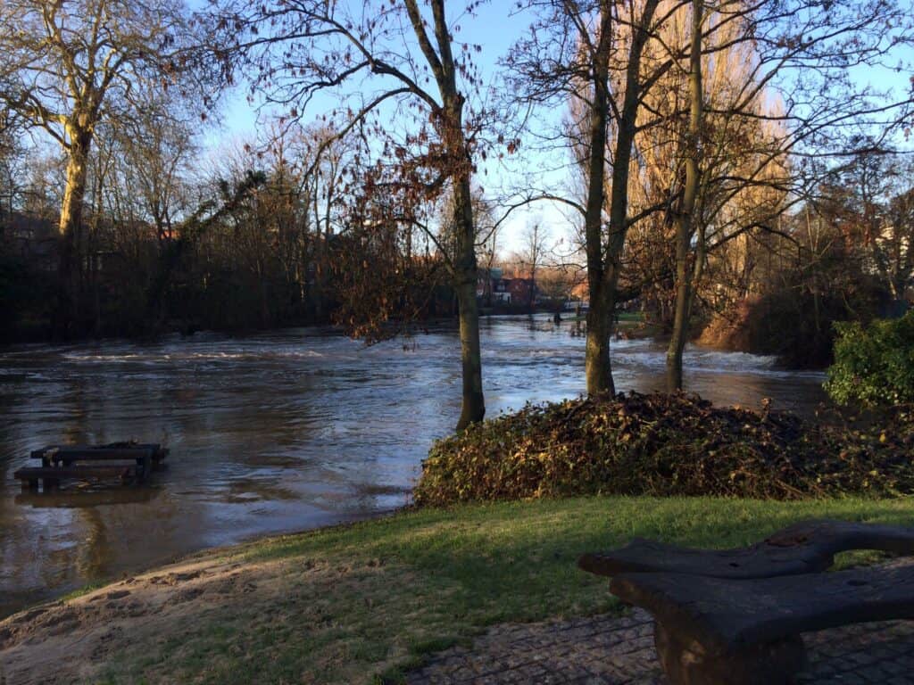
Guildford's relationship with flooding is long-standing and well documented. The town sits at a natural constriction on the River Wey, where historic development, bridges and river training have progressively reduced the space available for flood flows. Significant flooding was recorded in 1968 during a wider South East England event, which remains a key reference point in Environment Agency records for the Wey catchment. More recent measured data shows peak river levels in November 2000, and again during the winter of 2013–14, when prolonged rainfall led to rapid rises in water levels and widespread disruption across the town centre. Tributaries add to the pressure: on Christmas Eve 2013, Cranleigh Waters reached its highest recorded level at Bramley, and the water it pushed into the Wey helped flood homes and businesses through the town.
For Freya Pott, Flood Risk Consultant at Unda, this history is not abstract. Having grown up in Guildford, she recalls the 2013–14 floods vividly:
"I remember the 2013 – 14 floods very clearly. The bottom part of Guildford flooded, and many of the restaurants and shops along Friary Street were closed because of water damage. It brought home how exposed parts of the town centre really are."
Freya Pott, Flood Risk Consultant at Unda
The winter 2013–14 events remain particularly influential in shaping current thinking. Post-event reviews confirmed that the flooding was driven by exceptionally high flows in the River Wey and its tributaries, rather than by operational problems at weirs or sluices. They also showed that flooding in Guildford rarely comes from a single source. Surface water and, in places, groundwater compounded the river flooding, with runoff travelling through streets and low-lying routes into the town centre.
Guildford has kept flooding since. Temporary defences were deployed during high-flow events in 2019 and 2020, and the Millmead area flooded again as recently as March 2024. Taken together, this record underlines that flood risk in Guildford is persistent and systemic, not the result of isolated extreme events.



From flood response to a long-term scheme
The scheme has been in development for years rather than months. The Environment Agency, Guildford Borough Council and Surrey County Council have worked in partnership since 2018 to develop a long-term flood alleviation scheme for the town centre, moving from emergency flood response towards a permanent, engineered reduction in risk.
The project has since worked through technical appraisal and public engagement. Public information events were held in January 2026, when the emerging designs were shared and residents, businesses and developers were invited to comment. The Environment Agency published a feedback summary report afterwards. That consultation was the point at which the shape of the scheme became public, covering the direction of travel on defences, conveyance and land lowering, even though several key decisions were still open.
If you are weighing up how the scheme affects a specific site, an independent flood risk assessment in Guildford is the practical way to understand what the proposals change and what risk will remain. The scheme reshapes the strategic picture. It does not answer the site-specific question that a planning application or a purchase actually turns on.
The partnership behind the scheme, the Environment Agency, Guildford Borough Council and Surrey County Council, has been developing it since 2018.
The scale and form of the proposed scheme
The emerging proposal is large. It comprises more than two kilometres of new or improved flood defences through the town centre, combined with selective lowering of land along the river corridor to create additional flood storage and conveyance. Rather than a single continuous wall, the scheme is being designed as a series of context-specific interventions.
There are also important interfaces with planned development. As Freya notes:
"It will be really interesting to see how the flood alleviation scheme works alongside the redevelopment of the old Debenhams site. Any major redevelopment in this part of the town centre will need to address floodplain compensation and storage properly, and how that aligns with the wider scheme will matter."
Freya Pott, Flood Risk Consultant at Unda
In constrained locations, defences would sit close to the river or next to existing buildings. Where space allows, they would be set back and shaped into landscaped features, forming part of enhanced public spaces along the River Wey. Freya sees an opportunity in that:
"If it's done well, the scheme could help regenerate the town centre. At the moment, large parts of the river are edged by concrete paths or muddy areas that can't really be used. There's a real opportunity to make those spaces better."
Freya Pott, Flood Risk Consultant at Unda
The Environment Agency's consultation material sets out the emerging design in more detail: Guildford Flood Alleviation Scheme consultation summary (PDF).
Hydraulic constraints and the role of the bridges
One of the most technically significant aspects of the scheme is how it treats existing river crossings. Town Bridge and Millmead footbridge are identified as major hydraulic constraints within the town centre. During high flows, these structures restrict how quickly water can pass, causing levels to rise upstream and increasing flood risk to surrounding areas.
The scheme documentation is clear on the trade-off. Introducing new defences without addressing these constraints could worsen flooding upstream, by stopping floodwater from spilling out of the channel and relieving pressure. This is a point Freya returns to repeatedly:
"There's always a concern that putting new defences in one place can push flood risk elsewhere. Places upstream like Godalming already experience flooding, so the question is whether the proposed changes at Town Bridge and Millmead will really be enough."
Freya Pott, Flood Risk Consultant at Unda
That upstream point is a real constraint on the design, not a hypothetical. Godalming and the Wey villages carry their own flood history, so a scheme that protects the town centre has to avoid simply moving the water onto them.
The preferred approach emerging from the appraisal includes removing decorative ironwork and parts of the parapet or abutments at Town Bridge to improve conveyance, alongside replacing Millmead footbridge with a longer clear-span structure and associated bank works. On this, Freya is cautious:
"The scheme has clearly thought about upstream impacts, but it will be important to see whether the replacement of Millmead footbridge and the removal of ironworks at Town Bridge provide enough capacity during the largest events, especially once climate change is factored in."
Freya Pott, Flood Risk Consultant at Unda
The open question is whether those two changes, on their own, provide enough extra conveyance to offset the effect of containing floodwater through the town centre. That test gets harder for larger, climate-driven events, which is where the margins are thinnest.
Standards of protection and climate change
The appraisal has tested different standards of protection. These include events with annual probabilities of one in 50 and one in 100, and a one in 100 event with an allowance for climate change. The final standard depends on the balance between cost, benefit and wider impacts, and is fixed as the business case develops rather than at the consultation stage.
This decision is critical. The chosen standard shapes the level of flood risk reduction achieved. It also shapes how the town centre is planned and developed in future, from assumptions around residual risk to safe access and emergency planning. Design allowances for a changing climate matter here too. The Environment Agency's climate change allowances for planning require schemes and developments to look decades ahead, well beyond today's flows, in line with the government's published allowances.
Surface water and the wider flood system
Importantly, the river scheme is not being developed in isolation. Surrey County Council, in its role as the Lead Local Flood Authority, is running a parallel surface water flood alleviation study for Guildford town centre. This work recognises that many recent flooding incidents involved surface water routes interacting with the built environment, rather than the river acting alone.
The intention is for surface water and fluvial modelling to inform each other, so that measures complement rather than undermine one another. Developer-led attenuation and drainage strategies are expected to play a role in managing runoff into the town centre. That is one reason a scheme this size does not remove the need for site-level surface water drainage strategies on new development, whether in the town centre or elsewhere across Surrey.
The River Wey drains 904 square kilometres of Surrey, Hampshire and West Sussex before it reaches Guildford, so the town's risk is shaped by a catchment far larger than the town itself.
What has been ruled out
The appraisal documentation is clear that upstream flood storage and large-scale natural flood management have been considered, but are not expected to deliver meaningful reductions in flood risk to Guildford during large events. Constraints of topography, environmental impact and cost relative to benefit mean the focus stays firmly on managing flood risk within the urban area itself.
That does not make natural flood management irrelevant across the wider catchment. It can still help with smaller, more frequent events and bring benefits for the environment. But for the scale of flooding that threatens Guildford town centre, the evidence points towards engineered defences and conveyance improvements as the measures that actually move the risk.
What the scheme can and cannot do
It is worth being clear about the scheme's limits. Even delivered in full, it will not eliminate flood risk. Temporary defences, operational river management and emergency response planning will remain part of Guildford's flood toolkit. Residual risk from extreme events, surface water flooding and system interactions will still need careful consideration.
Funding also remains a live issue. The Environment Agency has been clear that the scheme can only proceed once full funding is secured, and that it is still working through the business case and funding route. As Freya points out:
"Full funding for the scheme hasn't been secured yet. That uncertainty matters, because it affects how quickly the scheme can move forward and how confident people can be about when flood risk conditions in the town centre might actually change."
Freya Pott, Flood Risk Consultant at Unda
Local leadership strikes the same note of realism. Councillor Vanessa King of Guildford Borough Council has described the scheme as "essential to protecting communities and supporting long-term economic growth, ensuring Guildford remains a great place to live, work and do business."
The Outline Business Case and what comes next
The most significant recent development came in June 2026, when the partners submitted the scheme's Outline Business Case to government. This is the formal step that sets out the case for funding. If it is approved, the project can progress to detailed design and planning applications. Announcing the milestone, Jon Mansbridge, the Environment Agency's Major Projects Manager, said "the submission of our 'Outline Business Case' marks a significant step forward for the Guildford Flood Alleviation Scheme."
The figures behind the case give a sense of its scale.
- Properties protected. Around 750 homes and businesses in Guildford town centre would benefit from the scheme.
- Economic benefits. The business case projects benefits of £330.76 million over 100 years.
- Economy at stake. The scheme is designed to help protect Guildford's roughly £6.7 billion local economy.
- Strategic routes. It aims to keep key transport links, including access to the A3 and M25, open during flood events.
- Regeneration. Better connections between the town centre and the River Wey sit alongside flood risk reduction as a core objective.
The immediate next step is a government funding decision through Defra. Guildford Borough Council has publicly asked government to avoid delays in approving that funding, because timing determines how quickly the town's flood risk conditions can change. Subject to the Outline Business Case being approved, the scheme would then move into detailed design and seek the planning permissions it needs.
Guildford is one of several Environment Agency town-centre schemes at different stages. The Oxford flood alleviation scheme was approved in 2026 after a comparable appraisal, while the smaller Skinningrove scheme in the North East is already in construction. Both show the same pattern Guildford now faces: a long appraisal, a funding decision, then delivery, with a mapped flood risk that persists behind the finished defences.
For Freya, the period around these decisions is where scrutiny matters most:
"This is the stage where it's really important to get the fundamentals right. Once decisions on alignment, levels and structures are locked in, they're very hard to undo. The scheme has real potential, but it needs to be tested properly against how the river actually behaves in big events."
Freya Pott, Flood Risk Consultant at Unda
The scheme's progress can be followed on the Environment Agency's project webpage and its formal consultation pages, where the partners publish updates and invite feedback.
What this means if you own, buy or develop in Guildford
For residents, businesses and developers, the most important practical point is easily missed. A flood defence scheme does not, by itself, move a property out of its flood zone. The Environment Agency's Flood Map for Planning is drawn as though defences were not there, so a site in central Guildford can stay in Flood Zone 2 or 3 even once the scheme is complete. It can still need a flood risk assessment for planning. You can check a property's headline position on the government's long-term flood risk service and watch how the Wey is behaving on Unda's live river levels map, but the mapped planning position is what a case actually turns on.

That gap between the mapped position and the defended reality is exactly where independent advice earns its place. If you are buying, a flood risk survey for a property purchase will interpret what the scheme is likely to change and what risk remains. If you are developing, a site-specific flood risk assessment for planning sets the design flood levels, safe access and drainage that the local planning authority will expect under national planning practice guidance on flood risk. Near a scheme like this, questions of floodplain compensation and how a site aligns with the wider works are live from the outset.
The success of the Guildford Flood Alleviation Scheme will ultimately depend on whether it answers the town's flood history as much as its future aspirations. If it does, it can materially reduce risk, support regeneration and reshape the relationship between the town centre and the River Wey. If it does not, flooding pressures may simply be displaced or deferred rather than resolved. Either way, early and informed engagement, reading the technical detail rather than the headlines, is how residents, businesses and developers protect their own interests as the scheme moves forward.
In or near a Guildford flood zone?
A new defence scheme does not change your flood zone on the day it opens, and planning and property decisions cannot wait for it. Our consultants assess your site against the current maps and the emerging scheme, so you know exactly what you are dealing with.
Start a quoteFrequently asked questions
Will the Guildford Flood Alleviation Scheme stop Guildford flooding completely?
No. Even delivered in full, the scheme is designed to reduce flood risk to the town centre, not to remove it. Temporary defences, operational river management and emergency planning will still be needed, and residual risk from extreme events and surface water will remain. The scheme lowers the likelihood and severity of flooding rather than guaranteeing it can never happen.
If my property is behind the new defences, do I still need a flood risk assessment?
Usually yes. The Environment Agency's Flood Map for Planning is drawn ignoring defences, so a site can stay in Flood Zone 2 or 3 even once the scheme is built. Planning applications on such sites still require a site-specific flood risk assessment, and lenders and insurers still read the mapped position rather than the defended one.
When will the Guildford Flood Alleviation Scheme be built?
There is no confirmed construction date. The Outline Business Case was submitted to government in June 2026, and the scheme can only progress to detailed design, planning and construction once funding is approved. The timeline therefore depends on a government funding decision, which the council has urged should not be delayed.
How many properties will the scheme protect, and what will it cost to build?
Around 750 homes and businesses in Guildford town centre would benefit, and the business case projects benefits of £330.76 million over 100 years while helping protect a local economy of roughly £6.7 billion. The construction cost is being settled through the business case and funding process, and has not been published as a single confirmed figure.
Which river causes flooding in Guildford?
The River Wey is the main source of river flooding in Guildford, funnelling water from a 904-square-kilometre catchment through a natural constriction in the town centre. Flooding is rarely from the river alone. Surface water running off streets and, in places, groundwater regularly combine with high river levels to flood low-lying parts of the town.
About the author. Freya is a Flood Risk Consultant focused on planning (NPPF/TAN15), insurance and property. Unda has been trading since 2014, is a CIWEM Business Partner with CIWEM member and chartered (C.WEM MCIWEM) consultants, and has delivered 5,000+ flood risk assessments and drainage strategies across England and Wales.
Freya Pott · MSc, BSc (Hons), GradCIWEM
Latest news






One of our experienced Flood Risk Consultants will get back to you within 60 minutes