Natural Flood Management Schemes in the UK: How Real Projects Slow the Flow
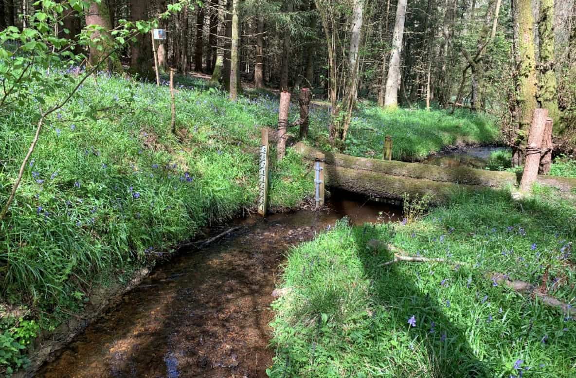
Estimated reading time 12 minutes
Natural flood management schemes use woodland, wetlands, leaky dams and better-managed soils to slow and store rainwater across a catchment, taking the edge off flood peaks downstream. Across the UK, councils, rivers trusts and landowners now run dozens of these schemes, from grant-funded work on Pennine hillsides to catchment-scale partnerships in the Scottish Borders. This page looks at the schemes that are actually working on the ground, what they have achieved, how they are funded, and where they fit alongside conventional flood defences and the flood risk work a development site still has to do.
In 2023 the Environment Agency and Defra committed £25 million to a national natural flood management programme, now delivering around 35 catchment projects across England through to March 2027.
For the underlying question of whether natural flood management works and what the evidence says, see our deep dive into the Environment Agency's natural flood management research. This article is about the schemes themselves.
What is a natural flood management scheme?
A natural flood management scheme is a coordinated set of nature-based measures, usually across a whole catchment or sub-catchment, that works with natural processes to slow, store and filter water rather than rushing it downstream through engineered channels. The Environment Agency groups the measures into a handful of families, and most schemes combine several of them.
- River and floodplain work: re-meandering straightened rivers, reconnecting floodplains, and building leaky barriers to push high flows out onto the land.
- Woodland and hedgerows: planting trees on slopes and along riverbanks to intercept rain, stabilise soil and roughen the ground so water moves more slowly.
- Run-off management: improving soil structure, changing grazing, and adding bunds, ponds and swales that catch surface water before it concentrates.
- Wetlands and storage: creating attenuation ponds, scrapes and wetland complexes that hold water back and release it gradually.
The point of a scheme, as opposed to a single feature, is that these measures add up. Each leaky dam or new pond does a little; a catchment full of them, arranged so they do not all release their water at the same moment, can meaningfully lower and delay a flood peak. It is the same source-control logic that underpins green sustainable drainage in modern developments, scaled up from the plot to the hillside.
Natural flood management uses natural processes to reduce the risk of flooding. These processes protect, restore, and mimic the natural functions of catchments, floodplains and the coast to slow and store water.
Environment Agency, GOV.UK
How do natural flood management schemes slow the flow?
A scheme slows the flow by intervening at every stage of a raindrop's journey, from the moment it lands on a hilltop to the point where a swollen stream would otherwise reach a town. Healthy, uncompacted soils and new woodland soak up and hold more rain at the top of the catchment; leaky dams and reconnected floodplains store and spread water in the middle; and wetlands and ponds provide temporary storage before the water reaches anything at risk. Arranged well, these measures desynchronise a catchment, so tributaries do not all peak together.
The effect is real but bounded: it is strongest for smaller, more frequent floods and in smaller catchments, and it fades as storms grow more extreme.
Two of the best-known building blocks of a scheme, leaky dams and beaver dams, both follow that pattern: they take the edge off ordinary floods and do progressively less against the rarest, largest events.
Natural flood management schemes across the UK
The clearest way to understand what these schemes do is to look at ones that have run long enough to show results. The five below span the range: a council grant scheme, a Defra innovation programme, a post-flood upland pilot, a National Trust estate, and a long-term research catchment.
Calderdale: council-led grants that pay landowners to slow the flow
Calderdale in West Yorkshire, badly hit by flooding in 2012, 2015 and since, runs one of England's most established council-led schemes. Managed by Calderdale Council with Environment Agency funding, the Calderdale natural flood management grant scheme pays farmers and landowners to install measures such as leaky dams, attenuation basins, tree planting and cross-slope hedgerows on their land. Now in its sixth round of funding, the scheme has awarded almost £1 million to around 60 landowners. Between them they have created more than 25,000 cubic metres of water storage, built over 300 leaky dams and planted some 11,000 trees.
The RAIN project, Northamptonshire
RAIN – Resilience And Innovation Northants – is a five-year, Defra-funded flood resilience innovation programme led by West Northamptonshire Council with North Northamptonshire Council. It works across the Harpers Brook and Wootton Brook catchments, combining natural flood management with property-level protection and community engagement. On the natural side, RAIN partners have worked with farmers to hold water upstream, including a flood storage wetland at Brigstock and floodplain reconnection work. Alongside that, the project has fitted property flood resilience measures to well over a hundred homes. Its legacy is being carried forward through the Northamptonshire Nature Fund.
Pickering: the "Slowing the Flow" upland pilot
The Slowing the Flow project at Pickering, North Yorkshire, is the scheme most often cited as proof of concept for upland natural flood management. Led by Forest Research and funded by Defra after the 2007 floods, it placed 167 leaky woody dams and 187 heather bale dams in the streams above the town, alongside a flood storage bund and new woodland. Together these measures are credited with cutting the town's annual flood risk from around 25% to under 4%, with the woodland and woody structures shaving an estimated 15–20% off design-event peak flows.
Holnicote: a National Trust estate catchment
On the Holnicote Estate in Somerset, the National Trust has run a landscape-scale scheme reconnecting rivers to their floodplains, restoring wetlands and reintroducing beavers to fenced enclosures. Monitoring has recorded flood peak reductions of up to around 40% for some events, along with longer lag times and clearer water, and the project was a finalist for the 2025 UK River Prize.
Eddleston Water: the long-term evidence catchment
Eddleston Water in the Scottish Borders is the closest thing the UK has to a long-term, real-world dataset on catchment-scale natural flood management. Led by Tweed Forum within the Scottish Government's research programme, and working with 20 farmers since 2012, the scheme has planted over 330,000 native trees across 207 hectares, restored 3 kilometres of river meanders, created around 30 ponds and wetlands, and installed 116 high-flow log structures. Modelling of the restored catchment points to peak flow reductions of up to 55% for some events, among the strongest figures recorded anywhere in the UK.
Set side by side, the schemes tell a consistent story.
| Scheme | Location | Lead | Key measures | Headline result |
|---|---|---|---|---|
| Calderdale NFM grants | West Yorkshire | Calderdale Council / EA | 300+ leaky dams, 25,000 m³ storage, 11,000 trees | ~£1m to ~60 landowners over six rounds |
| RAIN | Northamptonshire | West Northants Council / Defra | Storage wetlands, floodplain reconnection, PFR | 100+ homes given property-level protection |
| Slowing the Flow | Pickering, N. Yorkshire | Forest Research / Defra | 167 leaky dams, 187 bale dams, bund, woodland | Annual flood risk cut ~25% to under 4% |
| Holnicote | Somerset | National Trust | Floodplain reconnection, wetlands, beavers | Peak reductions up to ~40% |
| Eddleston Water | Scottish Borders | Tweed Forum | 330,000 trees, 3km re-meandering, 116 log structures | Modelled peak reductions up to 55% |
What the best natural flood management schemes have in common
The schemes that deliver share a few features, and they are worth noting for anyone planning or appraising one.
- Catchment scale: they work across a whole catchment rather than as one isolated feature.
- A mix of measures: they combine woodland, storage, leaky barriers and soil work rather than relying on any single one.
- Realistic ambition: they are designed for smaller, more frequent floods, with honest expectations for extreme events.
- Long-term care: they depend on landowner cooperation and ongoing maintenance, not a one-off install.
The Environment Agency is explicit that natural flood management cannot guarantee a specified standard of protection on its own.
They also work best as a complement to conventional defences, not a replacement. The honest reading of the evidence, set out in the Parliamentary Office of Science and Technology's review of the nature-based resilience evidence gap, is that these schemes are additive: valuable and multi-benefit, but sized to work alongside hard engineering and site-level drainage rather than instead of it. One recurring constraint is woodland. Tree planting is central to most schemes, yet the UK is falling well short of its planting targets, which weakens natural flood resilience at exactly the moment more of it is needed.
How to fund and get involved in a natural flood management scheme
For a landowner, farmer or community group, the practical question is who pays. Funding for natural flood management schemes now comes from several overlapping sources, and most delivered schemes stitch together more than one.
Around £225 million is available through Capital Grants in 2026, covering dozens of eligible items including natural flood management.
- The Environment Agency NFM Programme: the £25 million national programme delivering around 35 projects to March 2027, building on an earlier £15 million pilot of 60 projects; in 2026 the EA also opened a call for larger, landscape-scale schemes covering catchments above 25 km².
- Countryside Stewardship and Capital Grants: capital payments for individual measures — roughly £461 for a small leaky woody dam and £764 for a large one — with rates and windows that change often, so check the current offer first.
- Council-led grant schemes: local authorities such as Calderdale channel national flood money into their own landowner grant rounds and handle the administration.
- Private and blended finance: a growing share of schemes draw on corporate, water-company and biodiversity funding packaged alongside public grants.
The sequence for getting involved is usually the same.
- Understand where your land sits in the catchment and what problem it could help solve.
- Identify which measures suit the land and the local flood risk.
- Approach the relevant risk management authority or catchment partnership.
- Line up the funding, often combining more than one source.
- Commit to maintaining what you install — a leaky dam or wetland only keeps working if it is looked after.
What natural flood management schemes mean for planning and development
For anyone developing land, a natural flood management scheme in the catchment is helpful context, but it changes nothing about your own obligations. Upstream measures may reduce catchment-wide risk, yet they do not remove the need for a site-specific flood risk assessment or a compliant drainage strategy, and they cannot be assumed to protect a particular site to a particular standard.
Borrowing a headline "38%" or "55%" reduction from a named scheme and applying it to an unrelated site will not survive scrutiny from the Environment Agency or a Lead Local Flood Authority.
Two cautions matter in practice. First, the reduction figures from named schemes are specific to those catchments. Second, climate change allowances still apply in full — natural flood management does not offset the extra rainfall and river flow the guidance requires you to design for. Treated as one layer within an integrated strategy, with engineered fallbacks sized for the residual risk, these schemes are an asset; treated as a substitute for proper site-level assessment, they are a liability.
If you are weighing how catchment measures interact with a development site, talk to Unda's flood risk consultants — we prepare flood risk assessments and drainage strategies that account for natural flood management without over-relying on it.
Frequently asked questions
How long does a natural flood management scheme take to work?
It varies by measure. Leaky dams, bunds and ponds start slowing and storing water as soon as they are built, so their effect is near-immediate. Woodland is the slow component: newly planted trees deliver only a fraction of their eventual benefit for the first decade or two, and the full flood-risk gain arrives as the canopy and root systems mature. That lag is one reason planting shortfalls today matter for flood resilience years ahead.
Can a natural flood management scheme make flooding worse anywhere?
Poorly designed schemes can. If measures across a catchment happen to release their stored water in synchrony rather than staggering it, they can add to a downstream peak instead of lowering it, and dense floodplain woodland can locally raise water levels by slowing flow. This is why catchment-scale modelling and design matter, and why a scheme is more than a scatter of leaky dams.
Can a developer use an offsite natural flood management scheme to satisfy planning?
Rarely on its own. An upstream scheme may form part of a wider, agreed catchment strategy, but planning authorities assess a development on its own flood risk and drainage performance. Offsite natural measures are unlikely to substitute for on-site sustainable drainage or a site-specific assessment, though they can strengthen the overall case where they are secured, evidenced and maintained.
Are natural flood management schemes only worth it in the uplands?
No, though upland and small rural catchments show the clearest results. Lowland and urban schemes — storage wetlands, run-off management and floodplain reconnection — also contribute, particularly to managing the surface water flooding that now dominates urban flood risk. The measures simply have to be matched to the catchment.
Latest news






One of our experienced Flood Risk Consultants will get back to you within 60 minutes
