Bristol Wetland City: Can 200 Wetlands Cut the City’s Flood Risk?
Estimated reading time 9 minutes
Bristol Wetland City is a five-year plan to build more than 200 wetland projects across Bristol and to win the UK's first Ramsar Wetland City accreditation. The charity WWT launched it in September 2026, with £8.9m from the insurer Aviva. The projects run from rain gardens and drainpipe planters to restored brooks and floating wetlands in the harbour. In ordinary storms they can keep a useful share of rain out of Bristol's sewers. Against tidal and river flooding from the Avon, which is the biggest flood risk the city faces, they will do almost nothing. Accreditation is some years off.
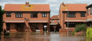
More than 1,000 homes and businesses in central Bristol are at risk of a severe flood from the River Avon today, and the council expects up to 4,500 by the end of the century.
What is Bristol's wetland city plan?
The programme is led by WWT, the Wildfowl & Wetlands Trust, with Aviva as principal funder and Bristol City Council and the West of England Combined Authority as partners. WWT announced it on 8 September 2026. There is no fixed project list yet: WWT says sites will be chosen from evidence, local knowledge and community input, against a target of more than 200 projects and direct contact with 100,000 people.
- Household and street projects. Rainwater ponds, drainpipe wetlands and rain gardens that catch roof and road runoff where it falls.
- Brooks and rivers. Restoring urban watercourses and, where there is room, reconnecting them to their floodplains.
- New and restored wetlands. Larger features in parks and open spaces, placed where they do the most good.
- Floating wetlands. Planted rafts in the Floating Harbour. Two went in on 16 July 2026 beside the SS Great Britain and the Cascade Steps, paid for by WWT with Planet Wild and Bristol BID.
The harbour work extends something the council had already started. The floating ecosystems at Capricorn Quay, first launched in 2024, now cover about 700 square metres with more than 6,000 native plants and 24 trees, and the council has six more planned. The funder matters too. Aviva has spent the past year arguing that planning is not keeping pace with flood risk, and its chief sustainability officer described the Bristol money as a way to reduce risk as well as insure it.
Which flood risks can wetlands reduce, and which can't they?
Wetlands work on the rain that falls on the city. Water pushed up the Severn Estuary by a surge tide, or arriving down the Avon from Wiltshire, is beyond their reach. Bristol's flooding comes from four sources, and the 200 projects reach two of them: surface water and the combined sewers that carry rain and sewage in the same pipe. For a development site that split decides a great deal. The programme does not change which of these sources a site is exposed to, so a flood risk assessment in Bristol still has to deal with every one of them.
| Flood source | Scale in Bristol | What manages it | Can the wetland projects help? |
|---|---|---|---|
| Tidal River Avon | Over 1,000 properties at severe risk now; up to 4,500 by 2100 | Avon Riversides 2100: raised defences, about £250m for phases 1 and 2 | No. Surge tides come up the estuary whatever happens in the streets |
| River flooding (Avon, Frome, Malago, Trym, Brislington Brook) | Concentrated in the river corridors | Environment Agency and the council | Only at the margins. Restored brooks can slow small floods, but large ones come from far upstream |
| Surface water | Around 3,400 properties at risk | The council, as lead local flood authority | Yes in frequent storms, very little in the extreme storms that flood maps are drawn for |
| Combined sewers | Overflow into the rivers in heavy rain | Wessex Water | Yes. Rain kept out of a combined sewer leaves room for the sewage |
The figures come from the council's 2023 Local Flood Risk Management Strategy. The Avon is handled by Avon Riversides 2100, formerly the Bristol Avon Flood Strategy, which is costed at about £250m for its first two phases. Construction will not start until 2030 at the earliest. The detail of the Avon's tidal and river behaviour is on the River Avon (Bristol) flood risk page.
What do measured UK schemes show?
The nearest comparisons are street retrofits in Cardiff and Nottingham, where rain gardens were measured or modelled after they were built. Both show real gains in ordinary rain and say very little about the rare storms that flood homes. WWT's own programme page gives no figure at all for how much flood risk the Bristol projects will remove.
Greener Grangetown in Cardiff, finished in 2018, put 108 rain gardens across 12 streets for about £2m. It takes around 40,000 cubic metres of rain a year out of the combined sewer and sends it to the River Taff instead. On Ribblesdale Road in Nottingham, 21 rain gardens with a total area of 148 square metres were modelled to cut the flow reaching the sewer by 33% in a 1-in-1-year storm.
The Nottingham figure is for a storm of a size expected about once a year. Flood maps for planning are drawn for storms with a 1% or 0.1% chance in any year.
Spread over a whole city, 200 projects of that kind could keep a large volume of rain out of Bristol's combined sewers every year and cut how often they overflow. That is a water quality gain at least as much as a flood one. It also stays a guess until somebody measures it, and WWT lists impact measurement among its research themes without yet saying how it will be done.
“…we can actually manage the water where it lands.”
Peter Lee, programmes lead, WWT, speaking to the Guardian
Rural schemes point the same way. The Environment Agency's position on natural flood management schemes elsewhere in the UK is that they cannot guarantee a set standard of protection on their own. That is why the green SuDS in a surface water drainage strategy for a development site are sized against a design storm and checked by calculation. Nobody takes their performance on trust.
How long will Ramsar accreditation take?
Not soon. Cities cannot apply on their own, and the current round closes on 31 December 2026. A programme that only started in September is unlikely to be ready for that deadline, which points to the following round.
74 cities in 27 countries hold Wetland City status, 22 of them in China. No UK city has it.
- Build the evidence. Bristol has to show it meets the criteria in Ramsar Resolution XIV.10, which include a positive relationship with nearby Wetlands of International Importance. The Severn Estuary Ramsar site, listed in 1976 and extended in 1995, borders the city at Avonmouth.
- Get a national nomination. The city sends its form to the UK's Ramsar Administrative Authority, which decides whether to forward it to the Ramsar Secretariat.
- Pass independent review. An Independent Advisory Committee assesses the candidates. Decisions on the 2026 round are due at the 69th meeting of Ramsar's Standing Committee.
- Renew it. Accreditation lasts two COP cycles, normally six years, and then has to be renewed.
What should developers in Bristol take from it?
Mainly that the planning system has not moved. An application that leans on the city's wetland ambitions in place of its own drainage evidence is exposed to an objection from the council and, in the end, refusal.
- Flood zones stay put. The Environment Agency's maps reflect modelled rivers, tides and formal defences, not street rain gardens. A site in Flood Zone 3 beside a new wetland is still in Flood Zone 3 and still needs a flood risk assessment for planning.
- Drainage is judged site by site. Since 17 August 2026, NPPF policy F8 has applied the 2025 national SuDS standards to all development. Bristol City Council, as lead local flood authority, expects each site to manage its own runoff, and a WWT rain garden down the road earns a development no credit against those standards.
- Gaps are hard to fix after refusal. Planning appeals now turn mainly on the evidence the council had, so a drainage gap that leads to refusal usually means resubmitting and losing months, not putting it right at appeal.
- The estuary is protected. Drainage that reaches the Severn Estuary from Avonmouth or Severnside may have to show it will not harm the Ramsar site and the overlapping special protection area and special area of conservation, the same habitats tests that slow many schemes near protected sites.
Where the programme does line up with development is in the kind of drainage it favours. Rain gardens, swales and ponds are what the national standards and the council already prefer, and on a constrained city site they are often what makes the numbers work. A surface water drainage strategy built on site-specific evidence remains the way to get drainage through planning in Bristol, whatever the city's wetland status turns out to be.
Questions about Bristol's wetland city bid
Can a landowner or community group put a site forward for the programme?
WWT invites groups to register project ideas at wetlandcities@wwt.org.uk, and says some community projects may receive grants, although it has not yet published how much is available or who qualifies.
Would Wetland City status protect Bristol's wetlands from development?
No. Accreditation is a voluntary recognition from the Ramsar Convention and carries no weight in English planning law. Protection comes from designations such as the Severn Estuary's Ramsar, SPA and SAC status, and from local plan policy.
Will other UK cities follow Bristol?
WWT and Aviva describe Bristol as the first of several UK wetland cities and want it to serve as a model for other towns. No second city has been named.
About the author. Jackie is a co-founder and Director of Unda with 30+ years in flood risk, and sits on CIWEM's South Eastern Branch committee. Unda has been trading since 2014, is a CIWEM Business Partner with CIWEM member and chartered (C.WEM MCIWEM) consultants, and has delivered 5,000+ flood risk assessments and drainage strategies across England and Wales.
Jackie Stone · MSci, BSc (Hons), DIC, CIWEM Environmental Partner


One of our experienced Flood Risk Consultants will get back to you within 60 minutes
