Can I Raise My Land to Get Out of the Floodplain?
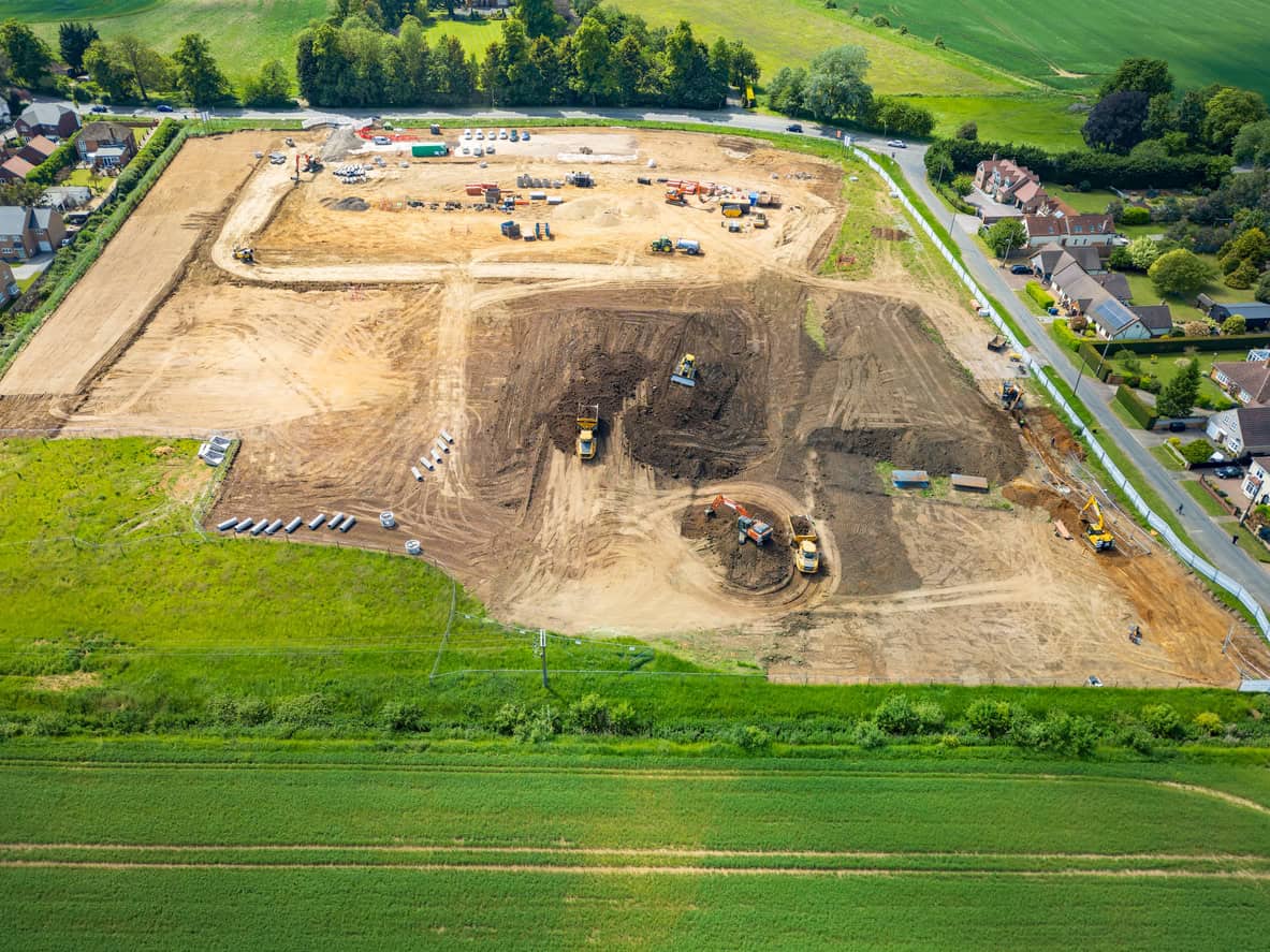
Estimated reading time 21 minutes
Raising the ground is one of the first ideas people reach for when a site turns out to sit in Flood Zone 2 or 3. The answer is almost always no. You cannot raise land out of the floodplain in any sense that changes how the planning system treats the site: Flood Zones are not redrawn because fill has been tipped on a field, land raising is itself development in the flood zone under the August 2026 National Planning Policy Framework, and the water the fill displaces has to go somewhere. There is one narrow route to a different flood zone, and it involves a surveyor rather than a dumper truck. Two versions of this go wrong often enough to be worth separating: the site raised before anyone asks, and the garden raised after a bad flood by someone trying to protect their own home.
The Environment Agency will not review its flood mapping for land raising that has not yet been carried out. That bar is written into its own evidence review process.
Does raising land take a site out of the flood zone?
No. A Flood Zone is a modelled probability band covering the land surface, produced nationally and not site by site. Since 25 March 2025 the zones shown on the Flood Map for Planning have come from the second National Flood Risk Assessment, NaFRA2, which combines detailed local hydraulic models with a new national model. Nobody re-runs that model because a landowner has imported soil.
The mapping also ignores things that hold water back far more reliably than fill does. Annex F of the NPPF states that the zones "do not account for the benefits of flood defences or the possible effects of climate change". A completed defence scheme does not move a property out of Zone 3, and a raised field is a much weaker claim than a defence.
So the argument is settled in a flood risk assessment for planning, not on the map. The local planning authority decides on site-specific evidence, and the Environment Agency says as much itself: a correction to the Flood Zones "is rarely needed for planning decisions", because planning authorities rely mainly on site-specific flood risk assessments.
Can you challenge the flood map instead?
Sometimes, and this is the one legitimate route. Where the national model has the existing ground level wrong, the Environment Agency will look at evidence through an evidence review request. Only three kinds of evidence are accepted: new or updated flood modelling, recorded flood information, or topographical survey data for areas smaller than 250 square metres where ground levels are not represented correctly.
We cannot accept model or survey evidence as ERRs for areas where changes such as land-raising are planned but not yet completed.
Environment Agency · Flood and coastal risk products: submit an evidence review request, September 2026
The distinction is the whole point. Proving that ground already sits higher than the national terrain model assumed is a survey exercise, and a commissioned topographical survey is what supports it. Raising the ground so that the model becomes wrong in your favour sits outside the process altogether. Requests go to the Agency's general enquiries address, and it warns that incorporating new evidence may take several months.
Raising land is development in the flood zone
Land raising is not a way around flood risk policy. It is caught by it. The August 2026 NPPF names land raising twice, and both mentions work against the applicant: once in Policy F5, as something that cannot sit in an at-risk area if a site wants to skip the sequential test, and once in Annex F, as a development type with a vulnerability classification of its own.
- Policy F5(2)(b)(i). The sequential test exemption applies only where no built development "including access or escape routes, land raising or other potentially vulnerable elements" would sit in an area at risk of flooding, now or in the future.
- Annex F, Table 2. "Land-raising (unless part of or enabling a development with a higher vulnerability classification)" is classified as less vulnerable. Raising ground to enable housing therefore inherits housing's more vulnerable class.
- Annex F, Table 3. More vulnerable development should be refused in Flood Zone 3b and requires the exception test in Flood Zone 3a.
- Environment Agency standing advice. A sequential test is required where any proposed building, access and escape route, "land-raising or other vulnerable element" falls in Flood Zone 2 or 3.
Land raising has its own entry in the NPPF's flood risk vulnerability classification, so ground raised to enable housing is assessed as housing, not as earthworks.
Inspectors apply this directly. Deciding a 250-home appeal at Ham Road, Faversham (APP/V2255/W/24/3350524) in June 2025, the Inspector rejected the argument that ground raising carried out as site remediation should be treated differently from ground raising carried out as flood mitigation, holding that the policy "clearly states that land raising, with no qualifications as to the purpose of such land raising, should not be used as a means to avoid the sequential test". That decision applied paragraph 175 of the December 2024 Framework; the wording now sits in Policy F5, and the point is unchanged. The decision was upheld on judicial review in July 2026.
Where a scheme does have to run one, a sequential test report for planning is the evidence a case officer needs. The test is applied to the site as it is, not as it would be once the fill arrived.
Where does the displaced water go?
Onto someone else's land, which is the objection in one line. A floodplain holds water temporarily during a flood and releases it slowly. Fill removes that capacity, and the water it would have held rises somewhere else, usually upstream and on the opposite bank. National guidance treats this as a reason to refuse, not a detail to resolve at condition stage.
Planning Practice Guidance is explicit that development, or the cumulative impact of development, may increase flood risk elsewhere through "the loss of floodplain storage, the deflection or constriction of flood flow routes or through inadequate management of surface water", and that where flood storage is lost, on-site level-for-level compensatory storage accounting for climate change over the lifetime of the development should be provided. Level-for-level compensation is a subject in its own right, and the method matters as much as the volume.
The cumulative wording is what defeats the "it is only a small raise" argument.
At a Runcorn appeal in June 2024 the scheme passed the sequential test and was still dismissed, because ground raising in Flood Zones 2 and 3 was proposed with no compensatory provision at all.
The Environment Agency's representation in that appeal warned that treating many similar developments the same way could, aggregated over time, have a demonstrable adverse effect on flood levels elsewhere. The Inspector accepted it, and noted that the modest scale of the raising made no difference to the principle.
What about the functional floodplain?
There the answer is flat. Flood Zone 3b is land where water from rivers or the sea has to flow or be stored in times of flood. Only water-compatible uses and essential infrastructure that has passed the exception test belong there, and both must result in no net loss of floodplain storage and must not impede water flows or increase flood risk elsewhere.
Tipping fill does not remove the designation. Guidance on preparing a strategic flood risk assessment allows functional floodplain to go undesignated where flooding would be prevented by existing flood defences, flood risk management features or structures, or buildings. Raised ground does not appear on that list. The same guidance treats the designation as capable of returning, noting it may be reasonable to assume that sites revert to functional floodplain where buildings have been demolished for more than a year.
What permissions would raising land actually need?
Up to five separate consents, and planning permission is only the first of them. Raising ground is an engineering operation under section 55 of the Town and Country Planning Act 1990, and where the fill is waste it is separately a material change of use once the height of the deposit exceeds the level of the adjoining land. Which further consents apply depends on what the land sits next to.
| Consent | What triggers it | Who decides | Position without it |
|---|---|---|---|
| Planning permission | Raising ground levels as an engineering operation, or a waste deposit above adjoining land level | Local planning authority | Enforcement notice requiring the material to be removed |
| Flood risk activity permit | Works within 8 metres of a non-tidal main river or 16 metres of a tidal one, and any floodplain activity beyond those distances likely to divert or obstruct flood water where planning permission has not been granted | Environment Agency | An offence to carry out the works |
| Ordinary watercourse consent | Anything likely to obstruct the flow of an ordinary watercourse | Lead local flood authority, or the internal drainage board inside a drainage district | Removal, and liability for damage caused |
| Byelaw consent | Structures or deposited material within 9 metres of the landward toe of a bank in a drainage district | Internal drainage board | Enforcement under the board's byelaws |
| Waste exemption or environmental permit | Any imported fill that counts as waste | Environment Agency | Prosecution, a restoration order and Landfill Tax liability |
The two regimes run independently, and Environment Agency standing advice spells out what that means: flood risk permits or consents are often needed as well as planning permission, and getting planning permission does not guarantee a flood risk permit or consent will follow.
Not sure which consents your scheme needs?
A site-specific assessment sets out what applies to your land, what the Environment Agency will expect to see, and what a case officer needs before determination.
Get a flood risk assessment for planningWhere would the fill come from?
This is where most schemes come apart. Imported soil is usually waste, and the rules on depositing waste on land are tighter than the planning rules. The U1 exemption, which people assume covers landscaping of this kind, caps soil at 1,000 tonnes per site across a three-year registration and expressly excludes landscaping, land levelling and land reclamation carried out as standalone activities rather than as part of construction or engineering works.
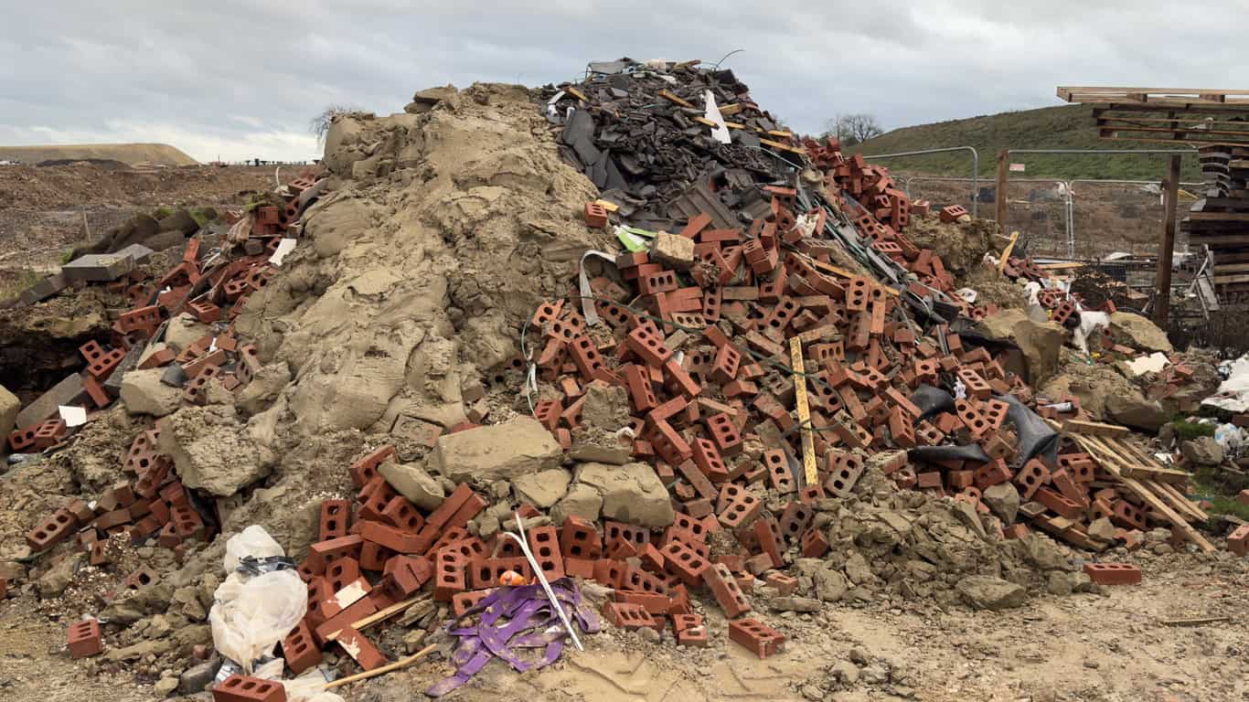
A thousand tonnes of soil is roughly 500 to 700 cubic metres, which is a few hundred square metres at half a metre deep and nowhere near enough to lift a site out of a flood zone.
Beyond the exemption the route is a deposit for recovery permit, and that turns on the Environment Agency's substitution test: depositing waste counts as recovery only where the applicant can show the works could and would have been carried out using bought-in, non-waste material. A speculative raise on a low-lying field fails that test, because nobody would buy clean fill to do it. The Agency also closes the obvious workaround, noting that the argument for substitution is undermined where waste is already present on site.
Floodplains perform a vital function and their effectiveness must not be reduced in anyway. The defendant deliberately deposited waste material in the floodplain at Five Bridges and significantly increased the risk of flooding to previously protected communities.
Environment Agency · on the prosecution of a landowner who deposited more than 4,000 tonnes of waste on floodplain land at Cullompton, Devon
That case ended at Exeter Crown Court in March 2021 with an order to spend £85,344 removing the material, alongside £26,180 in fines and costs. A second Devon case, at Kingsteignton, reached 32 months' imprisonment and a £200,885 confiscation order in July 2024. Landowners who allow tipping are themselves liable persons for Landfill Tax where the site should have held a permit and did not, so the bill for somebody else's lorries can land on the person who owns the field.
Raising land first and applying later
Some landowners take the view that it is easier to raise the ground first and argue about it afterwards. That makes the position worse.
In October 2023 an Inspector dismissed a housebuilder's appeal against a Wiltshire Council enforcement notice covering land beside its own development at Corsham. The notice alleged "a change to the profile of the Land, which includes the raising of the ground levels resulting from the deposit of material on the Land". The requirement was to take roughly 7,500 cubic metres of material back off. The Inspector recorded that "there is no dispute that the change in ground levels on the site has had an effect on surface water run off", and refused to vary the notice to allow any intermediate level, because that "would not achieve the purpose of remedying the breach in this case".
Restoration to the levels that existed before is the standard remedy. So the raised ground never becomes the site's new starting point, and a flood risk assessment written on those levels describes a site the planning system is working to undo.
The only circumstance in which spoil may lawfully be spread on the floodplain of a main river without a permit is a wetland scrape, and even then to a depth of no more than 100 millimetres.
- The remedy is restoration, not compromise. An enforcement appeal at Hoddesdon in February 2026 ended with a requirement to "restore the depth of the ground level within the hatched area to its original depth".
- The clock got longer. Since 25 April 2024 the enforcement time limit for operational development in England has been ten years, not four. Land raising is an engineering operation, so anyone hoping to sit it out now waits more than twice as long.
- It surfaces on a sale. Every district authority keeps a public register of enforcement notices under section 188 of the 1990 Act. The standard CON29 local search asks directly whether an enforcement notice, a stop notice or any other notice relating to breach of planning control subsists.
- It can be a criminal offence in its own right. Where the works needed a flood risk activity permit and did not have one, the Environment Agency's stated position is that offenders "could face an unlimited fine and up to 2 years imprisonment".
The Agency issued that warning to residents, landowners and developers in Bassetlaw in April 2025, after officers found works at several sites carried out without permission. The flood risk consequence stands on its own too. Dismissing four linked appeals at Welham in January 2025, over a site straddling Flood Zone 3a and Flood Zone 3b, an Inspector took the Environment Agency's suspicion that levels had been raised and held that if it had happened, "any such change in land levels may put other developments within the functional floodplain at further risk of flooding".
Raising land to protect your own home
Not every raise is speculative. People build up a garden, bank an earth bund or lift a patio after a bad flood, in good faith, to keep water out of the house. The instinct is sound. The execution usually is not, for two reasons: the works are rarely permitted development, and the water has to go somewhere close by.
In permitted development terms, "raised" means a platform higher than 0.3 metres, and Classes A, B and E of Part 1 each exclude a raised platform outright.
Class F permits laying a hard surface in a garden. It does not permit building the ground up beneath one. Raising ground with retaining structures and infill is an engineering operation, and an Inspector deciding an enforcement appeal at Hoddesdon in February 2026 treated a rear garden raised "by between 30cm and 1.7m" exactly that way. The works were assessed cumulatively, as one operation, so the scheme could not be sliced into pieces each under 300mm. Walls and other means of enclosure carry separate limits under Part 2: one metre next to a road used by traffic, two metres elsewhere.
Government advice to householders preparing for a flood puts the consent point in a single line. "You may need permission to do work that will affect the flow of a river or divert flood water." Where the works touch an ordinary watercourse that consent comes from the lead local flood authority or the drainage board, and it is not available retrospectively.
Where that water goes
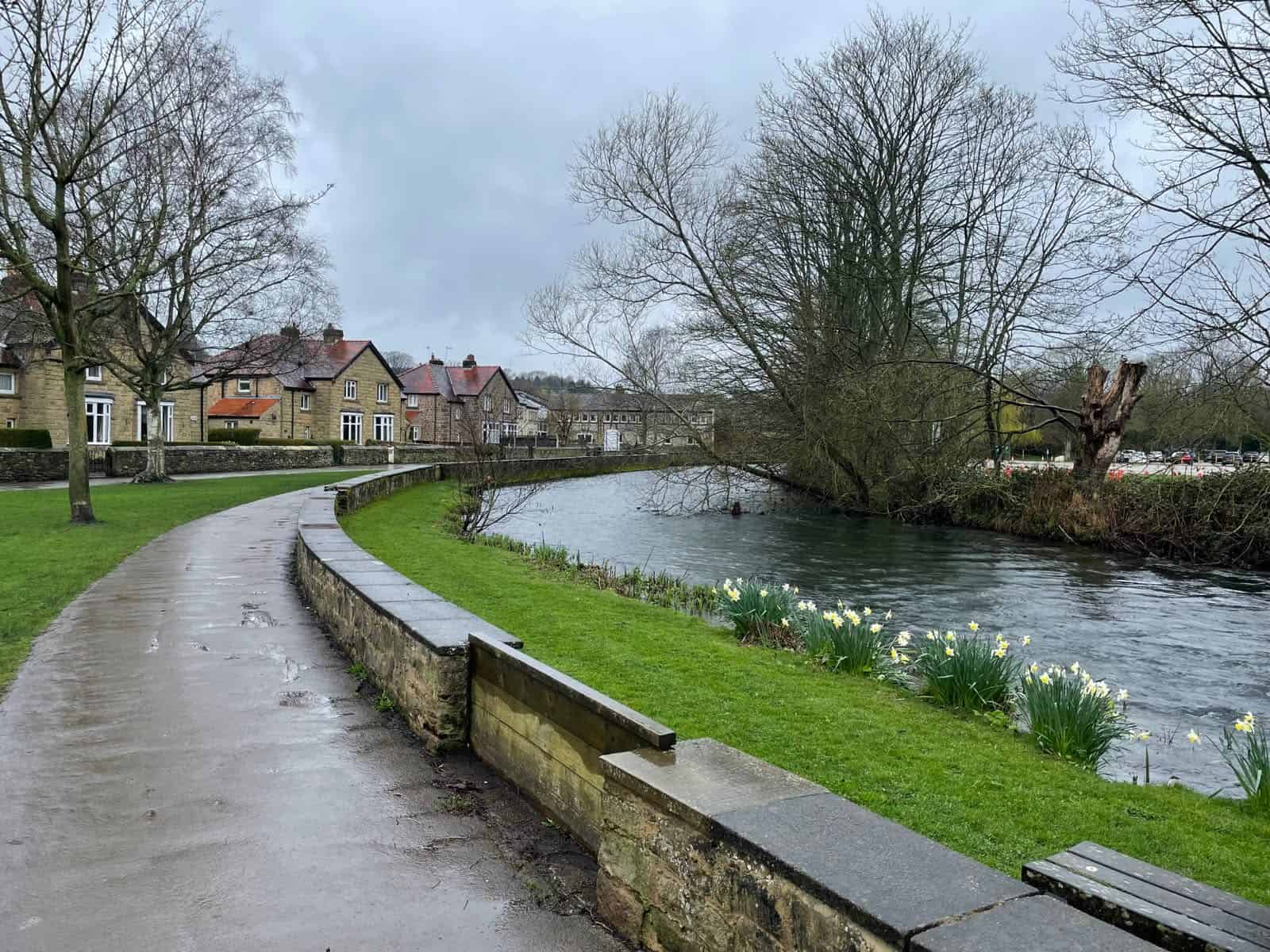
The hydrology is simpler than the law. A raised garden sheds rainfall and flood water towards whatever is lower, which is usually next door.
In Partakis-Stevens v Sihan the High Court found a Wilmslow developer liable in nuisance after excavation spoil was used to build up a rear lawn with a steep slope down to the boundary. Damages came to £59,500, the current owners were ordered to install drainage, and the council's enforcement notice required the garden put back to its pre-development levels. The principle the court applied is settled: a higher owner is liable where artificial alterations to levels and contours cause water to reach a lower neighbour in a more concentrated form than it naturally would.
There is no second chance either. The court noted that where the problem continues, reasonable foreseeability "is not a once and for all question, because knowledge gained after a first flooding event may be relevant to the reasonable foreseeability of continuing flooding". The first complaint from next door closes the defence set out in the next section.
For a house that already exists the answer runs the other way. BS 85500:2025, the British Standard on flood resilient construction, leaves site layout and external avoidance measures outside its scope on purpose. Protecting an existing home is a property flood resilience job rather than an earthmoving one: flood doors and barriers, airbrick covers, non-return valves on drains, raised services, and finishes that dry out and go back into use.
Could a neighbour take you to court?
Possibly not. English common law has long allowed a landowner to defend land against flood water even where the consequence is that a neighbour gets wetter. The principle is the common enemy rule, and the Court of Appeal applied it in 2004 to a floodplain field at Aberfan that had been raised ten to twelve feet with colliery spoil.
Thirty-two homes flooded to about a metre when the Taff overtopped, and the infilling was conceded to be a material cause. The claim still failed, partly on the common enemy rule and partly because the damage had not been reasonably foreseeable when the works were done.
The rule has limits, and they are narrower than the headline suggests. It does not permit interference with the channel of a watercourse. It does not permit water that has already arrived on your land, or is about to, to be exported to a neighbour. And works going beyond what protection requires may still be actionable where the excess independently causes damage. Raised ground that sheds surface water onto a lower garden falls on the wrong side of that line, and claims of that kind do succeed.
The common enemy rule is a defence in private nuisance. It is no answer to a planning refusal, an enforcement notice or a prosecution, and the planning test is materially stricter than the common law one.
What works instead of raising the land
Raising the floor rather than the ground, and using the site layout. Environment Agency standing advice sets finished floor levels at whichever is highest of 600mm above the average ground level of the site, the adjacent road level, or the estimated flood level, reducible to 300mm where the flood level is known with a high degree of certainty.
- Set the floor level, not the ground level. A raised finished floor level lifts habitable space above the design flood level without taking any storage out of the floodplain.
- Use the site vertically. Planning Practice Guidance supports locating the most vulnerable uses on upper storeys and the least vulnerable elements in the lowest-lying parts of the site.
- Consider a floodable void. Where the footprint allows, an open void beneath a raised building lets flood water pass through instead of displacing it, though guidance is clear that voids should not normally be relied on to compensate for lost storage.
- Compensate properly where raising is unavoidable. Direct, banded, hydraulically connected, and calculated against a climate-adjusted flood level rather than today's.
- Build for resistance and resilience. Policy F7 expects development to be capable of being brought back into use quickly after a flood without significant refurbishment.
All five are settled in a site-specific flood risk assessment for planning, and the assessment is what a case officer and the Environment Agency respond to. Getting it in front of them before the layout is fixed is cheaper than redesigning around an objection, and it turns the question from how to leave the floodplain into how to occupy it without making anyone else's flooding worse.
Frequently asked questions
Would raising the land help with flood insurance?
Not directly. Insurers price on their own models and claims data, not the planning Flood Zone, so a raised garden changes little on a renewal quotation. Flood Re, the reinsurance scheme that backs household cover in high-risk areas, is available only for homes built before 1 January 2009, so a new dwelling built on raised ground sits outside it whatever the ground level.
Can land be raised on an agricultural field without planning permission?
Agricultural permitted development rights do not extend to raising land levels in a floodplain, and section 55 applies however the land is used. The Environment Agency's permit regime is narrower still: the only agricultural works it treats as allowed without a permit are hay stacks, straw stacks and manure clamps built in accordance with accepted practice.
Does the answer change where the flood risk is tidal rather than fluvial?
Partly. Planning Practice Guidance notes that the loss of floodplain storage is less likely to be a concern where the source of flood risk is solely tidal, because the tide sets the water level and the storage available does not. The sequential test, the vulnerability classification and the consents regime all still apply.
What if the land was raised years ago, before the current owner bought it?
The mapping will still show the undefended flood zone, because that is how the zones are drawn. On enforcement, England moved to a single ten-year time limit for all breaches of planning control on 25 April 2024, with transitional protection for breaches substantially completed before that date. Historic raising is worth establishing properly before anything is built on the strength of it.
Is the position different in Wales?
The structure is similar but the documents differ. Wales works to TAN15 and its own flood map for planning, and the site-specific document is a flood consequence assessment rather than a flood risk assessment.
Does a raised garden or patio need a flood risk assessment?
Householder development is exempt from the sequential test under Policy F5, but a site-specific flood risk assessment still accompanies development proposals in Flood Zones 2, 3a and 3b, and the exemption changes nothing about the permit and consent position.
What should someone do if land has already been raised without permission?
Take levels first. A topographical survey of what is there now, set against whatever historic levels can be evidenced, is what any conversation with the council or the Environment Agency will turn on. Expect restoration to the original levels to be the starting point, and note that consent for works on an ordinary watercourse cannot be granted retrospectively.
About the author. Edward is a co-founder and Director of Unda with 20+ years in flood risk and drainage, and a national-press commentator on flooding. Unda has been trading since 2014, is a CIWEM Business Partner with CIWEM member and chartered (C.WEM MCIWEM) consultants, and has delivered 5,000+ flood risk assessments and drainage strategies across England and Wales.
Edward Bouët · BSc (Hons)
Latest news






One of our experienced Flood Risk Consultants will get back to you within 60 minutes
