Flood Zone 3b Explained: The Functional Floodplain in England
Estimated reading time 23 minutes
Flood Zone 3b is the functional floodplain: land where water from rivers or the sea has to flow or be stored in times of flood. It is the most heavily restricted flood zone in the English planning system, and the only one that never appears on a national map. A council draws it, in its own Strategic Flood Risk Assessment, to a method that council chose.
The Environment Agency states it in its own data guidance: “The Flood Map for Planning does not identify functional floodplain.”
That is not a gap in the data. It is how the system is designed, and it means the 3b line over a particular site is a local judgement made at strategic scale on whatever evidence the authority held at the time. Strategic-scale judgements are sometimes wrong at the scale of one field. This article sets out what Flood Zone 3b is, how the line gets drawn, why two neighbouring councils can draw it differently, and what can be done when it falls across a site.
What Flood Zone 3b is, and how it differs from Flood Zone 3a
Flood Zone 3b is land doing a job: storing floodwater, or carrying it downstream. Flood Zone 3a is land at high probability of flooding that is not performing that function. Both sit inside the same dark blue band on the Flood Map for Planning, which draws no line between them, so a site shown as Flood Zone 3 may be either. What that map does and does not show decides how much weight a 3b line on it deserves.
The distinction decides what can be built. In Flood Zone 3a, housing and most commercial uses are possible where the sequential and exception tests are met. In Flood Zone 3b, Annex F, Table 3 of the National Planning Policy Framework says highly vulnerable, more vulnerable and less vulnerable development should be refused, leaving only water-compatible uses and essential infrastructure that passes the exception test. Nothing else about a site changes between the two; the outcome does.
Functional floodplain is easiest to recognise when it is doing the work.
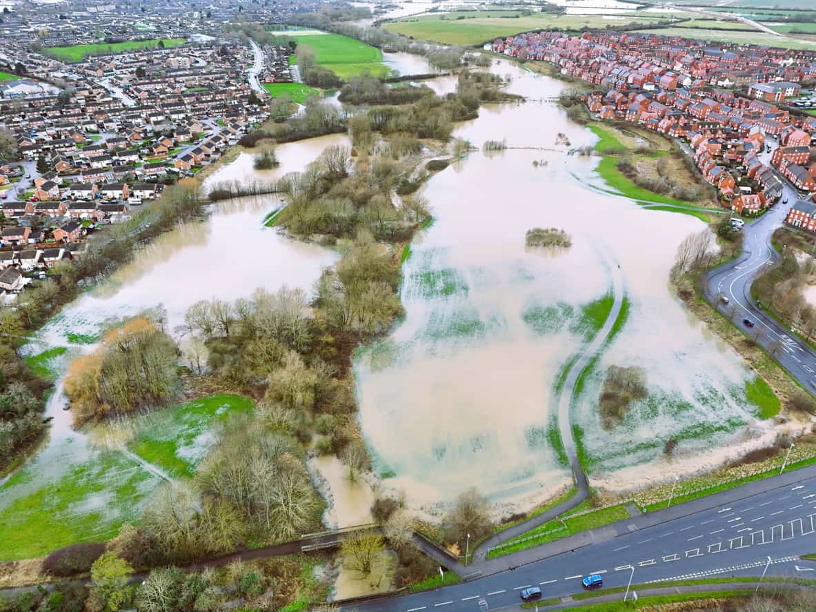
In a flood the undeveloped corridor fills and the built-up land either side stays dry. The volume has to sit somewhere, and a development that removes the storage moves that water onto land downstream or across the valley. That is the reasoning behind the restriction, and it is why the test turns on what the land does, not on how often it floods.
Two limbs put land into 3b. The first is frequency: a 3.3% or greater annual probability of flooding, which is a 1 in 30 year event, modelled with any existing flood defences working as intended. The second is design: land built to flood, such as a flood attenuation basin or a washland, counts as functional floodplain even if it would only fill in a 0.1% annual probability event. A storage basin that has never flooded in an ordinary year is still 3b.
What a Flood Zone 3b designation does to a proposed development
For housing, there is no route. Annex F, Table 3 marks more vulnerable development in Flood Zone 3b for refusal and gives no exception test to argue against it. That is the difference from Flood Zone 3a, where the exception test at least exists and a well-evidenced scheme can pass it. In 3b there is nothing to pass.
The exception test is not a higher bar in Flood Zone 3b for housing, care homes, schools, hotels or drinking establishments. It is not available at all.
How severe that is depends on how much of the site the line covers, and the two situations behave very differently. A site wholly inside functional floodplain has development value only if the designation is wrong, or if the proposal is one of the two permitted classes. A site with a 3b strip across one edge is a design problem, not a dead site — provided the strip is treated properly from the first sketch rather than after the layout is fixed.
- Developable area shrinks to the land outside the line. Built development, access and escape routes, parking and any land raising all have to sit clear of the functional floodplain. On a tight site that can take a scheme below the density it was bought at.
- Layout is a policy requirement, not a preference. Policy F7(2)(a) requires the most vulnerable development to be located in the areas of lowest flood risk within the site, unless there are overriding reasons for a different arrangement. A layout that scatters housing across the risk gradient invites refusal on its own.
- Designing clear of the line can remove the sequential test entirely. Policy F5(2)(b)(i) exempts a scheme where a site-specific flood risk assessment shows clearly that no built development, access or escape route, land raising or other vulnerable element sits in an area at risk of flooding from any source, now or in the future. That is the strongest outcome available on a part-3b site, and it is evidential — the assessment has to show it, not assert it. The surface water limb of the same policy works the same way.
- The scheme is judged as proposed, not as it could be carved up. In Faversham Town Council v SSHCLG [2026] EWHC 1651 (Admin) the High Court upheld an Inspector who declined to compartmentalise a mixed-zone scheme, holding that the development was proposed as a whole and was not severable. Splitting an application on paper to keep the 3b part out of the assessment does not work.
A 3b strip can pull an entire application into the sequential and exception test process even where every building sits clear of it, unless the F5 exemption is made out on the evidence. That is the difference between a planning application and a planning application plus an area-wide alternative sites assessment, and it is decided by work done at layout stage, long before validation.
Who decides where the line goes
Local planning authorities do, in their Strategic Flood Risk Assessments, in agreement with the Environment Agency. The definition they work to moved into national policy on 17 August 2026, when the rewritten Framework brought the flood zone table into Annex F; before that it sat only in Planning Practice Guidance.
The identification of functional floodplain should take account of local circumstances and not be defined solely on rigid probability parameters. Functional floodplain will normally comprise: land having a 3.3% or greater annual probability of flooding, with any existing flood risk management infrastructure operating effectively; or land that is designed to flood (such as a flood attenuation scheme), even if it would only flood in more extreme events.
National Planning Policy Framework, Annex F, Table 1
Three phrases in that definition decide whether a designation is sound. “Normally” makes the figure a convention, not a rule. “Not defined solely on rigid probability parameters” is an instruction to look at the site. And “with any existing flood risk management infrastructure operating effectively” means the 3.3% extent has to be modelled with the defences in place, which is the opposite of how the published flood zones are produced. Each phrase is a place a designation can go wrong, and the sections that follow take them in turn.
Where the line on a particular site came from
Start by asking the authority which document the designation sits in and which dataset drew it. Most councils publish a functional floodplain methodology note as an appendix to the SFRA, and it will say whether the line came from detailed hydraulic modelling, from a national extent, or from neither. That answer decides whether there is anything to argue with. Often there is. Screening the site on a flood risk map postcode checker first is a reasonable way to frame the question.
The Environment Agency’s own flood risk assessment guidance contemplates the applicant doing the work where the SFRA does not reach: where suitable information is not available for a site, the assessment has to supply it. That places the burden on the developer, but it also opens the door, because a strategic line has no special protection against better evidence about one field. In practice the work lands inside the flood risk assessment for planning that the application needs anyway.
Which probability the SFRA used
The threshold has been 3.3% annual exceedance probability, or 1 in 30, since the guidance was revised in August 2022. It was 1 in 20 before that. Four years on, a fair amount of published evidence base still works to the old figure, and a designation drawn to a superseded threshold is the simplest of all the challenges to make.
The direction of the change is not the one people assume. A 1 in 30 event is rarer and therefore larger than a 1 in 20 event, so on the probability limb alone the 2022 revision widened functional floodplain rather than narrowing it.
What pulls it back is the defended requirement in the same sentence. Whether a particular site gained or lost extent in 2022 depends on how much protection sits between it and the river, which is a modelling question, not a policy one. The annual exceedance probability is only half the test.
Defended or undefended, and the contradiction it creates
Annex F requires the 3.3% extent to be modelled with existing flood risk management infrastructure operating effectively. The Flood Zones published on the Flood Map for Planning are modelled with the defences removed. The two are computed on opposite assumptions, and they are not interchangeable.
Since 25 March 2025 the Flood Zones have been produced through the second National Flood Risk Assessment, which removes or deactivates defences before modelling. The Environment Agency’s product description states that it is not required to map the outer boundary of Flood Zone 3b, and that the zone is usually contained within the mapped extent of Flood Zone 3. So a 3b line sitting flush against the published Zone 3 boundary is a warning sign: on the policy definition, a defended 3.3% extent should normally sit well inside an undefended 1% one. It is the same reason a defended site still maps as Flood Zone 3.
The Agency now publishes the dataset the policy definition calls for. The present-day 3.3% defended rivers and sea extent sits on the Defra Data Services Platform alongside mapped water storage areas and the matching depth data, and the Agency’s flood risk assessment guidance points applicants at both. Where that layer is tighter than the SFRA’s 3b line, the discrepancy costs nothing to find and is the first thing to put to the case officer. Two cautions: the Agency requires the suitability of those datasets to be appraised for each location before they are adopted, and climate change allowances do not widen the designation, because guidance is explicit that a future extent may be assessed but should not form part of the functional floodplain designation itself.
How the SFRA treated buildings and defences
This is where authorities diverge most, because national guidance permits rather than requires. An authority may exclude land from functional floodplain on three grounds, and may equally decline to.
- Existing defences. Where evidence shows flooding would be prevented by flood defences or flood risk management structures, the authority need not designate functional floodplain at all.
- Existing buildings. Building footprints may be removed from the extent. Guidance adds that it may be simpler to leave them in and control redevelopment through local policy, which is exactly why practice splits.
- Demolished sites. Where buildings have been demolished for more than a year, it may be reasonable to assume the land reverts to functional floodplain. A cleared site does not keep the benefit of what stood on it, which is why demolish-and-rebuild schemes need the sequence thought through before anything comes down.

The same building, two answers
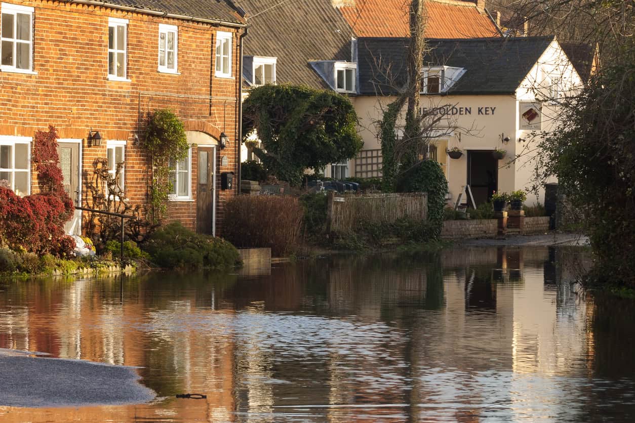
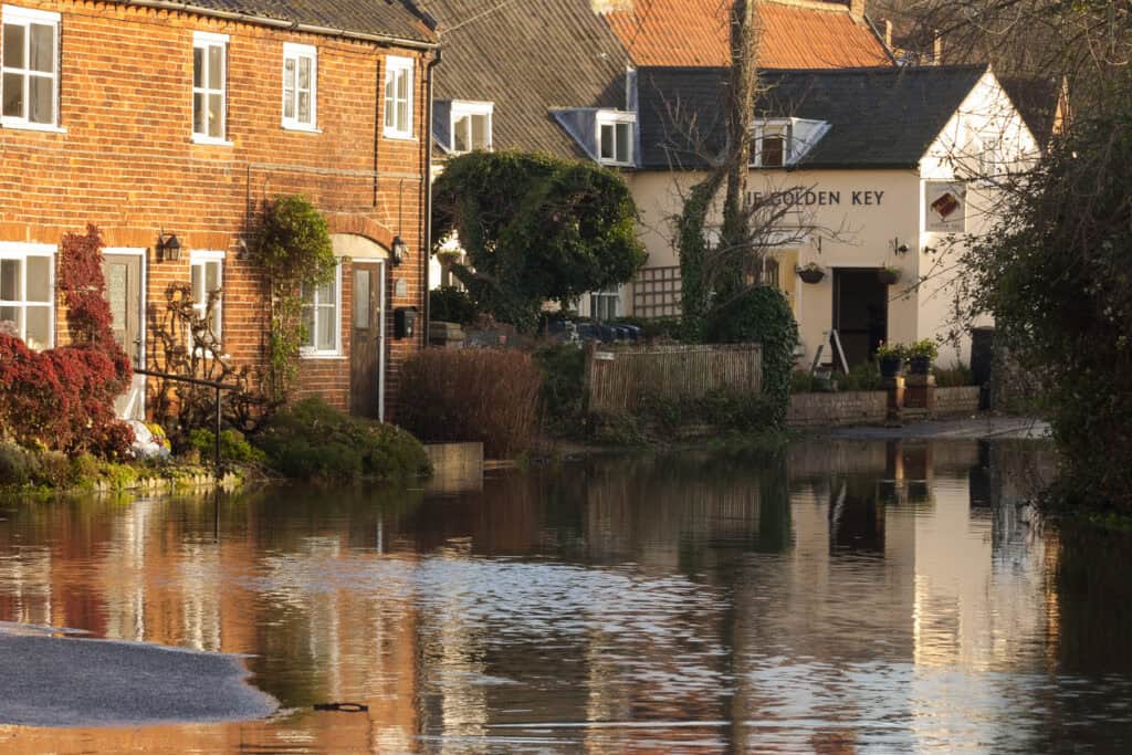
The water here is standing against the wall. It is not running through the house. A footprint that physically excludes floodwater is what the West London method treats as Flood Zone 3a, and what Bradford’s 2023 note leaves inside 3b. Nothing about the building changes between the two readings. Only the document does.
For a site with an existing building on it, which choice the SFRA made is usually the whole argument. Where footprints were excluded, the developed part of the site is Flood Zone 3a and the sequential and exception tests apply instead of a refusal. Where they were not, the building sits in 3b regardless of the fact that water has never reached it. Establishing which of the two applies takes one read of the methodology note, and flood modelling to test a functional floodplain line is what follows if the note leaves the question open.
What happens where no hydraulic model exists
Not every watercourse in England has been modelled in detail, and an authority preparing a Strategic Flood Risk Assessment has to designate functional floodplain across its whole area regardless of where the national modelling programme has reached. The usual solution is a proxy: the Flood Zone 3a outline is used to stand in for 3b until a model exists. Two published SFRAs say so in terms, and it is a precautionary default, and not a considered finding about any particular site.
The overstatement that follows is large. A 1% annual probability outline standing in for a 3.3% one is roughly threefold against what the policy asks for, and it is usually modelled undefended as well. A site in an unmodelled reach can therefore be designated on a line that policy never intended, purely because of where the national modelling programme has reached. That is the single most rebuttable form of 3b designation, and the one most likely to repay a site-specific model.
Why two councils draw the line differently on the same river
Because guidance is permissive at each decision point, published methods genuinely disagree. The table below sets out four real approaches, all current or recently published, all defensible against the same national guidance.
| Authority | Threshold | Existing buildings | Where no model exists |
|---|---|---|---|
| Cotswold | 1 in 20 (5%), the superseded figure | Removed using OS data | Not stated |
| Bradford (2023) | 1 in 30 (3.3%), defended | Not removed | Flood Zone 3 used to define 3b |
| Wyre (2024) | 3.3% AEP, defended | Not addressed | 3b taken as equal to 3a (1% AEP) |
| West London (2025) | 1 in 30, defended | Removed, and reclassified as Flood Zone 3a | Not stated |
The West London approach matters to anyone with an existing building on a 3b-mapped site: parts already occupied by infrastructure or solid buildings that physically obstruct flooding can be interpreted as Flood Zone 3a instead. Bradford’s 2023 note takes the opposite view and leaves buildings in. Neither is wrong. Both cite the same guidance. Both are defensible. They are different answers to a question national policy deliberately leaves open, which is why the first question about any 3b line is always which document governs the site.
What planning appeals show about challenging a designation
Inspectors will depart from a 3b designation. They will not do it on assertion. Recent decisions are consistent about what counts as evidence, and they run against appellants at least as often as for them.
- Evidence decides it, assertion does not. At Potter Brow Road, Baildon (August 2025), the Inspector recorded that the site was identified as Flood Zone 3b in the authority’s SFRA mapping and that there was “no clear technical evidence that would lead me to dispute this”. The appeal was dismissed on a designation drawn from an SFRA that itself uses Flood Zone 3 as a proxy where no detailed model exists.
- Partial survey is worse than none. At Northmoor, West Oxfordshire (October 2023), a flood risk assessment argued the site was Flood Zone 1 but did not provide levels across the whole site. The Inspector concluded he could not be certain parts of the site did not fall within Flood Zone 3a or 3b, and treated it as at least partially within them.
- A real model ends the argument. At Mill Lane, Syston (January 2024), the Environment Agency’s detailed hydraulic modelling showed the site was affected by the 1 in 5 year event, an annual exceedance probability that, as the Inspector noted, far exceeds the 3.3% used to define functional floodplain.
- Leaving 3b is not the same as getting consent. At Station Road, Stoke D’Abernon (November 2024), the Inspector accepted the authority’s own excluded-footprint approach and treated the proposal as Flood Zone 3a rather than 3b. The appeal was still dismissed, on the flooded access route and on the sequential test.
- Existing buildings are the strongest ground. At Bridge End, Harpford (August 2025), a conversion was allowed on a site the Environment Agency identified as functional floodplain, flooding to between 0.8 and 1.5 metres. It succeeded as minor development exempt from the sequential approach, helped by the removal of containers and a mound that increased the site’s flood storage capacity.
Stoke D’Abernon is the decision to read before commissioning anything. Moving from 3b to 3a does not unlock a site by itself. It moves the argument to the sequential and exception tests, where safe access and alternative sites decide the outcome, and a site that fails those fails whichever zone it sits in. Where that is the live question, a Sequential and Exception Test report is the document that settles it.
What can still be built in Flood Zone 3b
Where the designation holds, Annex F, Table 3 is unforgiving. The wording is now “refused”, firmer than the guidance it replaced, and the outcome turns entirely on the flood risk vulnerability classification of the use proposed.
| Vulnerability class | In Flood Zone 3b | Typical uses |
|---|---|---|
| Water-compatible | Permitted, with design conditions | Amenity open space, outdoor sport and changing rooms, nature conservation, moorings, sand and gravel working |
| Essential infrastructure | Exception test required | Data centres, EV charging stations, solar farms, wind turbines, hydrogen production, carbon capture, heat networks, electricity network infrastructure |
| Less vulnerable | Refused | Car parks, shops, offices, storage and distribution, land-raising |
| More vulnerable | Refused | Dwellings, hotels, schools, care homes, drinking establishments |
| Highly vulnerable | Refused | Basement dwellings, caravans and park homes for permanent residence, emergency services |
A car park is less vulnerable, not water-compatible, so it is refused. A sports ground is water-compatible; its bar is a drinking establishment and its parking is neither. Those two rows account for a good share of the objections Unda sees on part-3b sites. Essential infrastructure, meanwhile, was widened in August 2026 to name data centres, electric vehicle charging, solar, wind, hydrogen, carbon capture and heat networks, which brings a set of energy and digital uses within reach of the exception test on the highest-risk land.
Both open routes carry three design conditions: development must remain operational and safe for users in times of flood, result in no net loss of floodplain storage, and not impede water flows or increase flood risk elsewhere. The storage condition is the binding one. It admits no de minimis, which is why a piled solar array with no ground-level fill is a far stronger Flood Zone 3b proposition than a building with a solid footprint on a constrained site. Two routes do not work: raising ground does not move a site out of the floodplain, and compensatory storage answers whether a scheme worsens flooding elsewhere, not whether its occupants will be flooded, so it cannot rescue a use the table refuses outright.
When to stop spending
Some designations are correct and no amount of modelling will change them. Where the Environment Agency holds a model showing frequent inundation, as at Syston, the case is closed. Where the land is open and undeveloped and the proposal is housing, there is no exception test available for more vulnerable development in Flood Zone 3b at all, so the only route is to show the site is not 3b. And where land is designed to flood, the designation is about function rather than frequency, so better modelling does not help.
The question is whether the SFRA’s method, once read, leaves room for the site to be somewhere else. Where it does not, the money goes further on a different use or a different site.
Where it does leave room, the work is specific and finite.
- Read the methodology note. The SFRA appendix states the threshold, the defended assumption, the treatment of buildings and what was done where no model exists. Four of the five questions above are answered here.
- Pull the Environment Agency’s defended 3.3% layer. Compare it with the SFRA line. A material discrepancy is free evidence and needs no survey to find.
- Survey the whole site to Ordnance Datum. Partial coverage invites an inspector to fill the gap against the applicant, which is what happened at Northmoor.
- Establish whether a model exists, and how it was run. Request the modelled levels and extents from the Environment Agency, and check whether the run was defended and when it was built. The assessment process sets out where this sits in the wider sequence. A hydraulic model of the right vintage settles the question either way.
The cost of getting this wrong is mostly abortive. A layout drawn before the 3b line is checked has to be redrawn. An option exercised on a site whose developable area turns out to be half what was assumed is money spent against land that cannot carry the scheme. An allocation made on a 2019 Strategic Flood Risk Assessment can look different under a 2026 one. By the time any of those surface they are programme and land problems, not flood risk problems, and each of them is answered by reading the methodology note first.
A flood risk feasibility study answers all four before a site is bought or an option is exercised, which is a great deal cheaper than finding out at determination. The same logic applies to any site where building on the floodplain is the question.
Is the 3b line on your site right?
Unda reviews the SFRA evidence, models the site against the defended 3.3% extent and says whether the designation holds.
Start a quoteUnda’s flood risk consultants review functional floodplain designations, model sites against the defended 3.3% extent and prepare the flood risk assessment for planning that carries the result through. Send the site address and the authority’s SFRA reference, and the position will be clear within a working day.
Frequently asked questions
Does a functional floodplain designation affect an existing building, or only new development?
It bites on development, not on occupation. An existing lawful building can stay and be used as it is, and no designation obliges anyone to move out or stop trading. The classification only engages when something is proposed, whether an extension, a change of use, a replacement dwelling or redevelopment, because that is the point at which Annex F, Table 3 is applied. It also has no effect on permitted development rights unless the local authority has removed them by condition or by an Article 4 direction.
Can a Flood Zone 3b designation change when the Strategic Flood Risk Assessment is updated?
Yes, in both directions. SFRAs are refreshed alongside the local plan, and a refresh that brings in new hydraulic modelling, a revised threshold or a different treatment of buildings can move the line. A site outside functional floodplain under a 2019 assessment can be inside it under a 2026 one, and the reverse happens just as often. Anyone relying on a designation more than a few years old should check whether a newer assessment has been published or is in preparation.
Will the Environment Agency review site-specific modelling before an application is submitted?
It can, through pre-application engagement, and the timing matters. Appeal decisions repeatedly turn on whether the Agency had seen and accepted the modelling. Evidence submitted after a refusal, with the Agency’s objection still standing unexamined, carries much less weight than the same evidence agreed beforehand.
Does Wales use the same functional floodplain definition?
No. Wales works to Technical Advice Note 15 and its own development advice maps, with different zones and different tests, so an English Flood Zone 3b analysis does not transfer. Cross-border sites need both assessed separately.
Does a Flood Zone 3b designation affect insurance or a mortgage?
It is a planning classification, not an insurance one, and insurers price on their own flood models rather than on planning zones. In practice a site in functional floodplain will usually also sit in a high-risk band on the models lenders and insurers use, so the practical answer is often that it does, for reasons that run in parallel to planning.
About the author. Emma is a Senior Flood Risk Consultant, and a policy and flood modelling expert. Unda has been trading since 2014, is a CIWEM Business Partner with CIWEM member and chartered (C.WEM MCIWEM) consultants, and has delivered 5,000+ flood risk assessments and drainage strategies across England and Wales.
Emma Jeffery · MSci (Hons)





One of our experienced Flood Risk Consultants will get back to you within 60 minutes