Kasumi-tei: how Japan built levees with gaps in them on purpose, and why it stopped
Estimated reading time 24 minutes
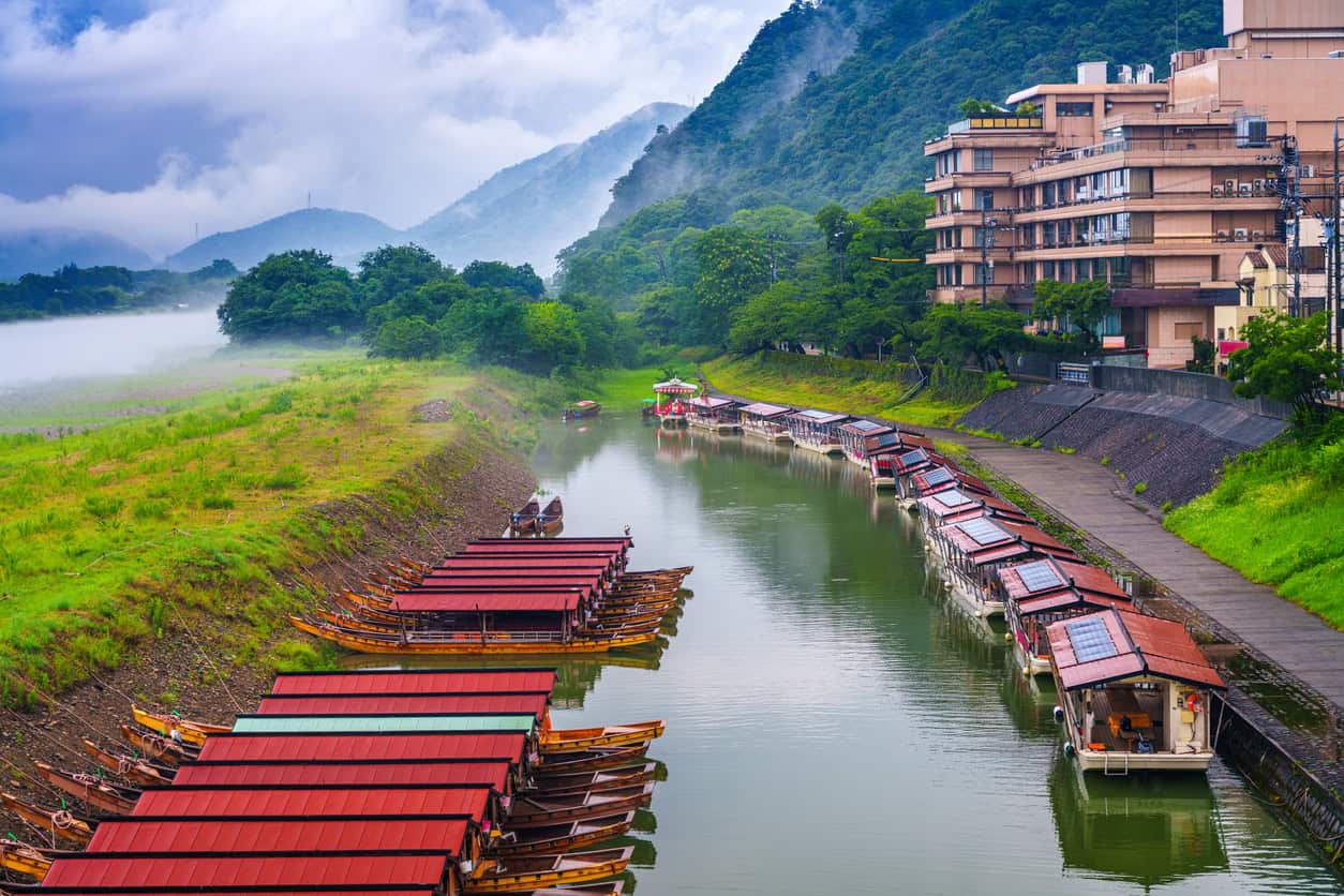
An open levee is a flood embankment built in overlapping segments with deliberate gaps left between them, so floodwater can spread sideways onto farmland as the river rises and drain back out through the same gaps as it falls. Japan has been building them for something like four centuries, calls them kasumi-tei, and still has roughly three hundred of them. For most of the twentieth century it was closing them. Since 2021 it has started building them again.
That reversal is the interesting part, and it is not really an engineering story. The structures were never complicated. What changed was whether a country was willing to say out loud which land it expected to flood, and the Japanese answer to that question has been rewritten twice in living memory. It is the same question an English flood risk assessment for planning has to settle at site scale, on one red line at a time.
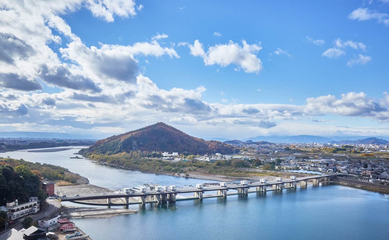
These are not ancient waterworks kept for show. Four new ones were approved after Typhoon Hagibis, the first built in Japan for about fifty years.
The plain that made it necessary
Three large rivers reach the sea across a single lowland in central Japan. The Kiso, the Nagara and the Ibi run more or less side by side over the Nobi plain, so close together in their lower reaches that they braid, swap channels and back up into one another during a flood. A fourth, the Shonai, discharges through Nagoya to the same bay. The land between them is flat, low and some of the best rice ground in the country, which is the combination that forces the issue: too valuable to abandon, too exposed to defend conventionally.
The map shows the other half of the problem. Around 274 square kilometres of the delta sit below mean sea level and roughly 400 square kilometres below the spring mean high tide at Nagoya, which is the official definition of a zero-metre zone, and about 900,000 people live inside it. It is the largest such area in Japan, it depends on pumping in the way the Fens depend on pumping, and it is still going down: a benchmark at Nagashima has dropped 1.64 metres since 1961, most of it through groundwater withdrawal. Ground that subsides while the sea rises is losing height from both ends at once.
The rivers also arrive fast. Japanese catchments are short and steep, dropping from mountains to sea in a few tens of kilometres, so a typhoon that would give an English river two days of rising gives these ones a few hours. A flood bank either holds or it does not, and there is little time to find out which. Nor do the events arrive politely spaced, which is a problem back-to-back flooding makes just as sharply in Europe.
Faced with that, the people of the Nobi plain did not try to build a bank tall enough. They built for the flood they expected to lose.
Two responses came out of it, and they are the two halves of this article. One was to shape the embankment so that flooding happened in a controlled way rather than a catastrophic one. The other was to ring individual villages and farm blocks with their own levees, and then design the buildings inside on the assumption that water would eventually get in.
Why would anyone build a levee with a gap in it?
An open levee works on both limbs of the hydrograph. On the rising limb, water passes through the gaps onto designated floodplain at low velocity, which is attenuation in its oldest form, because the embankment segments are angled back upstream and overlap one another rather than presenting a face to the flow. On the falling limb, the same gaps become gravity drains, returning water to the channel as the river drops.
The structures are small. Ohtsuki, Itsukushima and Sato measured the Kuji River examples at about one to two metres above ground level and around three metres wide, tied into the natural levee microtopography rather than imposed on it. That is a fraction of the height of a continuous flood bank, and it is deliberate. An open levee is not trying to hold water out. It is trying to govern where the water goes, how fast it arrives and how quickly it leaves.
The second limb is the part English practice tends to miss. A continuous embankment that is overtopped leaves the land behind it ponded for weeks, sometimes until it is pumped clear, because the structure built to keep water out works just as well at keeping water in once the water is on the wrong side of it. The open levee has no such failure mode. Water that came in through a gap goes out through the same gap.
Silt was the payment. Fine sediment carried off the upstream forests settled on the retention areas each time they flooded, and it is why farmers tolerated an arrangement that put their fields under water on purpose for as long as they did. The land got something back.
One caution about the name. Kasumi-tei, "mist levee", is a modern term. It first appears in print in 1891, reaches a dictionary in 1921 and enters the engineering literature only in 1936, so it was applied backwards to structures that had been built for centuries without it. The technique is old. The word is not, and anything that calls it an ancient term is repeating a mistake.
Takeda Shingen and the Kofu Basin
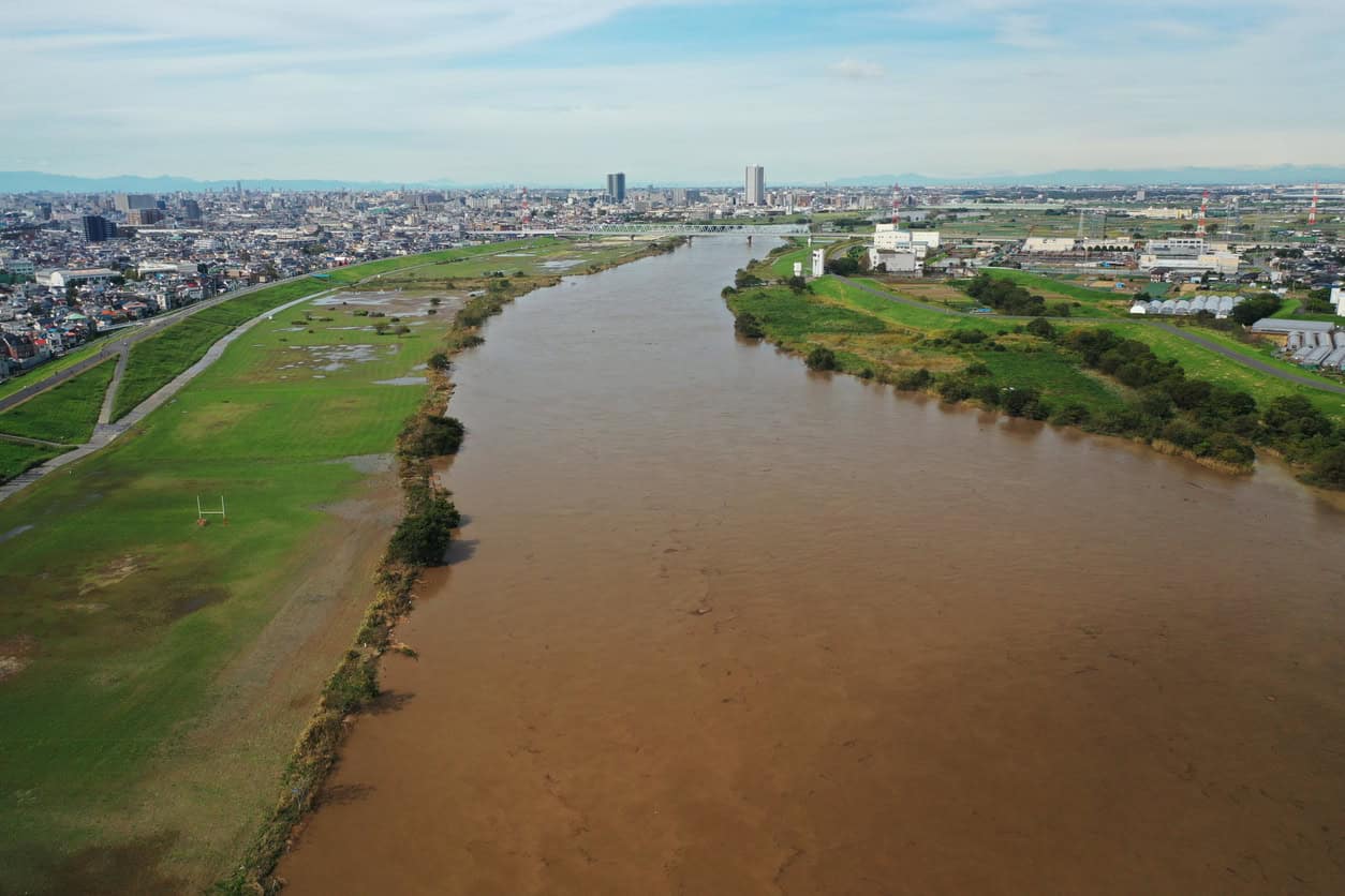
The earliest named practitioner is Takeda Shingen, the sixteenth-century warlord, whose river works in the Kofu Basin are still visible and still partly in use. Tradition dates the start to 1542, after a severe flood at the confluence of the Kamanashi and Midai rivers. The first firm documentary trace is later: a decree of 1560 exempting residents at Ryuo from tax in return for maintaining the works. Both dates are worth carrying, because the gap between them is a fair summary of how much of this history is attested and how much is inherited.
What he did was to stop fighting the river head-on and start managing where it hit.
| Structure | What it did | How firmly attested |
|---|---|---|
| The Takaiwa cliff | An embankment swung the Midai north onto a natural rock face, letting geology absorb the impact that masonry would have lost | Documented; the cliff and the diversion are both still identifiable |
| The Shogi-gashira | A wedge-shaped stone structure set in the channel, named for the pointed head of a shogi piece, splitting and slowing the flow before it reached the works downstream | Named and preserved locally; the detailed mechanics are less fully recorded |
| The Shingen-zutsumi | The embankment itself, on the Kamanashi. Early nineteenth-century records describe its downstream sections as staggered and overlapping | The bank is certain; whether the staggered form is Shingen's or a later modification is not settled |
Planting went in alongside the earthworks, on the same principle behind a modern leaky dam: a belt of trees strains debris out of a flood and takes the energy off it before it reaches the bank. That is standard practice for the period across Japan; how much of it at Kofu was Shingen's own is less clear than the popular account suggests.
The stated philosophy is what survives best: flooding will happen, and the job of the engineer is to control where it goes and how fast it gets there.
The villages that built for the flood they had accepted
Downstream on the Kiso plain the answer was different in form and identical in logic. Communities enclosed themselves and their fields in ring levees, called waju, and then built inside them for the flood that would eventually arrive anyway.
Counts vary with how sub-enclosures inside larger rings are treated. About eighty were recorded in the Meiji period, and other tallies run from seventy-three to a hundred and thirty-three. The dating is firmer than the count. Individual waju are sometimes claimed from the fourteenth century, but the earliest well-evidenced example is 1606, and the real proliferation follows 1609, when the Owari domain completed its own protected levee and everyone on the other side had to make their own arrangements.
Inside the rings, the buildings were the flood strategy:
- Mizuya. Tower houses raised on ishigaki stone plinths above the design flood line, so a family could move upstairs and wait the water out. They were built by landowners who could afford them, and the surviving examples are labelled as such: the one preserved at the Kiso Three Rivers confluence, marked on the map above, is described as the house of a relatively wealthy farmer. The logic is the same as a modern floodable void beneath a raised building.
- Jomeidan. Earthen refuge mounds for everyone else, raised high enough to stand on. The term varies between sources, which also record it as inochizuka and jomei-zuka; the Kanto word mizuka is a different region's practice and does not belong here.
- The three-shaku rule. Tradition holds that levees on the Mino side had to sit three shaku, about ninety centimetres, below the Owari embankment, so that Mino flooded first. The geography made that easy to arrange: the Owari bank ran down the left side of the Kiso, as the map shows, and waju country sits on the other bank. Japanese sources are explicit that this cannot be verified from contemporary records and treat it as legend. It has lasted anyway, which tells you something about what it describes.
- Waju konjo. The "ring-levee mentality", a phrase still in use: if the bank breaks somewhere else, the water goes down and your own land is saved.
Take the refuges together and the system says something uncomfortable. A tower house for those who could pay for one, a mound in a field for those who could not. That is not a reason to romanticise the arrangement, and it is not a quirk of the period either. It is the same stratification the Environment Agency now measures in England, four hundred years later and with better instruments.
England has its own long record of building around water rather than against it, from Roman drainage to the medieval moats and great drains, and its own record of very large agricultural floods: 690,000 acres went under in 1947, across thirty of the forty counties. What it never produced was a settled convention for whose land went under first.
Closed in the age of exclusion
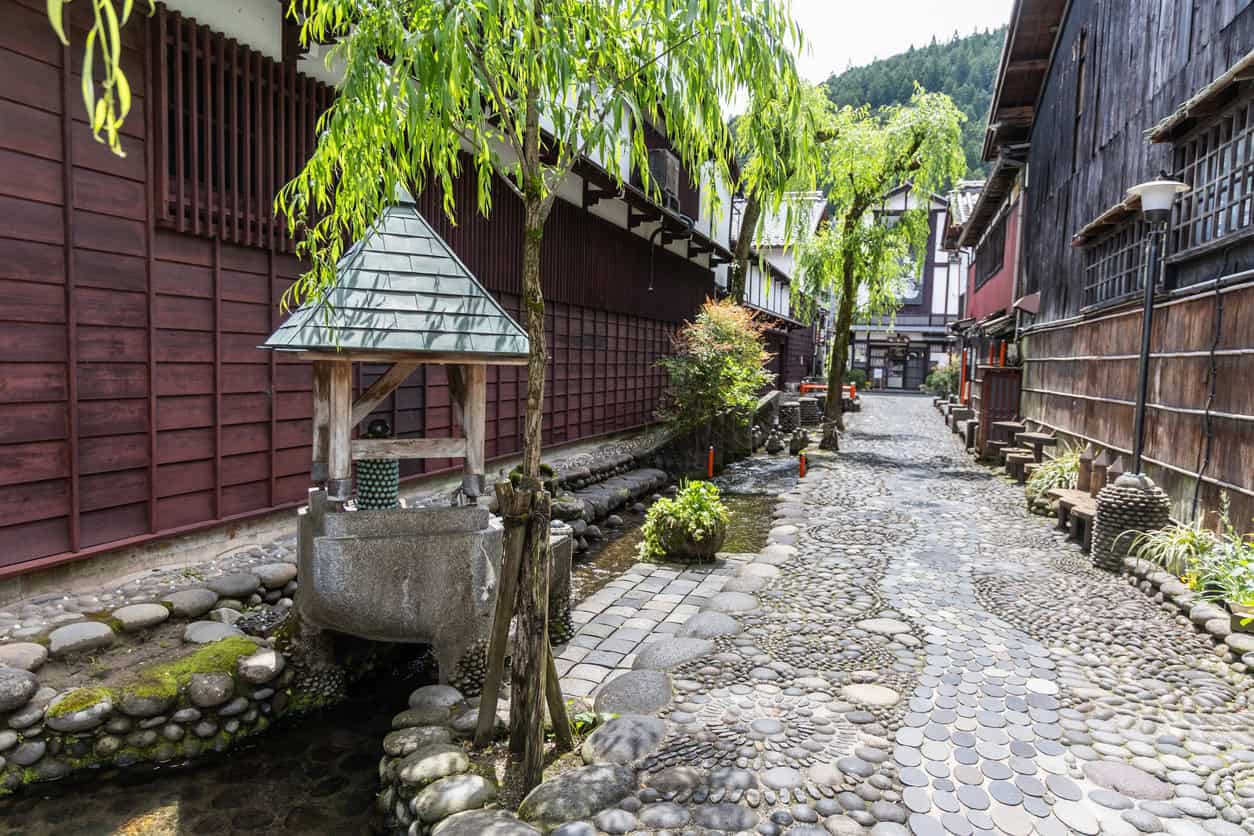
The open levees peaked before the Second World War and were shut in large numbers after it. The reason was doctrinal rather than technical. Post-war river engineering in Japan, as in Britain, worked to the principle that a flood bank should not overflow at all, and on that principle a deliberate gap is not a design feature but a defect. Many were closed off and rebuilt as continuous embankment.
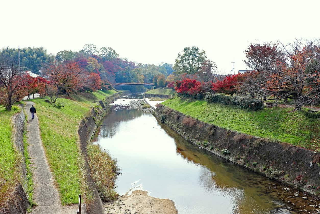
What is left is a partial inventory rather than a working system. A national survey found 296 open levees across 48 river systems, of which 107 sit in farmland, 75 in grassland, 66 in residential or commercial use and 48 in woodland. The same survey notes that many surviving examples have been altered into what are effectively continuous banks and no longer hold their original form, so even 296 flatters the picture.
The technique did not fail. It was retired, along with the assumption that land behind a bank should never get wet.
That assumption is the one thing the Japanese and English stories genuinely share. Both countries spent the twentieth century building to exclude water and discovering the same limit: a defence that works until it does not concentrates the damage into the moment it stops working, which is the same problem as a bank that is protected on paper but below standard in practice. It is the argument behind residual flood risk, and behind the way Venice runs exclusion and tolerance at the same time.
Watarase, and the village underneath it
Not every Japanese answer to this question is one to admire, and the largest of them is the worst.
Watarase is Japan's biggest retarding basin: 3,300 hectares holding around 170 million cubic metres where the Watarase meets the Tone, spanning four prefectures and listed under the Ramsar convention since 2012. It exists because of the Ashio copper mine, whose pollution had already poisoned the land downstream, and the basin was proposed in 1902 partly as a way of trapping contaminated sediment.
Yanaka was the village that had to go. It had about 2,700 people in some 450 households.
- December 1904. The prefecture voted in private to buy the village.
- 1905 to 1906. Purchases went through, priced against land values the mine's own pollution had already driven down to roughly a fifth of comparable ground nearby.
- July 1906. Yanaka was legally dissolved and folded into a neighbouring town.
- 1907. The government invoked its seizure powers against those who would not sell, threatened arrest, and demolished sixteen homes over the summer.
- February 1917. The last eighteen residents left.
- 1919. The compensation case concluded with a fifty per cent uplift, thirteen years after the purchases it corrected.
So Japan has been settling the who-floods-first question for a very long time, and it has settled it badly at least once, on a scale nobody would now defend. The modern machinery is a reaction to that as much as to any hydrology.
Does the old technique stand up?
Yes, within limits that have to be stated alongside the benefit. The Kuji River in Ibaraki Prefecture was hit by Typhoon Hagibis in October 2019, peaking at 3,700 cubic metres per second at Yamagata Observatory. Modelling the event with and without the open levees in place produced a reduction in peak flow of up to about ten per cent along the modelled reach between Tatsunokuchi Weir and Nukada Observatory. That is a reach figure, not a catchment figure, and it should never be quoted as one.
The cost of that ten per cent was severe inundation inside the levee line, with depths passing three metres in places and rising at two to three and a half metres an hour. The same study found something more uncomfortable, and it is the finding that should travel furthest: continuous levees reduced the area that flooded but increased how badly the land that did flood was damaged, because a bank that holds until it does not concentrates the harm rather than removing it.
| Open levee | Continuous levee | |
|---|---|---|
| Peak flow downstream | Reduced by up to about 10% on the modelled reach | Unchanged or increased |
| Area inundated | Larger | Smaller |
| Depth and rate of rise where it floods | Over 3 m, rising 2 to 3.5 m/hr | Lower until failure, then sudden |
| Recovery | Drains back through the gaps | Ponded until pumped |
| What it costs | Land, repeatedly | Damage severity, occasionally |
On the Matsuura River in Kyushu, Teramura and Shimatani recorded 378,203 cubic metres held at Okawano during the August 2019 flood, and valued the flood-control service of the Azame-no-se site at ¥4.2 billion against a construction cost of ¥800 million. Farmers interviewed there reported that soil fertility improved after inundation, which is the silt argument again, measured this time.
None of this makes an open levee a natural flood management measure, or a nature-based solution in the sense the 2026 NPPF now uses. It is hard engineering that works by spending land, and its effectiveness depends entirely on what surrounds it.
Reopened, and the part that has not gone smoothly
In 2021 Japan amended its river law to make basin-wide flood management a legal framework rather than a policy preference. Two things followed. The Kanto regional bureau approved four new open levees on the Naka and Kuji rivers after Hagibis, the first kasumi-tei built anywhere in the country for about fifty years, and the river plans for those catchments committed to preserving the survivors and using them properly.
The other thing was a new designation for private land intended to hold floodwater, with the landowner's written consent, three years of reduced property tax, and a duty to give notice before raising ground levels or building anything that would reduce the land's capacity to store water.
That designation has been used twice.
The first came in July 2024, nearly three years after the law took effect, covering two parcels in Nara Prefecture. The second came in December 2025, and had to be widened a month later once more residents agreed.
Aichi, one of the most flood-exposed prefectures in Japan, has designated none. Meanwhile the same reform brought 382 rivers across 30 river systems under the wider law without apparent difficulty. The engineering scaled in three years. The consent produced two sites in four. The reports on the new levees are candid that the sites needing people to move are the hardest, and that the resident briefings come before the survey work, not after it.
What England takes from this
Not the structures. The catchments are different, the tenure is different and the farm economics are different, and nobody should read four hundred years of Nobi plain practice as an argument for gapped embankments on the Somerset Levels or across the Fens. What transfers is the habit of naming the arrangement.
England has three mechanisms that touch the question and none of them allocates. Countryside Stewardship pays £330 per hectare a year for flood mitigation on permanent grassland and £366 for enhanced floodplain storage, on five-year agreements, but it is demand-led: the farmer applies and Natural England agrees a plan, so the land that ends up holding water is the land whose owner volunteered. Section 30 of the Flood and Water Management Act 2010 designates a structure that already performs a flood function and stops the owner altering it, which protects what exists rather than creating anything new, and it is a power held by the Environment Agency, lead local flood authorities, district councils and internal drainage boards alike. Flood Zone 3b, the functional floodplain, restricts what can be built and pays nothing.
And the pots do not meet. Government guidance is blunt: farmers whose land is engineered as a flood storage area are not eligible for recovery payments.
The gap has been noticed. In October 2025 the Environmental Audit Committee reported on flood resilience in England and recommended a standardised approach to compensating farmers who host floodwater.
Farmers are increasingly expected to absorb runoff from upstream developments on their land, often without consultation, compensation, or clarity over their legal obligations as riparian landowners.
Environmental Audit Committee, Flood resilience in England, October 2025
The Land Use Framework followed in March 2026 and did not take it up. Meanwhile the Environment Agency's own figures show 6.3 million properties and 11.3 million people in England at risk, with more than 2.5 million vulnerable people living in the twenty per cent most deprived neighbourhoods, and the 2026 FCERM funding rules now carry deprivation targets into how schemes are scored. Which is the mizuya and the jomeidan again, in a national dataset.
At site scale English practice is precise about this. Where development takes floodplain storage away, level-for-level compensatory storage has to put it back band by band, and hydraulic modelling of third-party flood impact is what turns an assertion about someone else's land into evidence a consultee can test. The discipline exists. It just stops at the red line, which is why the clearest English decisions about who is not defended sit in shoreline management plans and in one-off cases like the managed retreat at Clydach Terrace.
The hydraulics were never the hard part. Shingen knew where the water should go in the 1550s, and the villages of the Kiso plain knew who would be standing on the mound. Working out whose land floods, saying so, and paying for it is the hard part, and it is the part England has not built a mechanism for. Until it does, the question keeps being settled one flood risk assessment for planning at a time.
Frequently asked questions
Can you still go and see any of this?
Yes, and more of it than you would expect. The Shingen-zutsumi survives at Ryuo in Yamanashi and is still part of the working flood defences there. A preserved mizuya stands at Kiso Sansen Park on the Kiso plain, plinth and all. Watarase is a Ramsar wetland with public access. Around 296 open levees remain across 48 Japanese river systems, though many have been modified enough that the geometry is hard to read on the ground.
Does England have anything like an open levee?
Not in the structural sense, but it has washlands, which do a related job. The Ouse Washes are the clearest example: a strip roughly thirty kilometres long and up to eight hundred metres wide, engineered as deliberate flood storage from the 1630s and completed in 1656, holding up to ninety million cubic metres. The difference is that the Ouse Washes were designed as storage from the start rather than as a levee with gaps in it, and the land is now largely in conservation ownership rather than working farms.
Can a landowner in England refuse to have their land used for flood storage?
In practice, yes, because nothing compels it. The Countryside Stewardship options are voluntary applications, and a designation under section 30 of the Flood and Water Management Act 2010 attaches to a structure that already performs a flood function rather than creating a new obligation to store water. Research on how flood storage has actually been secured in England and Wales found that funding as compensation is the main driver of landowner agreement. What a landowner cannot refuse is water arriving because of a mapped floodplain or an upstream change, which is a different situation with no payment attached to it.
Are open levees used anywhere outside Japan?
Comparable retention areas exist across Germany and the Netherlands, though built as polders and dyke relocations rather than as segmented levees, and the Dutch have their own long history of flooding land deliberately. The German experience is instructive: a 2017 change to national water law gave water authorities pre-emption rights and easier expropriation for flood retention, and research since has found authorities still prefer negotiated land purchase and land consolidation to using those powers. Having the legal power to compel does not make compelling attractive.
About the author. Edward is a co-founder and Director of Unda with 20+ years in flood risk and drainage, and a national-press commentator on flooding. Unda has been trading since 2014, is a CIWEM Business Partner with CIWEM member and chartered (C.WEM MCIWEM) consultants, and has delivered 5,000+ flood risk assessments and drainage strategies across England and Wales.
Edward Bouët · BSc (Hons)
Latest news





One of our experienced Flood Risk Consultants will get back to you within 60 minutes