Coastal Erosion in the UK: How It Happens and What It Means for Property
Estimated reading time 17 minutes
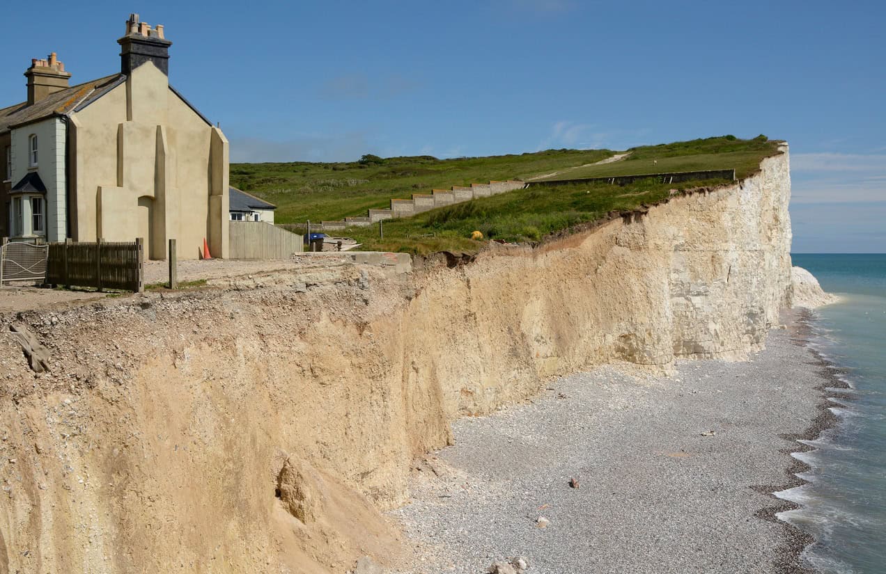
Coastal erosion is the permanent loss of land to the sea. On the soft clay and sand cliffs of eastern and southern England, waves cut away the foot of the cliff and the face above collapses. The cliff top moves inland by a metre or two in a typical year, and by several metres in a bad one. Unlike a flood, the land does not come back. This guide covers how the coast erodes, where it is retreating fastest, how to check the risk for a property, and what erosion means for a planning application, a mortgage and a sale.
Even with every shoreline management plan delivered, the Environment Agency puts 3,500 properties in England at risk of coastal erosion by 2055, and 19,700 by 2105 once climate change is allowed for.
What is coastal erosion?
Coastal erosion is the wearing away and removal of rock, soil and sediment from the coastline by waves, tides and currents, together with the collapse of cliffs the sea has undercut. The difference from coastal flooding is permanence. A tidal flood is temporary, and the land is still there when the water drains away. Erosion takes the land.
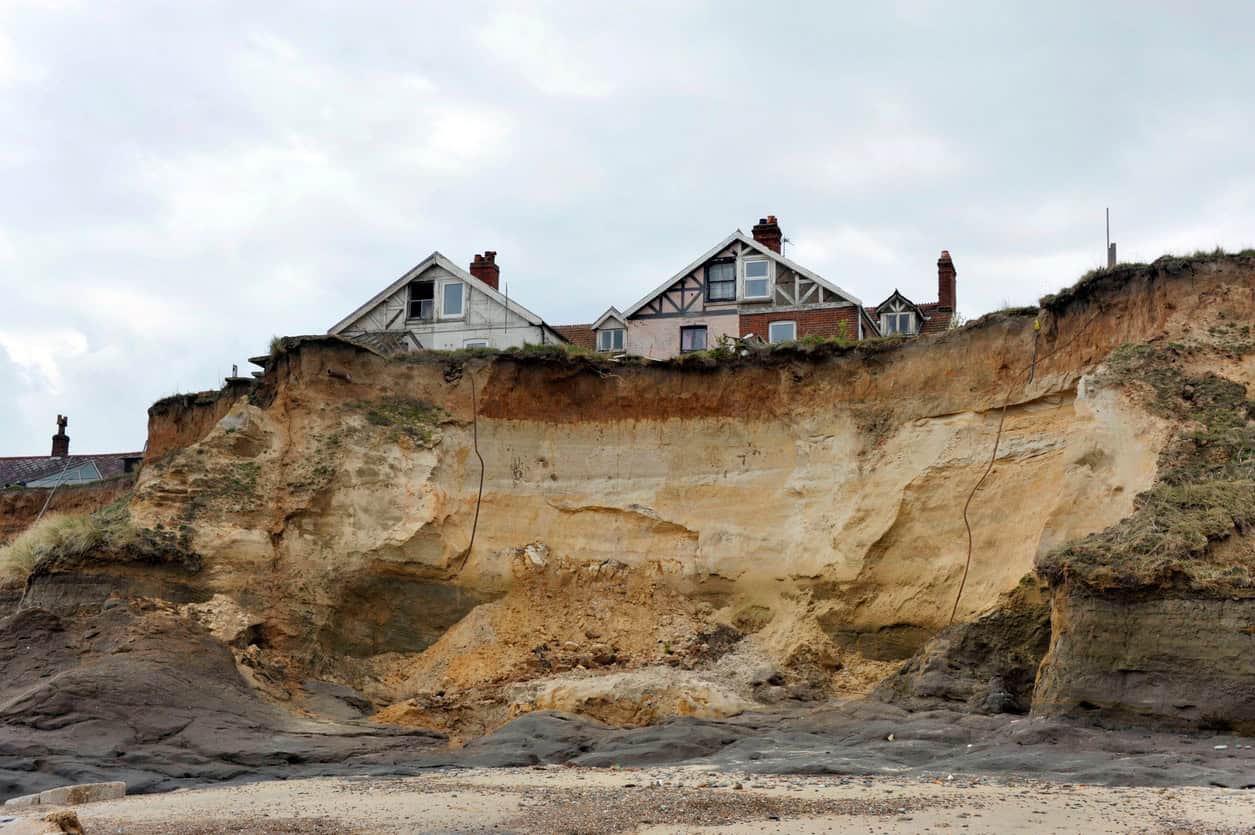
That difference matters to anyone reading the official maps. The Flood Zones on the Environment Agency's Flood Map for Planning show how likely flooding from rivers and the sea is. They say nothing about erosion. A cliff-top house can sit in Flood Zone 1, the lowest flood probability, and still be inside a projected erosion zone. Erosion is mapped and assessed on its own terms, which is why a flood risk assessment for planning on a coastal site has to treat the two as separate hazards.
- No insurance behind it. Standard home insurance does not pay for land or buildings lost to erosion, and there is no statutory compensation.
- Uneven. Retreat is quoted in metres a year, but a cliff can stand for years and then lose tens of metres in one failure.
How does the coast erode?
The sea erodes the coast through four marine processes that act at the foot of the cliff and on the beach: hydraulic action, abrasion, attrition and solution. On England's soft cliffs these processes mostly prepare the ground. The land itself is lost when the undercut face fails and slides onto the beach, where the waves clear the debris away and the cycle starts again.
| Process | What happens | Where it matters most |
|---|---|---|
| Hydraulic action | Waves force water and trapped air into cracks and joints; the pressure, and its sudden release, prises the rock apart | Jointed and fractured cliffs, and the base of sea walls |
| Abrasion | Waves hurl sand, shingle and boulders at the cliff, grinding and chipping it (also called corrasion) | The cliff foot and the wave-cut notch, above all in storms |
| Attrition | Stones carried by the waves knock against each other and break into smaller, rounder pieces | Beaches and the nearshore, where it supplies the sediment that drifts along the coast |
| Solution | Seawater dissolves soluble rock (also called corrosion) | Chalk and limestone coasts |
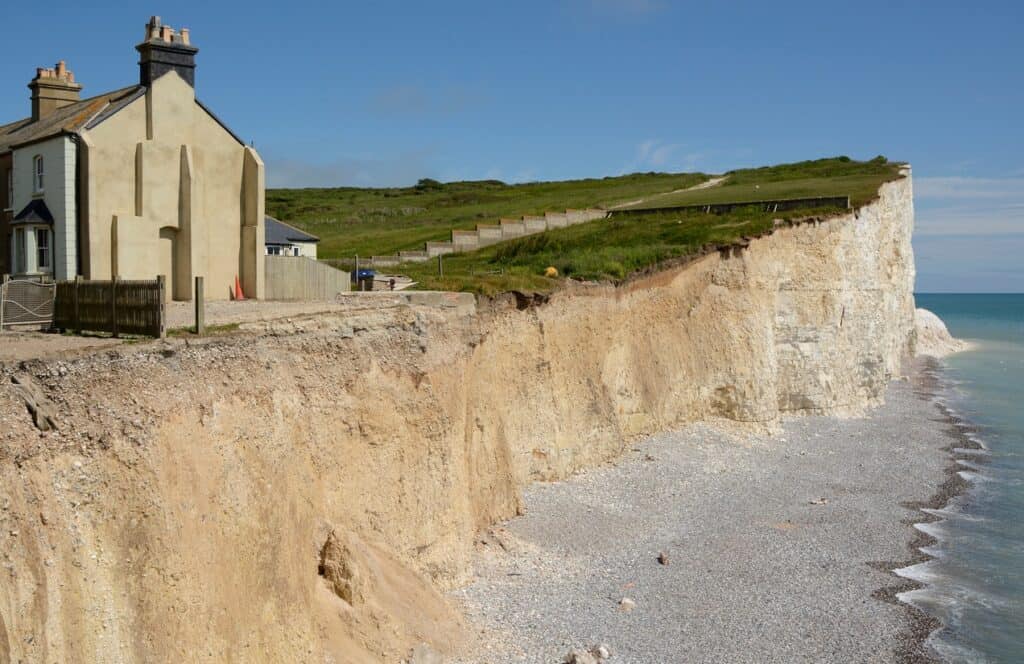
Most property losses come from what happens above the waterline. Once the waves cut a notch at the base, the face above loses its support. Soft clay cliffs such as those of Holderness and north-east Norfolk fail by slumping and by rotational slips. In a rotational slip, a block of cliff top rotates and slides down a curved surface. Harder rock falls in blocks instead.
Water inside the cliff makes this worse. Groundwater draining through sand and gravel layers raises the pressure in the clay and weakens it, so a wet winter can trigger failures some distance back from the edge. North Norfolk District Council commissioned a 2025 study of how water drives cliff failure at Happisburgh. For any one cliff, ground data from the British Geological Survey shows which layers it contains.
Eroded material does not disappear. Waves arriving at an angle move sand and shingle along the shore by longshore drift, and the coast divides into sediment cells, stretches within which that material largely circulates. Erosion in one place feeds the beaches further along, so defending one frontage can starve the next: groynes and walls that hold sediment in place cut off the supply downdrift. The sea defences explainer shows how this terminal groyne effect has moved erosion onto undefended villages.
Where is England's coast eroding fastest?
England's coast retreats fastest on the soft cliffs of the east. The glacial clay of Holderness in the East Riding of Yorkshire, the sand and clay cliffs of north-east Norfolk and the low cliffs of north Suffolk all lose metres in a year. The south-west coast of the Isle of Wight retreats more slowly but loses ground in large landslips. Averages depend on the period measured, so each figure below carries its source.
| Coast | Long-term rate | Faster periods and single events | Source |
|---|---|---|---|
| Holderness, East Riding of Yorkshire | 1.5 to 2 m a year at the council's marker posts; 1.8 m a year average at Aldbrough | Parts averaging up to 4.5 m a year; up to 14 m lost at one post in a single year (1951 to 2004) | Humber SMP2 Appendix C (2010); BGS, Hobbs et al. (2019); East Riding of Yorkshire Council (2026) |
| North-east Norfolk (Happisburgh) | 0.3 to 4.4 m a year across cliff sections, 2000 to 2025 | 8 to 10 m a year on unprotected cliffs, 2001 to 2003 | Mott MacDonald for North Norfolk District Council (2025); BGS, Payo et al. (2018) |
| North Suffolk (Covehithe, Benacre, Easton Bavents) | About 2.8 m a year at Easton Bavents since 1849 | 5.2 m a year at Covehithe (1882 to 1903); 5.8 m a year at Benacre (1925 to 1958) | SMP7 Appendix C (draft, 2010) |
| Isle of Wight, south-west coast (Compton to Chale) | 0.3 to 0.75 m a year | Up to 50 m in a single landslip at Blackgang; rates projected to roughly double by 2105 | Isle of Wight SMP2 (2010) |
Holderness is often described as the fastest-eroding coastline in Europe. No primary source states that as a measured ranking. British Geological Survey researchers describe it as one of the most rapidly eroding coastlines in Europe, and that is as far as the evidence goes.
Averages hide single events: East Riding of Yorkshire Council's marker posts recorded up to 14 metres of cliff lost at one point in a single year between 1951 and 2004.
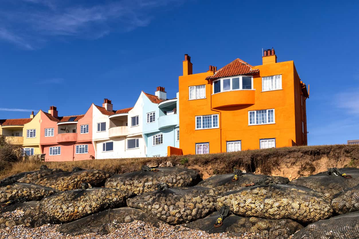
Flood risk in each of these counties is covered in the area guides for Yorkshire, Norfolk, Suffolk and the Isle of Wight.
How is coastal erosion risk mapped?
England's coastal erosion risk is mapped in the Environment Agency's National Coastal Erosion Risk Map (NCERM), published in its current form in January 2025. It projects how far the coast is likely to retreat by 2055 and by 2105, under two management scenarios (shoreline management plans delivered, or no future intervention) and with present-day or higher sea levels. The public view of it is the GOV.UK service to check coastal erosion risk for an area.
To check the coastal erosion risk for a property:
- Open the GOV.UK coastal erosion risk service and find the stretch of coast in front of the property.
- Read the projected erosion zones for 2055 and 2105, and note whether each assumes the shoreline management plan is delivered or that there is no future intervention.
- Check the shoreline management plan policy for that frontage in each epoch. A policy of hold the line today can change to managed realignment or no active intervention later.
- Look for a ground instability zone. On complex cliffs the map adds a buffer where past landslips mean the ground may move further back than the cliff edge suggests.
- Treat the result as a screening answer. The Environment Agency states that the data cannot give details for individual properties. A purchase or a planning application needs a site-specific look at the frontage, the defences and the council's own monitoring.
With no further shoreline management, the number of properties at risk of coastal erosion by 2105 rises to 65,100, and to 102,100 once climate change is allowed for.
| Scenario | To 2055 | To 2105 |
|---|---|---|
| Shoreline management plans delivered | 3,500 | 10,100 |
| Plans delivered, with climate change | 5,200 | 19,700 |
| No plan delivery | 32,800 | 65,100 |
| No plan delivery, with climate change | 44,500 | 102,100 |
The figures come from the Environment Agency's national assessment of flood and coastal erosion risk in England, first published in December 2024. The gap between the first and third rows, 55,000 properties by 2105, is the number the shoreline management plans are expected to protect. The map covers England only. In Wales, Natural Resources Wales publishes its own coastal erosion risk map with bands to 2025, 2055 and 2105. Its wider role in Welsh planning is set out in the Natural Resources Wales explainer.
Who is responsible for coastal erosion?
No public body has a duty to stop the sea eroding a particular property. Under the Coast Protection Act 1949, each maritime district council is the coast protection authority for its coast, with a power, not a duty, to carry out coast protection work. The Environment Agency holds the strategic overview in England, and shoreline management plans set the long-term policy for each stretch of coast.
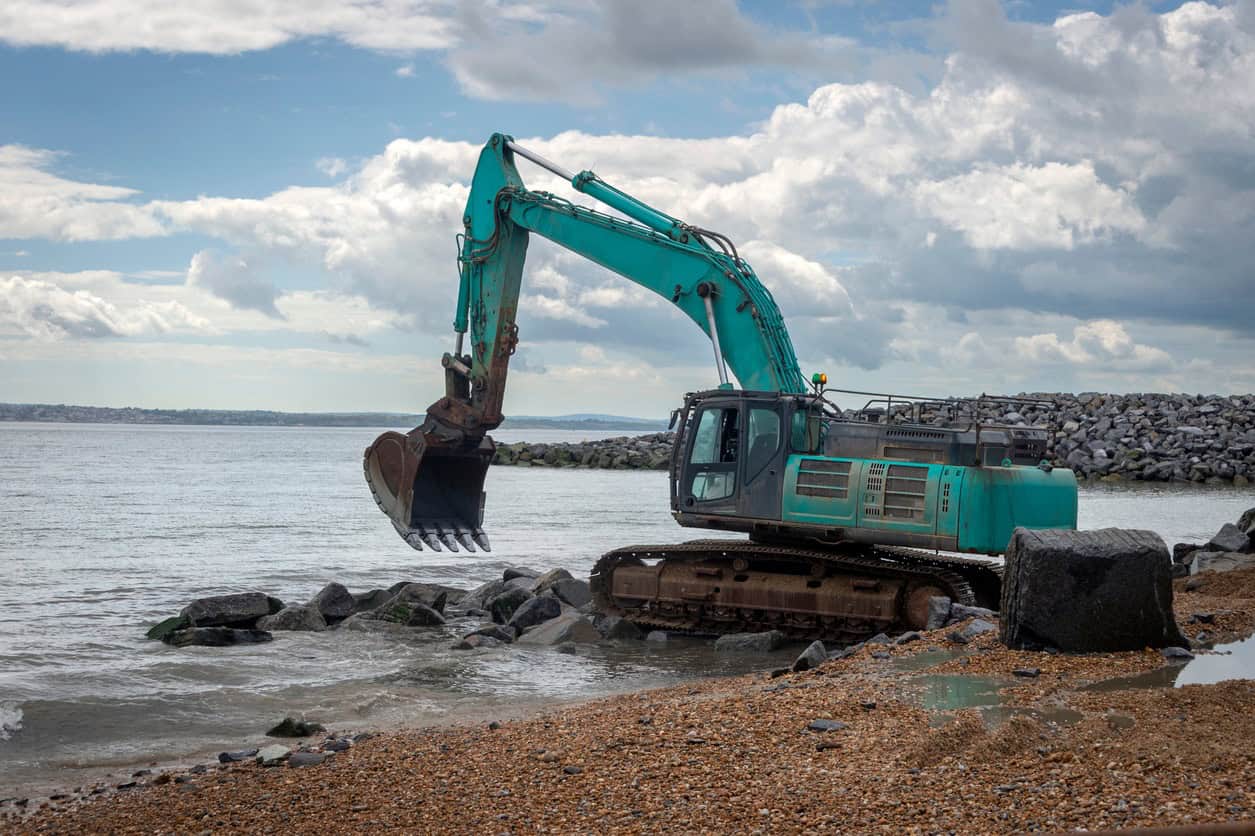
- Coast protection authorities. Section 4 of the 1949 Act lets maritime district councils build and maintain coast protection works. Each council decides where to use that power, guided by funding rules and the shoreline management plan.
- The Environment Agency. Section 7 of the Flood and Water Management Act 2010 requires it to develop, maintain, apply and monitor a strategy for flood and coastal erosion risk management in England. It also runs the national capital programme for defences, as the Environment Agency explainer sets out.
- Shoreline management plans. Twenty plans cover England's coast, and each gives every frontage one of four policies for each epoch: hold the line, advance the line, managed realignment or no active intervention.
- Owners. A landowner cannot simply build their own defence. Under section 16 of the same Act, new coast protection work needs the coast protection authority's written consent (maintenance and repair are exempt), and a private wall on one frontage can speed up erosion next door.
How will climate change affect coastal erosion?
Higher sea levels let waves reach the cliff foot more often and with more energy. Stronger storms remove more in each event. The Environment Agency's 2024 national assessment expects erosion rates to increase with sea level rise and climate change through this century. Its own figures show the scale: even with the plans delivered, allowing for climate change roughly doubles the number of properties at risk by 2105, from 10,100 to 19,700, because the same defences hold back less of a rising sea.
On the Isle of Wight's south-west coast, the shoreline management plan projects recession rates of 0.3 to 0.75 m a year rising to 0.58 to 1.44 m a year by 2085 to 2105.
Sea level does not stop rising in 2100 either. Sea level rise in the UK covers how much and how fast, planning for sea level rise beyond 2100 covers the longer view, and the climate change allowances guide sets out the figures an assessment applies.
Who pays when the land is lost?
In most cases, no one. The government stated in its 2026 response to the Environment, Food and Rural Affairs Committee that standard home insurance policies typically exclude losses from coastal erosion, and Flood Re, which keeps flood cover affordable, covers flooding only. There is no statutory compensation for land or buildings lost to the sea.
The one payment is the Coastal Erosion Assistance Grant: up to £10,000 per property, administered by the Environment Agency for Defra, towards demolition and basic moving costs. It rose from £6,000 in July 2026, against the £25,000 to £35,000 the committee puts on the real cost of demolition. The owner pays the rest. Without insurance or compensation behind it, a house with a projected erosion line in front of it can be hard to mortgage and hard to sell. The coastal erosion compensation explainer covers the grant's eligibility rules, and the wider effect on lending is set out in Could UK Homes Become Uninsurable?
What coastal erosion means for a property or planning application
Planning policy treats land likely to be lost to the sea within a century as the wrong place for permanent new homes. Local plans identify those areas as Coastal Change Management Areas. The National Planning Policy Framework allows development in them, or in any other area likely to erode within 100 years, only where the applicant shows it will be safe for its whole life and passes two further tests.
Policy F3 directs local plans to take account of shoreline management plans and the National Coastal Erosion Risk Map. Any area likely to be affected by physical changes to the coast over the next century is to be identified as a Coastal Change Management Area. Plans should also say what development is acceptable there, safeguard land needed for managed realignment, and provide for development that has to move away. Policy F9 then sets the test for individual applications:
Development should not take place within a Coastal Change Management Area (or within other areas likely to be subject to coastal erosion or tidal inundation over the next century, accounting for the National Coastal Erosion Risk Map and other up-to-date evidence on coastal change and its management) unless it can be demonstrated that it would: a. Be safe over its planned lifetime; b. Reflect the provisions of the relevant Shoreline Management Plan and not have an unacceptable impact on coastal change processes; and c. Provide wider sustainability benefits which justify the development.
National Planning Policy Framework, Policy F9(1)
Paragraph 3 of the same policy states that new residential development (including through changes of use) is inappropriate within an area to which this policy applies unless it meets all three tests, and paragraph 2 expects time-limited permissions and site-restoration conditions where development does go ahead. The NPPF August 2026 changes explain where these policies sit in the new framework, and NPPF flood risk guidance and advice covers how they apply to a particular scheme.
Planning Practice Guidance explains how an applicant shows this: a coastal change vulnerability assessment, scoped in advance with the local planning authority and the coast protection authority. It has to show the development will be safe through its planned life without new or improved defences, will not speed up erosion elsewhere, and will be removed or relocated before the cliff edge reaches it. The same guidance assumes a home has a lifetime of at least 100 years, which for a house built now runs about 20 years past the map's 2105 horizon.
In practice, that means:
- A permanent new home is likely to be refused. Inside a projected erosion zone, policy starts from the position that a new dwelling or a conversion to residential use is inappropriate, and the applicant has to prove all three tests to overturn that.
- A short planning life may be the best outcome. Where development is acceptable, permission may be time-limited, with a condition to remove the building and restore the site.
- An existing home faces a market problem rather than a planning one. Planning policy does not remove a house already standing, but with no insurance, no compensation and the erosion line on a public map, lenders and buyers may walk away.
- Relocation is the policy direction. Plans are expected to provide for development that has to move inland, so the long-term answer for a threatened building is usually a new site rather than a new defence.
Buying or building near an eroding coast?
A flood risk assessment or due diligence report sets out the tidal flood risk, the defences and the erosion position before money changes hands. Quotes come back within 60 minutes.
Get a free quoteWhere Unda comes in
Unda prepares flood risk assessments and due diligence reports for coastal sites across England and Wales. On the coast, a flood risk assessment for a planning application deals with tidal flooding and with overtopping and breach of the defences. It also checks the site against the National Coastal Erosion Risk Map and the shoreline management plan, so the planning officer sees both hazards in one report.
For a purchase, a flood risk survey when buying a house flags a home inside a projected erosion zone before exchange, and flood risk due diligence does the same for land and commercial acquisitions. Where a local planning authority asks for a coastal change vulnerability assessment, that is a separate report by a coastal specialist, and the flood risk assessment sits alongside it.
Frequently asked questions
Does a sea wall stop coastal erosion?
It stops erosion of the frontage behind it for as long as the wall stands, but not the processes. Waves reflected off a wall scour the beach in front of it, which undermines the toe, and the unprotected coast on either side keeps retreating until the wall is outflanked.
Can a coast gain land as well as lose it?
Yes. Where longshore drift drops more sediment than the waves remove, beaches widen and spits grow, a process called accretion. Planning Practice Guidance counts accretion among the physical changes a Coastal Change Management Area can cover. It rarely helps the cliffs that supply the sediment, though: the land gained is usually further along the coast from the land lost.
Do sellers have to disclose coastal erosion risk?
There is no specific statutory duty on a seller to disclose it, a gap the Environment, Food and Rural Affairs Committee criticised in its 2026 report. A buyer near an eroding coast should check the erosion map and the shoreline management plan, and ask their conveyancer and surveyor about both.
Does every eroding coast have a Coastal Change Management Area?
No. Planning Practice Guidance says one is only needed where shoreline change is expected to be significant over the next 100 years, and not normally where the shoreline management plan policy is to hold or advance the line for the whole plan period. A defended frontage without one can still be inside the erosion map's no-intervention zones.
About the author. Edward is a co-founder and Director of Unda with 20+ years in flood risk and drainage, and a national-press commentator on flooding. Unda has been trading since 2014, is a CIWEM Business Partner with CIWEM member and chartered (C.WEM MCIWEM) consultants, and has delivered 5,000+ flood risk assessments and drainage strategies across England and Wales.
Edward Bouët · BSc (Hons)
Latest news
One of our experienced Flood Risk Consultants will get back to you within 60 minutes
