Managed Retreat: When Homes Are Moved Away From Flood Risk
Estimated reading time 14 minutes
Managed retreat is the planned removal of homes, people and infrastructure from land where the risk of flooding or erosion can no longer be managed at an acceptable cost. The buildings are bought, then demolished, and the land goes back to the river or the sea, or becomes open space. In the UK it has mostly happened on eroding coastlines. Now it is reaching river towns. On 23rd September 2026, Angus Council approved an options appraisal for the River Street area of Brechin that recommends demolishing flood-damaged homes and leaving the ground open.
Brechin's £16 million flood scheme was built in 2016 to a 1 in 200 standard. After Storm Babet, the council's own assessment put it at roughly 1 in 50.
What is managed retreat?
Managed retreat means deciding in advance to move away from a hazard rather than defend against it indefinitely. A public body buys or relocates the properties most at risk, clears them, and changes how the land is used so nobody lives there again. Unplanned retreat is different: it happens after a disaster, when people cannot go back.
The scale varies. Clydach Terrace in south Wales was one row of 14 houses; the long-term plan for Fairbourne covers a village of around a thousand people.
- Planned, not forced. The move is decided before the next flood, with time to rehouse people, rather than after homes have already been lost.
- Permanent. The cleared land is not rebuilt for housing; it usually becomes open space, habitat or functional floodplain.
- Publicly led. A council, government agency or national scheme makes the decision and usually funds the purchases.
- Driven by cost and safety. Retreat is reached when defences cannot be justified on cost, or cannot make the homes safe.
How is managed retreat different from managed realignment?
The two terms are often confused. Managed realignment is a coastal policy that moves the line of defence, often inland to create saltmarsh. Managed retreat moves people and property. A realignment scheme may involve no homes at all. A retreat always does.
Managed realignment is one of the four policies a shoreline management plan can set for a stretch of coast. Retreat can follow from it where homes sit behind a defence that will no longer be maintained.
| Approach | What moves | Typical setting | Example |
|---|---|---|---|
| Managed retreat | People, homes and infrastructure | River floodplains and eroding coasts | Clydach Terrace, Ynysybwl; River Street, Brechin |
| Managed realignment | The line of the defence | Estuaries and low coasts, often to create habitat | Medmerry, West Sussex |
| No active intervention | Nothing is moved; defences are not maintained | Undeveloped or lightly developed coast | Epoch three of the Fairbourne frontage, after 2055 |
Where is managed retreat happening in the UK?
Managed retreat has been under way on the UK coast for more than a decade, mainly where soft cliffs are eroding faster than any defence could be justified, and since 2020 it has also appeared on rivers, where councils have bought and demolished flood-prone homes that no scheme could protect. Both kinds are covered below.
On the coast: Fairbourne, Thorpeness and North Norfolk
Fairbourne in Gwynedd is the best-known case. Its shoreline management plan holds the line to 2025, moves to managed realignment until 2055 and to no active intervention after that. Talk of "decommissioning" the village by the 2050s has since been disputed by Gwynedd Council, and residents still contest the plan.
Thorpeness, in Suffolk, lost 11 homes to the sea in a single winter, the Environment, Food and Rural Affairs Committee heard in 2026. In Norfolk and the East Riding of Yorkshire, which between them hold 84.1% of homes at risk of coastal erosion in the next 20 years, the government's Coastal Transition Accelerator Programme is funding relocation, rollback and new ways of paying for homeowners to move until 2027.
On rivers: Clydach Terrace and Brechin
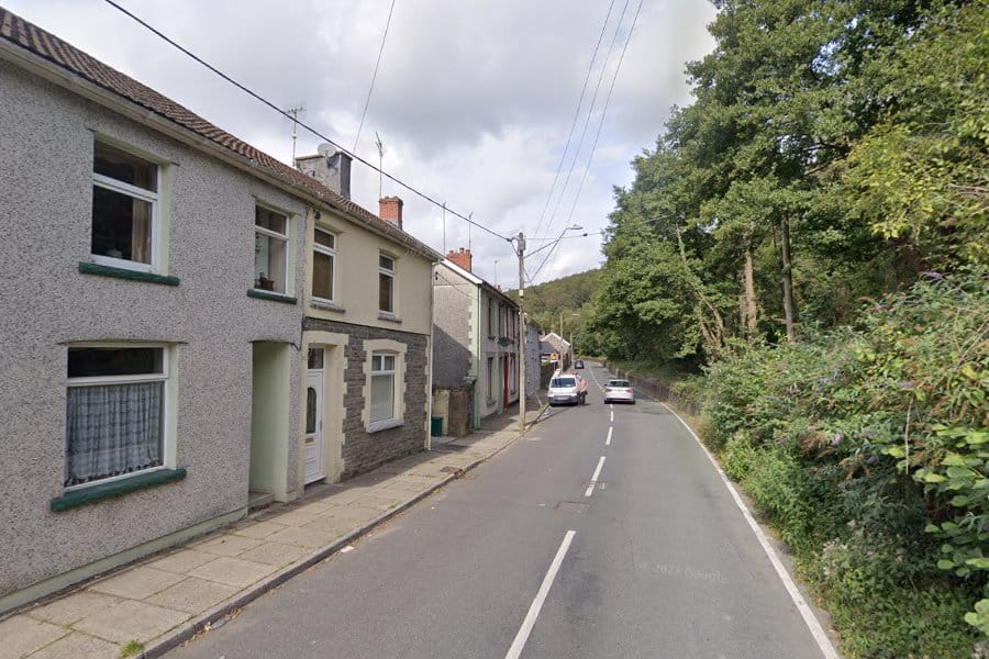
At Clydach Terrace in Ynysybwl, Rhondda Cynon Taf, floodwater reached nearly two metres inside homes during Storm Dennis in 2020 and returned with Storm Bert in 2024. Natural Resources Wales found no defence option that met its funding rules, so the council's cabinet agreed on 2nd February 2026 to buy 14 homes for about £2.57 million, demolish them and turn the site into public space. The full story of Clydach Terrace shows how the decision was reached outside the flood defence system altogether.
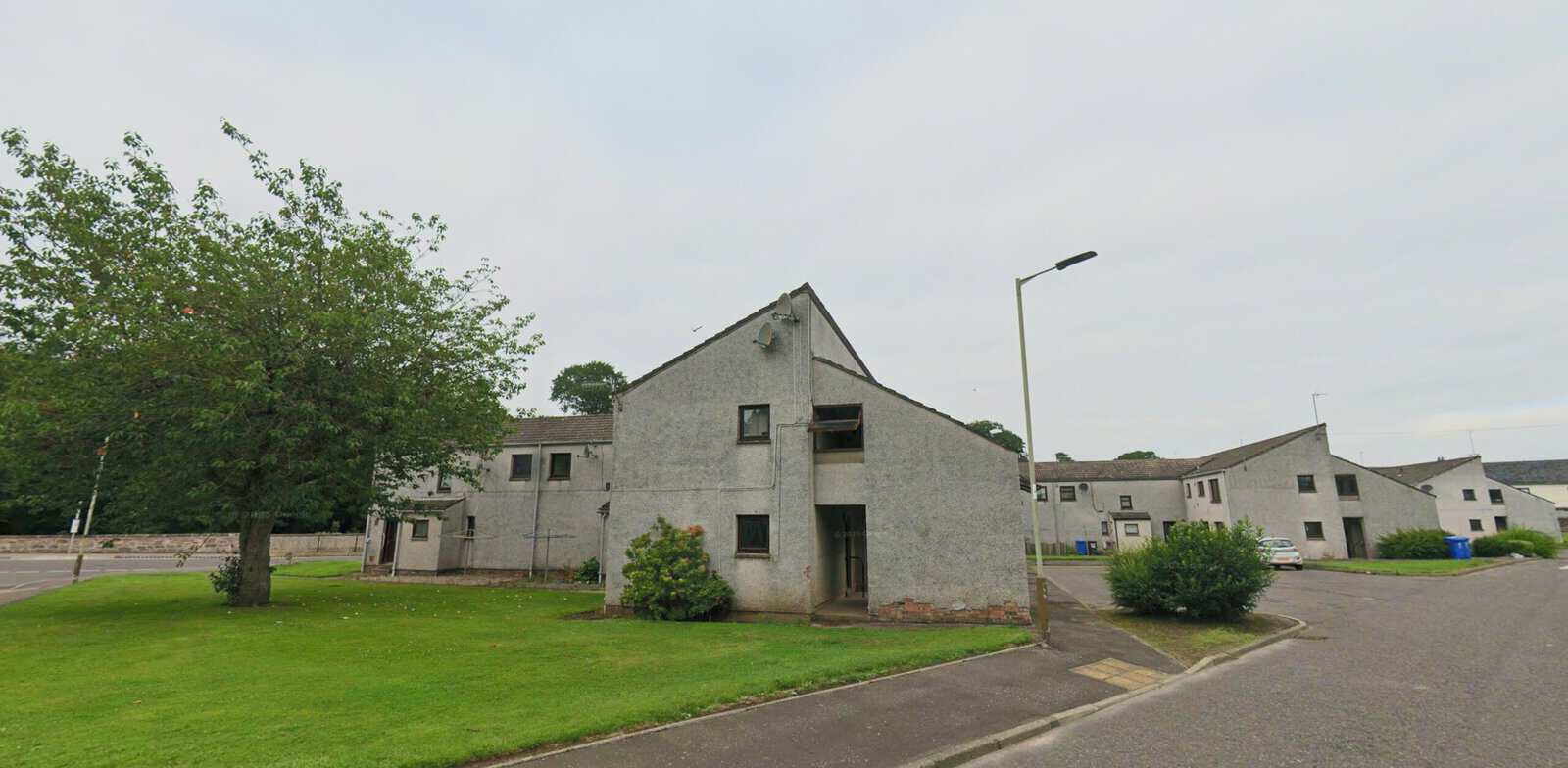
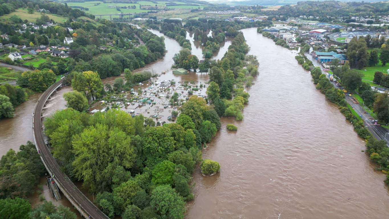
Brechin is bigger. Storm Babet, in October 2023, significantly damaged more than 138 homes around River Street. The council's September 2026 options appraisal covers about 150 council homes and 29 privately owned properties, and recommended demolition followed by open space, without raising the flood defences.
A 2026 study in Earth's Future found 44 managed retreat projects across 11 European countries, covering more than 8,700 households. Most were started after a major flood, not before one.
The Earth's Future study also found that fair compensation, early engagement and clear direction from government made the most difference to how projects turned out. Anyone assessing a site close to places like these needs a flood risk assessment for planning that tests the current risk, not the risk a defence was designed for.
Why do flood defences stop being the answer?
Defences stop being the answer when protecting a place costs more than the damage it would prevent, or when the protection falls as flood estimates rise. Public funding in England and Wales depends on benefits exceeding costs. A handful of homes in a deep, fast-flowing floodplain can fail that test even where the danger to life is extreme.
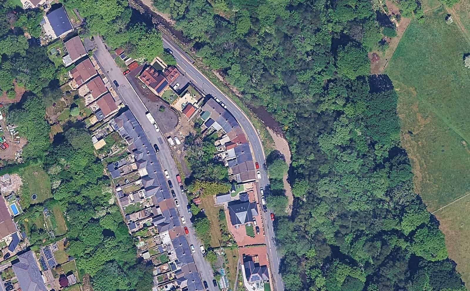
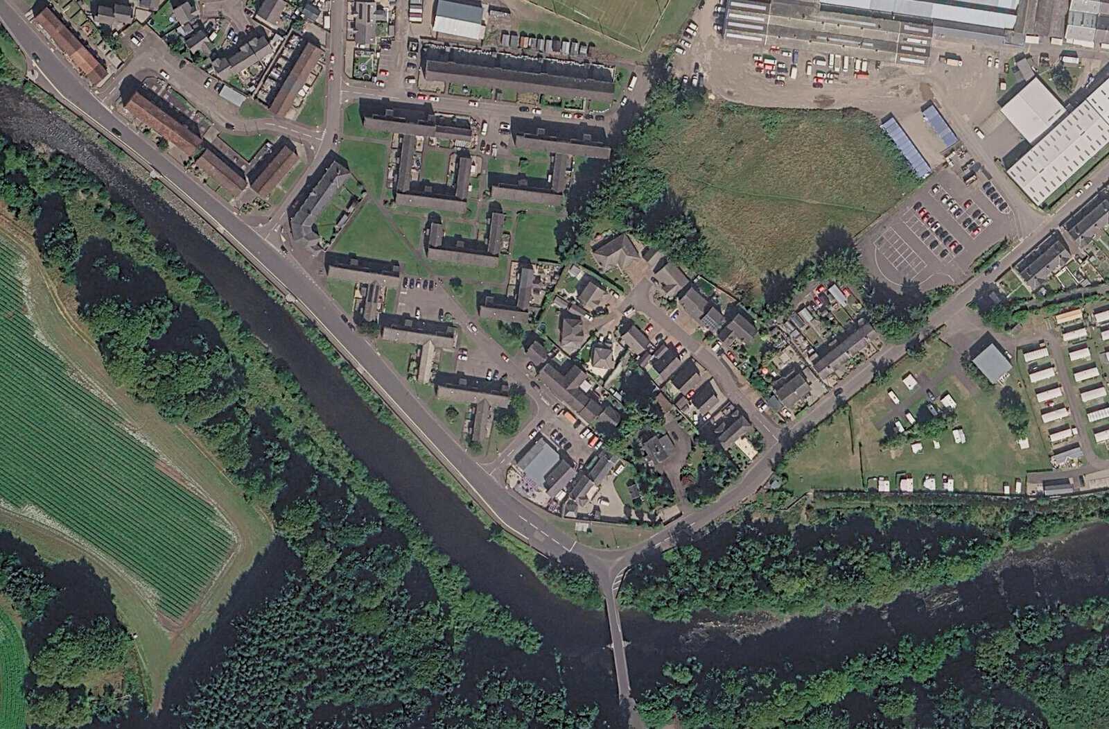
In England, the 2026 funding rules rank schemes by the economic benefit they return for each pound of government money. At Clydach Terrace, a raised flood wall was judged not economically viable under the UK and Welsh Government funding rules. At Brechin, the appraisal put the cost of raising the defences at about £4 million, with a benefit-cost ratio below 1.0.
The second reason is less obvious. A defence is built to a standard of protection, expressed as a return period or annual probability. That standard moves. As river flow records lengthen and climate change allowances rise, the same wall protects against a smaller share of floods. Nothing about the wall has changed.
Scheme completed
The £16 million River South Esk defences are designed to a 1 in 200 standard.
Standard falls
A hydraulic review finds protection has dropped to about 1 in 100, largely because of updated flow estimates and climate change.
Storm Babet
Peak flow of about 434 m³/s against a design capacity of about 335 m³/s. The wall is overtopped and the standard is reassessed at about 1 in 50.
Clearance approved
The council approves an options appraisal recommending demolition and open space, not higher walls.
Brechin's defences held. Water came over the top of a wall in good condition, because the flood was far larger than the one it was built for: the council's November 2024 recovery report put the Storm Babet peak at about 434 m³/s against a design capacity of about 335 m³/s, and the scheme's protection at about 1 in 50. A 2021 hydraulic review had already found it had fallen from 1 in 200 to about 1 in 100. The residual flood risk behind a defence, and a defence's condition and standard over time, are therefore as important as the defence itself. The Environment Agency's Fens 2100+ evidence makes the same point at landscape scale: defended land still floods.
- A defence is built to a design standard, such as 1 in 200.
- Flood estimates rise as new data and climate change allowances arrive, and the standard falls.
- A flood exceeds the design and homes behind the defence are damaged.
- Raising the defence fails the cost test, or cannot make the homes safe.
- The homes are bought and cleared, and the land is given a use that can flood.
What does planning policy say about managed retreat?
National planning policy in England now names relocation directly. The National Planning Policy Framework published on 17th August 2026 tells local plans to look for opportunities to move existing development, including housing, where climate change means it may not be sustainable. On the coast it goes further, with Coastal Change Management Areas where new homes are normally inappropriate.
Where climate change is expected to increase flood risk so that some existing development may not be sustainable in the long-term, seeking opportunities to relocate development, including housing, to more sustainable locations.
National Planning Policy Framework (August 2026), Policy F2(1)(d)
That wording sits in the plan-making policies of the new Chapter 18 on flood risk and coastal change. It gives councils a policy basis for relocation. It gives them no money and no process for buying homes, which is why Clydach Terrace and Brechin were both handled under councils' own powers.
The National Planning Policy Framework also covers the coast in two further policies. Policy F3 requires local plans to identify Coastal Change Management Areas, safeguard land for managed realignment and provide for development that needs to move away from them. Policy F9 makes new housing in those areas inappropriate unless it would be safe over its planned lifetime, reflect the shoreline management plan and bring wider benefits, and it allows time-limited permissions, a point that matters more as sea level rise pushes planning horizons beyond 2100.
Wales and Scotland have no national relocation scheme either. In Wales, Fairbourne and Clydach Terrace have been handled by councils and Natural Resources Wales. Scotland's National Flood Resilience Strategy, published in December 2024, refers to a slow transition away from the areas most exposed to flooding and coastal erosion, and Brechin was decided by Angus Council under its own powers.
Who pays for managed retreat, and what do owners get?
Managed retreat is paid for case by case. Councils have used capital budgets and insurance settlements, and owners are offered compensation on the same basis as a compulsory purchase. There is no national fund for inland retreat. Payouts do not always cover a comparable home nearby.
At Brechin, the recommended option was estimated at £3.4 million and can be met from the remaining £1.7 million insurance settlement and £3 million from the council's infrastructure fund. The council plans to offer owners compensation equivalent to compulsory purchase and to prepare a compulsory purchase order in parallel, and its report accepts that some owner-occupiers may not receive enough to buy a similar home locally. Residents at Clydach Terrace have said the same.
On the coast, owners get less. There is no compensation for a home lost to erosion, only a demolition grant that rose from £6,000 to £10,000 in July 2026, against demolition costs the EFRA Committee put at £25,000 to £35,000. The Committee asked for a national relocation strategy by March 2027; the government has deferred it to pilots that run until spring 2029.
Homes that have flooded lose about 3% of their value straight away and around 10% by year fifteen, with no recovery, according to a 2026 study of 27 million sales in England.
That study, published in Communications Earth & Environment, goes some way to explaining why owners in a place like River Street, whose homes have flooded and whose street is now earmarked for clearance, can struggle to sell up and move on without public help. Flood risk already affects house prices, and Flood Re, which keeps insurance affordable for many older homes, is due to close in 2039.
What managed retreat means for development and property
For anyone planning development or buying property, managed retreat is a warning sign. A council that has concluded existing homes cannot be kept safe is very unlikely to approve new ones on similar land nearby. The evidence it gathered to justify clearance can be used to refuse an application, and a refusal on flood safety grounds is hard to overturn on appeal.
- Refusal is the default. Under Policy F7, development in a location at risk of flooding now or in the future should be refused unless it will be safe for its lifetime, normally taken as 100 years for housing. A site beside a clearance area starts with the burden of proof against it.
- The Sequential Test is harder to pass. A local plan that identifies an area as unsustainable in the long term gives the council grounds to say lower-risk sites should be used first.
- Functional floodplain rules out homes entirely. Land cleared and given back to the river can be mapped as Flood Zone 3b, where new housing has no route to approval.
- Rebuilding is not a way round. A replacement house is treated as a new dwelling, so knocking down and rebuilding in a flood zone still faces the full tests.
- A defence's design standard is not evidence. An assessment that quotes a scheme's original standard, rather than current modelling with climate change, may overstate protection by a factor of four, as Brechin shows.
- Value and saleability suffer. Homes near a retreat area can become hard to insure, mortgage or sell, and permissions on the coast may be time-limited.
Where a site is anywhere near a place like Brechin or Clydach Terrace, the strength of the evidence decides the outcome. Sequential and Exception Test reports need to deal with the local plan's view of long-term sustainability head on, and a flood risk feasibility study before purchase can show whether a site is worth pursuing at all.
For buyers of existing homes, a flood risk survey before buying a house checks the history, the defences and the shoreline or local plan policy for the area, so a purchase is not made in a place the council has already decided to leave.
Frequently asked questions
Can a council force you to leave your home under managed retreat?
A council can use compulsory purchase powers, but it must justify them for each property, and the owner is entitled to statutory compensation and can object. Schemes start with voluntary purchase. At Brechin, voluntary offers and a compulsory purchase order are being prepared at the same time, so owners who do not agree can still be bought out.
What are the advantages and disadvantages of managed retreat?
The main advantage is that it removes people from danger permanently and ends the cost of repeated repairs and emergency response. It can also create habitat and floodplain storage. The disadvantages are the loss of homes and community, compensation that may not buy an equivalent home, the upfront cost, and years of uncertainty while decisions are made.
How much does managed retreat cost?
It depends on property values and scale. Clydach Terrace cost about £2.57 million for 14 homes, roughly £184,000 each including fees and relocation support. At Brechin, the recommended clearance option was estimated at £3.4 million, compared with about £4 million to raise the defences, which would still not have removed the risk.
How can you tell whether an area could face managed retreat?
On the coast, check the shoreline management plan policy for the frontage and the National Coastal Erosion Risk Map. Inland, no such list exists. The best indicators are repeated flooding, a local plan or strategic flood risk assessment that questions an area's long-term sustainability, and defences whose standard of protection has fallen since they were built.
About the author. Jackie is a co-founder and Director of Unda with 30+ years in flood risk, and sits on CIWEM's South Eastern Branch committee. Unda has been trading since 2014, is a CIWEM Business Partner with CIWEM member and chartered (C.WEM MCIWEM) consultants, and has delivered 5,000+ flood risk assessments and drainage strategies across England and Wales.
Jackie Stone · MSci, BSc (Hons), DIC, CIWEM Environmental Partner

One of our experienced Flood Risk Consultants will get back to you within 60 minutes
