Below Standard Flood Defences: Protected on Paper, Vulnerable in Practice
Estimated reading time 12 minutes
Flood defence condition is measured against a target, not against whether a wall is still standing. On 1 April 2026 the Environment Agency reported that 93% of its flood risk assets in high consequence systems were in the required condition, exactly hitting its 93% target. That figure is narrower than it first appears: it covers the assets protecting the most people and property, not the whole national stock, and it says nothing about the thousands of defences held by councils, internal drainage boards, water companies and private landowners.
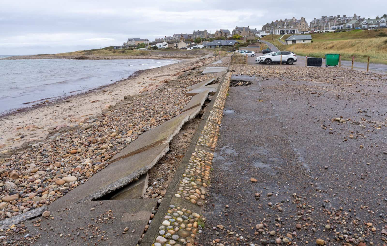
Reporting during the winter 2025 storm season put almost one in ten flood defences below their required condition as severe weather arrived.
So two things are true at once: the Agency is meeting the target it sets itself on the assets it prioritises, and a great many communities are living behind defences that still work but with less margin than they had a decade ago, in places where the consequences of a failure are already well documented. Individually, the inspection findings sound technical. Together they describe a country defended on paper and, in places, thinner in practice.
What does "below standard" actually mean?
Below standard does not mean failed. Flood defences are inspected against a target condition that reflects how they are expected to perform in a flood, and falling short of that target triggers a maintenance job rather than an evacuation. The wall is still there. The Environment Agency puts it plainly whenever local figures are published.
A below required condition classification means that work is required, it may not have failed and may still perform as expected during a flood event.
Environment Agency, on East Riding asset inspections, December 2025
What changes is reliability under pressure. Cracks, erosion, overgrowth, blocked drainage, ageing gates and tired mechanical parts all cut the margin when rivers rise fast or storms arrive one after another, and the margin is the whole point of a defence. How much that matters depends on how flood probability and severity are understood in the first place, particularly where decisions rest on defined return periods and annual exceedance probabilities.
The distinction also explains the size of the numbers. In the East Riding of Yorkshire, 101 defences were logged below required condition in December 2025, from a stock of 1,301. Of those, 854 are classed as high consequence, but only 63 of the below-standard assets sat in that group. So the headline count and the count that drives the Agency's target are not the same number. Mixing them up gives you either false comfort or false alarm.
This is how an area stays officially defended while quietly becoming more exposed. Where that matters for a specific site, the answer comes from a site-specific flood risk assessment for planning rather than from the mapped position.
Defended on maps, exposed in reality
None of this is new. The gap between protection and exposure sits at the heart of England's most serious flood events, and it long predates any of the current inspection data.
Along the Severn, flooding at the turn of the millennium showed flood risk becoming a repeating state rather than a single shock. Communities there were protected, then tested again as conditions shifted. That fed later thinking about managing risk across a whole catchment instead of leaning on downstream defences alone, including the approaches now grouped under natural flood management.
York is the clearest case. Its relationship with the River Ouse has always paired defended status with a sharp local awareness of what is left over, which is exactly why recent inspections finding multiple York defences below target condition, several of them protecting homes and businesses, landed harder there than the raw count of assets would suggest to anyone reading it from a distance.
In Lewes, catastrophic flooding forced a reckoning with the limits of protection in a historic town and shaped recovery for decades. Further east, flooding around Crawley and Gatwick showed how transport and economic infrastructure depends on catchment behaviour rather than on any single defence holding, with surface water routing and drainage capacity mattering as much as river levels.
In every one of these places flood protection existed. The issue was never its absence, but its performance under stress.
Investment headlines versus flood defence condition
Condition and investment are separate questions. The announcements answer only one of them, and it is not the one a homeowner behind an ageing embankment is asking. Government has committed £10.5 billion to flood and coastal erosion risk management between 2024 and 2036, with £1.4 billion allocated for 2026/27 across more than 600 schemes. Maintenance is a much smaller line: the Agency allocated £262 million to maintaining its assets across 2025/26. We have set out where that annual funding actually goes separately.
| What it covers | Figure | Period |
|---|---|---|
| Long-term flood and coastal erosion risk management programme | £10.5 billion | 2024 to 2036 |
| Flood defence funding for the year, across 600+ schemes | £1.4 billion | 2026/27 |
| Maintaining existing Environment Agency assets | £262 million | 2025/26 |
| High consequence assets at required condition (target 93%) | 93% | at 1 April 2026 |
| Properties better protected by completed work | 34,000+ | 2025/26 |
New schemes and maintained assets draw on the same programme but answer different questions, and a strong build figure says nothing about how well what is already there is holding up. Whether existing assets still perform as intended depends on flood modelling reflecting current land use and climate assumptions, using contemporary modelling tools and techniques. Where national mapping cannot resolve the question, bespoke 1D and 2D flood modelling is what settles it.
In defended areas, small errors in ground levels or defence geometry can change predicted extents and depths a great deal, which is why reliable baseline information from topographical surveys and LiDAR data does more for a defended site than another round of national mapping.
Who is responsible when defences fall below standard?
Ownership is why condition problems linger. Responsibility for England's flood defences is split across the Environment Agency, lead local flood authorities, internal drainage boards, water companies, highways authorities and private landowners, and the asset in front of you may belong to any of them. Reporting shows again and again that defences kept by third parties fall below standard more often than those the Environment Agency runs itself. The pattern turns up locally too: more than 80 defences were found below standard in Wiltshire, and clusters in parts of Hampshire, including Test Valley, fell short of target condition.
- Environment Agency. Main rivers, the sea and its own raised defences, and the only body reporting asset condition against a published national target.
- Lead local flood authorities. Surface water, groundwater and ordinary watercourses, with no equivalent national condition target to report against.
- Internal drainage boards. Watercourses and pumping infrastructure in low-lying drainage districts, funded largely through local levies and drainage rates.
- Water companies. Sewer and pumping assets, which fail in ways a river defence never does and rarely appear in flood defence condition figures at all.
- Riparian owners. The bank and bed of a watercourse crossing private land, together with any wall or embankment sitting on it, whether or not the owner knows.
Responsibility gets awkward where defences sit on or beside private land, because riparian ownership shapes who may access, maintain or alter an asset at all. Where works affect smaller channels, ordinary watercourse consent slows intervention further, and in regulated environments physical works to defences or channels may need flood risk activity permits on top.
When condition slips below target, this split framework delays repairs and blurs who answers for them, leaving communities unsure who is actively managing the risk they live with.
Planning, property and insurance implications
Planning decisions routinely assume nearby defences will keep performing as intended. That assumption is rarely tested. Site layouts, finished floor levels and mitigation strategies are often informed by Strategic Flood Risk Assessments. Those give a high-level picture of risk and show where defences sit. They do not settle how well a defence is holding up, what risk remains behind it, or how long it can be relied on at site level.
That assumption now sits inside a rewritten framework. The August 2026 NPPF dropped the old paragraph numbering for Chapter 18 and Policies F1 to F9. Policy F4 sets when a flood risk assessment is required; Policy F7 words the safety tests as grounds for refusal unless they are met. Our guide to what the new NPPF requires maps the old paragraphs to the new policies. Worsening condition does not undo a permission already granted, but it raises the price of an optimistic assumption.
- Identify the defence that protects the site, and establish who owns and maintains it.
- Find its standard of protection and its most recent condition rating, and whether it is classed as high consequence.
- Survey the site properly, so floor levels and ground levels are real numbers in mAOD rather than inferred from national terrain data.
- Test what happens when the defence is exceeded or breached, and rate the hazard that results.
- Design around that answer, through floor levels, freeboard, safe access and resilient construction, rather than around the mapped zone.
That sequence is how the risk that remains behind a defence is assessed and evidenced, and it is what a case officer or the Environment Agency will look for on a defended site. Planning Practice Guidance is blunt about why it matters: land behind defences is at particular risk from rapid onset of fast-flowing and deep water, with little or no warning if a defence is breached.
Insurance follows the same logic. Properties behind defences usually stay insurable, but pricing now turns on how well the risk that remains is understood and managed rather than on whether a defence exists at all, which is a harder question to answer with a postcode and a map. Where an insurer has queried a property, a flood risk assessment for insurance gives an underwriter site-level evidence instead of a postcode score. Buyers facing a flagged search are better served by an independent flood risk survey before they commit than by the mapped position alone.
Living with conditional flood protection
For most people, living behind a below-standard defence is dull. There is no drama in it. It shows up as warnings arriving more often, roads flooding more often, and a creeping sense that protection has become conditional rather than assured, which is corrosive in a different way to an actual flood because there is nothing to point at and no obvious moment to act on.
This is not a story of failure everywhere. Most defences still do their job, and serious flooding is avoided because they are there. The Agency's assets protected nearly 60,000 properties across 2025/26, and new work better protected just over 34,000 more in the same year. But flood risk management moves. Assets age, climates shift, and who owns an asset decides how fast it gets fixed.
Whether an area is genuinely resilient, rather than simply defended on paper, depends on reading asset condition, residual risk and responsibility together.
For anyone weighing a purchase, a planning application or a site they already own, that reading has to be site-specific. If it would help to understand what the defences near a particular site actually mean for it, our chartered consultants can prepare the right flood risk assessment for the situation and talk you through what the condition data does and does not tell you.
Frequently asked questions
My property sits behind a defence recorded as below standard. Should I do anything?
Not urgently, in most cases. A below-standard rating means maintenance is due, not that failure is expected, and the asset may still perform as designed. It is worth knowing three things: who owns the defence, whether it is classed as high consequence, and whether your own floor levels and access route would cope if it were overtopped. Those answers change what, if anything, is worth spending money on.
Can I find out what condition a specific flood defence near me is in?
Partly. The Environment Agency publishes a spatial dataset of the defences it owns, manages or inspects, and condition figures are released by area, which is where most local reporting gets its numbers. What none of it will tell you is how that asset behaves against your own ground levels. That is the question that decides whether its condition matters to you at all.
Does a below-standard defence change my flood zone?
No. Flood Zones on the Flood Map for Planning are drawn as though defences were not there, so their condition cannot move the mapped zone in either direction. We explain why a new defence does not change your flood zone in more detail. Condition affects the risk that remains and how a case officer or underwriter weighs it, not the zone itself.
Who pays to repair a defence that has fallen below standard?
Whoever owns it. That may be the Environment Agency, a lead local flood authority, an internal drainage board, a water company or a private landowner, and on smaller watercourses it is frequently the riparian owner. Where a defence protects several properties but is privately held, paying for the repair is usually the sticking point, not the engineering.
About the author. Edward is a co-founder and Director of Unda with 20+ years in flood risk and drainage, and a national-press commentator on flooding. Unda has been trading since 2014, is a CIWEM Business Partner with CIWEM member and chartered (C.WEM MCIWEM) consultants, and has delivered 5,000+ flood risk assessments and drainage strategies across England and Wales.
Edward Bouët · BSc (Hons)
Latest news






One of our experienced Flood Risk Consultants will get back to you within 60 minutes