Runways Underwater: The 2000 Crawley and Gatwick Floods
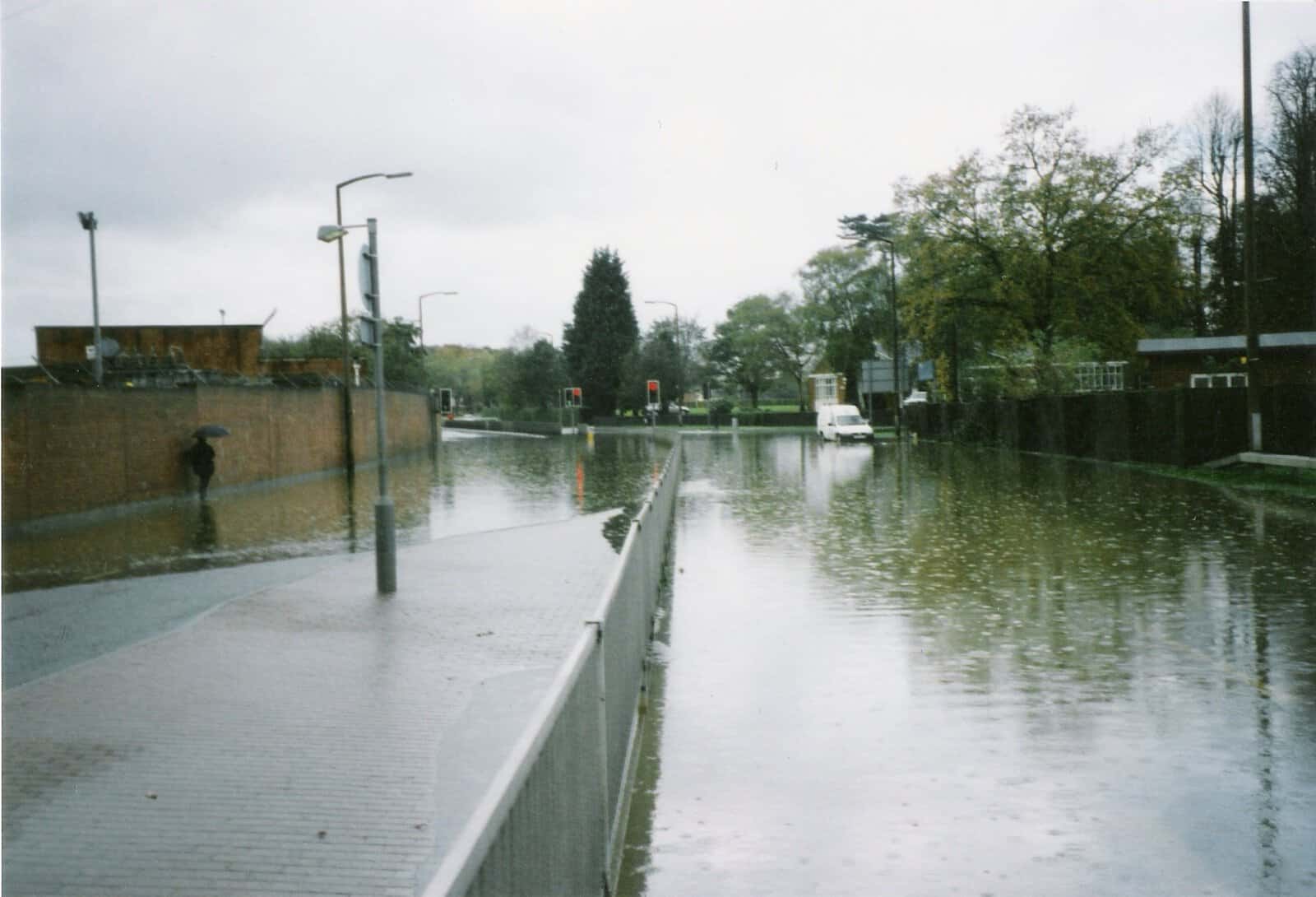
Estimated reading time 15 minutes
The Crawley and Gatwick floods of November 2000 saw the Gatwick Stream and the wider Upper Mole catchment overwhelm homes, roads and even the runways at one of the country's busiest airports. They were one local chapter of the wettest autumn in England for nearly 300 years. Nationally, that autumn flooded more than 10,000 properties and cost over £1 billion. Twenty-five years on, the Crawley and Gatwick floods still shape how flood risk is assessed and managed across the South East.
At the peak, water levels in the Gatwick Stream were estimated to exceed the 1-in-75-year flow, well beyond the design tolerance of the drainage network serving the estate.
At Unda we have a particular reason to revisit this event: it unfolded right on our doorstep. Our offices sit between Crawley and Gatwick, within the same upper catchment that flooded 25 years ago. That is also why the town stays a live concern for anyone developing here today. Where a site sits in the Upper Mole basin still governs whether it needs a flood risk assessment for planning. Looking back now is a chance to reflect on how this landscape has changed since those waters rose, hydrologically, technically and in policy terms.
These same storms also inundated Lewes, an event remembered to this day for its devastation and lasting legacy in English flood management, as explored in our reflection on the Lewes floods 25 years on.
What caused the 2000 Crawley and Gatwick floods?
The 2000 Crawley and Gatwick floods were caused by prolonged Atlantic rainfall falling onto already saturated clay soils across the Upper Mole basin, on a drainage network built for a smaller, less developed town. In early November, surface water from Crawley's built-up neighbourhoods drained fast towards the Gatwick Stream. That stream is one of several short, steep tributaries feeding the River Mole.
At Maidenbower, the local drainage and culvert network was quickly overwhelmed. The suburban layout is typical of 1980s and 1990s new-town expansion, channelling runoff along roads, footpaths and landscaped corridors that converge on the Gatwick Stream just north of the Balcombe Road. When the rainfall arrived, these systems were already close to capacity. As the main watercourse swelled, smaller lateral drains and highway gullies began to surcharge.
Water overtopped channels and surged through the landscaped floodplain at the centre of the estate. Gardens and garages flooded first. Low-lying roads followed as water backed up against culvert entrances too narrow to pass the flow. Those structures had long been a constraint. Their original concrete pipes were designed for a much smaller contributing catchment and built before extensive upstream housing was finished. By the evening several of the estate's pedestrian underpasses were submerged, trapping water that took more than a day to recede.
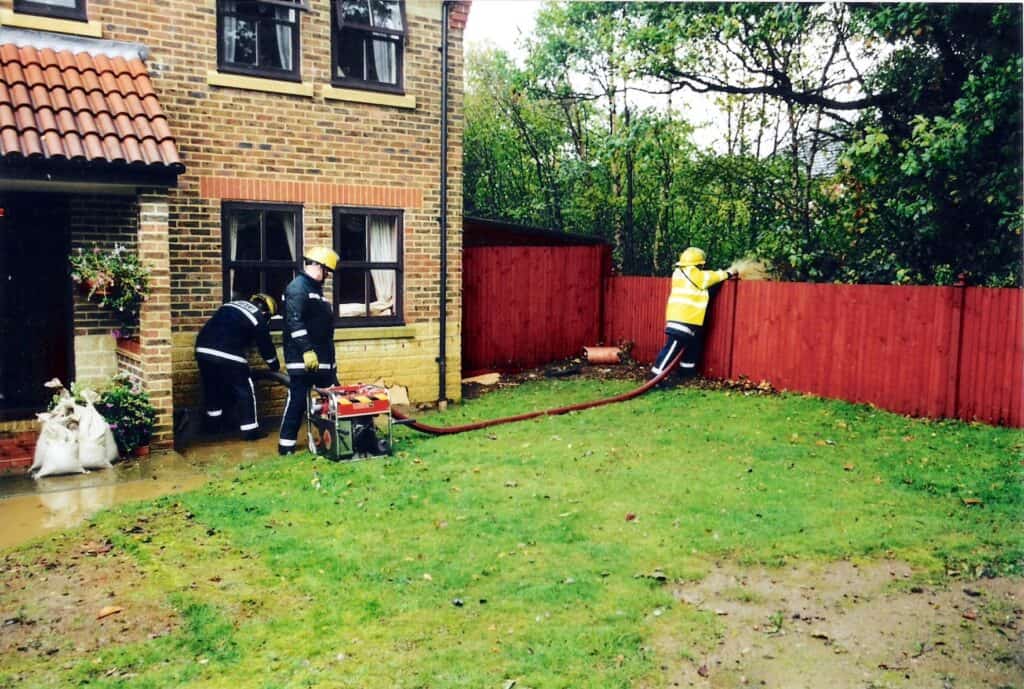
Residents later described the water "rising faster than it could be swept away", as rain falling on paved drives and roads compounded the problem. With infiltration effectively zero on Crawley's impermeable clay soils, the runoff coefficient was close to total. Even where soakaways existed, the saturated subgrade rendered them useless. Rainfall totals across the Upper Mole exceeded 150 mm in just 72 hours, more than a month's worth of rain. The Environment Agency's Autumn 2000 floods review, published in March 2001, recorded this as among the most extensive flood events in modern British history.
How the Gatwick Stream and Upper Mole overwhelmed the town
The flooding spread well beyond Maidenbower because Crawley's tributaries converge within a confined corridor with little room for water to spread safely. Upstream, balancing ponds filled within hours and overtopped. Further downstream at Three Bridges, narrow road drainage feeding into the Gatwick Stream culvert beneath Haslett Avenue could not cope with the rate of runoff. As the culvert filled, water forced its way back through highway drains, flooding dozens of homes and closing Haslett and Hazelwick Avenues for almost a full day.
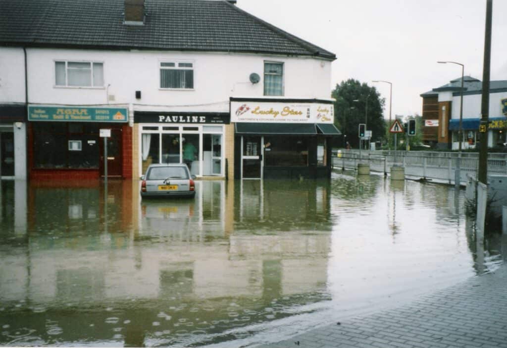

The incident highlighted a recurring problem in urban flood hydrology: a mismatch between historical drainage design standards and the rainfall intensities now being experienced. When local structures such as culverts or highway drains are undersized, exceedance flow has nowhere to go but overland. It follows roads, footways and landscaped corridors that had unknowingly been built along historic drainage lines. This is exactly why a modern surface water drainage strategy has to plan for the storms that exceed the pipe network, then route that excess water safely across the site.
Gatwick Airport underwater
At Gatwick Airport, the River Mole overtopped its southern banks and flooded parts of the perimeter roads and service tunnels. Taxiways and low-lying stands were submerged. Operations were disrupted as emergency teams worked through the night to protect critical systems. The airport, a major national transport hub, had become a temporary floodplain, and that image gave the event its lasting name.
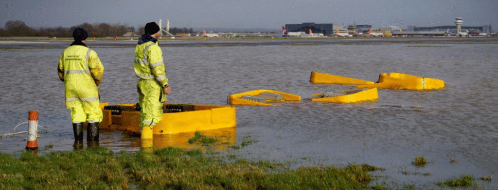
Peak discharges in the Gatwick Stream and the Mole exceeded the pre-development 1-in-100-year flow, confirming that urbanisation had sharply amplified the catchment's hydrological response.
Independent hydrometeorological appraisals of the 2000 floods reached the same conclusion nationally. Saturated ground and record multi-day rainfall had turned ordinary watercourses into destructive ones.
A catchment under strain
The Upper Mole is one of the fastest-responding river systems in the South East, and that is the root of Crawley's flood risk. Clay geology, dense urban coverage and heavy culverting combine to give the catchment a time of concentration measured in hours rather than days. When the 2000 rainfall arrived, runoff had nowhere to go.
- Impermeable geology. Crawley's clay soils give almost no infiltration, so nearly all rainfall becomes runoff.
- Dense urban cover. Roads, roofs and paved drives across the New Town leave little permeable ground to soak up a storm.
- Heavy culverting. Long lengths of the Gatwick Stream run in pipes and culverts sized for a smaller, earlier town.
- Converging tributaries. Tilgate Brook, Gatwick Stream and Crawters Brook meet in a tight corridor north of the town, leaving little room for natural attenuation.
So the town's flood risk came from more than rainfall. It was built into a design inheritance from the New Town era, which prized convenience and efficiency over capacity and exceedance. Modern mapping and modelling have since transformed how these weaknesses are found. Tools such as the Environment Agency's Flood Map for Planning and the newer National Assessment of Flood Risk (NaFRA2) now capture pluvial, fluvial and combined risks at far higher resolution. That lets mitigation be designed long before development reaches the ground.
After the flood: the national response
The 2000 floods triggered one of the Environment Agency's most thorough post-event assessments to date. Its Lessons Learned work found that communication, data sharing and forecasting had been inconsistent across the country, and that flood warnings were often too late or too vague to prompt action. Locally, Crawley Borough Council and West Sussex County Council worked with the EA and Gatwick Airport Limited to review drainage networks and maintenance.
The airport went on to redesign its stormwater systems, adding automated telemetry, real-time pumping controls and perimeter storage lagoons to cut its dependence on single culverts. Nationally, the floods reshaped attitudes to flood insurance and accountability. Backed by Defra research, the insurance industry warned that universal cover was becoming untenable without stronger controls on development in high-risk areas. That conversation laid the foundations for today's Flood Re scheme. The experience also drove closer cooperation between public agencies, including a new Flood Forecasting Centre and better coordination between the Met Office and the EA.
From floods to frameworks: the policy legacy
The 2000 floods became a turning point for UK flood governance, and they set off a chain of reforms that still defines how flood risk is managed today. They helped prompt Defra's Making Space for Water programme in 2004 and, after the 2007 floods, the Pitt Review. Together these produced the Flood and Water Management Act 2010. That Act created Lead Local Flood Authorities, clarified responsibilities between national and local bodies, and embedded a catchment-based, partnership approach.
| Year | Milestone | What it changed |
|---|---|---|
| 2000 | Autumn 2000 floods | Exposed inconsistent forecasting and urban drainage built to outdated standards |
| 2001 | EA Autumn 2000 Floods Review | Recommended better flood warning, data-sharing and defence appraisal |
| 2004 | Making Space for Water (Defra) | Shifted national policy from hard defence towards catchment-scale risk management |
| 2008 | The Pitt Review | 92 recommendations following the 2007 floods, reshaping roles and responsibilities |
| 2010 | Flood and Water Management Act | Created Lead Local Flood Authorities and clarified who manages which risk |
| 2025 | National Standards for SuDS | Made sustainable drainage the default expectation for new development |
Planning policy shifted in parallel. The Sequential Test was strengthened under the National Planning Policy Framework, which directs development first to lower-risk zones. Lead Local Flood Authorities now coordinate closely with Local Planning Authorities, reviewing drainage and flood risk at every stage.
The Upper Mole Flood Alleviation Scheme
For the Upper Mole, this policy shift translated into major works on the ground. The Upper Mole Flood Alleviation Scheme (UMFAS) became one of the Environment Agency's flagship inland projects. It was delivered as four linked interventions across the catchment.
According to the Environment Agency's scheme summary, the Upper Mole works now protect over 1,400 homes and businesses in Crawley and Horley, along with Gatwick Airport itself.
- Tilgate Lake dam raising, Crawley (2011). The dam was raised to hold more water upstream, intercepting flow before it reaches the town centre.
- Worth Farm reservoir, near M23 Junction 10a (2013). A new attenuation basin that temporarily stores peak surface runoff above the motorway.
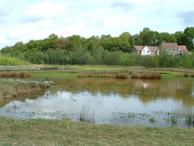
- Grattons Park restoration, Crawley (2013). River restoration reconnecting the Mole's floodplain and combining flood storage with ecological gain.
- Clay's Lake reconstruction, near Balcombe (2016). The ageing embankment was rebuilt with new spillways sized for future climate scenarios.
Together these works delivered a shift from traditional flood defence to catchment-scale water management, according to the Environment Agency's scheme summary. They reduced flood risk while adding biodiversity gain and community amenity. The principle still guides good practice today: store and slow the water high in the catchment, rather than forcing ever-larger volumes through the town's culverts.
Crawley and Gatwick today: modern flood risk management
Two and a half decades on, the Upper Mole catchment looks very different, but the underlying vulnerability has not gone away. Gatwick's drainage and telemetry are now among the most advanced in the UK, integrating rainfall forecasting, storage control and early warning. Crawley Borough Council and West Sussex County Council work together as LLFA partners, supported by the Environment Agency's standing advice and updated mapping. Strategic documents such as Crawley's Strategic Flood Risk Assessment now build climate change allowances directly into land allocation.
New development across the South East is also guided by the 2025 National Standards for Sustainable Drainage Systems and the design principles in the CIRIA SuDS Manual (C753). These treat stormwater as a design asset rather than a nuisance. It is attenuated, stored and released at a controlled rate, often with ecological and amenity benefits built in.
Projections from the Met Office's UKCP18 dataset suggest short-duration rainfall could rise significantly by mid-century, so the storms that overwhelmed Crawley in 2000 may become more frequent, not less.
Challenges remain, though. Much of Crawley's drainage dates from the 1960s and 1970s, when rainfall intensities were assumed to be lower and exceedance pathways were rarely mapped. The UKCP18 dataset underlines the direction of travel. Resilience will depend on constant adaptation: retrofitting older assets, adding nature-based solutions, and sharing data across agencies to anticipate compound events.
Reflections – 25 years on
Crawley's 2000 floods were not unique, but they captured the lessons of a generation. They exposed how fragile urban systems built to historical design standards can be, and how often flood risk had been treated as an afterthought. Since then, flood management in England has grown from a narrow engineering discipline into an integrated system that connects hydrology, planning, insurance and community resilience.
"The 2000 floods exposed the reality that resilience isn't built overnight. Back then, managing flood risk was primarily about defences — about how quickly water could be moved away. Those events showed us that resilience is as much about foresight as it is about response. It's about how we design our places, how we plan for exceedance, and how we work with the natural processes that shape every catchment."
Edward Bouët · Director, Unda
"The reforms that followed — from Making Space for Water to the creation of LLFAs and the rise of SuDS — all trace their roots back to that winter. They changed the language of flood risk from 'protection' to 'management'. Two and a half decades later, the same principles guide everything we do: using data intelligently, planning collectively, and designing infrastructure that respects water as both a risk and a resource."
Edward Bouët · Director, Unda
Those lessons are now embedded in national policy and local practice. Integrated catchment management, adaptive design and partnership working stay at the core of how the South East continues to live with water.
What the 2000 floods mean for development in the Upper Mole today
If you are building, buying or developing in the Crawley, Horley or Gatwick area, the legacy of 2000 is not history alone. It is written into the flood zones, drainage conditions and planning tests your site must satisfy. The Flood Map for Planning ignores existing defences, so a property behind the UMFAS works can still sit in Flood Zone 2 or 3 and still need a site-specific assessment. The lesson of the Gatwick Stream, that exceedance flow will find the old drainage lines, is exactly what a modern assessment is designed to catch.
For most sites in the Upper Mole catchment that means two things. First, a flood risk assessment for planning that tests the site against fluvial, surface water and residual risk. Second, a surface water drainage strategy that attenuates runoff to greenfield rates and designs safely for the storms that exceed the network. Where the local authority has attached drainage conditions, we also handle their discharge. You can check the headline position for any site on our flood risk map, or watch the Mole and its tributaries in real time on our live river levels map.
Developing in the Upper Mole catchment?
From Crawley to Horley and Gatwick, our chartered consultants turn the lessons of 2000 into planning-ready flood risk assessments and drainage strategies, often with a quote back within the hour.
Start a quoteFrequently asked questions about the Crawley and Gatwick floods
Is Gatwick Airport at risk of flooding today?
Gatwick still sits on the floodplain of the River Mole, so the hazard has not gone away, but its exposure is far better managed than in 2000. The airport now runs automated telemetry, real-time pumping and perimeter storage, and it is protected by the wider Upper Mole scheme. Residual risk remains, which is why development around it is still assessed site by site.
Is Crawley near Gatwick?
Yes. Crawley sits immediately south of Gatwick Airport, at the head of the Upper Mole catchment, and the two share the same river system. The Gatwick Stream rises in and around Crawley before joining the River Mole beside the airport, which is why a single storm in 2000 flooded homes in the town and the runways at the airport.
Do I need a flood risk assessment for a property near Crawley or Gatwick?
Often, yes. Any site in Flood Zone 2 or 3, over one hectare, or flagged for surface water usually needs a site-specific flood risk assessment for planning. Being behind the Upper Mole defences does not remove that requirement, because the Flood Map for Planning ignores existing defences. A quick check of the flood map for the postcode is the place to start.
Which river flooded Crawley and Gatwick in 2000?
The Gatwick Stream and the River Mole. The Gatwick Stream is one of several short, steep tributaries, along with Tilgate Brook and Crawters Brook, that drain Crawley and converge into the Upper Mole near the airport. Their combined, fast response to heavy rain is what overwhelmed the town's drainage in November 2000.
Has Crawley flooded since 2000?
Yes. Environment Agency records list notable flooding across the Upper Mole in 1947, 1960, 1968, 1974, 1990, 2000 and the winter of 2013–14. The Upper Mole Flood Alleviation Scheme, largely completed between 2011 and 2016, has since reduced the risk to more than 1,400 properties, though it cannot remove it entirely.
About the author. Edward is a co-founder and Director of Unda with 20+ years in flood risk and drainage, and a national-press commentator on flooding. Unda has been trading since 2014, is a CIWEM Business Partner with CIWEM member and chartered (C.WEM MCIWEM) consultants, and has delivered 5,000+ flood risk assessments and drainage strategies across England and Wales.
Edward Bouët · BSc (Hons)
Latest news






One of our experienced Flood Risk Consultants will get back to you within 60 minutes
