Medieval drainage: the moats, monks and great drains you can still go and see

Estimated reading time 24 minutes
Medieval drainage has a public-relations problem. The popular picture is a filthy street, a chamber pot tipped out of a window and a moat brimming with sewage. A thousand years of squalor, sitting neatly between the Romans and the Victorians. The building record says something rather different. Between roughly 1100 and 1500, English builders were separating clean supply from foul flow, sizing channels so they could be got into and cleaned out, harvesting roof water to flush latrines, and writing separation distances into law.
Some of what they built is still running. This is a tour of what medieval engineers got right, what they got spectacularly wrong, and where you can go and stand in it on a Sunday afternoon. If you enjoyed what the Romans did for our drainage, this is the next thousand years.
The stone drain beneath Canterbury Cathedral was built in the 1160s. It still discharges towards the Stour, and its maintenance record includes a tree-root clearance in 2017.
What medieval builders actually understood about water
Four ideas run through almost every medieval drainage scheme in Britain. Gravity does the work. Clean water is spent before dirty water. A channel you cannot get inside is a channel you cannot maintain. And the water landing on your land is your problem before it is your neighbour's. Every one of those is still in the modern rulebook, which is the quietly startling part.
- Read the ground first. Sites were chosen for fall and for a spring above them. Furness Abbey's church is aligned north-east to south-west rather than the conventional east–west purely to exploit Mill Beck and the springs. The drainage decided the architecture, not the other way round.
- Separate the clean from the foul. Supply arrived in lead pipe or a covered conduit; foul flow left in an open or vaulted stone channel. The two were designed as two systems, which is more than can be said for most Victorian towns.
- Size it for the person who has to clean it. The great monastic drains are large enough to walk or crawl through because somebody had to rod and de-silt them. Nobody built a channel they could never reach.
- Deal with rainfall where it lands. Roof water was caught, stored and reused rather than simply shed. That is the instinct behind source control, rainwater harvesting within a SuDS scheme and, in its modern hard-surface form, permeable paving.

Look up and the same instinct is carved into the stonework. A gargoyle is a spout. A trough is cut into its back and the water leaves at the mouth, and the animal is elongated because its length sets how far clear of the wall the flow lands. Several on one elevation divide the discharge off a roof and limit storm damage, and the whole exercise exists to keep water off the masonry and out of the mortar joints. Gargoyles stopped being drainage components in 1724, when the London Building Act made downpipes compulsory in new construction.
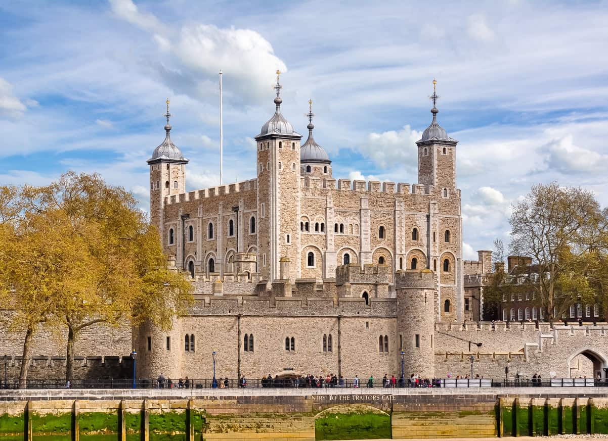
The same principle reached the throne. In 1240 Henry III ordered that the lead guttering of the White Tower be extended, on the grounds that the freshly limewashed wall was at risk of "perishing or falling outwards through the trickling of the rain". A thirteenth-century king specifying rainwater goods to protect a render is not the Middle Ages most people carry around in their heads. It is also, more or less exactly, the reasoning a modern surface water drainage strategy for planning has to set out before a local authority will discharge the condition. The difference is that CIRIA C753 runs to rather more pages than a royal writ.
The monastic cascade: one flow, ranked by cleanliness
Britain's most sophisticated medieval drainage was monastic. A single gravity flow was taken from a spring above the precinct and spent in strict descending order of how clean it had to be: drinking and cooking first, then washing, then the kitchen, then the fishponds, and only last the latrine block, after which it left the site altogether. Nothing was pumped, and nothing was wasted.
- Source and settle. Spring water to a covered conduit house, where silt dropped out. St Augustine's Abbey in Canterbury had a roughly octagonal conduit house fed by four barrel-vaulted tunnels tapping the aquifer, discharging to the abbey through a three-inch lead pipe.
- Potable use. Kitchen, brewhouse and bakehouse. At Mount Grace Priory the lead main ran sandwiched between two layers of stone flags to a conduit house in the middle of the great cloister, and every individual cell had its own tap, set in a wall niche.
- Washing. Durham's cloister laver, made in 1432–33, is an octagonal basin cut from a single block of Egglestone marble, seven feet across, with twenty-four brass cocks round the rim. A twenty-four-position wash trough on one gravity feed.
- Reuse the greywater. At Kirkstall Abbey the cloister cistern filtered water before distribution, and the waste from the south range was deliberately routed into the main sewer to flush the monks' latrines.
- Foul flow, last. The reredorter, or latrine block, sat over a stone channel at the bottom of the chain, where the water was already doing its least fastidious work.
- Outfall. To the river, or to the town ditch. At which point, as the fourteenth-century pollution statutes make painfully clear, it became somebody else's problem.
The best-documented scheme of the lot is Prior Wibert's, built at Christ Church Priory in Canterbury between 1151 and 1167. It survives as a drawing, folios 284v–285r of the Eadwine Psalter held at Trinity College, Cambridge, and it is a working drawing rather than an illustration: it marks flow directions, stop-cocks and purge pipes. Water came from spring-fed ponds about a mile north with roughly ten metres of static head, and passed through five settling tanks in series, each fitted with a cock so it could be washed out. That is de-silting by design, with washout provision, in the 1160s.
The Canterbury plan is colour-coded: mains in green, storm drains in brown, sewage outflow in dark red. Eight and a half centuries later, that is still roughly the key on a drainage drawing.
The foul side survives too. Canterbury's Great Drain averages 0.85 m wide and its fabric reads as a maintenance log in section: squared chalk blocks from Wibert's build, repairs under Prior Chillenden between 1390 and 1411, and a brick-vaulted extension by Prior Goldstone between 1495 and 1517, put in specifically to stop the crypt flooding. Two pipes on the north side collected roof run-off and used it to flush the latrines. The Kent Archaeological Society survey records the whole sequence, wartime bomb damage included.
At Fountains Abbey the ambition was larger still. In the 1140s the monks re-cut the River Skell about 28 metres south of its natural course, then kept the abandoned channel as a stone drain to flush the latrines built over it. Under Abbot John of Kent the Skell was canalised through four stone-vaulted tunnels running more than 75 metres, and the infirmary was built on top of them: a medieval box culvert carrying a building.

Was a castle moat really an open sewer?
Sometimes, and it depended entirely on throughput. A moat with a spring inflow, a sluice and a daily overflow behaved like a small impounded reservoir with genuine turnover. A moat with no through-flow behaved like a stagnant pond that latrines discharged into. The difference was engineering rather than luck, and the medieval record contains very clear examples of both.

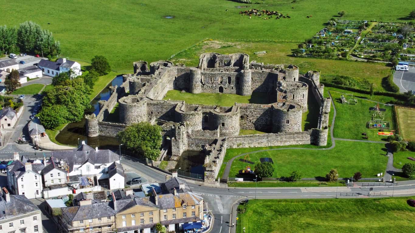
The engineered ones are better than their reputation suggests. Bodiam's moat is roughly 155 m by 115 m with water standing about two metres deep, fed by springs to the north-west and by land drains from the north-east, and it overflows daily through an eastern sluice into an overflow pond. The western side is a cut scarp; the southern and eastern sides are dammed to hold water against the natural fall. In plain terms it is a bunded attenuation pond on a slope, and the National Trust record notes it was re-lined with clay in 1919–20.
| Site | Built | What was engineered | How it ended |
|---|---|---|---|
| Bodiam, East Sussex | 1385 | Spring-fed moat, dammed on two sides, daily overflow through an eastern sluice | Still wet; re-lined in 1919–20 and drained for survey in 1970 |
| Caerphilly, Glamorgan | from 1268 | About 30 acres impounded by damming the Nant y Gledyr; a 152 m south dam; Felton's Tower built to guard the sluice gates | Sluices fell into disrepair after 1486 and the water drained away; re-flooded in 1962 |
| Kenilworth, Warwickshire | 12th–13th c. | A mere of roughly 100 acres held by a dam about 150 m long and 40 m wide at its base, with several sluice gates | Dam deliberately breached after the Civil War to drain the mere |
| Tower of London | 1270s | Tidal moat at least 50 m wide, ebb and flow controlled by sluice gates; stocked with pike in 1292 | Tidal exchange failed; drained on Wellington's orders after the 1843–45 outbreak |
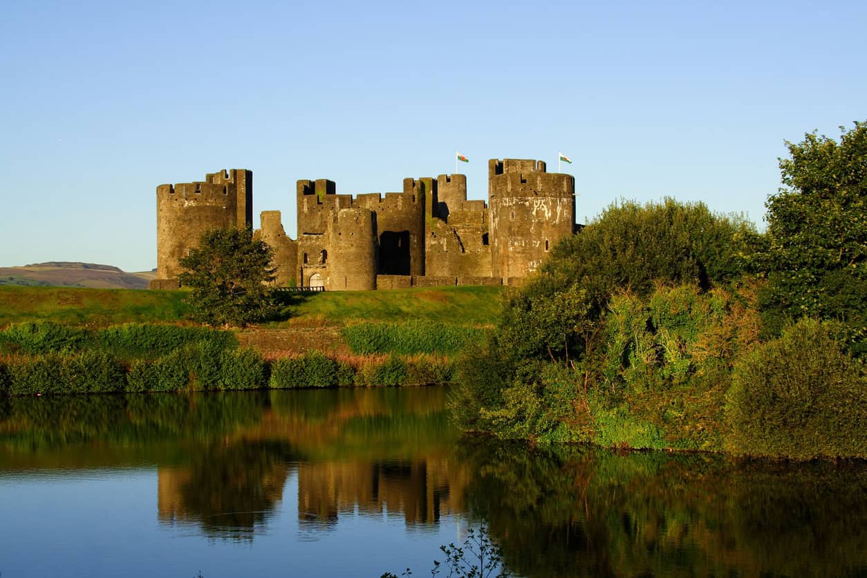

Caerphilly is the one every drainage engineer should know. Gilbert de Clare's water defences were described as the most elaborate in Britain, and they were not defeated by an army. Kenilworth's mere was drained on purpose, and the Tower's moat failed because the tidal flushing it depended on stopped working: by the 1840s Historic Royal Palaces records it holding "putrid animal and excrementitious matter". Caerphilly was simply not maintained.
Caerphilly's thirty acres of water defences were lost to deferred maintenance on a set of sluice gates. Anyone who has seen a modern basin fail its post-adoption inspection will recognise the mechanism exactly.
The engineering point still holds. A water body with an inflow, an outfall and turnover behaves nothing like one without, which is why water quality sits alongside quantity in the four pillars of SuDS, and whoever holds the riparian responsibility for the channel feeding it is the person the modern regime looks to. Whether the channel is a main river or an ordinary watercourse now decides who consents the sluice, and a blocked surface water drain still fails in exactly the way a silted moat did.
The garderobe was a medieval soil stack
A garderobe is a medieval latrine: a timber bench with an aperture over a masonry shaft, which either corbels out from the wall face and discharges into open air, drops within the wall thickness to a cesspit, or goes straight into a moat or river. What is striking to a modern engineer is that they stacked them, and that at least one castle vented the stack.
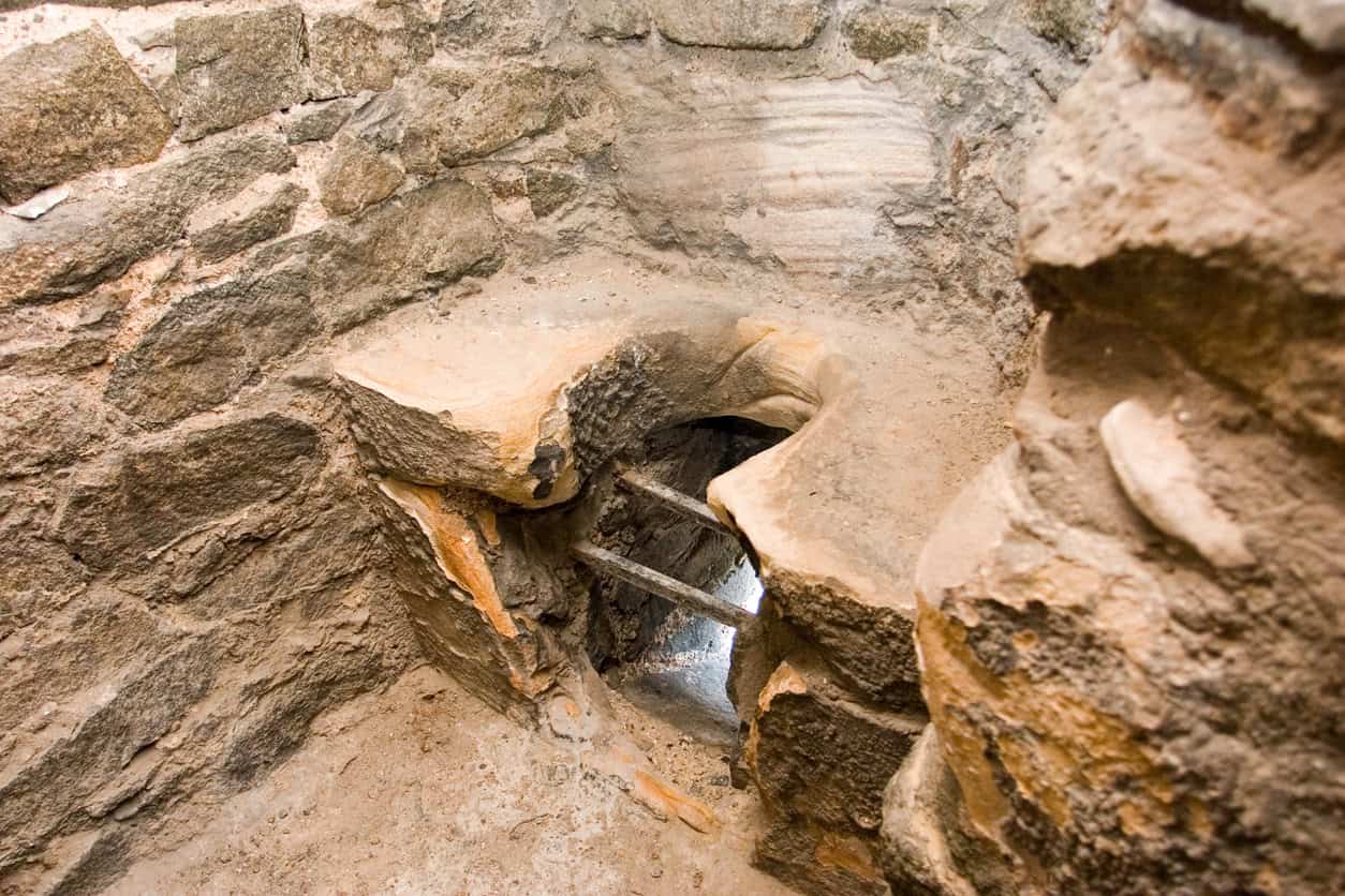
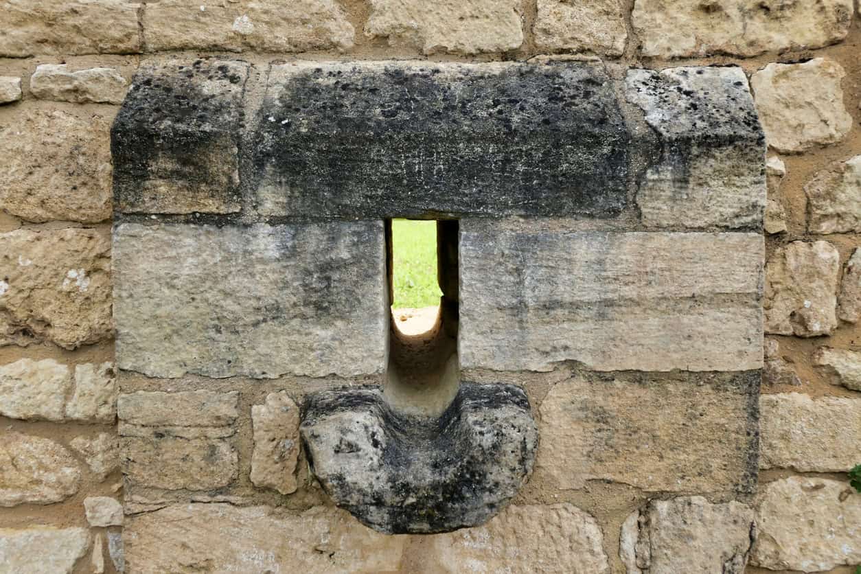
The word is garde-robe, a guarded room for robes and valuables, and the transfer to "privy" is a euphemism of exactly the same kind as "wardrobe".
- Twelve on one shaft. Langley Castle in Northumberland, built around 1350–64, has a garderobe tower with twelve latrines, four to each of three floors and each stall under its own pointed arch, all discharging into a common pit scoured by a natural stream. A soil stack with a self-cleansing base.
- A vented stack, around 1300. Beaumaris is recorded in the Cadw literature as having 32 latrines in back-to-back pairs, sixteen per level, with each shaft connected to a central ventilation shaft rising to the crown of the wall.
- The first documented failed flush. Beaumaris was also designed with a moat-water flushing system for those latrines. The record notes, with some restraint, that it "does not appear to have worked well in practice".
- A public convenience block you can still visit. Conwy's town walls carry twelve medieval latrines built into the southern wall for royal staff working in the buildings alongside. They survive, and you can walk past them.
- The moth story is a myth. The much-repeated claim that ammonia from the shaft kept moths out of the clothes hung there is a back-formation with no medieval documentary support. Clothes were kept in garderobe closets; the strongroom is the original meaning.
The discharge arrangement is the part that dates fastest. At Chepstow the latrines in the lower ward direct their outlets straight to the River Wye; at Furness the reredorter and the late-fifteenth-century guest house were both built over the stream. Direct discharge to a watercourse is the one medieval habit with no modern equivalent at all. Today it is the difference between a compliant scheme and an enforcement notice, and it is why a development needs a foul drainage strategy for planning alongside its surface water design. The two flows have to be shown separately, and Building Regulations Part H governs what happens once the planners have finished.
Who emptied it? The gong farmer's trade
The gong farmer emptied medieval cesspits. The word comes from the Old English gang, "to go", and it meant both the privy and its contents. By law the work was done between nine at night and five in the morning; by the late fifteenth century it paid about two shillings a ton; and it was genuinely dangerous work in a confined space full of gas.
Around the trade sat a surprisingly complete municipal apparatus. Rakers appear in London from the mid-1350s, clearing the street channels and carting waste out to laystalls beyond the walls. Scavengers appear as ward officers in 1364, and in 1385 the City appointed a Serjeant of the Channel on about £4 a year: arguably England's first salaried sanitary inspector, walking the streets, checking the channels and empowered to fine. Sir Richard Whittington's executors built a public "longhouse" in the 1420s with 128 seats, flushed by the tide.
In 1326 Richard le Rakiere drowned in his own cesspit when the planks of the seat gave way. Confined-space risk is not a modern invention, and neither is the paperwork that now surrounds it.
It is worth being clear about what this system was and was not. There were no sewers in the modern sense: foul waste went to a pit and was carted away, or it went into a watercourse. Piping foul flow away from every property is a Victorian idea, and London's answer to the consequences, from Bazalgette's interceptors to the Thames Tideway Tunnel, descends directly from the problem the gong farmers were carting around by hand. What has changed is that we can now measure the result: a dry-day spill tells you more about a sewer's real capacity than any amount of medieval carting ever could.
Separation distances in 1189: medieval Britain's first drainage rules
The London Assize of Buildings, traditionally dated 1189 and attributed to the City's first mayor, set minimum offsets between a cesspit and a neighbour's boundary: two feet six inches if the pit was stone-lined, three feet six inches if it was not. It also required neighbours sharing a wall to build a rain-gutter between them at joint cost. It is the earliest English drainage regulation, and it prices the risk by construction type.
If the pit made in such chamber be lined with stone, the mouth of the said pit shall be distant two feet and a half from the land of the neighbour… if it shall not be lined with stone, it ought to be distant three feet and a half from the neighbour's land.
The Assize of Buildings, traditionally dated 1189 · British History Online
Outside the individual plot, the street itself was the drain: a cambered surface with a central channel taking roof water, yard washings and trade waste to the nearest watercourse, which is pluvial flooding designed in rather than out. But the surface water clause is the one that should stop a modern drainage engineer in their tracks. Where a party wall belongs to one neighbour, the other must gutter his own eaves and lead the water onto his own land — and only failing that into the high street. Manage it on your own land first; discharge to the public system only if you cannot.
A discharge hierarchy, written down in 1189. The SuDS hierarchy is a more rigorous version of the same instruction, eight centuries later.
Enforcement was the Assize of Nuisance, a civil procedure heard by the Mayor and at least six aldermen, with sworn masons and carpenters sitting as technical viewers. The published calendar runs from 1301 to 1431, and the actions are recognisable: your cesspit is too close to my wall, your gutter discharges onto my land, you have not paved your frontage. A party wall and drainage tribunal with an expert witness regime, running for a hundred and thirty years.
Policy also lurched about in a way any planning professional will find familiar. Latrines built over the Walbrook were ordered removed in 1345; in 1374 the City reversed itself and sold the right to build them; by 1388 they were permitted only if nothing else entered the stream; and they were abolished outright in 1463. The Statute of Cambridge of 1388 had meanwhile made dumping "dung and filth of the garbage and entrails" into ditches and rivers a £20 offence. That was England's first national anti-pollution law, and a recognisable ancestor of the rules that now govern what may enter a foul, surface or combined sewer.
Elsewhere in Europe the same centuries produced something closer still to modern practice. From the twelfth century onwards each Venetian campo was paved to fall towards inlets feeding brick channels into a sand-filled underground tank, sealed all round with about half a metre of clay to keep the lagoon out. There were eventually close to 6,000 of them: a city-wide network of filter drains and rainwater harvesting tanks, which is a fair description of what a sponge city is trying to achieve now, and one reason Venice still lives with water rather than against it.
When "sewer" meant a ditch: the medieval law still running your drainage rate
Until the nineteenth century a sewer was a land drainage channel rather than a foul one: a ditch or watercourse taking surface water off low ground to the sea. The Latin form of the royal commissions was de wallis et fossatis, "of walls and ditches", which says exactly what they did. The Commissioners of Sewers were flood risk management authorities, not sewerage undertakers.
The word only drifted when Victorian cities began putting foul flow into what had been surface water channels.
The institutional line from that world to this one is unbroken, which is the single most useful thing in this article for anyone who pays a drainage rate.
| Date | What happened | What survives of it |
|---|---|---|
| 1252 | Henry III charters Romney Marsh, protecting its 24 elected Jurats and giving them power to levy a rate, the scot, for sea wall and drainage maintenance | Land outside the rated area was, literally, scot-free |
| 1257–58 | Henry de Bathe hears a dispute over the Marsh's ditches and defences, and codifies the local law and custom | The template for English flood defence law for the next 672 years |
| 1280 | The first formal commission de wallis et fossatis, on the Thames at West Ham | The commission model: a locally constituted board with rating powers |
| 1379 | Commissioners in Sussex are told for the first time to work "according to the laws and customs of Romney Marsh" | Within a decade the custom is exported to Yorkshire and Lincolnshire |
| 1427 | The Sewers Act puts it on a statutory footing | A.E.B. Owen's verdict: it "contained the essentials of the law of sewers as it lasted until 1930" |
| 1531 | The Statute of Sewers lets commissioners compel labour, appoint expenditors and bailiffs, and levy the scot by acreage in proportion to benefit | Benefit-proportionate rating, which is still how a drainage rate is calculated |
| 1930 | The Land Drainage Act abolishes the commissions and creates catchment boards and internal drainage boards | Today's internal drainage boards, and the split of duties that still decides who manages flood risk in England |
Benefit-proportionate rating on the landowners who gain, levied by a locally constituted board, has been continuous English practice since the 1250s. The invoice has changed; the principle has not.
The engineering of that world deserves a paragraph of its own, because its failures are as instructive as its successes. The Rhee Wall, extended to New Romney in 1258, was a perched artificial watercourse running seven and a half miles between two parallel banks, built to impound water behind sluices and release it to scour silt out of the harbour. It is a thirteenth-century self-cleansing velocity scheme, and it did not achieve self-cleansing velocity: the silting continued, and the storm of February 1287 finished the harbour off. That storm sat inside a wider run of medieval extremes: Europe went on to record sixteen major floods between 1341 and 1343. A.E.B. Owen's study of the Romney custom traces how the law outlived the engineering by six centuries.
Two schemes fared better. Bishop John Morton's cut of the 1480s took the Nene straight from Stanground to Guyhirn, twelve miles long, forty feet wide and four feet deep according to the Victoria County History, and it set the geometric template every later Fen scheme followed. Between Guyhirn and Wisbech the river still runs in it. Glastonbury Abbey's diversion of the River Brue between 1230 and 1250 will feel more familiar still. The abbey cut the Brue west towards the sea for two reasons, navigation and flood risk, because when the Axe valley was in flood it backed up and flooded Glastonbury. A diversion driven by backwater effects from a downstream receiving watercourse is a problem statement anyone working on the Somerset Levels would recognise on sight, and the same tension runs through the Environment Agency's Fens 2100+ evidence.
One correction while we are here: the monasteries did not drain the Fens. The Victoria County History is explicit that the great religious houses "showed no ambition to attempt any large-scale project of drainage", partly because undrained fen was extremely valuable for fish, fowl, reed, sedge, peat and summer grazing. The Dutch engineers everyone credits arrived in the seventeenth century, long after Morton, though the Low Countries reached collective water governance first: Rijnland was chartered in 1255, three years after Romney's jurats, and the first drainage windmill went up at Zoeterwoude in 1408.
Medieval drainage you can still go and see
A surprising amount of it remains in service, and most of the rest is free to visit. If you would rather look at working medieval water infrastructure than read about it, these are the ones worth the drive.
- Still operational. Canterbury's Great Drain still discharges towards the Stour, the rhynes of the Brue valley are still maintained by an internal drainage board, and the Nene still runs in Morton's cut. Siena's bottini, 25 km of hand-cut brick tunnel laid at one metre per kilometre, still feed the city's fountains; Freiburg's Bächle still take 200 to 500 litres a minute off the Dreisam and are still swept daily.
- Walkable. Exeter's Underground Passages are vaulted galleries built from the 1220s onwards to house the lead water mains and give access to them: a medieval utility tunnel, built that way because lead pipe fails and nobody wanted to dig up the street. Guided tours run from Princesshay.
- The best sanitary survival in England. Muchelney Abbey in Somerset, where you stand on the upper floor of the thatched reredorter and look straight down through the open arches at the channel, with the fixings for the seat bench and the stall partitions still in place.
- Fabric and detail. Castle Acre Priory in Norfolk retains the reredorter chutes with their seat brackets. Kirkstall Abbey's lay brothers' reredorter is the only building on the site surviving to full roof height, cubicles still over the main drain, and entry is free.
- Landscape scale. Fountains Abbey for the vaulted tunnels under the infirmary and a mill that ran until 1937; Kenilworth for a 150-metre dam you can walk along; Bodiam for a moat with a working overflow. Several appear in our tour of flood risk at Britain's most famous landmarks, for reasons their builders would have found entirely unsurprising.
What the whole survey leaves behind is a set of design instincts: read the ground, keep the clean and the foul apart, size for the person who has to maintain it, deal with rain where it lands, and never assume the sluice will look after itself. A modern scheme has to demonstrate all five on paper before anyone will build it. If you have a site where those questions need answering properly, Unda can prepare a drainage strategy for your planning application or a flood risk assessment for planning that will satisfy the lead local flood authority and the Environment Agency, prepared by chartered flood risk consultants. The principles are eight hundred years old. The evidence base is not.
Frequently asked questions
Did Roman drainage stay in use through the Middle Ages in Britain?
Almost certainly not, on current evidence. Lincoln's Bailgate sewer and York's Church Street sewer are real, and both are substantial pieces of engineering, but neither has evidence of continued medieval use. What happened instead is that Roman fabric was robbed for stone, York's fourteenth-century St Mary's Abbey drain among the examples, while the operating systems lapsed. Claims that Britain's Roman sewers ran continuously into the medieval period are not supportable.
Were medieval drains combined sewers?
The monastic ones were deliberately not: clean supply arrived in a separate pipe or conduit, and the foul channel was a different structure entirely. Medieval towns were the opposite: the street channel took roof water, yard washings and trade waste together, which is a combined system in everything but name. The combined sewer as an engineered network is Victorian, and separating those flows again is a large part of what modern drainage design is for.
Who maintains a medieval ditch or watercourse today?
Its age gives it no special status. If a watercourse runs through or alongside your land you are almost certainly the riparian owner, with a duty to let water flow through without obstruction and to keep the bed and banks clear, the same duty whether the channel was cut in 1250 or 1950. Where it is an ordinary watercourse rather than a main river, altering it, culverting it or putting a structure in it needs consent from the lead local flood authority or the internal drainage board. The gov.uk guidance sets out the duties, the Land Drainage Act 1991 the statutory powers behind them, and our guide to ordinary watercourse consent covers the application.
Does a medieval drain on site affect a planning application?
It can, in two separate ways. If the feature is a scheduled monument, works affecting it need scheduled monument consent in addition to planning permission, and the local authority will normally attach an archaeological condition. Separately, a live historic channel is a drainage constraint in its own right: it may be the receiving watercourse for your outfall, it may set the water table an infiltration system has to be designed around, and it may carry flows nobody has ever gauged. Both are better resolved in the drainage strategy than discovered on site.
About the author. Edward is a co-founder and Director of Unda with 20+ years in flood risk and drainage, and a national-press commentator on flooding. Unda has been trading since 2014, is a CIWEM Business Partner with CIWEM member and chartered (C.WEM MCIWEM) consultants, and has delivered 5,000+ flood risk assessments and drainage strategies across England and Wales.
Edward Bouët · BSc (Hons)
Latest news






One of our experienced Flood Risk Consultants will get back to you within 60 minutes
