Living with Water: What the UK Can Learn from Venice’s Everyday Flooding

Posted on 23rd February, 2026
by Edward Bouët

Estimated reading time 27 minutes

Flooding in the UK is still widely framed as an abnormal disruption — a storm, a breach, an exceptional failure. Media narratives emphasise “record-breaking” rainfall and “once in a generation” events. Yet official modelling tells a more structural story.

The Environment Agency’s 2024 National Assessment of Flood and Coastal Erosion Risk indicates that approximately 6.3 million properties in England are currently at risk from rivers, the sea or surface water. Under climate projections, that figure could rise to around 8 million properties by the 2050s — close to one in four.

Five of the ten wettest years on record in the UK have occurred since 2000. Intense rainfall events are increasing. Annual flood damage costs are commonly estimated between £1.4 billion and £2.4 billion, excluding wider infrastructure and productivity impacts.

Flood risk in the UK is not marginal. It is embedded. What remains episodic is not exposure, but expectation.

Venice offers a useful counterpoint — not because it avoids flooding, but because it has institutionalised coexistence with water at strategic, architectural and behavioural scales.

Flooding in the UK: Risk Is Structural, Not Exceptional

National Exposure and Escalating Trends

The scale of exposure in England alone — 6.3 million properties currently at risk from rivers, the sea or surface water — reframes flooding from local anomaly to systemic condition. According to the Environment Agency’s 2024 National Assessment of Flood and Coastal Erosion Risk, this includes:

  • Approximately 2.4 million properties at risk from rivers and the sea
  • Around 3.6 million at risk from surface water flooding
  • Significant overlap between the two

Under climate change projections, the total number of properties at risk could rise to around 8 million by the 2050s. That equates to close to one in four properties in England.

The risk profile is also shifting in character. While river and coastal flooding remain significant, surface water flooding now represents the largest single source of property exposure. This reflects measurable changes in rainfall patterns. The UK Met Office reports that since the 1960s, the UK has experienced:

  • An increase in heavy rainfall days
  • Wetter winters on average
  • More intense short-duration rainfall events

Five of the ten wettest years in the UK record have occurred since 2000. Importantly, intense rainfall events are increasing at a faster rate than average rainfall totals. This matters because drainage systems, culverts and urban sewers are typically designed around historical intensity-duration-frequency curves.

Unlike tidal systems — where water levels are forecast, thresholds are known and strategic barriers can be deployed — surface water flooding is highly localised and rapid. It depends on micro-topography, impermeable surfaces, drainage capacity and soil saturation. There is no single “gate” solution.

Urbanisation compounds this risk. Increased hard surfacing reduces infiltration capacity. Even where Sustainable Drainage Systems (SuDS) are required through planning policy, retrofit across existing urban areas is limited.

In effect, exposure is both expanding and becoming more difficult to manage through singular infrastructure interventions.

Economic Consequences

Annual flood damage costs are typically estimated between £1.4 billion and £2.4 billion. These figures include direct property damage and some infrastructure repair, but they do not fully capture:

  • Long-term mental health impacts on affected households
  • Increased insurance premiums or loss of insurability
  • Business interruption and supply chain disruption
  • Transport network shutdowns
  • Emergency response and clean-up costs borne by local authorities

Following major events — such as the winter floods of 2013–14, Storm Desmond in 2015, or repeated flooding in parts of Yorkshire and Cumbria — average household repair costs have frequently exceeded £30,000 per property. Recovery times can extend to 6–12 months where internal strip-out and drying are required.

There is also a distributional dimension. Lower-income households are often disproportionately exposed to surface water risk in dense urban environments and may have fewer resources for resilient reinstatement.

Despite this recurring cost profile and increasing exposure baseline, flooding in the UK is still widely perceived as episodic crisis rather than routine environmental pressure. Political attention and funding typically surge following major events, then recede.

The structural reality — millions of properties exposed under intensifying rainfall and rising sea levels — suggests a condition that is not temporary but systemic.

Venice: A City That Assumes Water

Acqua Alta – Measured and Forecast

Venice’s flooding — acqua alta — is primarily tidal. It occurs when astronomical high tides combine with meteorological factors such as sustained sirocco winds (which push water northwards up the Adriatic), low atmospheric pressure (which reduces the weight of air on the sea surface, allowing it to rise), and seiche effects within the semi-enclosed Adriatic basin.

The Adriatic’s elongated north–south geometry amplifies storm surge. When strong south-easterly winds coincide with spring tides, water is funnelled toward the lagoon inlets at Lido, Malamocco and Chioggia.

Water levels are measured relative to the Punta della Salute datum (established in 1897). This long-standing reference point allows consistent comparison of flood events across more than a century.

Key operational thresholds include:

  • +80 cm — minor disruption begins in low-lying areas
  • +100 cm — raised walkways (passerelle) typically deployed
  • +110 cm — approximately 12% of the city surface floods
  • +120 cm — around one-third of the city experiences inundation
  • +140 cm — approximately 54% of the city floods

Events exceeding +110 cm occur multiple times during autumn and winter. Historically, levels above +110 cm averaged fewer than 10 events per year in the mid-20th century. In recent decades, exceedance frequency has increased.

Crucially, these events are forecast hours in advance through Venice’s Centro Previsioni e Segnalazioni Maree (Tide Forecasting and Warning Centre), which provides real-time monitoring and predictive modelling. Alerts are disseminated via:

  • SMS notification systems
  • Public sirens (introduced in updated form in 2019)
  • Digital displays across the city
  • Mobile applications

The siren system uses a graded acoustic signal corresponding to forecast thresholds, reinforcing public literacy in centimetre-based flood levels.

The most extreme recorded level was 194 cm in November 1966, an event that fundamentally reshaped Italian national flood policy. In November 2019, water levels reached 187 cm, flooding roughly 85% of the city and causing damage estimated at over €1 billion.

Between those extremes lies a recurring pattern of moderate tidal flooding — measurable, forecastable and anticipated.

The distinction is not magnitude but predictability. Moderate flooding is anticipated and operationalised through defined thresholds, civic systems and behavioural norms.

Relative Sea Level Rise: A Changing Baseline

Venice has experienced approximately 25 – 30 cm of relative sea level rise since the late nineteenth century. This results from two primary factors:

  • Global mean sea level rise, accelerating in recent decades due to thermal expansion and ice melt
  • Local subsidence, particularly during the mid-20th century when industrial groundwater extraction caused parts of the city to sink by over 10 cm

Although groundwater abstraction was significantly reduced by the 1970s, global sea level rise continues. Satellite altimetry suggests global sea levels are currently rising at approximately 3 – 4 mm per year, with projections under higher emissions scenarios exceeding 60 cm by 2100.

In a low-gradient lagoon system, small vertical increases substantially alter flood frequency. A rise of 5 – 10 cm can shift a threshold event from occasional to seasonal.

This is observable in exceedance statistics. Tidal levels that were once considered exceptional have become recurrent. The hydraulic baseline has shifted upward.

Comparable structural pressures are emerging along parts of eastern and southern England. The UK is experiencing:

  • Accelerating relative sea level rise, particularly along the east coast due to glacial isostatic adjustment
  • Increasing winter rainfall intensity
  • More frequent high river flows

These changes alter annual exceedance probabilities, meaning events historically modelled as 1% AEP may occur more frequently under future climate conditions.

Venice is therefore not static. It is a city adapting to a moving baseline — where the question is no longer whether water will rise, but how frequently and by how much.

Strategic Defence: The MOSE System

Engineering Overview

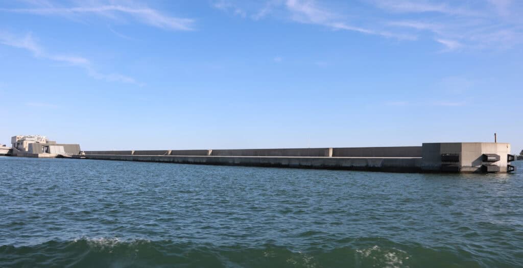
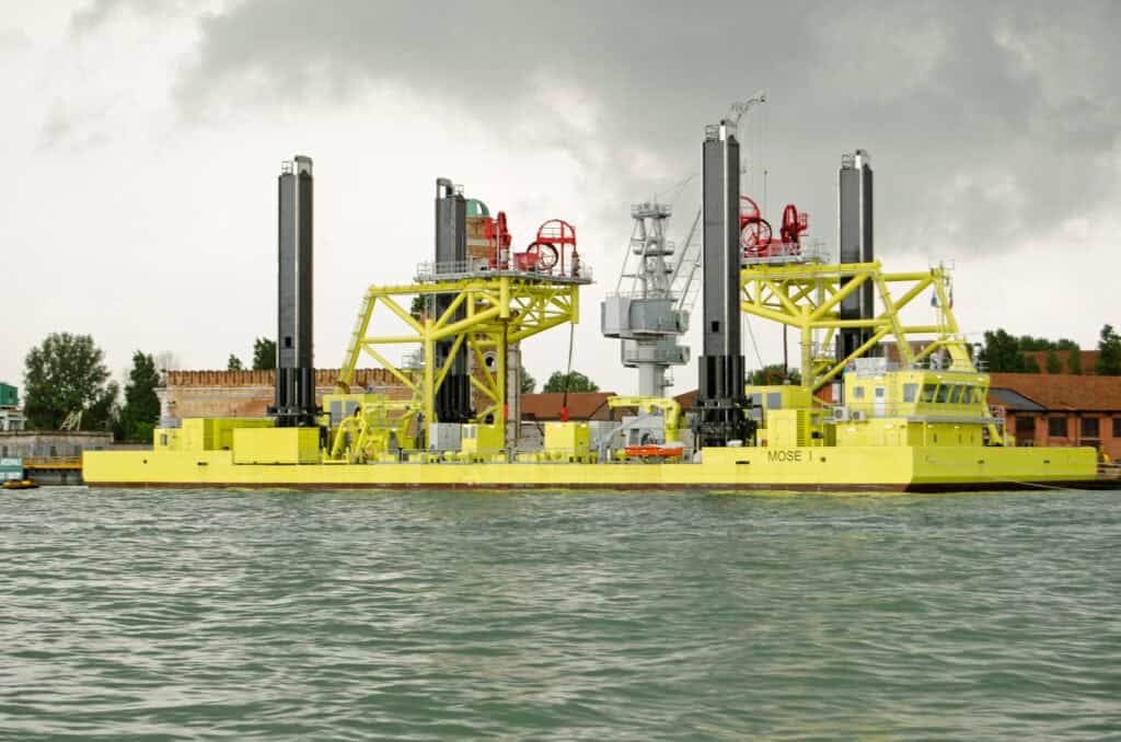
The MOSE system (Modulo Sperimentale Elettromeccanico) comprises 78 mobile steel gates distributed across the three lagoon inlets:

  • Lido (41 gates across two barriers)
  • Malamocco (19 gates)
  • Chioggia (18 gates)

These inlets are the only direct hydraulic connections between the Venetian Lagoon and the Adriatic Sea, making them strategic control points.

Each gate is approximately 20 metres wide, 18 – 29 metres long, and weighs around 250 – 300 tonnes. The gates are hinged to reinforced concrete caissons anchored to the seabed.

Under normal tidal conditions:

  • The gates are filled with water
  • They lie flat within recessed housings on the seabed
  • Tidal exchange between lagoon and sea continues uninterrupted

When forecast water levels exceed approximately +110 cm relative to the Punta della Salute datum, compressed air is pumped into the gates, expelling water and reducing their density. This buoyancy causes them to rotate upward into a temporary vertical position, forming a continuous barrier across each inlet.

Full closure isolates the lagoon from the Adriatic for the duration of the peak surge.

MOSE became operational in October 2020, following decades of planning, political controversy, cost overruns and corruption investigations. Construction began in 2003, and total project costs are estimated at over €5 billion, excluding long-term maintenance.

The system is designed to protect Venice against tides of up to approximately 3 metres above datum, well above historically recorded levels.

Deployment Data

Since becoming operational, MOSE has been used with increasing frequency.

By early 2025, the system had been raised close to 100 times, including:

  • 25 closures in 2023
  • 28 closures in 2024

The frequency of closures reflects the rising baseline of high-tide exceedance events rather than isolated meteorological extremes.

Closures typically last between 3 and 5 hours, depending on surge duration. During this period:

  • Commercial shipping traffic through Malamocco is suspended
  • Lagoon–sea water exchange is halted
  • Tidal currents are altered

A lock system at Malamocco allows limited passage for smaller vessels, but throughput is constrained.

Operational decisions are based on forecast modelling that balances flood risk against ecological and economic impacts. Closing too frequently risks altering sediment transport patterns and lagoon salinity gradients, both of which are critical to lagoon ecology.

The lagoon is a delicate brackish system. Prolonged isolation could:

  • Reduce sediment replenishment
  • Affect salt marsh stability
  • Alter nutrient exchange
  • Impact fisheries

The system therefore operates as a calibrated intervention rather than a permanent seawall.

Climate Change and Operational Sustainability

MOSE was designed under sea level rise projections developed in the 1980s and 1990s. At the time, expected increases were more conservative than some current projections.

Global mean sea level is currently rising at approximately 3 – 4 mm per year, with higher-end scenarios suggesting increases exceeding 60 cm by 2100.

As baseline sea level rises, the frequency at which forecast tides exceed the +110 cm activation threshold increases correspondingly. This raises several long-term operational questions:

  • Will closures become so frequent that navigation disruption becomes economically problematic?
  • Will lagoon ecology tolerate repeated hydraulic isolation?
  • At what point does temporary barrier use approximate near-continuous defence?

Some modelling studies suggest that under higher emissions scenarios, MOSE could require closure on dozens to potentially hundreds of days per year by late century if no further adaptation occurs.

This is not immediate, but it is material.

MOSE therefore represents a strategic line of defence against extreme events. It significantly reduces catastrophic flood risk. It prevented serious inundation during several high-tide events between 2020 and 2024.

However, it does not eliminate moderate flooding within the lagoon when not deployed. Nor does it remove the underlying trajectory of rising sea levels.

MOSE excludes catastrophe. It does not eliminate water from the system.

Adaptation at Street Level

The most revealing resilience in Venice is visible within everyday architecture. It is not confined to major infrastructure or heritage sites. It is embedded in doorways, paving levels and shopfront details.

Unlike many UK contexts, where flood protection is often retrofitted after a damaging event, Venice’s street-level adaptations reflect a long-standing assumption that moderate inundation will recur.

Raised Thresholds

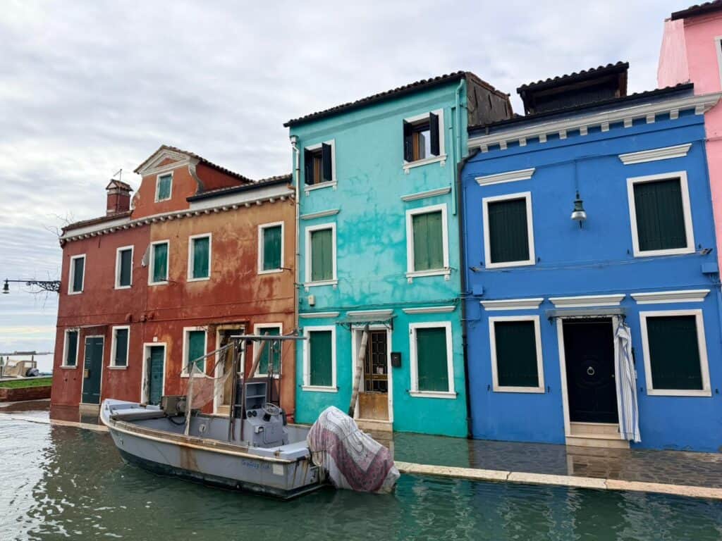
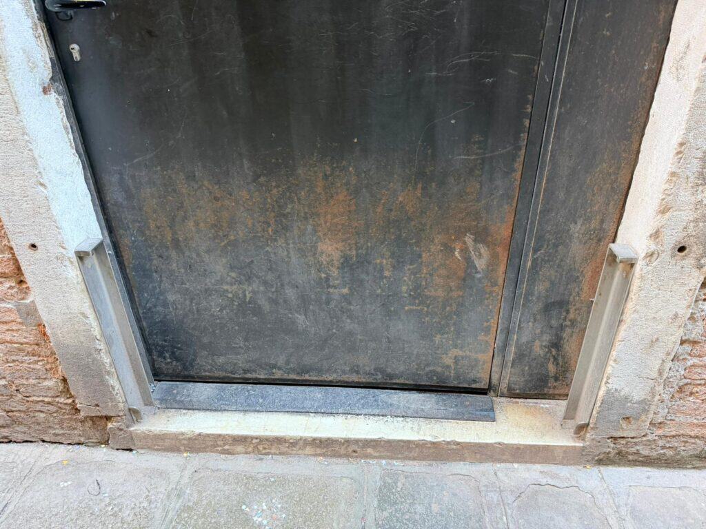
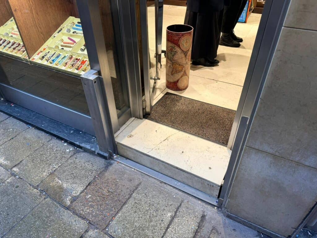
Across low-lying districts such as San Marco, Dorsoduro and parts of Castello, entrance thresholds are commonly raised 10 – 30 cm above adjacent paving. In areas historically affected by more frequent flooding, vertical offsets can be greater.

Original Istrian stone steps are often supplemented by:

  • Secondary upstands cast in concrete or stone
  • Integrated lips at the base of timber or metal doors
  • Discreet vertical offsets incorporated into shopfront redesigns
  • Double-door arrangements creating small internal lobbies

These adjustments correspond directly to typical shallow flood depths during moderate high tides. For example, at a +100 to +110 cm tide, street-level water depth in parts of San Marco may range from 10 – 25 cm above paving.

Rather than attempting to eliminate all water ingress, raised thresholds delay and reduce internal entry, particularly during short-duration events.

Over time, repeated paving works have subtly increased street levels. In some locations, pavement levels have been lifted by several centimetres relative to original medieval fabric. These incremental adjustments reflect long-term calibration rather than wholesale redesign.

In hydraulic terms, even a 10 cm vertical difference can materially reduce frequency of internal flooding in a low-gradient urban environment.

Demountable Flood Boards

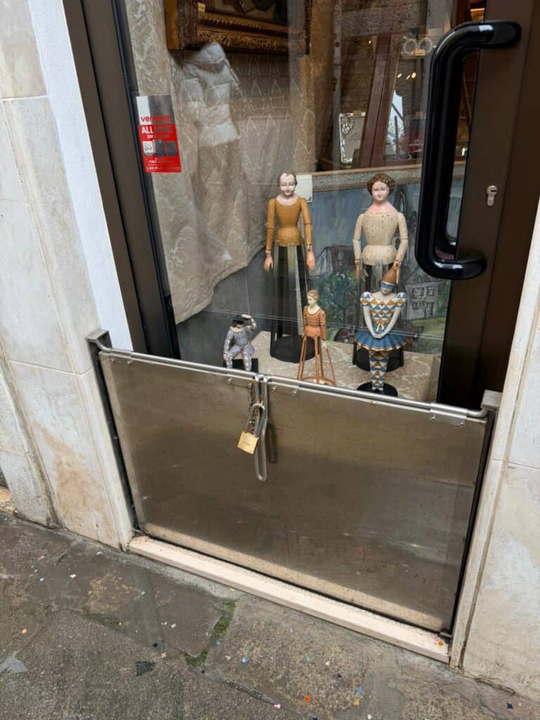
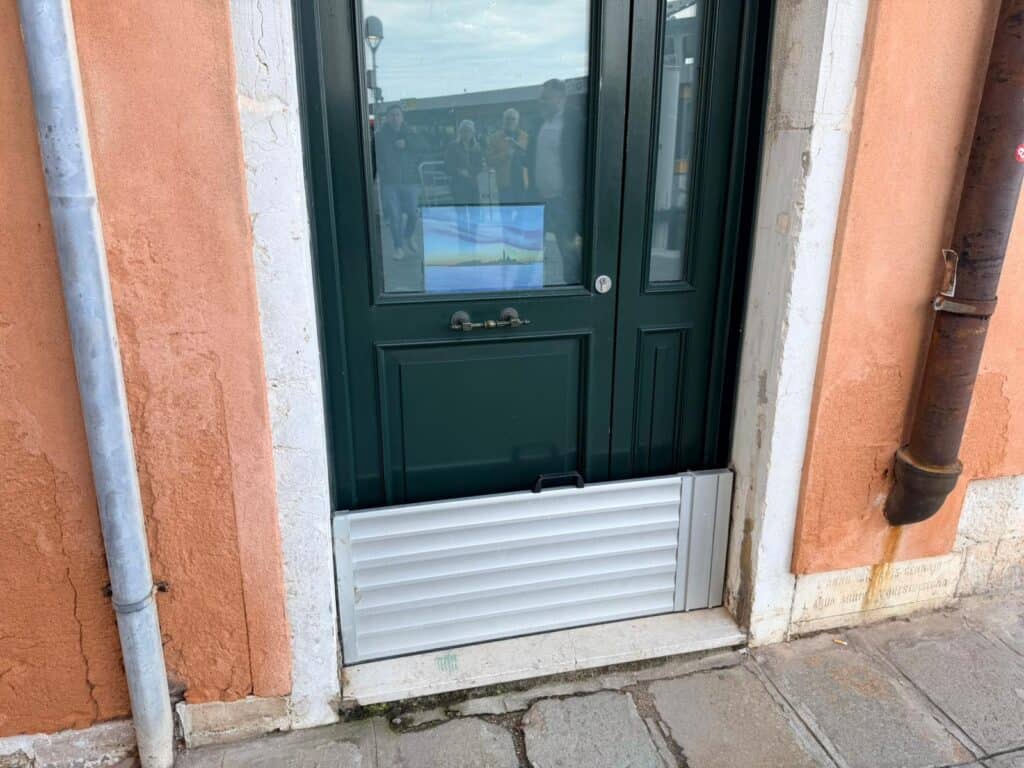
Commercial properties frequently incorporate flood board systems as part of standard frontage design.

Typical components include:

  • Recessed aluminium or stainless-steel guide channels integrated into masonry reveals
  • Slot-in composite or metal boards capable of resisting hydrostatic pressure
  • Compression seals or gaskets to limit seepage at joints
  • Internal drainage sumps or portable pumps for residual infiltration

These boards are often sized to anticipated flood depths of 20 – 60 cm, corresponding to moderate acqua alta events rather than extreme surges.

Importantly, they are deployed as a matter of routine when forecast alerts are issued. Installation time is typically measured in minutes.

Hydrostatically, shallow urban flooding generates relatively low lateral loads compared to riverine flood conditions. This makes demountable systems viable in a tidal context where water depths are limited and duration is short.

In many retail streets, guide channels remain permanently visible even when boards are not in place. This visibility reinforces normalisation: flood protection is part of the urban aesthetic.

Public Walkways and Temporary Infrastructure

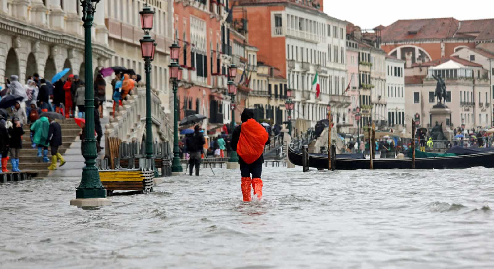
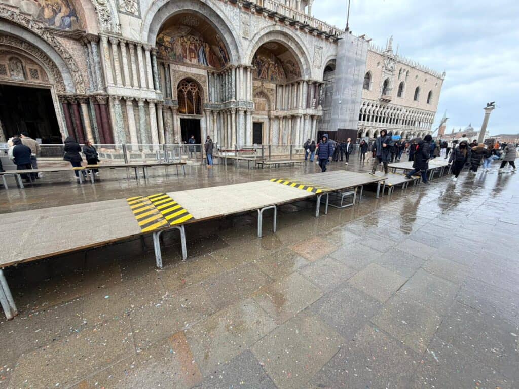
When forecast thresholds exceed approximately +100 cm, the city deploys raised wooden or metal passerelle along key pedestrian routes.

These elevated walkways:

  • Are installed rapidly by municipal teams
  • Connect major transport nodes and commercial streets
  • Allow daily life and tourism to continue

Their placement corresponds to mapped low points within the urban fabric. Over decades, the city has built a spatial understanding of hydraulic behaviour at centimetre resolution.

In effect, the public realm operates on a dynamic vertical system: paving, thresholds and temporary walkways form layered flood management infrastructure.

Architectural Signalling

Street-level adaptation in Venice also functions symbolically. Visible threshold steps, flood board tracks and temporary walkways signal risk literacy.

By contrast, in much of the UK, flood protection measures are often concealed or designed to appear temporary. Properties may remove visible flood boards outside flood season. There can be reluctance to advertise vulnerability.

Venice demonstrates a different cultural posture: resilience is not hidden. It is integrated.

Heritage Protection: Transparent Barriers at St Mark’s Basilica

St Mark’s Basilica sits at approximately +64 cm above the Punta della Salute datum, making it one of the lowest and most hydraulically vulnerable major structures in Venice.

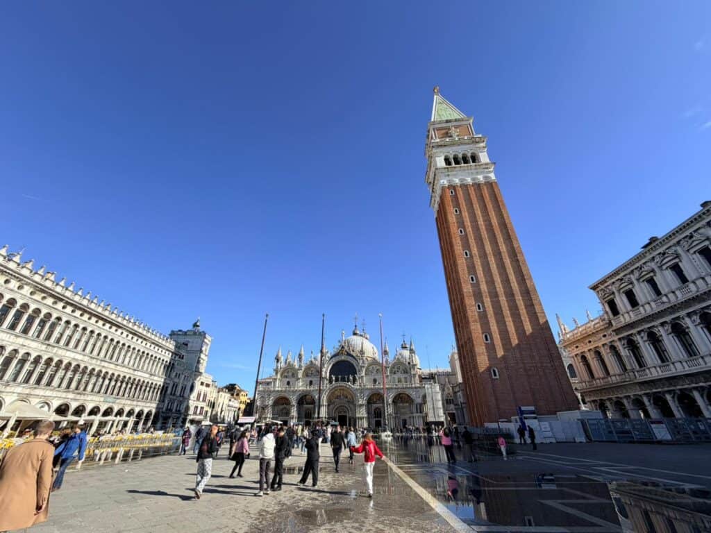
Its position at the eastern edge of Piazza San Marco — itself among the lowest public spaces in the city — has exposed it repeatedly to saltwater ingress during moderate and extreme acqua alta events.

During the November 2019 flood (187 cm), water entered the Basilica to depths of approximately 1 metre in parts of the narthex and crypt. Saltwater intrusion damaged marble pavements, brickwork, mosaics and column bases. Conservation authorities reported cumulative degradation from repeated tidal exposure over preceding decades.

The 2019 event accelerated long-planned permanent protection works.

Engineering and Installation (2021 – 2023)

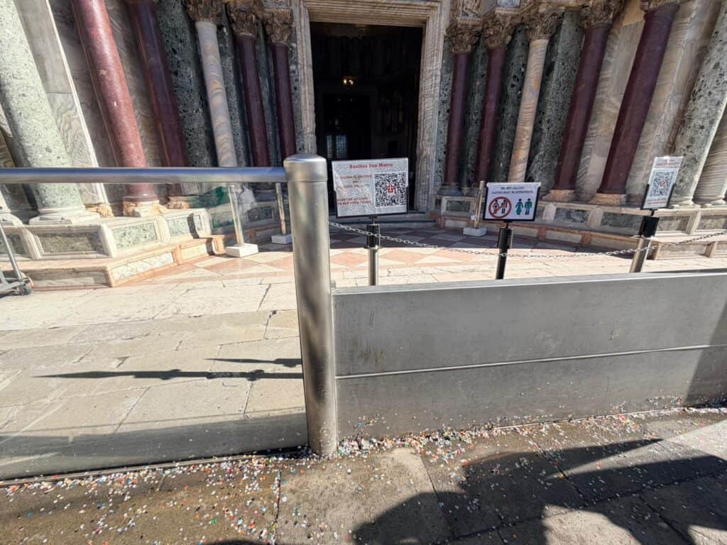
Between 2021 and 2023, a system of transparent tempered glass barriers was installed around the Basilica’s lower perimeter.

Key elements include:

  • Glass panels approximately 1.1 – 1.2 metres high
  • Multi-layer laminated and tempered safety glass designed to resist hydrostatic pressure
  • Stainless steel anchoring systems integrated discreetly into stone plinths
  • Sealed base connections to reduce seepage beneath panels
  • Integrated sub-surface drainage and upgraded pumping systems

The system is designed primarily to resist moderate recurrent events in the +90 to +110 cm range, which historically have occurred several times per winter season.

Hydrostatic loading at these depths is manageable without requiring opaque structural walls. The design balances:

  • Structural resistance to shallow tidal forces
  • Minimal visual obstruction
  • Reversibility in line with conservation principles

Unlike sandbagging or temporary aluminium barriers, the glass panels form a permanent but visually permeable edge.

Conservation Logic

The Basilica’s fabric includes:

  • Thirteenth-century mosaics
  • Marble revetments
  • Porous brickwork
  • Sub-surface crypt chambers

Repeated exposure to saltwater accelerates salt crystallisation within stone and mortar. As water evaporates, salt deposits expand within pores, leading to surface spalling and long-term structural weakening.

Preventing frequent shallow inundation therefore reduces cumulative deterioration rather than merely avoiding catastrophic single-event damage.

The glass barriers are part of a broader conservation strategy that includes:

  • Waterproofing of the crypt floor
  • Improved perimeter drainage
  • Internal monitoring of humidity and salt levels

The intervention acknowledges that tidal interaction will continue but seeks to limit the most damaging recurrent exposures.

Architectural and Cultural Significance

The choice of transparency is deliberate.

Opaque flood walls would undermine the visual and symbolic openness of Piazza San Marco. The glass barriers allow uninterrupted views while clearly signalling protective intent.

Protection is therefore neither hidden nor improvised. It is embedded within the architectural language of the site.

This contrasts with many heritage contexts in the UK, where flood protection is often temporary, reactive or visually minimised to preserve aesthetic continuity.

The Basilica’s protection illustrates a broader Venetian principle:

  • Flood risk is acknowledged.
  • Defence is made visible.
  • Integration is prioritised over concealment.

In this sense, the glass barriers are both hydraulic infrastructure and cultural statement.

Interior Flood Tolerance

Beyond barriers and thresholds, many Venetian buildings embed resilience internally. This layer of adaptation is less visually dramatic than MOSE or glass perimeter barriers, but it is arguably more fundamental.

Venice’s building stock evolved over centuries in direct relationship with tidal variability. As a result, internal configurations frequently reflect an assumption that shallow water may occasionally enter at ground level.

This is not universal, and some modern refurbishments remain vulnerable. However, in regularly exposed areas, interior resilience is common and deliberate.

Material Choices

Ground-floor material selection in Venice often reflects durability under periodic inundation.

Common features include:

  • Stone or terrazzo floors at ground level, often laid on compacted fill or lime-based substrates rather than timber joists
  • Istrian limestone thresholds, which are dense and salt-resistant
  • Lime-based plasters rather than gypsum plasterboard, allowing breathability and easier repair
  • Minimal use of cavity insulation at low level, reducing moisture retention
  • Masonry or solid brick wall construction, which can tolerate wetting and drying cycles better than lightweight stud partitions

Lime plasters are particularly significant. Unlike gypsum board, which degrades rapidly when saturated, lime-based finishes can:

  • Absorb moisture
  • Release it gradually through evaporation
  • Be repaired locally without wholesale removal

Electrical systems are often positioned above anticipated flood depths, with sockets and distribution boards raised well above floor level in flood-prone ground floors.

In hydraulic terms, moderate acqua alta events typically produce shallow water depths — often between 10 and 30 cm — and duration above peak level may be limited to 2 – 4 hours. Materials that can tolerate short-term saturation without structural failure are therefore viable.

The emphasis is not on watertightness, but on performance under wetting–drying cycles.

Furnishing Logic

Interior layout also reflects flood awareness.

In flood-prone areas:

  • Soft furnishings are minimised at low level
  • Upholstered seating may be limited or elevated
  • Retail displays are modular and movable
  • Lightweight metal or treated timber furniture is preferred
  • Valuable or sensitive goods are stored above floor level

Ground floors in many buildings — particularly in central districts — are configured for:

  • Commercial uses
  • Storage
  • Circulation

Residential sleeping accommodation is more commonly located on upper floors. Historically, Venetian palazzi were organised vertically, with piano nobile levels above ground-floor service areas — a configuration that inherently separated primary living spaces from flood-prone zones.

Moderate flood events often last only a few hours before water recedes with the falling tide. Once levels drop, interiors can be:

  • Washed down
  • Ventilated
  • Returned to use quickly

The objective is rapid reoccupation.

Recoverability as Design Principle

This approach differs materially from typical UK housing construction, where:

  • Timber floors and plasterboard linings degrade rapidly when wet
  • Insulation retains moisture
  • Fitted kitchens and built-in cabinetry require removal
  • Drying periods can extend for months

In Venice, the objective is recoverability, not impermeability.

The assumption is that water ingress may occur below certain thresholds. The design response reduces:

  • Structural damage
  • Replacement cost
  • Time out of use

This recoverability reduces economic disruption even when flooding occurs.

It also changes perception. If restoration takes days rather than months, flooding is disruptive but not catastrophic.

The UK Approach: Policy Permits, Culture Resists

Policy Framework

The UK planning system does require flood resilience — at least in principle.

The National Planning Policy Framework (NPPF) states that development in areas at risk of flooding must be:

  • Safe for its lifetime
  • Without increasing flood risk elsewhere
  • Where possible, reducing flood risk overall

The accompanying Planning Practice Guidance (PPG) on Flood Risk and Coastal Change goes further. It makes clear that where development is necessary in flood-prone areas — following application of the Sequential Test and, where relevant, the Exception Test — proposals should incorporate flood-resistant and flood-resilient construction techniques.

This includes designing buildings to:

  • Withstand floodwater entry
  • Minimise damage
  • Enable rapid recovery

Technical guidance such as CIRIA C790 – Code of Practice for Property Flood Resilience provides detailed recommendations, including:

  • Raised electrical sockets and distribution boards
  • Solid concrete ground floors in place of suspended timber
  • Closed-cell insulation that does not retain water
  • Water-resistant wall finishes
  • Removable skirting boards
  • Flood doors and demountable barriers
  • Use of lime-based or moisture-tolerant plasters

The Environment Agency also promotes resilience measures in Flood Zones 2 and 3, particularly where residual risk remains after finished floor levels are raised above modelled flood levels.

The technical toolkit exists. The regulatory framework permits — and in some cases encourages — layered resilience.

The Role of Finished Floor Levels

In practice, however, compliance often centres on finished floor levels (FFLs).

Developers commonly demonstrate that:

  • Ground floor levels are set above the 1% annual exceedance probability (AEP) flood level, plus climate change allowance
  • Safe access and egress routes are maintained
  • Surface water drainage is attenuated on-site

Once FFLs are elevated above modelled design flood levels, internal flood resilience measures may not be pursued further.

This reflects a probabilistic compliance model: if predicted water depth does not reach internal floor level under the design event, additional internal tolerance may be considered unnecessary.

However, this approach assumes:

  • Flood modelling is perfectly representative
  • Climate allowances remain accurate over the building’s lifetime
  • Exceedance beyond design thresholds is sufficiently rare

As exceedance frequencies shift under climate change, the robustness of this binary model becomes less certain.

Why It Is Not the Norm

Despite policy support, flood-resilient construction is not mainstream in UK housing.

Several structural factors contribute:

1: Market Perception

Visibly flood-adapted homes — with raised thresholds, flood doors or non-standard finishes — can be perceived as “at risk” properties. Buyers and lenders may treat them as less desirable, even if technically more resilient.

2: Cost Incentives

Upfront incorporation of resilient materials (solid floors, moisture-resistant finishes, raised services) can increase build costs. Where flood risk is modelled as low probability, there is commercial incentive to rely on compliance through FFLs rather than embed additional tolerance.

3: Insurance Model

The UK’s insurance framework, including Flood Re, spreads flood risk across the market. While this supports insurability, it can reduce immediate pressure to invest in resilience at point of construction.

4: Retrofitting Culture

Flood resilience measures are frequently introduced after a damaging event, supported by recovery grants (often capped at around £5,000 per property in past schemes). This reinforces a reactive rather than preventative model.

5: Design Norms

Standard UK construction remains based on:

  • Timber joisted or engineered timber floors
  • Plasterboard linings
  • Mineral wool insulation
  • Fitted kitchens and fixed cabinetry
  • Carpeted living areas

These systems perform efficiently under dry conditions but are vulnerable to shallow inundation.

A Binary Assumption

In much UK housing stock — even in areas with measurable flood exposure — the assumption remains binary:

Internal flooding should not occur.

Design, mortgage valuation, insurance underwriting and buyer psychology often reinforce this position.

By contrast, Venice embeds a graduated expectation:

  • Moderate flooding may occur
  • Damage should be limited
  • Recovery should be rapid

The UK policy framework permits such layered resilience. It does not yet make it culturally ordinary.

Until flood tolerance becomes part of mainstream design language rather than site-specific mitigation, adaptation will likely remain reactive rather than systemic.

Design Philosophy: Exclusion vs Accommodation

The UK largely designs to exclude water up to defined probabilistic thresholds. For fluvial flood risk, the standard benchmark is typically the 1% Annual Exceedance Probability (AEP) event — commonly described as the “1 in 100 year” event — with additional allowances for climate change. For tidal risk, particularly in densely populated areas, standards may be more stringent.

Planning consent and flood risk assessments frequently hinge on demonstrating that finished floor levels are set above the modelled design flood level. If internal flooding is not predicted under the 1% AEP event plus climate change, the development is considered safe for its lifetime. The system is rational, model-based and compliance-driven.

However, it operates on a largely binary assumption: below the threshold, buildings remain dry; above it, failure occurs.

Venice operates differently. It combines strategic exclusion of extreme surge events through MOSE with tolerance of moderate tidal flooding within the urban fabric. The barrier system is raised for exceptional tides, but it is not deployed for every moderate high water. Shallow inundation continues to occur, and the city is configured accordingly.

Thresholds are raised. Flood boards are deployed. Stone floors and lime plasters withstand wetting and drying cycles. Public walkways are installed when forecast levels exceed operational triggers. Buildings are arranged vertically, with primary living spaces above ground level. Rather than relying solely on a single protective line, Venice distributes adaptation across scales.

This layered model reduces brittleness. If the macro-defence is not activated — or if moderate events occur below activation thresholds — the micro-scale resilience of buildings and streets absorbs the impact. Shallow flooding may inconvenience daily life, but it does not necessarily trigger catastrophic repair cycles.

By contrast, exclusion-based systems can produce sharper failure edges when thresholds are exceeded. River embankments designed for a 1% AEP event may perform effectively until overtopping occurs, at which point inundation can be rapid and deep. Surface water systems designed around historical rainfall intensity curves may cope under most conditions but become overwhelmed during short-duration extreme downpours. Where internal construction assumes permanent dryness — timber floors, plasterboard linings, mineral wool insulation — even shallow flooding can result in extensive strip-out and months of drying.

The statistical framing of “1% AEP” also depends on a stable baseline. As sea levels rise and rainfall intensifies, exceedance frequencies may shift. Events historically categorised as rare may occur more frequently over a building’s design life. In that context, a model that assumes impermeability below a defined threshold may become progressively less robust.

In resilience terms, risk is a function not only of probability but of consequence. The UK system has historically focused on reducing probability through defence and modelling. Venice, while also investing heavily in probability reduction through MOSE, simultaneously reduces consequence by embedding flood tolerance in materials, layouts and cultural practice.

The distinction is subtle but important. One system seeks to prevent water from entering at all within defined limits. The other accepts that moderate water ingress will occur and designs to minimise damage when it does.

As baseline conditions change, the balance between exclusion and accommodation may become increasingly central to how flood risk is managed in both contexts.

Infrastructure Comparison: Thames Barrier

The Thames Barrier, operational since 1982, protects central London from tidal surges propagating up the Thames Estuary. It consists of ten steel gates spanning 520 metres across the river at Woolwich. When raised, the rotating gates form a continuous barrier preventing North Sea storm surges from travelling upstream into central London.

The barrier was originally designed to protect against a tidal surge with an estimated return period of 1 in 1,000 years at the time of construction, taking account of projected sea level rise to around 2030. Since commissioning, closure frequency has increased. In its early years, the barrier was raised only occasionally; in recent decades it has typically been closed several times per year, reflecting both operational caution and rising sea levels.

Like MOSE, it represents strategic exclusion infrastructure. It protects a high-value urban core from low-probability, high-consequence tidal events. It is also part of a wider Thames Estuary flood defence system that includes embankments, walls and upstream flood storage.

However, London’s urban design does not assume routine shallow tidal flooding. There is no expectation that parts of Westminster or the South Bank will periodically tolerate ankle-deep water as part of seasonal rhythm. The Thames Barrier’s purpose is near-total exclusion of extreme surge risk within its design envelope.

Elsewhere in the UK, flood management lacks Venice’s hydraulic simplicity. Venice has three lagoon inlets; the UK has thousands of kilometres of river channels, estuaries and open coastline. Flood systems are organised by catchment, with responsibilities distributed across the Environment Agency, Lead Local Flood Authorities, internal drainage boards and water companies.

Surface water flooding in particular has no single “gate” equivalent. It arises from intense rainfall overwhelming drainage systems, interacting with micro-topography and impermeable surfaces. Mitigation relies on distributed interventions: attenuation basins, Sustainable Drainage Systems, sewer upgrades, property-level protection. There is no singular control structure that can be raised to isolate an entire urban area.

This structural difference matters. Venice’s geography permits macro-scale tidal control. The UK’s fluvial and pluvial systems are inherently decentralised.

The transferable lesson, therefore, is not the barrier mechanism itself. The Thames Barrier and MOSE both demonstrate how strategic infrastructure can reduce catastrophic risk. The more substantive comparison lies in how macro-defence is complemented — or not — by micro-adaptation.

In Venice, large-scale tidal exclusion coexists with raised thresholds, flood boards, tolerant materials and cultural acceptance of shallow inundation. In the UK, macro-defence is often the dominant narrative, while building-level tolerance remains secondary or reactive.

As exceedance probabilities shift under climate change, the integration of strategic infrastructure with distributed, property-level resilience may prove more durable than reliance on exclusion alone.

A Future of Shared Constraints

Sea level rise and rainfall intensification are increasing pressures in both contexts, albeit through different mechanisms. In Venice, the principal driver is relative sea level rise acting on a tidal lagoon system. In the UK, the pressures are dual: rising coastal water levels and increasingly intense, short-duration rainfall events affecting both rivers and surface water systems.

UK Climate Projections indicate continued winter rainfall increases and greater rainfall intensity, particularly in heavy downpours. At the coast, sea levels around England are projected to rise significantly over the coming decades, with regional variation influenced by land movement and ocean dynamics. Even modest vertical increases alter exceedance frequencies. Events historically treated as rare become recurrent within a single building lifetime.

Venice already operates within that altered baseline. The city has had to adapt not only to individual extreme events, but to a measurable upward shift in mean water levels. Its response demonstrates that resilience can be:

  • Visible — in raised thresholds, glass perimeter barriers and temporary walkways
  • Material — in stone floors, lime plasters and elevated electrics
  • Cultural — in the public understanding of centimetre-based tide forecasts and routine deployment of protective measures

These interventions are not symbolic gestures. They are calibrated responses to defined tidal thresholds — +90 cm, +110 cm, +140 cm — and to the statistical reality of increasing exceedance.

Raised thresholds, transparent heritage barriers, flood-tolerant interiors and demountable boards are not signs of defeat. They are design responses to measurable hydraulic conditions.

For the UK, where millions of properties are already exposed and exposure is projected to increase, the distinction between preventing water entirely and tolerating shallow, recoverable flooding may become increasingly significant. Exclusion through strategic defence remains essential in many contexts. But where exceedance becomes more frequent, consequence reduction becomes equally important.

The challenge is not choosing between defence and acceptance. It is determining how much reliance is placed on single protective thresholds versus layered adaptation.

Living with water is not passive acceptance.

It is structured adaptation calibrated to changing baselines.

Get a no-obligation, free quote

One of our experienced Flood Risk Consultants will get back to you within 60 minutes

Get a Quote