The oldest drainage system in the world: who actually has the claim
Estimated reading time 23 minutes
A stone drainage system roughly 5,000 years old was reported at Liman Tepe on the Turkish Aegean coast on 14 September 2026, and the coverage reached, as it usually does, for the superlative. It should not have. There is no single oldest drainage system in the world, and the sites with the strongest claim are not the ones most often named. Not Rome. Not Minoan Crete. Not, on the dates the archaeology actually supports, the Indus Valley either.
What follows is an audit rather than a tour: who the credible claimants are, what has actually been excavated at each, and which of the dates in wide circulation do not survive being looked up. The excavator at Liman Tepe, it is worth saying at the outset, made no claim of primacy at all.
Three of the four earliest credible claimants were built to carry rainwater rather than sewage, which makes the oldest question in drainage the same one English planning still turns on.
What was found at Liman Tepe in September 2026
Liman Tepe sits at Urla on the southern shore of the Gulf of İzmir, a low headland dividing two bays, roughly 35 km west of the city. The mound is the prehistoric predecessor of the Ionian city of Klazomenai and has been excavated since 1992, first under Professor Hayat Erkanal and, since 2020, under Professor Vasıf Şahoğlu of Ankara University. The 2026 season fielded a team of about thirty-five.
The coast it sits on has not stayed put, and that bears directly on how much of the site can be dated at all. Geoarchaeological coring and seismic survey by Riddick and colleagues place the Early Neolithic shoreline, around 6700 BC, more than 500 m seaward of the present coast, with sea level 14 to 16 m lower than today. The sea then came in: by about 4800 BC it stood some 800 m inland of the modern shore, reaching roughly a kilometre inland at its maximum around 4000 BC, which left Liman Tepe a headland cut off from the mainland by shallow wetland. The excavators link that inundation to a gap of five or six centuries in the occupation record.
The coast has been building back out ever since, roughly a kilometre of it over four to six thousand years, at 16 to 25 cm a year, by longshore barrier accretion rather than river-borne sediment. That is why the earliest occupation at the site is unreachable rather than merely unexcavated: it lies offshore under several metres of silt, in the 10 to 14 m depth band the same survey flags as the most likely place to find it. Melian obsidian in the assemblage is most of the evidence that anyone was there at all.
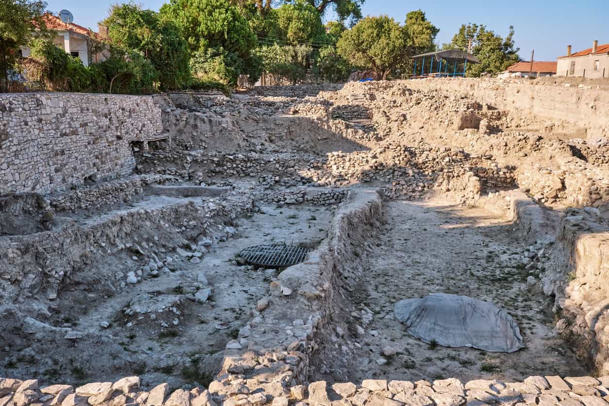
The feature reported is a set of stone-built channels running between the terraces of the Early Bronze Age settlement, at different levels, carrying water towards a point where the settlement deepens. It is dated to about 3000 BC, which places it in the site's Early Bronze I phase, a sequence set out in Ourania Kouka's synthesis of the eastern Aegean Early Bronze Age. The excavator was specific that this is not a water supply.
They made channels with stones, and water flows through those channels. It may not relate to drinking water. Since it deepens towards the centre of the settlement, it may have been built to direct flowing rainwater to a specific location.
Professor Vasıf Şahoğlu · excavation director, Liman Tepe
On how unusual it is, he was careful too: a system hardly known in western Anatolia, with very few examples in the Aegean. That is a claim about rarity, not about being first, and the distinction has not survived translation into English-language coverage.
It is worth being equally careful about what has not been released. There are no channel dimensions, no cross-section, no gradient, no lining or capping detail, no stated length or network extent, and no invert levels, and no description of what the terminal "deepening" actually is. Nothing has been published on what the channels were fed from. There is no radiocarbon determination: the 5,000-year figure is a stratigraphic assignment reported in a press release, not a measurement. That matters more than it sounds, because channels are voids, they fill late and they are cleaned repeatedly, so a date taken from the fill dates abandonment rather than construction.
Why "oldest" is four different questions
Most disagreement about the oldest drainage system in the world dissolves once the question is split, because four quite different things are being asked and the answer to each is a different site.
- The oldest drainage feature of any kind. A single channel cut to move water. Claims here run back into the Neolithic: a triangular channel at Tepe Pardis in Iran at around 5100 BC, and a press-reported channel at Çemka Höyük in Mardin with no publication behind it. Neither is urban drainage.
- The oldest settlement-scale network. Channels serving a whole town rather than one building. This is the question most people mean, and it has a defensible answer.
- The oldest system in a given material. Stone, baked brick, fired clay pipe, copper. The record splits cleanly by material, and most published "earliest" claims are quietly scoped to one of them.
- The oldest system still carrying water. A different question again, and the one where Rome has a genuine claim.
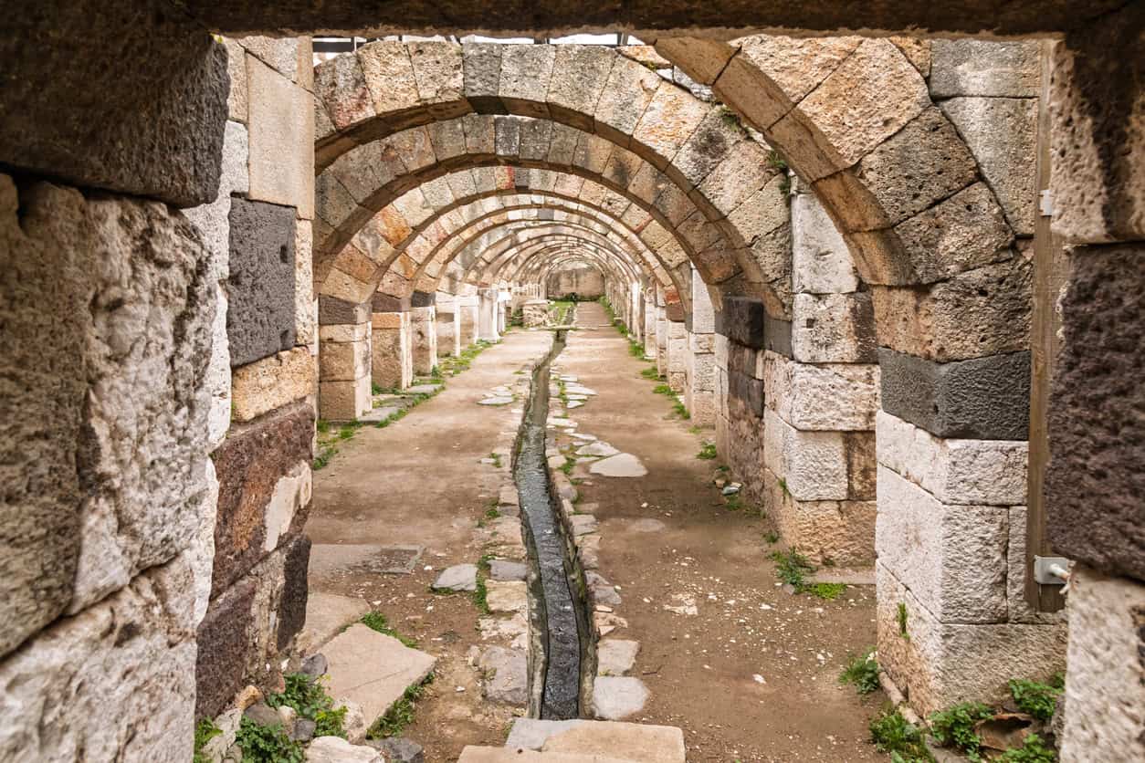
Underneath all four sits a distinction that popular accounts collapse almost every time. A channel may be carrying surface water, foul waste, groundwater, or nothing at all. It may equally be a rubble trench built to keep a wall footing dry. Archaeologists separate them by what the channel physically connects to, by the geometry of its cross-section, and increasingly by what is in the sediment: phosphate enrichment, faecal sterols and intestinal parasite eggs are the decisive modern tests. None of that analysis has been reported for any Early Bronze Age Aegean channel, Liman Tepe included.
The practical consequence is that "ancient sewer" is usually wrong. Most of the early systems in the record are storm drains: the pluvial problem, in modern terms, and the reason surface water flooding is assessed separately. It is the same discipline that produces a surface water drainage strategy for planning today, and a different one from the foul drainage that Victorian engineering is remembered for. Unda's explainer on foul, surface and combined sewers sets out how the three differ in modern systems, and why a combined sewer is a design choice rather than an inheritance, readable even in what one does on a dry day.
The claimants for the oldest drainage system, in date order
Placing the credible claimants on a single time axis does something a list cannot: it shows how crowded the centuries either side of 3000 BC actually are, and how far the famous systems sit from them. Liman Tepe is not an outlier in its period. It is one of four or five sites doing comparable things within a few hundred years of each other, across 5,000 km.
The single most misleading feature of the popular chronology is the gap between the two clusters. Minoan palatial drainage, which the engineering literature treats as the Aegean benchmark, post-dates the Liman Tepe group by eleven to thirteen centuries. The Cloaca Maxima post-dates it by twenty-four.
| Site | Date | What is attested | Type |
|---|---|---|---|
| Habuba Kabira South, Syria | c.3700–3100 BC | Planned town, 3 m mudbrick wall, paved streets with drainage, interlocking horizontal clay pipes | Storm and foul, building scale |
| Poliochni, Lemnos | Blue period, 3200–2700 BC | Stone-sided conduits on stone-paved floors, running with the paved streets and squares; two dry-stone wells | Rainwater only |
| Skara Brae, Orkney | from c.3180 BC | Stone drains beneath at least five houses; extent not fully mapped | Uncertain |
| Liman Tepe, Türkiye | c.3000 BC | Stone channels between terraces, leading to an internal collection point | Rainwater |
| Dholavira, India | occupied from c.3000 BC | Sixteen reservoirs, five check dams, stone-lined storm drains exploiting a 13 m natural fall | Stormwater harvesting |
| Abusir, Egypt | c.2480 BC | 380 m of copper piping, five stone basins, stone lion-head roof spouts | Roof and ritual |
| Mohenjo-daro and Harappa | 2600–1900 BC | Covered baked-brick street drains, house chutes, settling traps, corbelled culverts | Combined |
| Pingliangtai, Henan | c.2150–1950 BC | Ditches beside the houses feeding ceramic pipes laid at 3–7 degrees, discharging to the moat | Stormwater |
| Knossos, Crete | from c.1800 BC | Mortar-lined culvert 79 × 38 cm, vent holes, access ports, more than 150 m of run | Stormwater, toilet added later |
Habuba Kabira, Skara Brae and Poliochni: the 3000 BC group
Three sites sit alongside Liman Tepe in the centuries either side of 3000 BC, and between them they account for most of what can honestly be said about the earliest urban drainage.
Habuba Kabira South, on the Syrian Euphrates, is the strongest single claimant to the settlement-scale question. It is a planned Late Uruk colony of roughly 3700–3100 BC with a three-metre mudbrick wall, paved streets with drainage, and interlocking horizontal clay pipes. The honest caveat, made by Cambridge's Augusta McMahon in her survey of Mesopotamian trash and toilets, is that such systems served individual buildings rather than whole settlements, which is exactly the ambiguity that makes the "oldest" question so slippery.
Skara Brae in Orkney is the closest parallel to Liman Tepe outside the Aegean: stone-built, settlement-scale, roughly contemporary, and of genuinely uncertain purpose. Radiocarbon from the 1972–73 excavations places occupation from about 3180 BC, running some six centuries, with drains built beneath at least five of the houses. The popular claim that these are the world's first indoor toilets rests on small stone cells sitting over those drains. It is an interpretation, not a demonstration, and Historic Environment Scotland's own material does not make it.
Poliochni on Lemnos is the closest comparison of all, roughly 200 km across the Aegean from Liman Tepe and, if anything, slightly earlier. Its drainage appears in the Blue period, 3200–2700 BC: stone-built conduits with stone sides and stone-paved floors, running with the paved streets and squares, alongside two wells lined in high-quality dry stone. It is routinely described as the earliest sewer system in Europe, and on both counts that is wrong.
The Ephorate of Antiquities of Lesbos states plainly that Poliochni's conduits were intended for the drainage of rainwater only. A 2023 review in the water-engineering literature describes the same feature as an underground sewer carrying storm and wastewater beyond the city walls.
One feature, two labels, and one of them is not supportable. That single disagreement explains a great deal about why the chronology of ancient drainage is in the state it is: the archaeological site reports are phase-specific and cautious, the engineering syntheses compress and recycle, and the two bodies of literature rarely check each other.
Mohenjo-daro is six centuries younger than most sources say
The Indus cities are the benchmark case for early urban drainage, and their date is the single most commonly repeated error in the field. Engineering review papers routinely place the Mohenjo-daro drains at 3000 BC or 2500 BC. The Mature Harappan period is 2600–1900 BC, established on more than seventy radiocarbon dates from Harappa. Mohenjo-daro's own earliest levels have never been sampled, because the water table stopped excavation before they were reached.
What is there is genuinely remarkable, and better than the superlatives suggest. Street and lane drains of baked brick, with specially shaped bricks at the corners, closely fitted and sealed with mud mortar. Mostly covered, with flat baked bricks laid across the side walls, limestone slabs on the wider runs and a mud capping over the top. Larger culverts, the Great Bath outlet among them, built as a corbelled arch and walkable. House connections running down vertical pipes inside the walls to chutes discharging at street level. More than 700 wells, roughly one per three houses. The larger runs were laid to a consistent fall, which is the same self-cleansing logic behind a modern discharge rate.
Beside the settling traps at Mohenjo-daro sit heaps of greenish-grey sand dug out of them: the oldest physical evidence anywhere that someone was actually maintaining a drainage system rather than merely building one.
That detail is the strongest continuity between the ancient record and modern practice, and a sharper one than any comparison of pipes. A silt trap only works if it is emptied, which is the problem sediment ponds and sewer adoption still turn on, and the reason maintenance and adoption arrangements now sit at the centre of the national standards for sustainable drainage.
The Indus site that stored instead of shedding
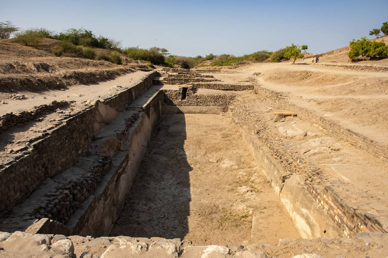
The most direct modern parallel is not Mohenjo-daro but Dholavira, where sixteen reservoirs cover around ten hectares, roughly a fifth of the walled city. The largest measures 73.5 by 29.3 m, with three staircases cut for varying water levels.
Three check dams on the Manhar and two on the Mansar feed a system that exploits a thirteen-metre natural fall, taking roof and street runoff into attenuation storage. As an arrangement it is closer to rainwater harvesting integrated into SuDS design than to anything in a Victorian sewer.
The dates that are simply wrong
Four claims circulate widely enough in the drainage and plumbing literature to be worth naming, because each one reappears in trade articles, review papers and, in one case, the most-read encyclopaedia entry on the subject.
- Clay sewer pipes in Babylonia at 4000 BC. No site, no excavation report, no stratigraphy. It appears in review papers as "documented by many" and is recycled from there. Wikipedia's history of water supply and sanitation still carries it. The properly evidenced early clay pipework is at Habuba Kabira and Chogha Mish, several centuries later.
- Copper pipes in the pyramids at 2500 BC. A garbled version of something better. The mortuary temple of Sahure at Abusir, around 2480 BC, carried over 380 m of copper piping and five stone basins with copper plating and lead plugs, with roof water discharged through stone lion-head spouts. That is the defensible earliest metal drainage claim, and it is not in a pyramid.
- The Minoans at 3200 BC. The engineering literature quotes the full Minoan bracket of 3200–1100 BC alongside descriptions of palatial plumbing, which implies third-millennium sanitation. No Minoan palace exists before about 1900 BC. Pre-palatial Crete has no reported drainage at all. The best-published system, in the Domestic Quarter at Knossos, was built in Middle Minoan IIA to drain the Central Court; the gypsum-lined toilet was inserted roughly a century later. It is a stormwater system with a toilet added, which is the opposite of the separation it is usually credited with.
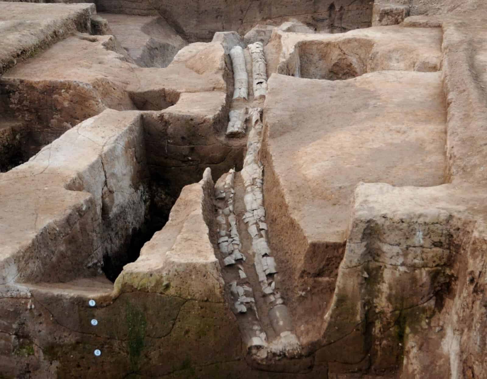
- Pingliangtai as the world's oldest. The 2023 Nature Water paper claims the earliest ceramic drainage system and the earliest complete one in prehistoric North China; University College London's release said "the oldest ever unearthed in China". Several outlets upgraded that to a global claim. At around 2000 BC the system is a thousand years younger than Liman Tepe's reported date.
The pattern is consistent. The two most-cited synthesis papers in the engineering literature are useful for structure and thoroughly unreliable for any claim of primacy, because they inherit their early dates rather than checking them. A date that cannot be traced to an excavation report is not a date.
So what does the record actually support?
Asked as a question about settlement-scale drainage, the oldest drainage system in the world is most defensibly Habuba Kabira South, which has the earliest good claim, at 3700–3100 BC, subject to the objection that its pipework served buildings rather than the town. By material the record splits and no single site wins: stone at Skara Brae, Poliochni and Liman Tepe; fired clay pipe at Habuba Kabira and Chogha Mish; copper at Abusir; baked brick in the Indus cities; and a complete ceramic network at Pingliangtai. On systems still carrying water, Rome keeps the Cloaca Maxima, which began as the canalisation of a stream through marshy ground and only became a sewer later, a sequence set out in Unda's article on what the Romans did for drainage. The medieval drainage that followed it, and the terraced drainage at Machu Picchu, are the two later chapters in the same story.
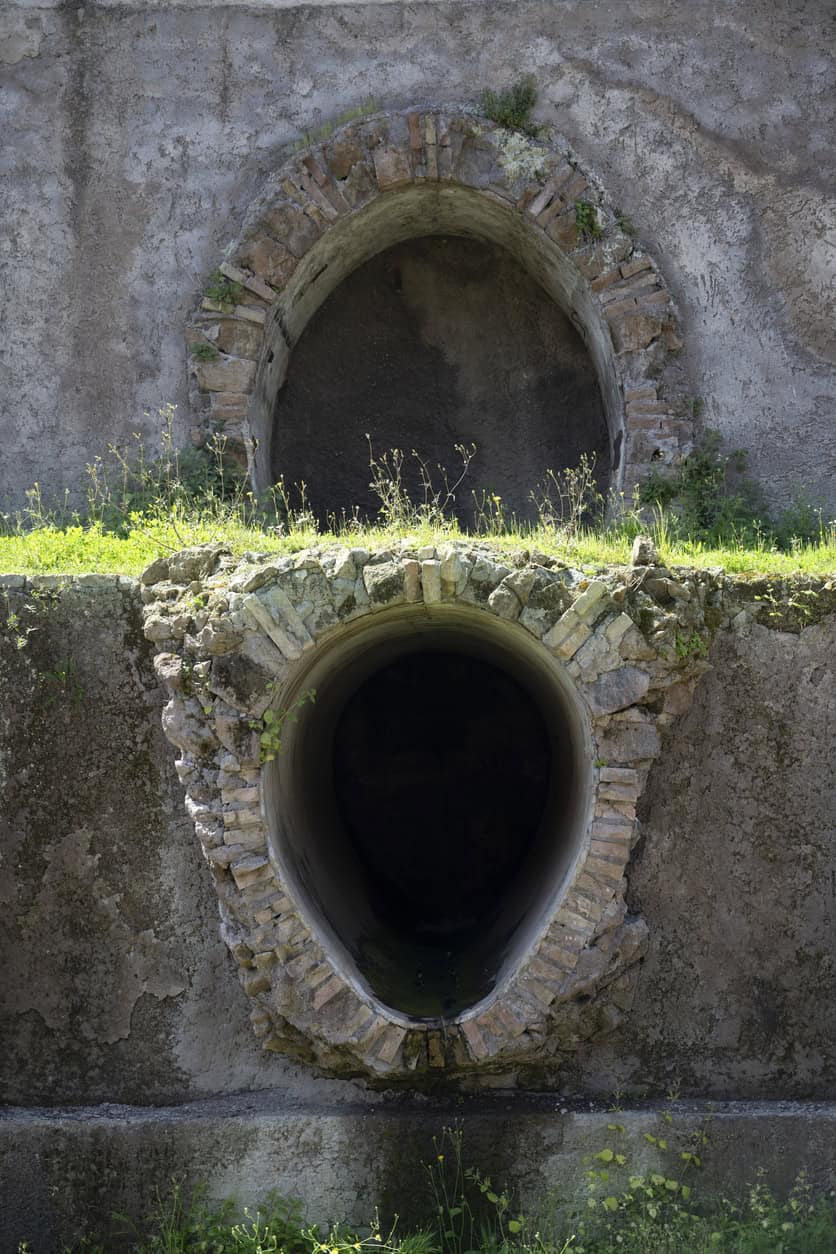
Liman Tepe's honest position is that it sits among the earliest known settlement-scale stormwater systems anywhere, contemporary with the very earliest, and that it is rare and early for western Anatolia specifically. It predates all Minoan palatial drainage by eleven to thirteen centuries. It is not the oldest anything, and the excavator never said it was.
The genuinely unusual thing about it is not the date but the direction of travel: channels running between terrace levels towards a collection point inside the settlement, rather than out through the wall to an outfall.
Every well-attested comparison runs the other way. Poliochni's drains follow the paved streets. Knossos discharges east to the Kairatos. Pingliangtai discharges to the moat. All of them move water out, and quickly. A system that gathers water to a low point inside the settlement is doing something else: storing it, infiltrating it, or continuing to an outfall nobody has found yet. On a coast with a five-month rainless summer and no perennial watercourse, storage would make obvious sense, and the arrangement would sit closer to the modern SuDS hierarchy, and to the sponge-city idea and to source control at plot level than to a storm sewer. None of which can be settled from a press release.
What the whole record does support is a less romantic point than the one usually drawn from it. The oldest decision in drainage is not which pipe to use. It is what water goes where: rainwater managed separately from waste, near where it lands, with somewhere for it to go and someone to keep that route clear. That is, more or less, what sustainable drainage was reinvented to do, and what the four pillars of SuDS formalise. Four thousand years later, and after a century of deliberately combining the two for reasons of cost, that is still the decision a drainage strategy for a planning application has to get right. It is also still the one that costs the most to get wrong, as the Thames Tideway Tunnel demonstrates at a scale the Bronze Age would have found difficult to imagine.
Frequently asked questions
What is the oldest drainage system still in use today?
Rome's Cloaca Maxima has the strongest claim: parts of it still carry rainwater to the Tiber after roughly 2,600 years. Continuous use is a different test from earliest construction, and it favours systems built at monumental scale in durable materials, which is why the answer is Roman rather than Bronze Age. Claims that Minoan drains on Crete remain in municipal service trace back to a single early twentieth-century observation that the drains at Agia Triada still ran during heavy rain, and should be treated as an anecdote rather than a record of service.
How do archaeologists tell a drain from other buried structures?
Four tests, in roughly descending order of reliability. What the channel connects to, which is the strongest evidence and the rarest, because it needs the connections themselves to have been excavated and phased. The cross-section, where a small low-flow channel inside a larger one implies both a dry-weather and a storm flow. The presence of silt traps or settling chambers, which implies sediment-laden surface runoff. And the sediment itself, where phosphate enrichment, faecal sterols and parasite eggs establish what the channel carried. A feature with no consistent fall that ends in a blind pit is more likely a soakaway, a sump, or a rubble trench built to keep a wall footing dry.
Why did Mesopotamia and Egypt not build settlement-wide drainage?
Both built drainage, but at the scale of individual buildings rather than whole towns. Mesopotamian toilets appear by the early third millennium BC, draining to cylindrical pits made of interlocking perforated ceramic rings, a soakaway in all but name. Coverage was poor: in well-excavated second-millennium neighbourhoods at Nippur and Ur, fewer than half of houses had one. Egypt's investment went into Nile basin irrigation, which is a flood-and-drain agricultural cycle rather than urban drainage, and the two should not be conflated. Street waste in both largely accumulated, with no evidence of organised collection.
What would confirm the Liman Tepe dating and function?
A measured long section with invert levels, establishing whether the channels fall continuously to a defined discharge point. The cross-section: width, depth, whether capped, whether the invert is paved. What surfaces feed each channel, and whether any fixed installation connects to one. Characterisation of the terminal feature as a sump, cistern, soakaway or unexcavated continuation. Sediment analysis to establish what the channels carried. Radiocarbon from a construction context rather than a fill. And the system's position in the site's own phase sequence, with any evidence that it was maintained, recut or raised. The primary reports to watch are the annual Kazı Sonuçları Toplantısı volumes.
About the author. Edward is a co-founder and Director of Unda with 20+ years in flood risk and drainage, and a national-press commentator on flooding. Unda has been trading since 2014, is a CIWEM Business Partner with CIWEM member and chartered (C.WEM MCIWEM) consultants, and has delivered 5,000+ flood risk assessments and drainage strategies across England and Wales.
Edward Bouët · BSc (Hons)
Latest news






One of our experienced Flood Risk Consultants will get back to you within 60 minutes
