Ground Investigation for Drainage and Flood Risk: What a Planning Application Needs
Estimated reading time 19 minutes
A ground investigation establishes what lies beneath a site: the soils, the rock under them, the depth of any made ground, and where the water sits. Drainage, foundations and earthworks can then be designed against measured conditions instead of assumed ones. On most housing and commercial schemes in England the reason one gets commissioned at all is drainage. The surface water drainage strategy proposes infiltration, and infiltration has to be proved before a planner will accept it.
What follows sets out what a ground investigation covers, which methods answer which questions, what the report should contain, and what a lead local flood authority expects to see at each stage of an application.
Expenditure on site investigation as a percentage of total project cost is low, and ranges typically from a mere 0.1 to 0.3% for building projects.
That figure comes from the Institution of Civil Engineers’ Site Investigation Steering Group, published in 1993 as Without Site Investigation Ground is a Hazard. No comparable UK dataset has replaced it since. It describes what was being spent, and it was never a recommendation. The proportion still frames the risk fairly, because an investigation that comes in at a fraction of a percent of build cost is simultaneously one of the very few line items capable of holding up a determination on its own, and one of the easiest to defer when a programme tightens.
Why the drainage strategy is usually what triggers it
Ground investigation reaches most planning applications through drainage policy, not through structural design. Policy F8 of the August 2026 NPPF requires sustainable drainage on any proposal that could affect drainage on or around the site (the Framework itself is the source to quote to an officer), designed in accordance with the 2025 National Standards for Sustainable Drainage Systems. Those standards send surface water to the ground first under the SuDS hierarchy, ahead of a discharge to a watercourse or a sewer with attenuation. Infiltration cannot be claimed without evidence drawn from the ground itself.
There is no major-development threshold in the Policy F8 trigger. A single dwelling that changes drainage is caught.
The only scale qualifier is that the systems be proportionate to the nature and scale of the proposal, and the sole mention of major development sits in a separate limb governing when lead local flood authority advice must be taken into account.
- Requirement 1.14. Infiltration drainage depends on the ground conditions being suitable and adequate infiltration rates being identified using the assessment methods in standard 3.
- Requirement 3.14. Geotechnical investigations shall be undertaken to confirm the ground is suitable for infiltrating surface water runoff, in accordance with recognised guidance and infiltration testing methods.
- Requirement 1.15. The base of an infiltration feature shall not sit within 1 metre of the maximum likely groundwater level.
- Requirement 1.18. Deep-bore infiltration is not considered to follow a SuDS approach, and is permitted only by exception, with agreement in principle from the relevant risk management authority.
- Requirement 3.11. Groundwater levels should be confirmed across the site through site investigation during high groundwater level periods.
The footnotes to those requirements name the standards directly. Footnote 15 cites BS EN 1997-2 and BS 5930; footnote 16 cites BRE Digest 365, CIRIA Report 156 and BS EN ISO 22282-2. Ground investigation is not a local invention by an awkward LLFA. It is written into the national standards by reference, and those standards are in turn pulled into the determination of a planning application by Policy F8, which means an officer asking for it is applying national policy rather than exercising a preference.
One caveat on status. Schedule 3 of the Flood and Water Management Act 2010 remains uncommenced in England, so none of this operates as statute there. It operates through planning policy, which is why an LLFA objection arrives as a consultee response and not a refusal. Wales took the other route, commencing Schedule 3 in 2018 with a statutory SuDS Approving Body and statutory national standards.
Phase 1: the desk study, and what it settles before anyone drills
A desk study assembles what is already known about a site: published geology, historical mapping, groundwater records, previous investigations and the strategic flood risk assessment for the area. It produces a preliminary ground model. It is the cheapest part of the process, and the part that decides whether intrusive work is worth commissioning at all.
Requirement 1.14.1 of the National Standards lets an approving body use published mapping as an initial evidence base on whether infiltration is appropriate and whether further ground investigation is needed. Its footnote lists British Geological Survey datasets specifically: the Infiltration SuDS Map, groundwater level information, GeoSure, borehole records, and the superficial and bedrock geology layers. A free first pass on the mapped geology under a postcode is available through Unda’s ground conditions checker for soakaways.
The dataset is intended to be used at a preliminary stage and is not a replacement for a site investigation.
That is the BGS writing about its own Infiltration SuDS Map. Mapping at 1:50,000 puts 50 metres in a mapped millimetre, and the weathered material in the top few metres, which is the material a soakaway actually sits in, often behaves nothing like the bedrock shown on the map.
A desk study that returns firm clay across the whole site, made ground of unknown depth, or a water table close to the surface has still done its job. It has told the design team to stop pricing soakaways and start pricing an alternative discharge route, which is a far cheaper discovery in week two, when the layout is still fluid, than in month nine, when it is not. Cheap, and early. That is the whole value of the phase.
Phase 2: the intrusive investigation, and what each method gives you
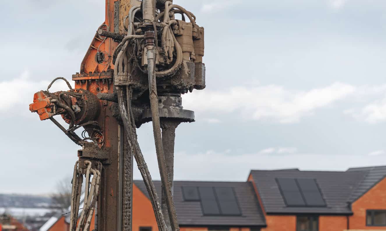
Intrusive investigation puts holes in the ground. Which technique suits a site depends on the depth of interest, the ground itself, access for plant, and what has to be measured. A drainage-led investigation frequently wants something quite different from a foundations-led one, because the depths of interest, the tests that matter and the installations left behind at the end of it are all chosen against a different question.
| Method | Typical reach | What it gives | Where it suits drainage work |
|---|---|---|---|
| Trial pit | 1–4.5 m | An exposed face of ground, bulk samples, and a pit that can take a soakage test | Shallow infiltration features, permeable paving sub-bases and swales |
| Window or windowless sampling | 3–10 m | Continuous small-diameter samples, light plant, limited access needed | Restricted sites, and quick coverage across a large layout |
| Cable percussion boring | 10–40 m | Full-profile samples, in-situ testing, and a hole that can be completed as a monitoring well | Deeper profiles, groundwater monitoring installations, sand and gravel sites |
| Rotary drilling | Beyond 40 m | Cored rock, structure and weathering profile | Chalk, limestone, and any site where solution features are a concern |
| Dynamic probing | 5–15 m | Relative density between exploratory holes | Filling gaps between holes, never replacing them |
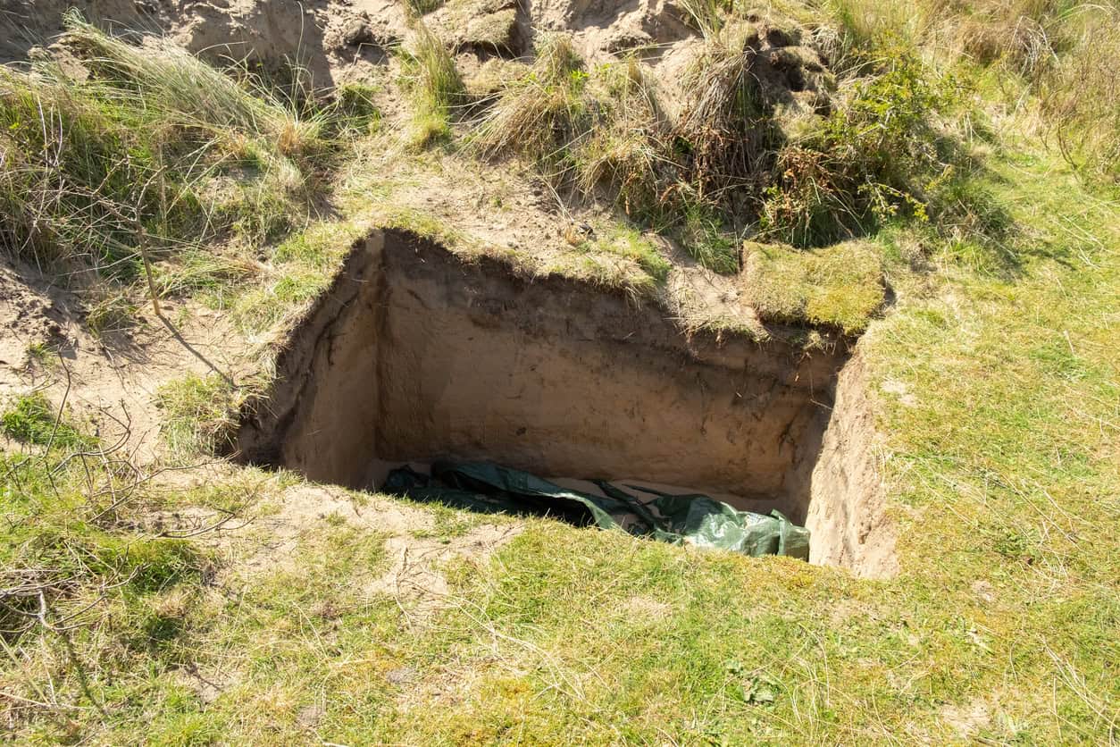
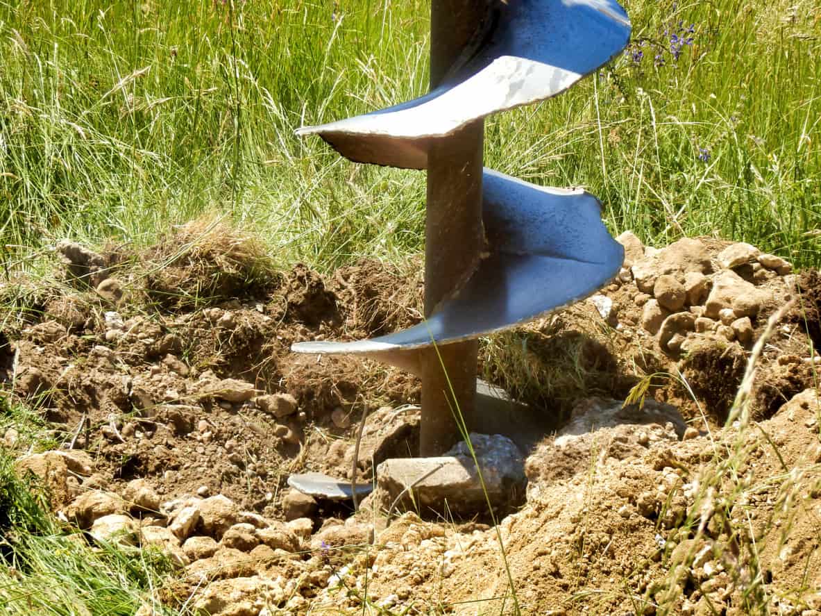
The distinction that matters for drainage sits between the trial pit and the borehole. A pit exposes a face and allows a BRE 365 soakage test at the depth a soakaway would occupy. A borehole reaches deeper, recovers samples through the full profile, and can be finished as an installation that is then read through the winter as groundwater monitoring.
CIRIA C753 is explicit that where depth or access rules out a trial pit, the testing can be done in a borehole following BS EN ISO 22282-2, with falling head tests still repeated at least three times. Testing in a borehole for access reasons is a method of last resort. It is not the same thing as proposing deep-bore infiltration, which requirement 1.18 all but closes off.
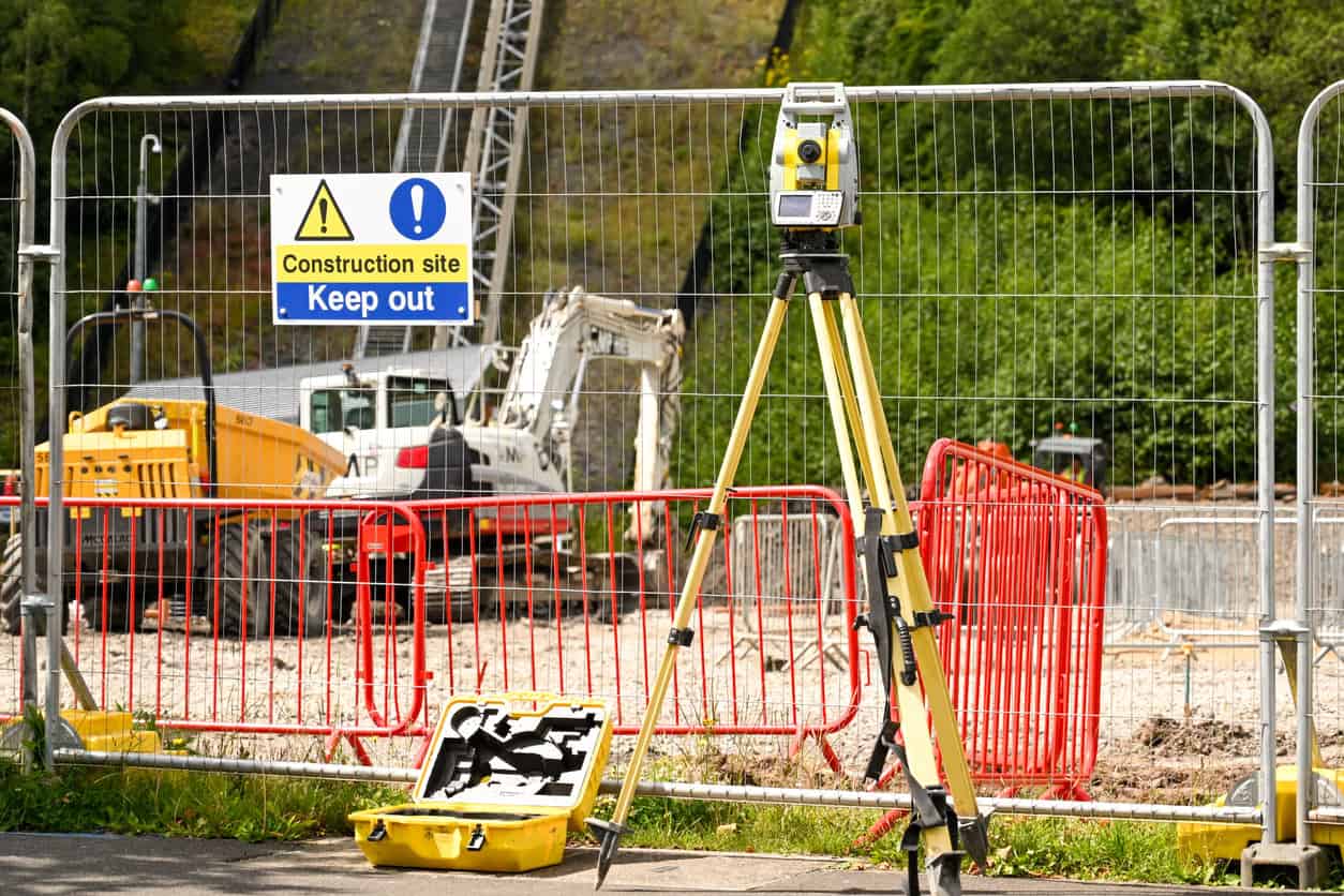
A topographical survey runs alongside the ground investigation and answers a different question. The survey fixes the levels the drainage is designed to; the investigation fixes what the ground will accept. Both, usually. Not one or the other.
The two are commissioned separately and often by different firms, which is how a scheme ends up with centimetre-accurate levels and no idea whether the ground will take the water.
What comes back: the report, the logs and the data
A ground investigation produces a factual report: exploratory hole logs, field test results, laboratory schedules and, on a properly specified job, a set of AGS data files. An interpretative report, where one is commissioned, adds the ground model and the design parameters. They are not the same deliverable. A drainage strategy draws on both.
- The exploratory hole logs. Strata descriptions to BS EN ISO 14688, depths, and every water strike recorded as it was met.
- The field test results. Infiltration rates, each carrying the test location, depth and head of water against it.
- The groundwater record. Struck and rest levels, plus any monitoring installed and the readings taken since.
- The laboratory schedule. Classification testing, and chemical testing where contamination is in scope.
- The AGS data file. The industry exchange format for geotechnical data, so the numbers arrive as data and not as a scanned page.
Ask for the AGS file when the investigation is specified, not afterwards. It is the difference between a drainage engineer re-keying figures out of a PDF and loading them straight into the model, and it is what lets the data be deposited and reused later.
Two traps sit in the reporting and not in the drilling. CIRIA C753 warns that incomplete tests should not be extrapolated: where the head of water does not fall below 25% of the initial head, the result should state that the infiltration rate cannot be determined. And where several tests exist, the design value is the worst of them, which is the figure that goes into the BRE 365 infiltration rate calculator and then into the sizing.
It is rare that sufficient tests are carried out on a site to allow statistical analysis. The worse-case infiltration rate value should be used (not the mean or any other value) unless a sound justification for doing otherwise is demonstrated.
CIRIA C753, The SuDS Manual, chapter 25
An average of six tests is not a design rate. A submission that presents one invites a query, and a query at consultation stage costs a determination cycle that nobody budgeted for.
What the LLFA expects at each planning stage
Expectations rise as an application progresses. At outline, a desk study paired with a named alternative discharge route is generally enough. At full application, measured infiltration rates at the depth and location of the proposed features are expected. At discharge of conditions, the groundwater record has to support the separation the design relies on. The results usually reach the authority inside the wider drainage information submitted with the application, and on many schemes inside a SuDS proforma.
| Stage | Generally accepted | What usually draws a holding objection |
|---|---|---|
| Outline | Desk study or preliminary investigation, with a viable alternative discharge route named and calculated | Infiltration assumed with no evidence and no fallback |
| Full application | BRE 365 results at the depth and location of each proposed feature, with the logs | Tests run elsewhere on site, or at a depth the design does not use |
| Reserved matters and conditions | Wet-season groundwater record demonstrating the separation, and final feature sizing | A single dry-season reading offered as the design groundwater level |
Councils publish their own bars, and those bars are not identical. Essex asks for a desk study or preliminary investigation at outline and full BRE 365 testing at full application or discharge of conditions, and states that infiltration should not occur on made ground. Devon will condition testing at outline where an attenuated alternative with a feasible receptor is submitted, and asks for as long a groundwater record as possible, with November to May the absolute minimum. Milton Keynes requires 1.2 metres of separation against the national 1 metre, and will not accept extrapolated results at all.
Requirement 3.10 provides that where local evidence supports a more stringent approach, the local approach takes precedence. A submission built precisely to the national floor can still fail against a published local requirement.
It is the most common reason a technically competent strategy attracts an LLFA objection, and it is avoidable in an afternoon: read the authority’s published SuDS guidance before the investigation is specified, not after the results come back.
Scoping ground investigation for a drainage strategy?
Unda specifies and interprets ground investigations for planning across England and Wales, and reviews existing factual reports against what the local authority will accept.
Get a quoteWhere ground investigations go wrong
Most rejected drainage submissions fail on a small set of recurring points, and nearly all of them are scoping errors, not testing errors. Missing ground data is also a recurring cause of an application being invalidated at registration. The test was fine. It was run in the wrong place, at the wrong depth, or in the wrong season, and by the time the lead local flood authority says so the layout has been fixed for months and the only remaining options are a second round of testing or a redesign of the discharge route.
- Tested in the wrong position. CIRIA C753 and several LLFAs require testing at the location, depth and head of water that replicate the proposed design. Tests scattered across a field do not evidence a soakaway in the corner of it.
- Tested in the wrong season. A summer rest level can sit metres below the winter peak, so a separation proved in August may not exist in February.
- Tested in an unrepresentative stratum. A rate measured in a sand lens within a clay mass is not a site rate, which is why C753 requires the log descriptions to accompany the results.
- Commissioned too late. Monitoring has to run through the wet season, so a scheme that learns this from a consultation response in March has lost the year.
- Scoped for foundations only. An investigation specified for structural design may never test at soakaway depth, never install a monitoring well, and never produce a usable infiltration rate.
- Assumed to satisfy building control and planning together. Approved Document H asks only that the water table not reach the base of the device at any time of year, a materially lower bar than 1 metre of unsaturated ground.
That last one is worth spelling out. Approved Document H, the National Standards and a published LLFA requirement can all apply to the same soakaway and ask for three different things. Designing to the least demanding of the three is how a scheme passes building control and still fails to discharge its drainage condition.
The standards, and two that have moved
The citation chain for a drainage-led ground investigation is short, and worth getting right, because parts of it changed recently and a good deal of published advice has not caught up.
| Standard | What it covers | Status as at September 2026 |
|---|---|---|
| BS 5930:2015+A1:2020 | Code of practice for ground investigations | Current. Explicitly excludes contamination and ground gas |
| BS EN 1997-2:2007 | Eurocode 7, ground investigation and testing | Superseded but remains current; named in the National Standards |
| BS EN 1997-2:2024 | Eurocode 7, retitled Ground properties | Current. First generation withdrawn 30 March 2028 |
| BS EN ISO 22282-2:2012 | Water permeability tests in a borehole | Current. The route C753 gives where a pit is impossible |
| BRE Digest 365 (2016) | Soakaway design and the soakage test method | Current. Named in National Standards footnote 16 |
| BS 10175:2026 | Investigation of potentially contaminated sites | Current since 28 January 2026; the 2011+A2:2017 edition is withdrawn |
Two of those rows deserve a second look. BS EN 1997-2 was retitled Ground properties when the second-generation Eurocodes were published on 30 September 2024, and BSI has set 30 March 2028 for withdrawal of the first generation. In the meantime the first-generation documents remain the applicable standards unless a project specifies otherwise. And BS 10175, the contaminated land code of practice, was replaced on 28 January 2026, so the 2011+A2:2017 edition still cited in most reports is withdrawn.
The 2025 National Standards cite BS EN 1997-2:2007 by name. The regulatory citation and the BSI catalogue will stay out of step until the transition completes.
A report that cites either is defensible, provided it says which and why. One further document is worth specifying by name: the UK Specification for Ground Investigation, third edition, published by ICE Publishing for the AGS in 2022, is the standard set of contract clauses for procuring the work. Specifying against it is what stops a cheap investigation becoming a narrow one, and it costs nothing at tender stage to name.
When to commission it, and what drives the cost
Cost scales with the number and depth of exploratory holes, the plant required, the laboratory schedule and any monitoring period. The controllable variable is rarely the day rate. It is the sequence. An investigation scoped once, against a layout settled enough to place the tests where the features will go, costs less than two rounds and a lost determination.
- At feasibility. Commission the desk study and let it decide whether infiltration is worth pursuing at all.
- Before the layout is fixed. Where infiltration looks plausible, install groundwater monitoring early, so the wet-season record accrues while the design develops.
- Once the drainage layout is settled. Run the infiltration testing at the depth and location of each proposed feature.
- With the application. Submit the results alongside the logs, and name the alternative discharge route wherever the evidence is not yet complete.
Contamination adds a further constraint, and it is easy to miss, because BS 5930 deliberately excludes it. Requirement 4.17 allows infiltration through contaminated ground only where there is no risk of mobilising pollutants, and an environmental permit may be required. The Environment Agency’s groundwater protection position statements say it will normally object where a discharge would mobilise contaminants already in the ground, and that infiltration SuDS in a source protection zone need a hydrogeological risk assessment for anything other than clean roof water.
A ground investigation is the evidence base a drainage strategy stands on, and the sequence matters more than the spend: desk study first, monitoring installed early, testing placed where the features will actually go. Unda scopes and interprets ground investigations as part of a surface water drainage strategy for planning and the wider drainage strategy for a planning application, and can review an existing factual report against what the local authority will expect before it reaches a case officer.
Frequently asked questions
Can an application be submitted before the ground investigation is finished?
Often, yes, provided the submission does not depend on a result it does not have. Essex, Devon and Milton Keynes all accept a desk-based assessment at outline where a second viable discharge route is submitted with calculations. What fails is a strategy that assumes infiltration, offers no measured rate and names no fallback.
Is a ground investigation the same as a site investigation?
In everyday use the terms are interchangeable, and BS 5930 covers both. Where practitioners draw a line, site investigation is the wider exercise including the desk study and walkover, and ground investigation is the intrusive fieldwork and testing within it. A specification should say which is being bought.
Who has to sign off the use of infiltration?
CIRIA C753 says infiltration should be approved by a geotechnical engineer or engineering geologist on sites where more than 1,000 m² drains to a single device, in areas where solution features or similar conditions are likely, and wherever failure would carry significant consequences such as damage to buildings.
Will an investigation done for the foundations cover the drainage strategy?
Not usually, and it is a common and expensive assumption. A foundations-led scope tests at foundation depth, may install no monitoring, and often produces no infiltration rate at all. Where both are needed they should be scoped together as one investigation, before the rig arrives.
What is an AGS file, and is it worth asking for?
AGS is the UK industry format for exchanging geotechnical data as data instead of as a report. Asking for it at specification stage means results can be loaded straight into a drainage model and deposited with the BGS afterwards, in place of being re-keyed from a PDF by hand.
Is a ground investigation still needed where infiltration is not proposed?
A reduced one, often. Even on an attenuation-and-discharge scheme the strategy needs groundwater levels for buoyancy and for the invert of below-ground attenuation storage, and needs to know whether made ground or contamination affects the outfall route. What it does not need is a full infiltration testing programme.
About the author. Ellen is a Flood Risk and Drainage Consultant working across flood risk assessment and sustainable drainage design. Unda has been trading since 2014, is a CIWEM Business Partner with CIWEM member and chartered (C.WEM MCIWEM) consultants, and has delivered 5,000+ flood risk assessments and drainage strategies across England and Wales.
Ellen Webb · BSc (Hons), GradCIWEM
Latest news






One of our experienced Flood Risk Consultants will get back to you within 60 minutes
