The Flood Knowledge Gap Between Communities and Institutions
Estimated reading time 30 minutes
In 1724, a local historian described one Berkshire village as "a low and watery place" where "water is a dominant theme … with disastrous floods, both within and beyond living memory." More than two centuries later, that village still requires every new building to be constructed nine inches above the level reached in the 1947 flood. The rule is not a hydraulic standard. It is a memory written into the planning system.
Today, the same village is mapped, modelled and forecast more thoroughly than at any point in its history. Environment Agency flood outlines record at least four floods after 1947. Hydraulic models simulate flow routes. Surface water datasets predict pluvial risk. The Flood Map for Planning classifies probability. National assessments project change to 2125. And yet, despite all this progress, a flood knowledge gap remains between local accounts of the village's recent flood history and the official record. Some floods that appear on the institutional timeline are missing from local memory. Others that loom large locally are technically minor.
That gap, between flood risk as institutions describe it and flood risk as communities experience it, is the subject of this article.
The flood knowledge gap is the difference between how institutions assess flood risk and how communities experience it. Institutions tend to understand flood risk through models, levels, extents, probabilities, return periods, standards and policy tests. Communities often understand it through disruption, memory, access failure, near-misses, drainage behaviour, emergency response, insurance anxiety and lived experience.
Both forms of knowledge matter. They do different work.
Flood risk management cannot function without evidence. Planning decisions need defensible analysis. Flood defences need design standards. Drainage strategies need calculations. Insurers, regulators, developers and local authorities all need a common technical language.
The Environment Agency's latest national assessment shows that around 6.3 million properties in England are in areas at risk of flooding from rivers, the sea or surface water, with that figure potentially rising to around 8 million by mid-century — and that around half of households at risk of flooding do not believe flooding will happen to them.
There is not too little flood data. The issue is that flood risk is understood differently by institutions and communities.
Why technical evidence dominates flood management
Planning authorities, the Environment Agency, Lead Local Flood Authorities, Internal Drainage Boards and other risk management authorities need evidence that can be tested, audited, compared and defended. A planning decision cannot rest only on the statement that "local people are worried". It needs to consider flood zones, climate change allowances, modelled flood levels, finished floor levels, safe access, surface water drainage, storage loss, off-site impacts and residual risk.
That is why documents such as flood risk assessment standing advice and the Environment Agency's guidance on Flood Zones 1, 2, 3 and 3b are necessarily technical. They require applicants to identify flood sources, assess flood levels, account for climate change, consider vulnerability, demonstrate safe development and show that flood risk will not be increased elsewhere.
This is also why a robust Flood Risk Assessment for Planning is not simply a map-checking exercise. It has to translate site conditions, policy requirements and technical datasets into a coherent planning case, which is exactly why the expertise behind the assessment matters. Where national mapping is insufficient, flood modelling may be needed to understand flood depths, velocities, hazard ratings and flow routes in greater detail.
Technical evidence also provides consistency. Without it, flood risk decision-making would become arbitrary. One development could be refused because a community is vocal, while another could proceed because previous flooding was poorly remembered or undocumented. Standardised evidence provides a common baseline.
This is especially important in planning, where Sequential and Exception Test reports must be capable of withstanding scrutiny. Recent appeal decisions, including those discussed in Unda's analysis of applying the Sequential Test post-Mead and the Yatton appeal, show how carefully flood risk evidence must be framed when policy, site safety and planning balance intersect.
Technical evidence therefore dominates for good reasons. It is how the system makes decisions.
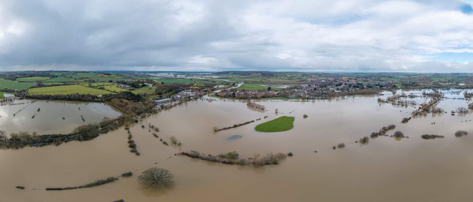
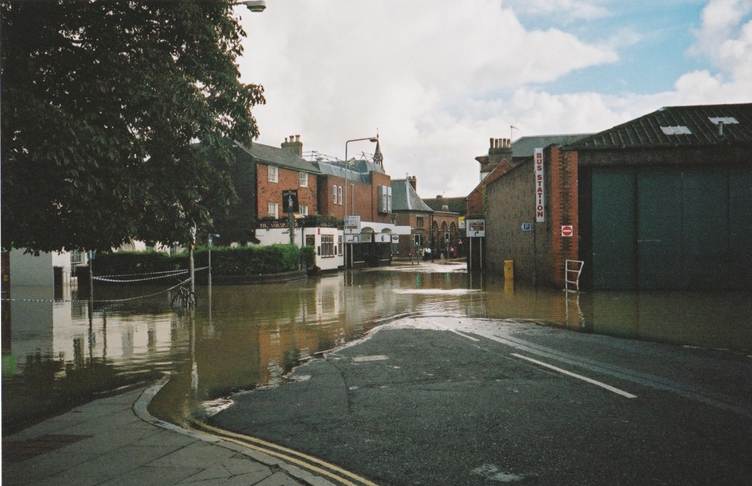
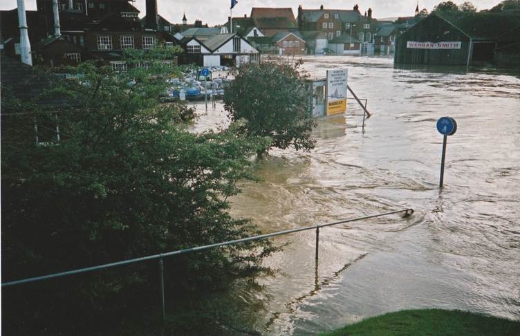
It does not, on its own, capture everything that matters. A flooded village ringed by water is the kind of event that becomes a local reference point long after the water has gone.
What communities often understand differently
Communities rarely experience flooding as an annual exceedance probability.
They experience it as the road that becomes impassable before the map says the property is at risk. The culvert that blocks every winter. The surface water that appears from an unexpected direction. The elderly neighbour who cannot evacuate easily. The school closure. The insurance renewal. The repeated anxiety whenever heavy rain is forecast.
Those experiences may not always fit neatly into a formal model, but they are still part of the risk picture.
Research into local and lay flood knowledge has been exploring this issue for some time. McEwen and Jones' work on building local and lay flood knowledges into community flood resilience planning after the July 2007 Gloucestershire floods emphasised that communities hold forms of knowledge that can support flood planning, particularly where they are combined carefully with expert and institutional evidence.
Local knowledge is not automatically correct. But it often captures details that formal systems miss or underweight: recurring small-scale flooding that never becomes a major recorded event, informal overland flow routes, blocked gullies and ordinary watercourse issues, sewer surcharge behaviour, maintenance failures, local access constraints, vulnerable households, and the practical consequences of flooding after water has arrived.
A member of the Parish Flood Team in the Berkshire village described the distinction with unusual clarity:
I have been able to analyse some things that the Environment Agency haven't done … how flooding works, from things on the ground. They can theorize so that they can come up with modelling and other things, but they haven't got 'knowles', it is an English word for common sense knowledge, thinking on the ground level, not the calculation.
That word, "knowles", captures something the formal evidence base struggles to record. It is the accumulated, often unwritten understanding of how water actually behaves in a particular landscape. It can be wrong. The same group's confidence that the Jubilee River was the dominant cause of the 2002 flood was contradicted by both the Environment Agency and an independent assessment. But the existence of "knowles" as a category is itself useful: it names a form of evidence that is not modelled, not standardised and not easily incorporated, but is nonetheless local, attentive and observational.
This is particularly relevant to surface water flooding, which is often localised, fast-moving and difficult to predict, and concentrated in urban areas where ageing drainage networks cannot cope with modern rainfall intensity. The same issues arise with groundwater flooding, where risk may be slow to emerge, locally variable and poorly represented by headline mapping. The Brookhouse v Environment Agency groundwater case turned partly on the absence of baseline monitoring data: an institutional gap that local observation could in principle have filled.
Communities may therefore appear to be challenging technical evidence when they are actually describing a different part of the same problem.
- A model may ask: where is water expected to go in a design event?
- A resident may ask: why does this junction flood every winter, even when the formal map shows limited risk?
Both questions are legitimate. They operate at different scales.
How flood history is remembered: the case of Datchet
Institutions record floods through evidence that can be standardised: gauge levels, mapped extents, return periods, modelled flood depths and recorded flood outlines.
Communities remember floods differently.
A flood may become significant locally because of who was affected, how long recovery took, whether the emergency response felt adequate, whether access was cut off, whether people felt abandoned, or whether it confirmed long-standing concerns about drainage and development.
This is why flood history is not simply a timeline.
The Environment Agency's Sustainable Flood Memories work recognises that flood memory can exist through oral histories, photographs, physical markers, community narratives and landscape practices. The related academic work on sustainable flood memory frames remembering as part of resilience, not just recollection.
A hydrologically modest event can become socially defining if it exposes vulnerability. A technically significant flood may fade from local attention if it caused little disruption to daily life.
That matters in planning. Local objections are often built around remembered risk rather than modelled probability. A technically robust FRA may demonstrate that a proposed development can be made safe, but the community may still be working from a different flood history: one shaped by blocked roads, overwhelmed drains, emergency vehicles unable to pass, or repeated "near flooding" that never appears in the formal record.
The local account is answering a different question. The technical question is often: can the development be made safe and avoid increasing flood risk elsewhere? The community question may be: will this make an already fragile local situation worse? Those are related questions, but they are not identical.
The clearest illustration of how the same flood history can produce two incompatible readings comes from the 2021 ethnographic study by Kseniia Puzyreva and Daniel H. de Vries of a Berkshire village downstream of the Jubilee River. The study examined two locally formed flood groups that emerged from the same community within roughly a decade of each other, and traced how each fared in its dealings with statutory flood risk authorities.
The Parish Flood Team
The Parish Flood Team formed after the 2002 flood. It interpreted that flood primarily as a hydrological problem and identified the recently opened Jubilee River, an 11.6 kilometre flood relief channel commissioned to protect Maidenhead, Windsor and Eton, as a major contributor to local flood risk. Authorities and an independent flood assessment attributed at most 10 per cent of the 2002 flood effect to the channel. The Parish Flood Team disagreed. It began collecting its own real-time flood data: water levels recalculated in cubic metres per hour, photographic evidence, calibration markers on the riverbank. Relations with the Environment Agency deteriorated to the point where the chair of the team was banned from meetings. After the 2013 flood, the team shifted from confrontation to consultancy, contributing its hydrological knowledge to scheme design, and was eventually treated by the Agency as a trusted partner in the Thames Scheme. One member described the change: "We went all way through from being nothing, but now we are working with them, we are all one team."
The Community Flood Group
The Community Flood Group formed in response to the same 2013 flood. Its concerns were different. During the flood, military assistance had arrived only to tell residents, in the words of one CFG member, "if you don't come together, we cannot help." For the group, the 2013 event was significant not for its hydrological properties but for what it revealed about local preparedness, vulnerability and welfare. The group focused on evacuation arrangements for vulnerable residents, sandbag and medicine distribution, household flood plans and the aftermath of insurance and recovery. The Parish Flood Team acknowledged these concerns but did not act on them. The local flood plan the Parish Team had compiled was, in the words of a CFG member, evidence of "a huge gap between the technical flood plan and the people." Volunteer lists were out of date. Shelter arrangements with the local vicar had not been confirmed. The flood exercise had not been run. The plan, the paper notes, had become a "dead document."
The Environment Agency's newly appointed community resilience advisor treated the Parish Flood Team as the de facto community voice. The Community Flood Group, despite addressing the preparedness and resilience agenda the Agency's own partnership rhetoric explicitly endorsed, was not picked up by any statutory partner. The County Council, as Lead Local Flood Authority and Category 1 emergency planner, had no documented engagement with the group. It lost momentum and eventually ceased its flood management activities.
| Parish Flood Team | Community Flood Group | |
|---|---|---|
| Formed after | The 2002 flood | The 2013 flood |
| Read the flood as | A hydrological problem — flow, levels, the Jubilee River's contribution | A preparedness and welfare problem — evacuation, vulnerability, recovery |
| Main activity | Collecting real-time flood data, calibration, scheme input | Evacuation plans, sandbag and medicine distribution, household flood plans |
| Institutional outcome | Absorbed — became a trusted partner in the Thames Scheme | Unattended — lost momentum and ceased activity |
The paper's conclusion is sharper than the usual academic gloss. To be heard institutionally, the authors argue, community groups are expected to "develop into 'local professionals'", mimicking the language, methods and frames of statutory flood management. Where local knowledge already looks technical, it can be absorbed. Where it does not, it tends to be left unattended, regardless of whether it is addressing a real and unresolved part of the flood risk problem.
This is the mechanism behind the abstract complaint that engagement is not the same as influence. Institutions do not ignore communities. They recognise only the parts of community knowledge that already resemble their own.
The limits of community engagement
Flood risk management policy now places considerable emphasis on partnership working and public engagement. That is welcome. But engagement is not the same as influence.
The Local Government Association's guidance on stakeholder engagement in local flood risk management recognises the need for early, meaningful engagement with communities and stakeholders. Academic work on multi-level stakeholder engagement in flood risk management has also highlighted the practical difficulties of roles, power and conflict within flood governance.
The risk is that engagement becomes informational rather than collaborative. A community is told what the model says. A scheme is presented. A consultation board is displayed. Comments are invited. The underlying evidence framework remains largely unchanged.
This is where the knowledge gap becomes important.
If local knowledge only counts when it can be translated into model-compatible, regulator-compatible or engineering-compatible form, only some communities will be able to influence decisions effectively. Those with technically literate flood groups, professional residents or strong local data will be heard more clearly. Others may be treated as concerned but not evidentially useful. That dynamic is exactly what the Datchet case study describes: the Parish Flood Team's hydrological reading fit the institutional cultural model and was absorbed; the Community Flood Group's preparedness reading did not, and the group dissolved.
The point is wider than one case study. It reflects a governance problem: institutional systems value community knowledge most when it already looks technical.
The problem with "the community"
There is also a danger in speaking about "the community" as though it is a single actor. It rarely is.
A parish council, flood action group or residents' association may be an important local voice, but it will not necessarily represent everyone affected by flood risk. Different people inside one "community" carry very different flood priorities:
- Long-term residents may understand flooding differently from new residents.
- Homeowners may have different priorities from renters.
- Businesses may focus on continuity and access.
- Vulnerable residents may be more concerned with evacuation and welfare.
- Landowners may focus on maintenance and liability.
- Developers may focus on policy compliance and deliverability.
This matters because flood engagement can become distorted when one organised group is treated as the community voice.
The National Flood Forum describes Flood Action Groups as community-led bodies that identify key issues, map their own flood plans, set their own agendas and work with flood risk agencies and authorities. That role is valuable. Flood Action Groups can identify problems, gather evidence, support communication and help sustain local attention between flood events.
Unda's article on CIRIA guidance encouraging communities to help maintain local flood defences reflects the same shift toward shared stewardship. Smaller drainage channels, culverts, trash screens and local assets are often too numerous and locally specific to be understood only through centralised systems.
Organised engagement should not obscure local diversity. One flood group may focus on maintenance. Another may focus on emergency planning. A parish council may prioritise development control. Individual residents may be most concerned about insurance or access. Engagement with one group is not the same as understanding the whole local flood knowledge system.
Why this matters for planning and development
The knowledge gap has direct implications for planning. A development can be technically compliant and still socially unconvincing.
A planning submission may include a compliant FRA, hydraulic modelling, finished floor level mitigation, safe access assessment, drainage calculations, SuDS design and policy justification. All of that may be necessary. In many cases, it will be enough to satisfy regulators and planning authorities. But it may not answer the community's underlying concern.
Local residents may be worried about cumulative development, blocked drainage networks, who maintains SuDS in twenty years' time, whether flood routes will be obstructed, whether emergency access will fail, whether previous local flooding has been properly understood, or whether climate change will make today's design assumptions obsolete.
A Flood Risk Assessment for Planning is designed to assess flood risk in planning terms. It is not a full social trust document. Similarly, a Preliminary Drainage Design for Planning or a report supporting the discharge of drainage planning conditions must demonstrate technical and policy compliance. It cannot, by itself, resolve every concern rooted in local flood memory.
The technical work may be adequate. The communication problem is just different from the calculation problem.
The strongest planning strategies recognise this early. They do not dismiss local concern as irrational simply because it is not expressed in hydraulic modelling terms. The best planning-stage Flood Risk Assessment work identifies the local flood narrative and then explains clearly where the technical evidence addresses it, where it does not, and what residual risk remains.
This is particularly important where development is proposed in or near areas with repeated surface water incidents, historic floodplain development, constrained drainage infrastructure, ageing flood defences, sewer capacity concerns, groundwater susceptibility or limited emergency access. Those are the places where a narrowly technical submission may be policy-compliant but publicly unpersuasive.
The stakes of getting that wrong have risen: Aviva analysis shows around one in nine new homes built in England between 2022 and 2024 sit in areas of medium or high flood risk.
Compliance with Environment Agency flood risk advice remains high: 96 per cent of planning decisions and 99 per cent of new homes in applications complied in 2024/25. But the gap between technical compliance and public confidence is increasingly the issue. Recent appeal decisions including Mead and Yatton show how flood risk evidence must now be framed for residual-risk rigour and alternative-sites credibility, not just for floor level and access standards. The April 2026 reforms to the planning appeals regime push that scrutiny earlier in the process. The cost of failing to address the local flood narrative at submission stage, when it can still be answered with evidence, has gone up.
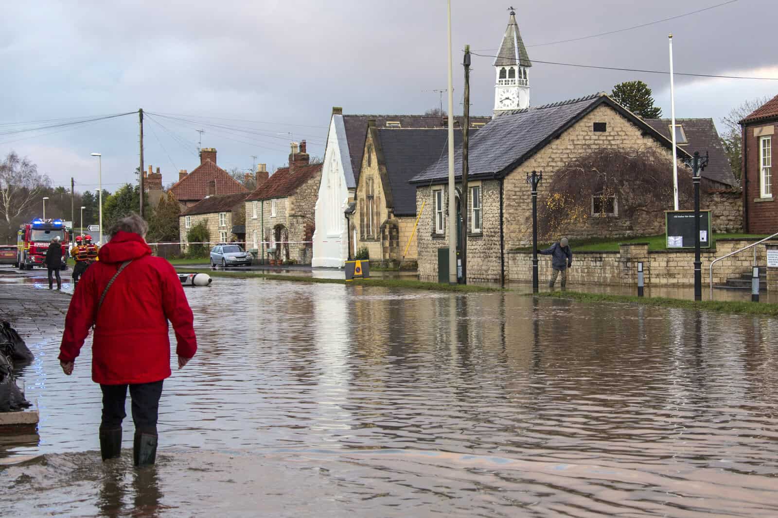
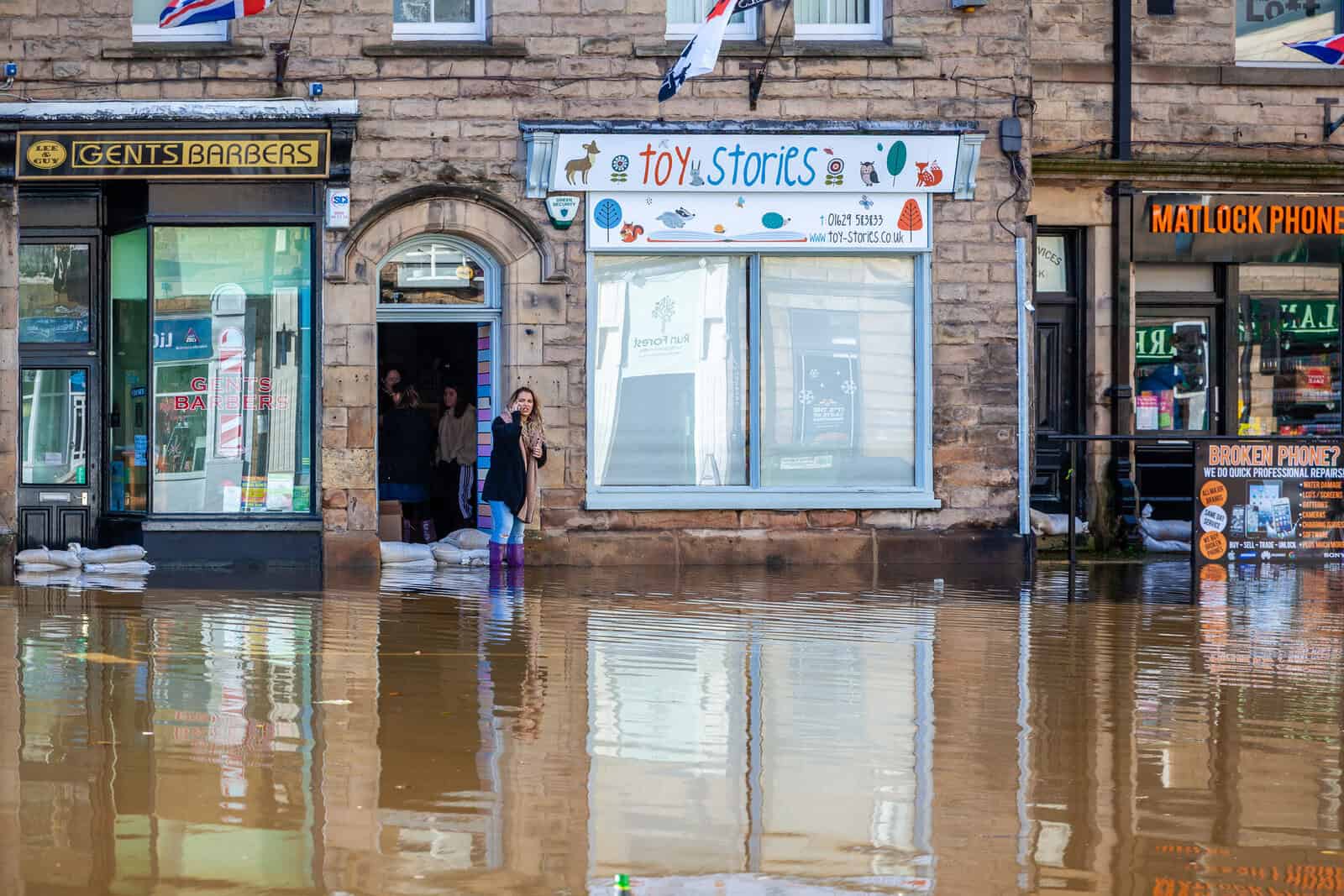
For residents who have walked through their own village in waders, flooding is a lived condition long before it is a planning category. For small businesses, it arrives with sandbags and lost trading days long before any policy document catches up.
FRAs are necessary, but they are not everything
A planning-compliant FRA has a defined role. It assesses flood risk from relevant sources. It considers climate change. It examines site levels, flood extents, flood depths, access and egress, vulnerability, mitigation, floodplain storage and off-site impacts. It supports the planning authority in determining whether development is acceptable in policy terms.
Unda's guide on how to do a Flood Risk Assessment for planning explains why this requires more than checking the Flood Map for Planning. The process often requires topographical data, modelling outputs, drainage assessment and policy interpretation.
But an FRA is not a guarantee that flooding will never occur. It is not a substitute for emergency planning. It is not a long-term maintenance plan. It is not always a public engagement strategy. It is not a universal answer to every local concern.
Communities sometimes expect technical reports to answer questions they were never designed to answer. An FRA may demonstrate that a development will not increase modelled off-site flood risk in the design event. That does not answer whether residents trust the maintenance regime for a proposed attenuation basin. It may demonstrate safe access within defined criteria. That does not reassure a community with lived experience of roads becoming impassable during intense rainfall. It may show that finished floor levels are above the design flood level. That does not address the wider disruption residents associate with flooding: loss of power, school closures, vehicle damage, insurance claims or prolonged recovery.
Those wider issues may sit outside the narrow scope of the planning assessment, but they are not irrelevant to how flood risk is understood locally.
Residual risk and the limits of deterministic thinking
The knowledge gap is likely to become more important as climate change changes the character of risk. The Environment Agency's latest national assessment makes clear that the updated flood risk picture reflects both improved data and changing future risk. Better models are revealing more exposure. Climate projections indicate that flood risk is likely to increase over the lifetime of many developments.
SWFFIP, the Surface Water Flood Forecasting Improvement Project, is one of the clearest examples of where this is heading. The Flood Forecasting Centre is moving from deterministic, zone-based language toward probabilistic, ensemble-based impact forecasting. Forecasting and planning are not the same activity, but they are increasingly drawing from overlapping datasets: rainfall data, terrain information, impact thresholds, receptor types and NaFRA mapping. As forecasting and planning evidence converge, "we used the published map" defences weaken. So does the language of safe and unsafe. Flood risk is increasingly about probability, uncertainty, depth, velocity, hazard, exposure, warning time, recovery and residual risk.
The Fens 2100+ programme demonstrates the same point on the asset side.
The Fens depend on more than 17,000 flood risk assets, of which the Environment Agency's baseline report projects 89 per cent will reach end of life by 2075.
Communities living in such places already know their defences are finite, even if they do not use the language of residual risk or asset end-of-life. The institutional vocabulary is catching up with what the community has long lived with.
Technical reports therefore need to avoid overclaiming certainty. They should explain what has been modelled, what assumptions have been made, what event standards have been used, what happens during exceedance, who maintains the drainage or defence assets, and what residual risk remains. That kind of explanation is part of making technical evidence usable. It is not a substitute for technical rigour.
The danger of overcorrecting
There is a tempting but flawed response to the knowledge gap: to say that local knowledge should simply be given more weight than expert evidence. That would be a mistake.
Local knowledge can be highly valuable, but it can also be selective, incomplete or mistaken. People may misattribute the cause of flooding. They may remember the most disruptive event rather than the most relevant one. Flood narratives can become politically amplified. Local experience can identify a problem without proving a mechanism.
The Datchet case study itself illustrates that limit. The Parish Flood Team's confidence that the Jubilee River was the primary cause of the 2002 flood was contradicted by both the Environment Agency and an independent assessment, which attributed at most 10 per cent of the flood effect to the channel. The team was operating on attentive local observation, but observation alone cannot establish causation. The same instinct that produced a valuable real-time data record also produced a misdiagnosis.
Wider research on lay flood knowledge warns against romanticising local knowledge or treating expert and lay knowledge as simple opposites. The more useful approach is hybrid: combining different forms of knowledge while recognising their limits. Hydraulic modelling can show where water is likely to go. Local knowledge can identify where water has gone, where systems have failed, and what consequences mattered most. Technical evidence can assess probability and mitigation. Community knowledge can reveal vulnerability, preparedness and trust.
The aim is to improve the evidence base, not replace expertise.
This is especially important because flood risk is a multi-source problem. River levels may affect surface water drainage. Surface water may surcharge sewers. Groundwater may persist long after rainfall stops. Infrastructure flooding may sit outside national mapping. Community reports can help identify these interactions, but they still need technical assessment to establish causation, probability and mitigation.
Towards better flood governance
Better flood governance requires better translation between different forms of flood knowledge. That could include participatory mapping of local flood routes and drainage issues, clearer explanation of uncertainty and residual risk, engagement before technical conclusions become fixed, better recognition of preparedness and vulnerability evidence, clearer distinction between modelled hazard and lived consequence, and long-term communication rather than one-off consultation.
Government research on community and citizen engagement in flood risk management points toward the same broad problem: engagement needs to build trust, improve preparedness and support better decisions.
Citizen science and local monitoring may also have a role. Research on citizen observatories and water governance shows how public participation can move beyond consultation into monitoring, data generation and shared understanding.
Institutions can learn from community-relevant events when forced to. The 2004 Boscastle flood produced catastrophic flooding in a small, steep catchment that national mapping at the time did not capture. It drove the move to higher-resolution Met Office models capable of resolving the convective rainfall that older models had missed, and fed the case for the national forecasting capability later delivered through the Flood Forecasting Centre. The Brookhouse v Environment Agency groundwater case offers the inverse lesson. A damage chain that played out gradually in heritage buildings was nearly impossible to litigate because there was no pre-construction groundwater monitoring. The Tribunal had to reconstruct, after the fact, what residents had already known. The cost of not having local baseline evidence integrated into the institutional record was paid years later in court.
This is not always easy. Local data must be quality-controlled. Responsibilities must remain clear. Statutory decisions still need defensible evidence. But the direction is important. Flood risk management will need to become better at integrating technical rigour with local intelligence.
For developers, that means recognising that flood objections are not always simply resistance to development. They may contain useful information about historic drainage problems, maintenance failures, access constraints, informal flood routes and local trust deficits. For public authorities, it means not treating one organised stakeholder as the entire community. It also means acknowledging that preparedness, welfare and recovery are legitimate flood risk concerns, not just secondary social issues. For consultants, it means acting as translators. A good technical team should be able to explain what the evidence proves, what it does not prove, and how local information has been considered.
From flood data to usable flood knowledge
The future of flood risk management is not purely technical. That does not mean modelling, mapping, standards or engineering are becoming less important. They are becoming more important. Climate change, surface water complexity, ageing infrastructure and development pressure all require better technical evidence, not less.
The National Planning Policy Framework published in August 2026, together with the September 2025 PPG update, now requires the Sequential Test to address all flood sources: fluvial, tidal, surface water, groundwater and reservoirs, with climate change impacts. Increasing rainfall intensity means historic flood data is no longer a reliable guide to future conditions. The institutional evidence base is broadening and tightening at the same time. None of that reduces the gap this article has been describing. If anything, it makes the gap more consequential, because the technical evidence is now doing more of the work of justifying where and how people will live in a changing climate.
But technical evidence alone will not close the gap between institutional decisions and community understanding. Flood risk is both a physical process and a lived condition. Models can show flood extents. Local knowledge can show what those extents mean. A drainage strategy can calculate attenuation. Residents may know where maintenance fails. A flood map can classify probability. Communities remember disruption.
The challenge is recognising that expert and community knowledge describe different parts of the same problem. Flood risk management will always need models, maps and levels. But if the system only values knowledge that already looks technical, it risks missing the forms of flood knowledge that explain how communities actually live with water.
What this means for FRA practice
A deep dive is not a checklist, but the argument above does have practical consequences for how flood risk evidence is prepared, framed and delivered. Five points follow.
- Identify the local flood narrative before the technical work is finalised. Most planning sites in flood-relevant locations carry some local memory: a road that floods every winter, a junction that backs up, a culvert that blocks, a development that residents already blame for changing drainage behaviour. That narrative will surface in objection letters, parish council minutes, planning committee speeches and appeal statements. It is far easier to address in a planning-stage Flood Risk Assessment than under the April 2026 planning appeals procedure, where new evidence cannot easily be introduced.
- Address the narrative explicitly rather than implicitly. A compliant submission may demonstrate that finished floor levels are above the design flood event, that the Sequential Test is satisfied and that off-site flood risk does not increase. That is necessary, but it does not answer concerns about cumulative development, blocked drainage networks, SuDS maintenance over decades, or the trust deficit a community may have built up with previous developers and authorities. The strongest submissions name the local concern, explain where the technical evidence answers it, where it does not, and what residual risk remains.
- Separate modelled risk from lived consequence in the writing. Modelled flood depths, hazard ratings and velocities describe a design event in defined terms. The lived consequences sit alongside that evidence rather than within it. School closures, vehicle damage, insurance renewal anxieties, evacuation difficulty and recovery time are real, but they are not what an FRA's design event quantifies. Acknowledging the distinction openly is more credible than collapsing both into "the site is safe."
- Explain residual risk in plain language. As flood evidence moves toward probabilistic, multi-source and impact-based framings, the gap between technical and lay vocabulary widens. A submission that translates probability and exceedance into language non-specialists can actually use does more work for the application than one that hides behind the modelling. What happens during a storm bigger than the design event? Who maintains the attenuation basin in twenty years? What is the warning time? Those are answerable questions.
- Recognise that the client's strongest local objector may not be the most technically literate one. Where local opposition comes from a flood action group with engineering capability, the assessment must answer it in technical detail. Where opposition is grounded in preparedness, vulnerability or recovery, a different register is needed. Both are legitimate. Neither is well served by a submission that defaults to a single language.
None of this changes what a Flood Risk Assessment is. It remains a planning document with a defined role and a defined standard. But it increasingly has to function as both technical evidence and a piece of planning communication. The firms that treat it as both will produce stronger applications than those that treat it as only the first. Unda's Flood Risk Assessment for Planning work is built on that principle.
Frequently asked questions
Can local or community flood knowledge be used as evidence in a planning application?
Yes, but as supporting evidence rather than proof. Local accounts of where water has gone, which roads close and which drains back up can shape the questions an assessment asks and point it at real overland flow routes. To carry weight in a decision it has to be corroborated with modelled or recorded evidence. It supplements the technical case; it does not replace it.
What is a Flood Action Group, and how do you start one?
A Flood Action Group is a community-led body that records local flooding, builds a local flood plan and works with the Lead Local Flood Authority, the Environment Agency and the district council between and during flood events. The National Flood Forum helps residents set one up. A group tends to be heard soonest when it gathers evidence rather than only raising concern.
Does a Flood Risk Assessment take account of a community's past flooding?
A site-specific assessment reviews recorded historic flooding from Environment Agency data and the Strategic Flood Risk Assessment, but the official record and local memory often diverge. The strongest assessments seek out the local flood narrative as well, then explain where the technical evidence answers it, where it does not, and what residual risk is left.
Is the flood knowledge gap the same as the flood insurance gap?
No. The insurance or protection gap describes properties that are uninsured, hard to insure or short of physical defence. The flood knowledge gap in this article is a different problem: the distance between how institutions model and map flood risk and how communities remember and experience it. A property can sit inside one gap, both, or neither.
Who decides how much weight community flood concerns carry in a planning decision?
The local planning authority is the decision-maker. It is advised by the Lead Local Flood Authority on surface water and ordinary watercourses and consults the Environment Agency on main-river and sea risk. Community representations are a material consideration, but they weigh most where they are backed by evidence the authority can test.
What can a community do to get its flood knowledge taken seriously?
Record it, and record it in a form an authority can test. Log the dates, depths, photographs, road closures and drain behaviour as flooding happens, share that log with the Lead Local Flood Authority and the Environment Agency, and frame it as observation rather than blame. Local accounts carry the most weight when they read as evidence: a dated record of where water actually went, not a general worry about where it might.
Do flood objections from residents change a planning decision?
They can, when they raise a material planning consideration and are backed by evidence. Flood risk is a material consideration, so a substantiated objection, such as a documented history of surface water flooding or a culvert that blocks every winter, can shape the conditions attached to a permission or support a refusal. A general fear of flooding, with nothing on record behind it, carries far less weight. A formal objection from the Environment Agency or the Lead Local Flood Authority weighs heaviest of all.
About the author. Edward is a co-founder and Director of Unda with 20+ years in flood risk and drainage, and a national-press commentator on flooding. Unda has been trading since 2014, is a CIWEM Business Partner with CIWEM member and chartered (C.WEM MCIWEM) consultants, and has delivered 5,000+ flood risk assessments and drainage strategies across England and Wales.
Edward Bouët · BSc (Hons)
Latest news




One of our experienced Flood Risk Consultants will get back to you within 60 minutes
