What is the River Thames Scheme, and why is it delayed?

Estimated reading time 23 minutes
The River Thames Scheme is a planned flood relief project on the lower Thames between Egham and Teddington, led by the Environment Agency and Surrey County Council. It would cut two new flood channels through Runnymede and Spelthorne and upgrade three weirs downstream, reducing fluvial flood risk to around 11,000 homes and 1,600 businesses. As at 24 September 2026 it has no Development Consent Order, no construction date and one year of confirmed funding.
The mid-project review closed on 28 May 2026 and confirmed that the design needs no changes. Four months later, the scheme's consent page still gives no date for the application that would allow construction to begin.
The River Thames Scheme delays matter to more people than the delivery partners. Until the channels exist, the land they are meant to protect floods as it always has, and every site-specific flood risk assessment for planning in the reach has to describe the risk without them. The sections below explain what the scheme is and how it would work, why it has stalled, what it will cost and when it might be built. The consequences for planning applications, including a January 2026 appeal the scheme could not rescue, are set out in their own section further down.
What is the River Thames Scheme?
The River Thames Scheme is a flood alleviation project for the stretch of the non-tidal Thames between Egham and Teddington, one of the largest areas of developed floodplain in England without formal defences. It combines two new flood relief channels with extra river capacity downstream, so that high flows can bypass the most exposed communities instead of spreading across them.
The reach has a long flood record, with major events in 1947, 1968 and 2003, and in the winter of 2013 to 2014, when around 1,000 homes flooded across the Thames area. Defra's 2022 appraisal recorded more than 15,000 properties at risk from a flood with a 1% annual exceedance probability, the benchmark used for the flood zones on the Environment Agency's planning map. The scheme is the long-term answer set out in the Lower Thames Flood Risk Management Strategy, which Defra accepted in 2011 after more than 50 options had been tested.
The two channel sections carry the scheme. The published route description places the Runnymede section between Egham Hythe and Chertsey, running through Fleet Lake and Abbey Lake before returning to the Thames along Burway Ditch below Chertsey Weir. The Spelthorne section runs from Laleham, through the Littleton and Sheepwalk lakes and Ferris Meadow Lake, to rejoin the river opposite D'Oyly Carte Island. Both pass through towns that already carry high river flood risk, including Egham, Staines-upon-Thames and Chertsey.
| Element | Detail | What it means in practice |
|---|---|---|
| Runnymede channel | About 4.8 km long, typically 3 to 4 m deep and 20 to 50 m wide | The upstream section, where modelled level reductions are greatest |
| Spelthorne channel | About 3.2 km long, similar cross-section | Runs from Laleham towards Shepperton, upstream of the Desborough Cut |
| Downstream capacity | Bed lowering below the Desborough Cut; new or modified gates at Sunbury, Molesey and Teddington weirs | Lets the channels move water without raising risk further down the river, on the same logic as level-for-level compensatory storage on a development site |
| Operating threshold | Intake gates begin to open above roughly 230 cubic metres per second, a flow reached on average about once a year | A high-flow channel, not a permanent watercourse |
| Diverted flow cap | Around 150 cubic metres per second | Above that, flooding still happens, at reduced depth and extent |
| Stated benefit | Around 11,000 homes and 1,600 businesses better protected | The current official figure, unchanged by the review |
A third channel section, from Datchet to Hythe End, was part of earlier designs. Spelthorne Borough Council's scheme page records that it was dropped because the Royal Borough of Windsor and Maidenhead could not raise the funding, and that its removal does not change the existing flood risk there. The scheme's own overview film sets out the whole project.
How would the flood channels work?
The channels only take water when the Thames is running high. In normal conditions their intake gates stay shut; once flows pass the operating threshold the gates open gradually, drawing part of the flood peak off the main river at a managed rate and returning it downstream. The river still floods in a severe event, but to lower levels and over a smaller area.
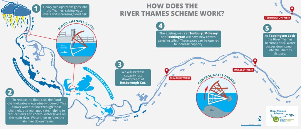
Spelthorne Borough Council's description of the design is a road bypass: the channel gives floodwater a different route round the town, but the volume passing downstream stays the same. The channels do push up to 2% more flow towards Kingston, and the capacity works below the Desborough Cut and at Sunbury, Molesey and Teddington weirs are there to absorb it. The partners' modelling reports no increase in peak river levels at any location, in any flood condition tested.
The modelling behind these figures is unusually strong for a scheme of this age. It draws on one of the longest continuous hydrometric records in the UK, has been calibrated against observed floods and has been through several rounds of independent peer review; the flood modelling tools and techniques involved are the same family used on individual sites. The promised benefit is uneven and specific to location: reductions of up to around 0.9 m near the upstream end of the Runnymede channel, up to around 0.8 m alongside the Spelthorne channel, up to about 0.5 m through Staines, tailing off towards Datchet and Windsor, and around 0.2 m below Shepperton. Below Teddington the effect is neutral.
The scheme has no single design standard, so it does not protect every property to the same flood. Its "no detriment" outcome also depends on the downstream works and on how the structures are operated, not on fixed infrastructure alone.
Why is the River Thames Scheme delayed?
The River Thames Scheme is delayed because most of its work stopped for a mid-project review that ran from late autumn 2024 to May 2026, and the programme has not yet restarted in a form that sets dates. The review cleared the design, but the business case has to be rewritten under new funding rules and the consent application has still not been made.
The review was commissioned by the Environment Agency and Surrey County Council and carried out independently by the Infrastructure Projects Authority, since renamed the National Infrastructure and Service Transformation Authority. It tested whether channels with weir improvements remained the best option, and whether the project team was organised to deliver a scheme of this scale. On the first question, the answer was unambiguous.
The review has now ended and has confirmed that channels with weir improvements is still the best option for reducing flood risk. This is excellent news and RTS will proceed on this basis with no changes required to the design of the flood defences.
River Thames Scheme, mid-project review update, 28 May 2026
While the review ran, the partners paused most activity not directly related to it. That pause is what the MP for Spelthorne described in the Commons as leaving the project "in abeyance", with a call for ministers to "knock some heads together". In a written answer reported by the BBC in February 2026, the water minister put development spending to that point at £104 million.
Several things now stand between the scheme and a spade in the ground.
- The management reset. The review recommended changes to how the project is run, and the partners describe that post-review reset as still ongoing.
- The business case. The outline business case is being rewritten to fit the new Defra partnership funding policy that took effect in April 2026. The partners aimed to submit it to Defra and HM Treasury before summer 2026; no published source has confirmed that it went in.
- The Development Consent Order. As a Nationally Significant Infrastructure Project, the scheme needs consent before construction money is released. Spelthorne's February 2024 committee papers expected the application early the following year.
- Ferris Meadow Lake. The scheme's consent page says options for the channel around the lake still need further community engagement, and that this must happen before the application goes in. The page was updated on 21 September 2026 and still gives no submission date.
On 24 September 2026 the scheme's former project page on the Planning Inspectorate's national infrastructure service returned "page not found", and the River Thames Scheme did not appear in the Inspectorate's project search.
No public explanation has been given for that change, and it should not be read as a withdrawal; the scheme's own site still describes it as at pre-application. It does leave the public record thinner than it was a month ago. The Government's policy paper on the scheme was last updated in October 2024, and the official line is that final timescales will become clearer once the business case has been approved.
What will the River Thames Scheme cost, and who is paying?
No current total cost for the River Thames Scheme's flood relief channels and weir works has been published. The figures in circulation range from £346 million to £640 million, all at least two years old, and the partners have said updated costs will come with the revised business case. What is confirmed is a much smaller sum, covering a single financial year.
| Figure | What it covers | Source and date |
|---|---|---|
| £501m | Total project cost at outline business case approval, with £285m of government approval and a £270m Surrey County Council contribution | Surrey County Council, June 2021 |
| £346m present value | Whole-life cost including 48% contingency, against a benefit-cost ratio of 7.97 and a partnership funding score of 183% | Defra Accounting Officer assessment, March 2022 |
| £640m | Total scheme cost, with £70m spent on pre-construction since 2014, obtained under freedom of information | New Civil Engineer, August 2023 |
| About £500m | Total scheme, with a £300m construction partner contract advertised | Ground Engineering, February 2024 |
| £104m | Development spending to date, given in a ministerial written answer | Reported by the BBC, February 2026 |
| Not published | No updated total since the mid-project review | Environment Agency and Surrey County Council, as at September 2026 |
The Environment Agency's published scheme list allocates £17,047,000 to the River Thames Scheme for 2026/27 and states that funding for projects beyond 2026/27 is subject to review.
The funding rules underneath all of this changed in April 2026, when Defra abolished the partnership funding calculator that had run since 2011. New and improved projects are now fully funded for the first £3 million and 90% funded above it; partner contributions are no longer mandatory but improve a project's priority, and schemes are ranked on benefit-to-cost ratio with weightings for deprivation and natural flood management. The mechanics are set out in the guide to the 2026 FCERM funding reform, and the national settlement it sits inside in the note on £1.4bn of flood defence funding for 2026/27. Only projects with a full business case approved by 31 March 2026 kept the old rules, and the River Thames Scheme did not have one. Whether Surrey County Council's £237 million commitment survives the change has not been addressed in any published 2026 source, including the council's own budget papers.
When will the River Thames Scheme be built?
Nobody can currently say when the River Thames Scheme will be built, because no construction start date has been published since the review. Every date the partners have given has slipped, and the scheme once expected to be finished by 2029 now has no programme in the public domain at all.
| Date of statement | Construction | Consent | Source |
|---|---|---|---|
| March 2022 | Start "around 2025/26", complete by 2029 | Not stated | Spelthorne Borough Council committee report |
| February 2024 | Not stated | DCO submission "early next year" | Spelthorne Borough Council committee report |
| April 2024 | "I'm not absolutely sure when we'll get a spade in the ground" | Consents hoped for later that year | Surrey County Council leader, quoted in Surrey Live |
| February 2026 | Updated timetable promised with the business case "this summer" | DCO timetable to follow | Water minister's written answer, reported by the BBC |
| May 2026 | Not published | Not published | River Thames Scheme mid-project review |
Some official pages have not caught up. Spelthorne Borough Council's scheme page still cites an indicative programme with construction from winter 2026 and the scheme operational by winter 2030, a timeline the review has overtaken. Ben Spencer, the MP for Runnymede and Weybridge, said in February 2026 that the original targets, delivery by 2030 at a cost of £500 million, would both be "missed by a mile".
Is the delay unusual among flood schemes?
The delay is unusual in one specific way: the engineering has been independently confirmed, yet the scheme has neither consent nor a construction contract after more than a decade of development. Other large English flood schemes have finished or are being built, which makes the River Thames Scheme harder to explain rather than easier.
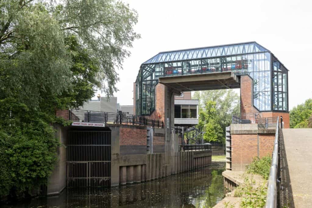
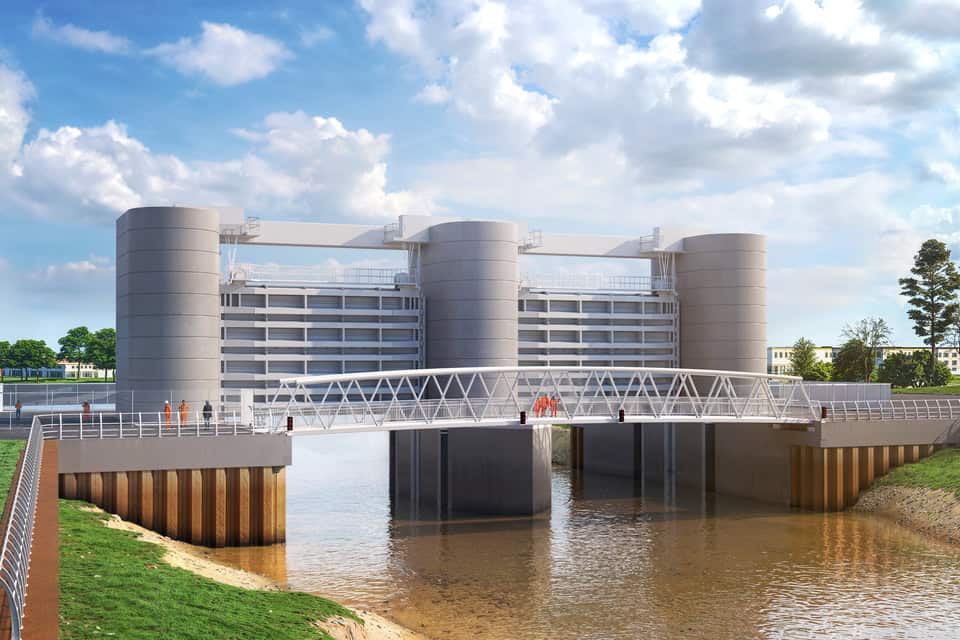
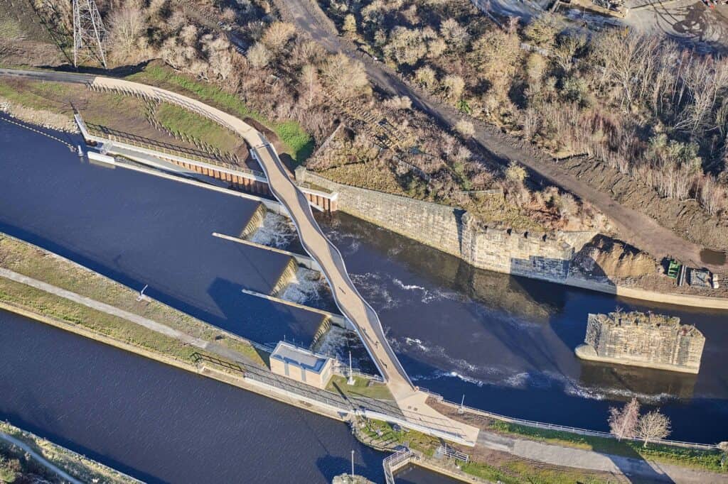
Leeds is finished and Bridgwater is being built. The Leeds scheme now gives one-in-200-year protection with a climate change allowance, and the Bridgwater tidal barrier drew £59,293,000 in 2026/27. Delay elsewhere is real but of a different order.
- Hebden Bridge. The £81 million Calderdale scheme slipped again in August 2026, with construction pushed from 2027 to early 2028 and full business case approval now expected in mid-2027.
- Oxford. The Compulsory Purchase Order for the £176 million Oxford Flood Alleviation Scheme was confirmed in May 2025, with construction expected to begin in late 2026.
The Environment Agency's executive director for flood and coastal risk management acknowledged the wider pressure in March 2026: "for others, funding gaps remain, and schemes that local people have been hoping to see progress will not move forward this year." The national picture behind that admission is covered in the analysis of what the National Audit Office found on England's flood defences, including the fall in the forecast from 336,000 properties better protected to 200,000. The Environmental Audit Committee returned to the same ground in October 2025, calling England's approach fragmented and reactive, noting that high-consequence assets in their required condition had fallen from 98% in 2018–19 to 93% by 2024, and recommending that funding reach at least £1.5 billion a year by 2030; the consequence for property owners is set out in the piece on below-standard flood defences.
What the River Thames Scheme adds is a specific failure mode. Defra's 2022 assessment records £42.8 million already approved and a further £61.1 million sought to develop the full business case, and the February 2026 ministerial answer put spending at £104 million. Tens of millions have gone into a project that has not reached the starting line. That is a programme problem for the delivery partners, distinct from the Environment Agency's role in flood risk planning and from Defra's policy and funding role. Meanwhile the hazard keeps moving: increasing rainfall is reshaping flood risk across the UK, and delays in flood risk data are already slowing planning and housing decisions.
What does the delay mean for planning applications?
For planning, the River Thames Scheme counts for nothing until it is built. A site between Egham and Teddington has to be assessed on the flood risk as it stands today, with no allowance for channels that do not exist, and a planning inspector has already refused to give the scheme weight. This section is written for applicants, agents and buyers with a site in the reach.
On 26 January 2026 an inspector dismissed two appeals at Priory Stables, Shepperton, a site inside the borough the scheme is meant to protect. The scheme was put to him, and he declined to weigh it.
I have been referred to the River Thames Scheme – a project being developed by the Environment Agency (EA) and Surrey County Council to reduce flood risk in the area. However, that scheme is currently subject to a review and so its relevance to the scheme before me is not currently clear.
Inspector Peter Willows BA MRTPI, appeal decision APP/Z3635/W/24/3348103, 26 January 2026
The appeal turned on safety rather than on the scheme. The site sits mainly in Flood Zone 2 with a small part in Flood Zone 3, the mobile homes on it are a highly vulnerable use, and although the homes stood above modelled flood levels the land around them would flood, leaving no dry access. Chertsey Road was rated "Danger for Most", reliance on flood warnings was rejected, and the Sequential Test had not been passed. A promised defence could not repair any of that.
The practical effect is severe. An application in the reach that relies on the scheme risks refusal, an Environment Agency objection or a failed appeal, and a consent won on promised protection cannot be taken back if that protection never arrives.
National guidance already sets the approach. Planning Practice Guidance says existing flood risk management infrastructure should initially be ignored when assessing risk, because its long-term funding, maintenance and renewal are uncertain; that applies with more force to infrastructure that does not yet exist. The August 2026 National Planning Policy Framework moved flood risk into a standalone Chapter 18 without changing this, and Annex F still records that the Flood Zones do not account for defences. Only functional floodplain is defined with existing infrastructure operating. That is also why a site behind a completed defence stays in its flood zone.
For a site in Runnymede, Spelthorne or Elmbridge, that points to a method that survives the delay.
- Establish the baseline undefended. Model and describe the risk as it stands today, without the scheme and without assuming its delivery, the same starting point a Strategic Flood Risk Assessment uses.
- Run the Sequential Test on that baseline. Guidance requires the test to ignore flood risk management infrastructure, so a proposed scheme cannot narrow the search area; Sequential and Exception Test reports should be prepared on that basis.
- Present any with-scheme case as a labelled sensitivity. It can show what the scheme would achieve. It cannot carry the assessment.
- Test the residual risk if the scheme slips or is never built. Guidance expects an assessment to consider whether funding is available for future improvement, and here it is confirmed for one year only; the residual risk belongs in the assessment, not in a footnote.
- Plan safe access and evacuation now. Where dry access fails, as it did at Priory Stables, a flood warning and evacuation plan has to work on today's flood levels.
- Date the evidence and state what it relies on. Since April 2025 an assessment has to appraise the suitability of the datasets it uses, and lead local flood authorities increasingly ask for the same discipline on any strategic scheme cited.
The same applies to anyone buying in Molesey, Walton-on-Thames or Weybridge: a flood risk survey for a property purchase should price the risk as it is, not as the scheme's publicity suggests it may become.
Where does this leave the lower Thames?
The River Thames Scheme is a well-evidenced answer to a real problem, and nothing in the past year has weakened the case for building it. The lower Thames still floods. What the past year has shown is how little a strong technical case achieves once consent, funding and programme fall behind it, and how quickly a planning system that deals in certainties learns to set aside a scheme that cannot offer one. The same tension is visible well beyond Surrey, including at some of the country's most recognisable landmarks.
Until the Development Consent Order is submitted and a construction date published, the defences are not there and should not be assumed. A site-specific flood risk assessment that treats the scheme on that basis, backed by specialist River Thames flood risk assessment work and the surface water drainage strategy that usually sits alongside it, is the basis on which an application in the reach will be judged.
Frequently asked questions
Does the River Thames Scheme change my flood zone?
No, and it would not even if it were built. The Flood Map for Planning shows the extent of flooding from rivers and the sea without defences, so a site behind a completed scheme normally stays in Flood Zone 2 or 3. Only Flood Zone 3b, the functional floodplain, is defined with existing infrastructure operating effectively.
Will Surrey's local government reorganisation affect the scheme?
It changes who the Environment Agency works with rather than what is being built. Surrey is being reorganised into two unitary councils in 2027: Runnymede and Spelthorne fall within West Surrey and Elmbridge within East Surrey, and the scheme partners have said the Environment Agency will work with the new councils from that point.
Does the Jubilee River already protect properties in the scheme area?
No. The Jubilee River is a separate 11.6 km relief channel opened in 2002, running from Taplow around Maidenhead, Windsor and Eton before rejoining the Thames near Datchet. It sits upstream of the River Thames Scheme reach and protects a different set of properties.
Can a developer contribute to the scheme to get a site through planning?
A contribution can help the scheme's prioritisation, but it does not make an unbuilt scheme something a flood risk assessment may rely on. Under the funding policy in force since April 2026, partner contributions are no longer mandatory and instead improve a project's ranking. The planning test is unchanged: the assessment is judged on the risk as it stands.
Does a stalled scheme mean the Environment Agency will object to my application?
Not automatically. The Agency assesses the application against the risk on the ground and the evidence submitted with it. An assessment that leans on the scheme is more likely to draw an objection than one that assesses the site undefended and treats the scheme as a sensitivity.
Will the scheme make flooding worse downstream in Kingston or Richmond?
The partners' modelling says not. The channels send up to 2% more flow towards Kingston, and the extra capacity at Sunbury, Molesey and Teddington weirs is designed to take it, so peak levels do not rise anywhere in the conditions tested. Below Teddington the river is tidal, and flood risk there is governed by the Thames Barrier and the tidal defences rather than by this scheme.
Why is Datchet no longer part of the River Thames Scheme?
A third channel section from Datchet to Hythe End was included in earlier designs, but the Royal Borough of Windsor and Maidenhead could not raise its share of the funding, so it was taken out. Spelthorne Borough Council's scheme page says the removal leaves flood risk in the area unchanged, and that the Environment Agency is still working with the Royal Borough on other options.
About the author. Edward is a co-founder and Director of Unda with 20+ years in flood risk and drainage, and a national-press commentator on flooding. Unda has been trading since 2014, is a CIWEM Business Partner with CIWEM member and chartered (C.WEM MCIWEM) consultants, and has delivered 5,000+ flood risk assessments and drainage strategies across England and Wales.
Edward Bouët · BSc (Hons)
Latest news


One of our experienced Flood Risk Consultants will get back to you within 60 minutes