Camp Mystic and the UK: Could a Flood Like Texas Happen Here?
Estimated reading time 29 minutes
The Camp Mystic flood of 4 July 2025 killed 28 people at a single riverside summer camp in the Texas Hill Country, 25 of them children. Two official investigations have since reported, and both reached the same uncomfortable conclusion: the water was extraordinary, but the deaths were avoidable. For anyone working in UK flood risk, that raises a direct question. Would the English planning system have stopped a camp being built where that one was?
The honest answer is partly. England would almost certainly have refused permission for permanent children's sleeping accommodation in the functional floodplain, and the sequential test would have bitten hard on the site. But England has no flood warning service at all for its largest flood risk category, no statutory duty on an existing campsite to hold an evacuation plan, and a permitted development right that lets a temporary campsite skip the flood tests entirely. The failure mode here would look different. It would still exist.
The Environment Agency's national assessment puts 4.6 million properties in England at risk of surface water flooding against 2.4 million from rivers and the sea, and surface water is the source it does not warn for.
This article revisits the Texas floods of 2025 against the settled record rather than the first reports, and works through what each finding would mean on an English site. Where the original version of this piece was written in the first week, when the Texas flooding was still being counted, everything below now rests on the two completed investigations.
What happened at Camp Mystic on 4 July 2025?
Between about 01:00 and 04:00 on 4 July 2025, roughly three hours of rain over the South Fork of the Guadalupe River in Kerr County, Texas, produced a flood wave that reached Camp Mystic before dawn. The river at Hunt rose from around ten feet to 37.52 feet in a little over two hours. Twenty-eight people at the camp died, and 119 died in Kerr County as a whole.
Where did the Texas flooding happen? In Kerr County, in the Texas Hill Country of south-central Texas, roughly 60 miles north-west of San Antonio, in the belt of steep limestone catchments and thin soils that American hydrologists call Flash Flood Alley. Camp Mystic stood at Hunt, immediately upstream of Kerrville, on the South Fork. That geography is most of the answer to why the Camp Mystic flood behaved as it did. Rain falling on those upland ridges reaches the river in minutes rather than hours, and the July 2025 storm, moisture drawn north from an unusually warm Gulf on the remnants of Tropical Storm Barry, dropped it over exactly the wrong catchment.
Correcting the early figures. The numbers first reported in July 2025 have moved a long way, and in one case they moved for a reason worth stating plainly. Kerr County's confirmed toll is 119: 117 bodies recovered and identified, plus two people never found. Statewide the figure is at least 135, and no fully reconciled total exists. The "173 missing" reported in the first week never represented 173 probable deaths. It was an artefact of duplicate reports and uncontacted holiday-weekend visitors, and verification work had reduced it to three by 19 July and two by 23 July. At Camp Mystic itself, 28 died: 25 campers, two counsellors and the camp's co-executive director, as the Texas legislative investigation records. There were 557 girls in the camp's care that night.
The hydrology. The USGS gauge at Hunt failed at 05:10 with the stage at 37.52 feet and still rising nearly linearly, so the recorded peak is a floor rather than a ceiling. Peak discharge has been estimated indirectly from surveyed high-water marks at around 314,000 cubic feet per second. That comfortably exceeded the 1932 flood, which had stood as the benchmark for 93 years.
| Date | Peak stage | Peak discharge | Status of the record |
|---|---|---|---|
| 4 July 2025 | 37.52 ft (11.44 m) | approx. 314,000 cfs | Provisional; indirect estimate from high-water marks. Gauge failed while the river was still rising. |
| 2 July 1932 | 36.60 ft (11.16 m) | 206,000 cfs | Approved. Stood as the site record for 93 years. |
| 17 July 1987 | 28.38 ft (8.65 m) | 108,000 cfs | Approved. The flood most local residents remembered. |
| 2 August 1978 | 23.50 ft (7.16 m) | 62,900 cfs | Approved. Tropical Storm Amelia. |
Two qualifications belong with that table. The 2025 peaks at Hunt and Kerrville are still provisional and have not yet entered the USGS approved annual peak-flow record. And the flood attenuated sharply downstream: at Comfort, some 30 miles on, the 2025 peak of 177,000 cubic feet per second was only the third largest on record, behind Tropical Storm Amelia in 1978 and the flood of 1900. Catastrophic in the headwaters. Severe rather than unprecedented further down.
How rare was it? The NOAA National Water Center published annual exceedance probability mapping for the event within days, with a legend extending to a band rarer than one in a thousand years. Published analysis puts the catchment-average rarity at roughly one in 250 years, a 0.4 per cent annual chance, with individual radar cells exceeding the local three-hour, 1,000-year rainfall threshold of 238 millimetres. That distinction between areal and point rarity is the professionally interesting one, and it is the same distinction that trips people up when they read a return period off a UK map.
The climate signal, stated carefully. No full probabilistic attribution study of this event has been published. The one rapid analysis that exists, from the ClimaMeter group, found that comparable synoptic conditions are now up to 7 per cent wetter than in the 1950 to 1986 baseline, and concluded natural variability alone could not explain the change. The widely circulated claim that climate change made the floods 20 to 30 per cent worse is secondary commentary, not a finding. Better established is the hydrological consequence: peer-reviewed and preprint work on the event argues the regional discharge envelope, the notional physical ceiling on flood magnitude in the Hill Country, needs revising upward, because the 2025 unit discharge exceeded the previous regional extreme by a wide margin. UK catchments are showing their own version of that instability, which Unda has covered in climate whiplash and what new river research means for flood and drought risk. England's answer to a moving baseline is to design against the future rather than the past, which is what the climate change allowances applied over a development's lifetime are for, using the UKCP18-based figures the Environment Agency publishes by catchment.
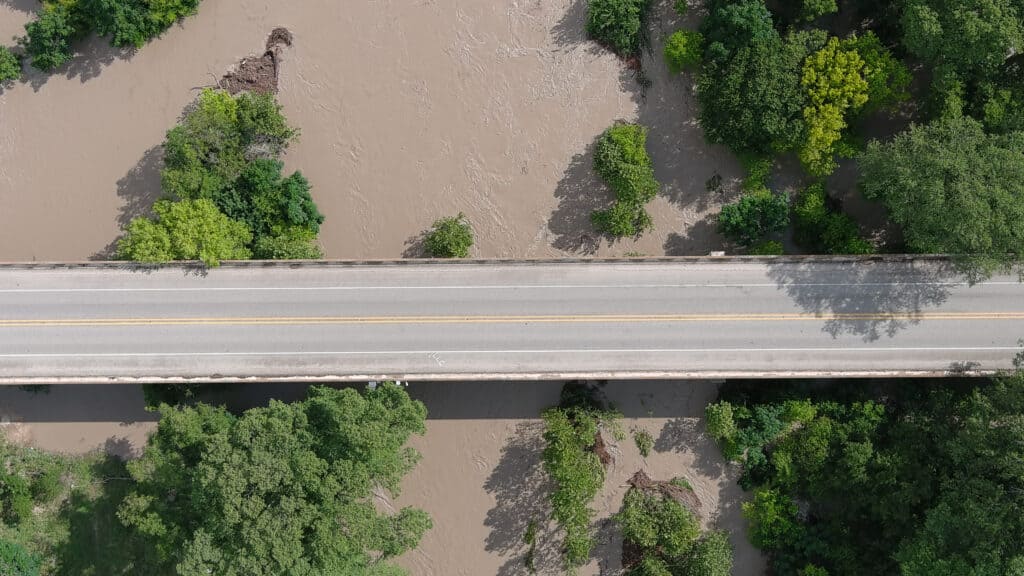
The Guadalupe at Hunt rose roughly 27 feet in two hours and ten minutes, and the gauge recording it stopped working before the river stopped rising.
How were 30 camp buildings mapped out of the flood hazard area?
FEMA's 2011 flood map for Kerr County placed most of Camp Mystic's riverside cabins inside the Special Flood Hazard Area, with several inside the regulatory floodway. Between 2013 and 2020 the camp used the federal Letter of Map Amendment process to have around 30 buildings removed from that designation: 15 at the Guadalupe River site in 2013, and 15 more at the newer Cypress Lake site in 2019 and 2020.
This is the part that translates. It is a story about the difference between a map and a hazard, and that difference is the same in Kerrville and in Kent.
A Letter of Map Amendment is not a finding that a building is safe. It is a determination, made on survey and engineering data the owner commissions and submits, that a structure's lowest adjacent grade sits above the modelled base flood elevation. Its practical effect is to lift the federal requirement to buy flood insurance. It does not lower the water. It says nothing at all about what happens in an event larger than the one that was modelled, which is the event that came. The July 2025 flood exceeded the 500-year floodplain at Camp Mystic. Everything beyond the modelled event is what a UK practitioner would call residual flood risk, and it does not disappear because a line on a map moved.
No one should be in a floodway. Floodways are the most dangerous of a danger zone.
Jim Blackburn · Severe Storm Center, Rice University
Two honest caveats. The Texas legislative committees expressly declined to adjudicate the map amendments, on the ground that their findings about how the camp prepared and responded did not turn on the map history. No official body has ruled that the amendments were wrongly granted. Equally, FEMA's own position, that flood maps are "snapshots in time" and "not predictions of where it will flood", is a fair description of what a regulatory floodplain map is, and the same caveat applies to the Environment Agency's Flood Map for Planning.
The wider mapping gap is measurable. First Street Foundation's parcel-level modelling identified at least 17 Camp Mystic structures in the path of the flood that FEMA's mapping did not capture. Across Kerr County as a whole, FEMA's Special Flood Hazard Area covered 2,560 properties, about 6.5 per cent of the county, while First Street's own model put the figure above 4,500. Most of the Kerr County homes that flooded on 4 July carried no flood insurance, precisely because they sat outside the designated hazard area and had no recorded history of inundation. The wider American pattern is well documented: the US Government Accountability Office reported in March 2026 that properties with two or more losses account for about 2.5 per cent of national flood insurance policies and 48 per cent of claims by value.
The UK parallel is not the amendment process, since England has nothing quite like it, but the underlying error. A national strategic map answers the question "is this area broadly at risk", and it answers it undefended, at catchment scale, from historical and modelled data of varying age. It does not answer "what will happen on this plot in an event of this size", and no site should be designed on the assumption that it does. That second question is what a site-specific flood risk assessment for planning is built to answer, and where the national mapping is too coarse it is what site-specific flood modelling is for. The May 2026 addition of surface water depth data narrowed the gap in England without closing it, and Unda's guide to flood modelling software, tools and techniques covers what a site-specific model can establish that a national one cannot.
FEMA's maps covered 2,560 properties in Kerr County. Independent modelling put the number genuinely at risk above 4,500.
What does the warning timeline actually show?
The warnings were issued, and for Hunt they were issued early. The US Department of Commerce Inspector General found the National Weather Service gave a 106-minute lead time on the 01:14 flash flood warning covering Hunt, 41 minutes better than its own performance target. Nine and a half miles downstream at Kerrville, the lead time was 26 minutes, 39 minutes short of it. The failure was that the warning did not consistently become an instruction to move.
Flash flood warning issued for Hunt
Delivered by wireless emergency alert, the emergency alert system and weather radio. Lead time 106 minutes, 41 minutes better than target.
River flood warnings issued, Hunt to Comfort
River flood warnings are not configured to trigger a phone alert, a broadcast alert or weather radio. They reached nobody who was asleep. A second warning followed at 03:33.
Flash flood emergency declared
Issued on radar evidence alone. Forecasters had been trying to reach the county from about 03:38 and could not get through to the sheriff's office until 04:32.
A firefighter asks dispatch to alert Hunt residents
The recorded reply: "Stand by, we have to get that approved with our supervisor."
The Hunt river gauge fails at 37.52 feet
The river was still rising nearly linearly when the instrument stopped reporting. There were no gauges at all above Hunt on the South Fork.
The first public alert goes out
Approximately 90 minutes after it was requested. Some residents received nothing until after 10:00.
Three things in that sequence deserve attention from anyone who designs or reviews a flood warning and evacuation plan.
River flood warnings reached nobody's phone. The river flood warnings issued at 03:19 and 03:33, covering the Hunt to Kerrville and Kerrville to Comfort reaches, are not configured to activate Wireless Emergency Alerts, the Emergency Alert System or NOAA Weather Radio. They went out into a channel that sleeping people do not monitor. Nobody woke. Forecasters later issued a second flash flood emergency at 05:34 specifically to force a phone alert along that reach, using the wrong product because it was the one with the delivery mechanism attached.
The local activation stalled on a permission. At 04:22 an Ingram firefighter asked dispatch to send a CodeRED alert to Hunt residents telling them to find higher ground. The dispatcher's reply was: "Stand by, we have to get that approved with our supervisor." The first alert went out at about 05:52, roughly 90 minutes later. Some residents received nothing until after 10:00. Kerr County's own emergency plan assigned the Sheriff primary responsibility for warning residents. The Sheriff and the emergency management coordinator were asleep, the County Judge was out of town, and the plan's training-completion forms were blank. The county had never run a full-scale evacuation exercise.
Nobody could see upstream. There were no river gauges above Hunt on the South Fork. England's network is denser, and the live river levels map shows how much of it reports publicly, but density is a function of investment and it thins in exactly the small steep catchments that produce rapid rises. Forecasters trying to establish ground truth attempted to reach the county emergency management coordinator and the sheriff's office from about 03:38 and could not get through to either until 04:32 and 06:19 respectively. They upgraded to a flash flood emergency at 04:03 on radar evidence alone.
The Inspector General also picked a fight worth noting, because it applies to any performance regime. NOAA defended the response by reporting an average lead time of 99.09 minutes across 43 flash flood events during 2 to 6 July. The Inspector General's response was that a single aggregated average "would obscure meaningful differences among communities and would not be representative of public experience". Averages hide the Kerrville 26 minutes inside the Hunt 106. That is worth remembering the next time a national performance figure is offered as evidence that a warning system is working, because the number that matters to a person asleep beside a river is the one for their reach, not the one for the region.
The Kerr County floods exposed one more absence. The county had no county-wide siren system, and it had asked for one. Grant applications covering gauges and public real-time information went to the state in 2017 and again in 2018, and both were refused. England's nearest equivalent to the retrospective inquiry that followed is the Section 19 flood investigation, which is discretionary here and produces no finding of liability either.

The dispatcher's answer to a request for a public alert, at 04:22 with the river already through the cabins, was that it needed supervisor approval.
How would England classify a children's camp beside a river?
Permanent residential accommodation for children is a "more vulnerable" use under the flood risk vulnerability classification. That means it is not permitted in Flood Zone 3b, the functional floodplain, at all, and in Flood Zone 3a it requires the exception test to be passed. A holiday or short-let camping and caravan site is also "more vulnerable", but with an explicit condition attached: it must have a specific warning and evacuation plan.
So on the classification alone, an English planning authority faced with a proposal to build cabins for sleeping children on a functional floodplain would refuse it, and the Environment Agency would object. That is a genuinely stronger position than the one that produced Camp Mystic, and it is worth saying so. Unda's guide to the flood risk vulnerability classification sets out all five categories and the full zone matrix, and the classification itself is published with the Framework.
- Establish the flood zone and every other source. The national planning practice guidance requires every source to be considered: surface water, groundwater, sewers and reservoirs as well as rivers and the sea. A postcode check against the flood risk map is the starting point, never the answer.
- Apply the sequential test. Sites at little or no risk must be developed in preference. Crucially, the usual exemptions do not apply to a change of use to a caravan, camping or chalet site, so for these proposals the test is effectively always engaged.
- Classify the use. Permanent children's residential accommodation is "more vulnerable" and is not permitted in the functional floodplain at all. Permanent residential caravans are "highly vulnerable", which excludes them from Flood Zone 3a as well.
- Consult the Environment Agency. In Flood Zone 2 a local planning authority must consult the Agency directly where a "more vulnerable" development is a caravan or camping site, rather than relying on the national flood risk standing advice. It is the only more-vulnerable use singled out that way.
- Apply the exception test where it is available. In Flood Zone 3a, the proposal must deliver wider sustainability benefits that outweigh the flood risk and be demonstrably safe for its lifetime, taking account of the vulnerability of its users. That is where a sequential and exception test report does its work.
- Secure the warning and evacuation plan before permission, not after. Guidance expects evacuation procedures to be established at the point of consent, with camping sites, caravan sites, hostels and hotels flagged specifically because of transient occupancy.
The 2026 National Planning Policy Framework, published on 17 August 2026, restructured flood risk policy into a dedicated chapter running from Policy F1 to F9, with the zone definitions and the vulnerability classification moved into a new annex. The substance of the vulnerability test survived the rewrite. The changes the August 2026 NPPF made to flood risk and drainage are set out separately, the sequential and exception tests themselves are unchanged in principle even where the drafting moved, and Unda's NPPF flood risk guidance and its explainer on planning for flood risk under the NPPF cover how the new policy numbering maps onto an application already in the system.
Whoever drafted the caravan and camping consultation trigger had understood something about transient occupancy. A person who arrived yesterday does not know which way the ground falls, where the river is, or that the field has flooded twice in living memory. That is the same category of vulnerability that killed 557 girls' worth of assumptions at Camp Mystic, where most of the children had been on site for less than a fortnight.
A permanent children's residential facility is not permitted in the functional floodplain in England under any circumstances, and no test is available to make it permitted.
The three safeguards England does not have
England's flood risk protections are concentrated at the moment of consent. Once a site exists, they thin out sharply. Three gaps matter for a site like Camp Mystic. There is no flood warning service for surface water at all, there is no statutory duty on an existing camping or caravan site to hold an evacuation plan, and permitted development rights let a temporary campsite bypass the flood tests entirely.
- No surface water warning service. The Environment Agency does not issue flood warnings for surface water flooding, and its flood warning service is generated from river level monitoring. Surface water puts 4.6 million English properties at risk, against 2.4 million from rivers and the sea.
- No duty to hold an evacuation plan. An existing caravan or camping site in England is under no statutory obligation to produce one. The requirement attaches at the point of planning consent, and then stops.
- No flood tests for a temporary site. Permitted development rights allow a campsite to operate for up to 28 days a year, extended to 60 for certain uses, with no sequential test, no exception test and no Environment Agency consultation.
Take the first one seriously, because it is the largest. The Environment Agency states plainly that it does not provide flood warnings for surface water flooding, on the ground that the sporadic and intense nature of the rainfall makes accurate prediction very difficult. Yet surface water is now England's most common flood risk, on the Agency's own national assessment: 4.6 million properties, against 2.4 million from rivers and the sea, rising to about 6.1 million by mid-century. Over a million of those sit in the highest risk band. Unda's explainer on pluvial surface water flooding covers how that risk is mapped, its complete guide to surface water flooding and planning covers what a developer has to demonstrate, and a compliant surface water drainage strategy is what an authority will expect where a development adds to it. The concentration is urban: Unda's analysis of surface water flood risk in England's cities sets out where the 4.6 million actually are.
The forecasting picture is improving without yet being sufficient. The Flood Forecasting Centre, a joint Met Office and Environment Agency operation set up after the Pitt Review into the 2007 floods and explained in full here, runs the national picture. Its Rapid Flood Guidance service became operational in 2025 and issues impact-based guidance from around six hours to three days ahead. There is no real-time hazard modelling in the nought-to-six-hour window, which is precisely the window a Hill Country type event occupies, and precisely the window in which Camp Mystic was lost. Trials are running with a target of 2029. In the meantime some authorities are filling the gap locally, and Lincolnshire is trialling its own approach to flood warnings for sources the national service does not cover. London, where the Mayor has warned 56,000 basement households directly, has taken the same view of the same gap and written it into its 2025 to 2030 surface water strategy.
The second gap is the one most likely to surprise people. The most recent Defra statement on the question, from February 2012, found that approximately 28 per cent of caravan and camping sites in England and Wales were at risk of flooding from rivers and the sea, that only about 5 per cent of at-risk sites had developed evacuation plans, and, in the operative sentence, that "there are currently no specific duties placed on the owners and operators of existing caravan and camping sites to produce evacuation plans." The framework is voluntary. Nobody has to do any of it, and the great majority do not, which is what the 5 per cent figure is telling you. That document is now well over a decade old and nothing has superseded it, which is itself the point: no new duty has been legislated in the interval. Local authorities can attach flood conditions to a caravan site licence, but the power is discretionary.
The third gap is structural. Permitted development rights allow temporary campsites to operate for up to 28 days a year, extended to 60 for certain uses, without a full planning application. No sequential test, no exception test, no Environment Agency consultation, no warning and evacuation plan requirement. A field beside a river can lawfully hold tents for a month a year with none of the scrutiny a permanent building would attract. Unda's guide to campsite and glamping flood risk and drainage requirements sets out where the line actually falls.
There is a fourth item that is less a gap than a live argument. The 2026 NPPF's Policy F5 removes the requirement for a sequential test where a site is at risk solely from surface water, provided the layout demonstrates occupiers will remain safe for the development's lifetime. The Association of British Insurers objected to it directly, and the insurance industry's warning about the NPPF flood risk changes is worth reading alongside the policy. England's largest flood risk category has just had a planning safeguard relaxed. Whether the safety demonstration that replaces it holds up is a question the surface water sequential test exemption will answer over the next few years, and not one anybody can settle now. The tension behind it is familiar from the long argument between housing delivery and floodplain policy, and the money to resolve it is real enough: the £7.9bn ten-year capital programme and the Defra reforms to the funding formula both took effect in this period.
The Environment Agency does not issue flood warnings for surface water, the source that puts 4.6 million English properties at risk.
What Texas changed, and what it did not
Texas legislated fast. Three statutes signed on 5 September 2025 now bar youth camps from operating floodplain cabins, require every camp to hold and rehearse a written emergency plan, and direct the state to identify flash-flood-prone areas warranting sirens. One provision in particular reads like a direct answer to the mapping story: a Letter of Map Amendment no longer exempts a camp from the floodplain restriction.
| Statute | What it does | The provision that matters |
|---|---|---|
| SB 1, the Heaven's 27 Camp Safety Act | Bars the state health department from licensing any youth camp operating a cabin within a floodplain, with narrow exceptions for still water and for cabins at least 1,000 feet from a regulatory floodway. | A federal Letter of Map Amendment does not exempt a camp from the restriction. |
| HB 1, the Youth CAMPER Act | Requires every youth camp to hold and annually update a written emergency plan, train all staff and volunteers on it, brief campers, and notify parents whenever any part of the camp lies in a floodplain. | Civil penalties of up to $1,000 per violation, with each day a separate violation. |
| SB 3, flood warning sirens | Directs the Texas Water Development Board to identify flash-flood-prone areas warranting outdoor sirens, which the local authority must then install, maintain and regularly test. | Sirens must have backup power independent of the primary supply, and the Board may withhold other funding from a non-compliant authority. |
That first provision is, as far as we can establish, the first US statute to disapply a federal map amendment for a safety-regulatory purpose. It is a legislature saying, in terms, that a map determination made for insurance purposes cannot be borrowed as a safety certificate.
Implementation has been quicker than most post-disaster legislation. New counsellor ratios were enforced from the 2026 camp season and camps had to submit emergency plans by 1 May 2026. The Texas Water Development Board published a siren guide in January 2026 and approved a provisional flash flood risk area map in March covering the 30 counties in the disaster declaration. In Kerr County, six sirens on 50-foot poles were installed and testing along the Guadalupe near the camps by May 2026, with 26 more agreed, nine river gauges reporting to a new public dashboard, and the Upper Guadalupe River Authority fronting a million dollars of its own reserves while it waits for state reimbursement.
Then the system was tested. On 16 July 2026 more than 20 inches of rain fell on the same region. Two people died. More than a hundred had died the year before. Three of the six new sirens sounded, and Kerrville's new river monitoring dashboard was credited by the mayor with saving lives.
It would be easy, and wrong, to read that as proof the infrastructure worked. The 2026 storm was a different animal: rain over several days at rates topping out around four inches an hour, in daylight, rather than three hours of it at three in the morning. Better warning helped. So did daylight, and a storm that gave people days rather than minutes, and honest post-event analysis from the region's own reporters says as much rather than claiming the credit for the hardware.
What did not change is as instructive. Texas imposed no restriction on RV park development in floodplains, despite more than 40 deaths in two Kerr County RV campgrounds in 2025. It remains behind more than half of US states on elevation standards for buildings at flood risk, and has more buildings in flood-prone places than any state except Florida. The camp cabin restriction that finally passed in 2025 was legislation the state had failed to pass in 1989. And journalists have documented Kerr County homes that flooded in July 2025, were rebuilt in place, and flooded again in July 2026.
Texas banned floodplain cabins at youth camps in 2025. It had failed to pass the same measure in 1989.
What key lessons emerged from the Camp Mystic tragedy for the UK?
Four, and none of them is "it could not happen here". The Camp Mystic flood is not a story about American incompetence, and reading it that way is the fastest route to missing what it says about England. England's consent-stage protections are genuinely stronger than the ones that failed in Texas. Its operational protections, once a site is built and occupied, are weaker than most people assume, and the flood source most likely to produce a UK equivalent is the one nobody gets a warning for.
A map is evidence, not a verdict. Camp Mystic's cabins were lawfully outside the mapped hazard area and inside the flood. The Environment Agency's Flood Map for Planning carries the same structural caveat. It is strategic, undefended, river-and-sea only, and it does not describe what happens on a particular plot. Where the answer matters, the site needs its own assessment, and where the assessment needs numbers the national data cannot give, it needs its own model. The EA's new rivers and sea flood depth data helps, and it also demonstrates the limit, because it returns "unavailable" wherever a detailed local model rather than national modelling underpins the zone. The same caution applies to defences: Unda's work on below-standard flood defences found plenty of communities protected on paper and vulnerable in practice.
A warning is not a plan. Kerr County received the warnings. What it lacked was a person authorised to act on them at four in the morning without asking permission, a rehearsed evacuation, and a route from a forecast to a child being walked uphill. A flood warning and evacuation plan that has never been exercised is a document rather than a mitigation, and in England, for an existing campsite, nobody is obliged to have even the document. When a UK flood does overwhelm a site, the response falls to the emergency services and to volunteers, and RNLI flood rescue teams arrive at the point where planning has already failed. What survives the water afterwards is a separate discipline again, covered in Unda's guide to property flood resilience.
The gap between consent and operation is where risk accumulates. England refuses the permission and then largely stops looking. Sites change hands, uses intensify, temporary uses appear under permitted development, and the assumptions that justified the original consent quietly stop being true. That is the same drift, in a different regulatory idiom, that put children asleep 60 metres from a river which had flooded to 36 feet in 1932. England has watched the same pattern play out on its own ground, from the Somerset Levels to the wider state of flood resilience in England.
Surface water is where the UK version of this happens. Not a Guadalupe-scale river flood: England's catchments are smaller and its rainfall less extreme, and the historical record bears that out. Boscastle in 2004 took more than 200 millimetres in five hours and killed nobody, while Lynmouth in 1952 killed 34. The plausible UK failure is a fast surface water event on a site with transient occupants, no warning service covering the source, and no rehearsed plan. Every element of that already exists in England now.
England refuses the permission and then largely stops looking. That gap, rather than the mapping, is where a UK version of this would form.
If you are promoting, buying or designing a site where flood risk and occupancy meet, whether a campsite, a holiday park or a residential institution, the questions the Texas investigations raise are answerable before they become urgent. Unda's chartered flood risk consultants prepare flood risk assessments and sequential and exception test reports for exactly these proposals across England and Wales, and can tell you quickly whether a site has a problem worth solving.
Does England have an equivalent of a FEMA Letter of Map Amendment?
Not directly. There is no process for removing an individual building from a Flood Zone on survey evidence, because the Flood Zones carry no insurance purchase requirement to be released from. What exists is a challenge process. Where a landowner believes the mapped zone boundary itself is wrong, they can submit modelling evidence to the Environment Agency and ask for the map to be amended. That changes the map for everyone rather than the status of one building, and it is assessed on hydraulic evidence rather than a spot level.
Do adventure activity licences cover flood risk at UK outdoor centres?
No. The Adventure Activities Licensing Regulations 2004 cover four activity groups only: caving, climbing, trekking above 600 metres or on moorland, and specified watersports. The scheme licenses activities, not accommodation, siting or flood risk. A residential children's camp offering no licensable activity needs no licence at all, and even where one is held it says nothing about whether the sleeping accommodation sits in a floodplain.
How would a camp beside a river be treated in Wales?
Differently, and under a different instrument. Wales does not use the NPPF. Flood risk in the Welsh planning system runs through TAN15, and the assessment required is a Flood Consequence Assessment rather than a Flood Risk Assessment, using Natural Resources Wales flood mapping. Wales has also commenced Schedule 3 of the Flood and Water Management Act 2010, so sustainable drainage approval is a separate statutory consent there, which England still has not implemented.
Has the UK ever sent an emergency phone alert for flooding?
Yes, twice, both issued by the Environment Agency. On 23 May 2024 an alert went out at 03:18 for the River Roe and River Ive between Highbridge and Stockdalewath, warning that floodwater was a threat to life. On 6 January 2025 an alert covered Proctor's Pleasure Park at Barrow upon Soar on the River Soar, where a caravan park was being evacuated. Both were fluvial, both were tightly targeted, and there is no published policy specifically governing the use of Emergency Alerts for flash flooding.
About the author. Edward is a co-founder and Director of Unda with 20+ years in flood risk and drainage, and a national-press commentator on flooding. Unda has been trading since 2014, is a CIWEM Business Partner with CIWEM member and chartered (C.WEM MCIWEM) consultants, and has delivered 5,000+ flood risk assessments and drainage strategies across England and Wales.
Edward Bouët · BSc (Hons)
Latest news






One of our experienced Flood Risk Consultants will get back to you within 60 minutes
